 English
 Spanish
 French
 Chinese
 Russian
 Portuguese
 最新宪章启动
Charter activations
Flood in Sudan
Heavy rainfall caused flooding in 17 states of Sudan which has killed at least 62 people and injured 98.
Over 190,000 people have been affected as over 40,000 houses have been destroyed or partially destroyed. Sudan's Humanitarian Aid Commission (HAC) reported that many of the deaths that occurred were due to collapsed roofs and electrocution.
UNICEF reported that affected persons are in dire need of shelter, sanitation and hygiene services, health and food supplies.
Since the beginning of August, most states of Sudan have been struck by heavy rains, which caused many houses to collapse and cut off main roads. The rain is forecast to continue.
| 事件类型: | Flood |
| 事件地点: | Sudan |
| 启动宪章的日期: | 2019-08-26 |
| 宪章启动时间: | 12:33 |
| 宪章启动时区: | UTC+02:00 |
| 宪章要求者: | UNITAR/UNOSAT on behalf of UNOCHA & UNICEF Ministry of Agriculture and Forestry in Sudan |
| 启动ID: | 617 |
| 项目经理: | UNITAR/UNOSAT |
Products
Preliminary satellite derived flood assessment
in White Nile State, Sudan
Download the full report
版权: Sentinel-2 © Contains modified Copernicus Sentinel data (2019)
SPOT-7 © Airbus DS (2019)
Report produced by UNITAR/UNOSAT
Information about the Product
已获得: 06/08/2019 - 05/09/2019
源: SPOT-7 / Sentinel-2
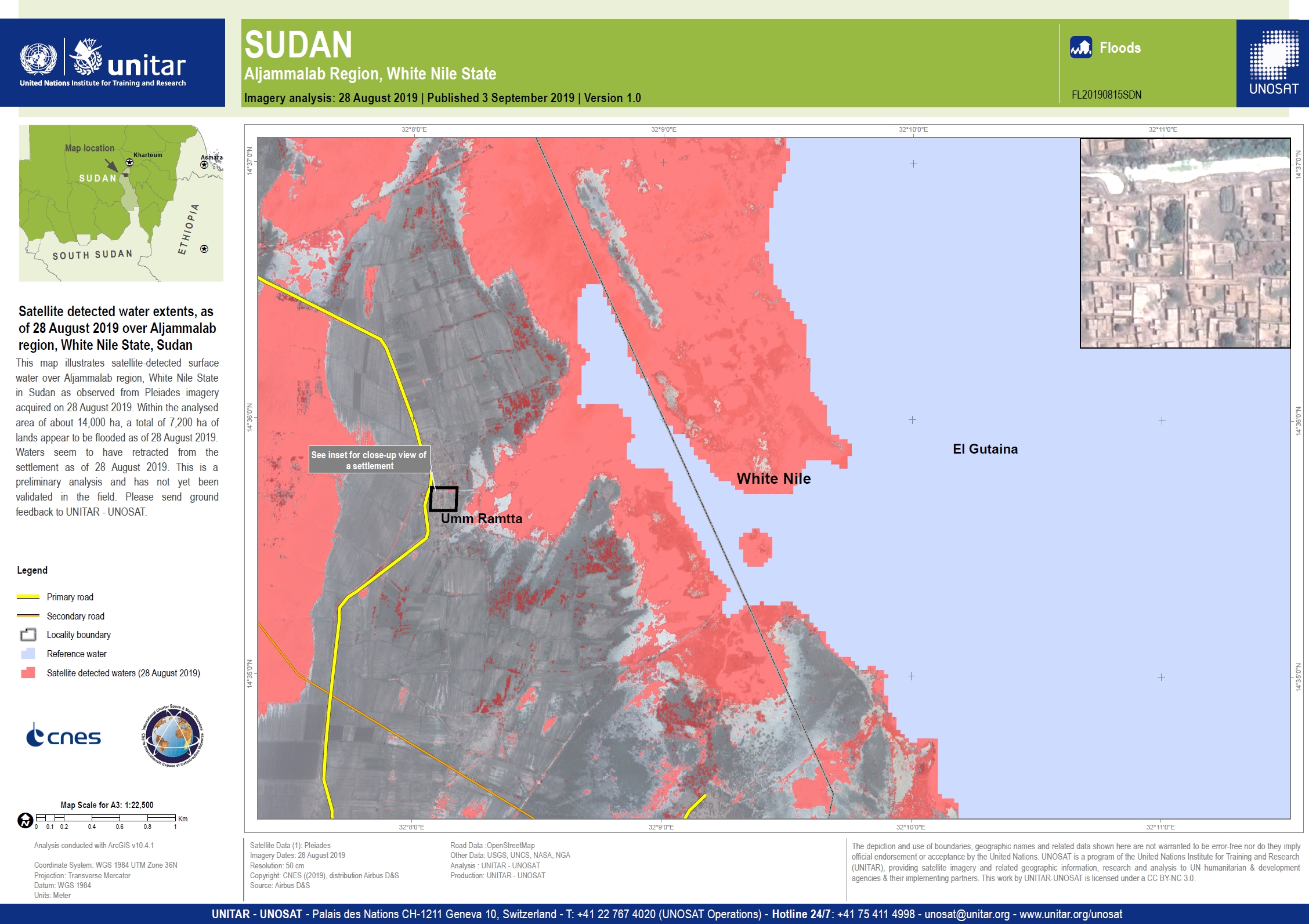

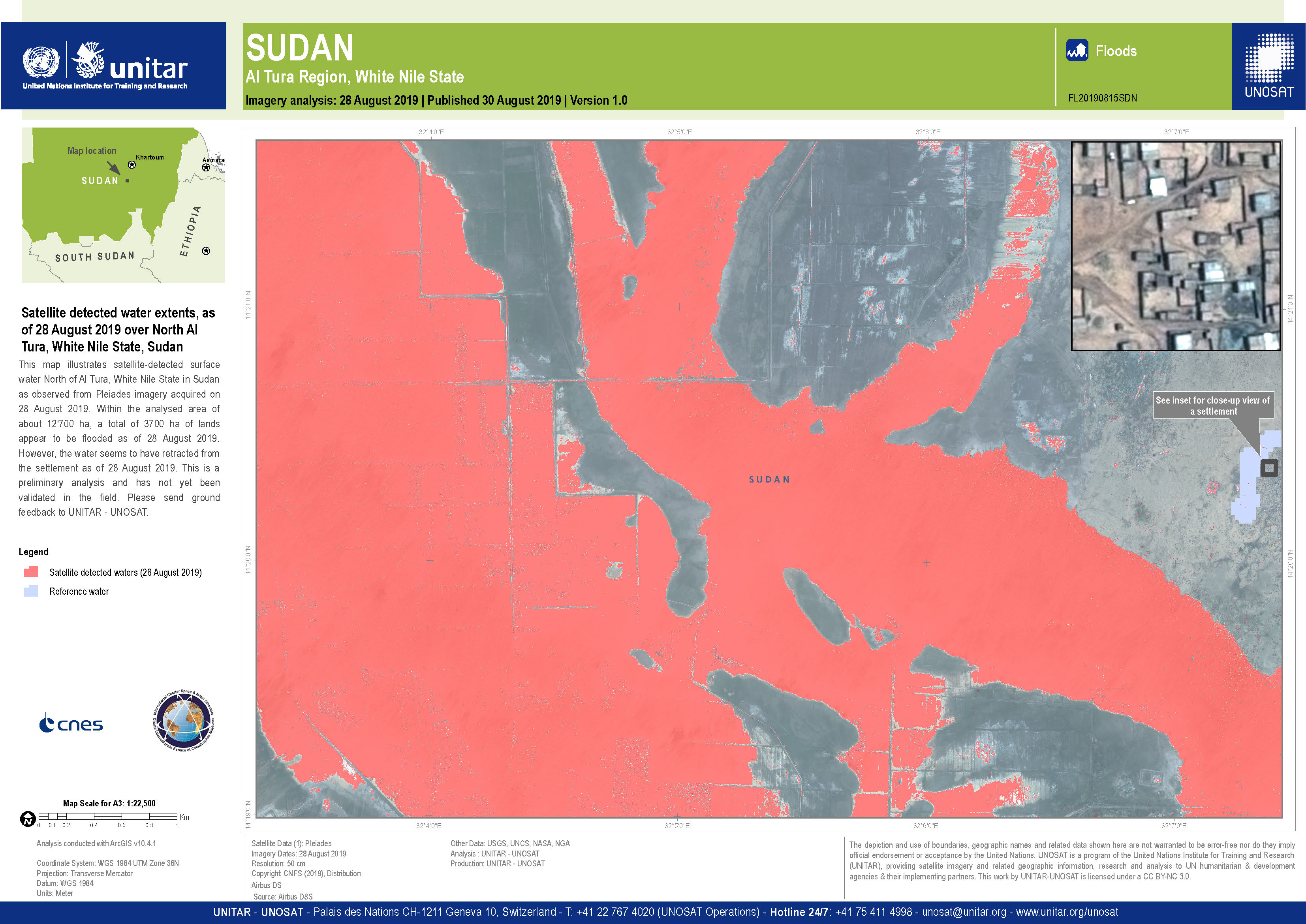

Surface water extent in White Nile state, Sudan
版权: RADARSAT-2 Data and Products © Maxar Technologies Ltd. (2019) - All Rights Reserved. RADARSAT is an official trademark of the Canadian Space Agency.
Map produced by UNITAR/UNOSAT
Information about the Product
已获得: 27/08/2019
源: RADARSAT-2
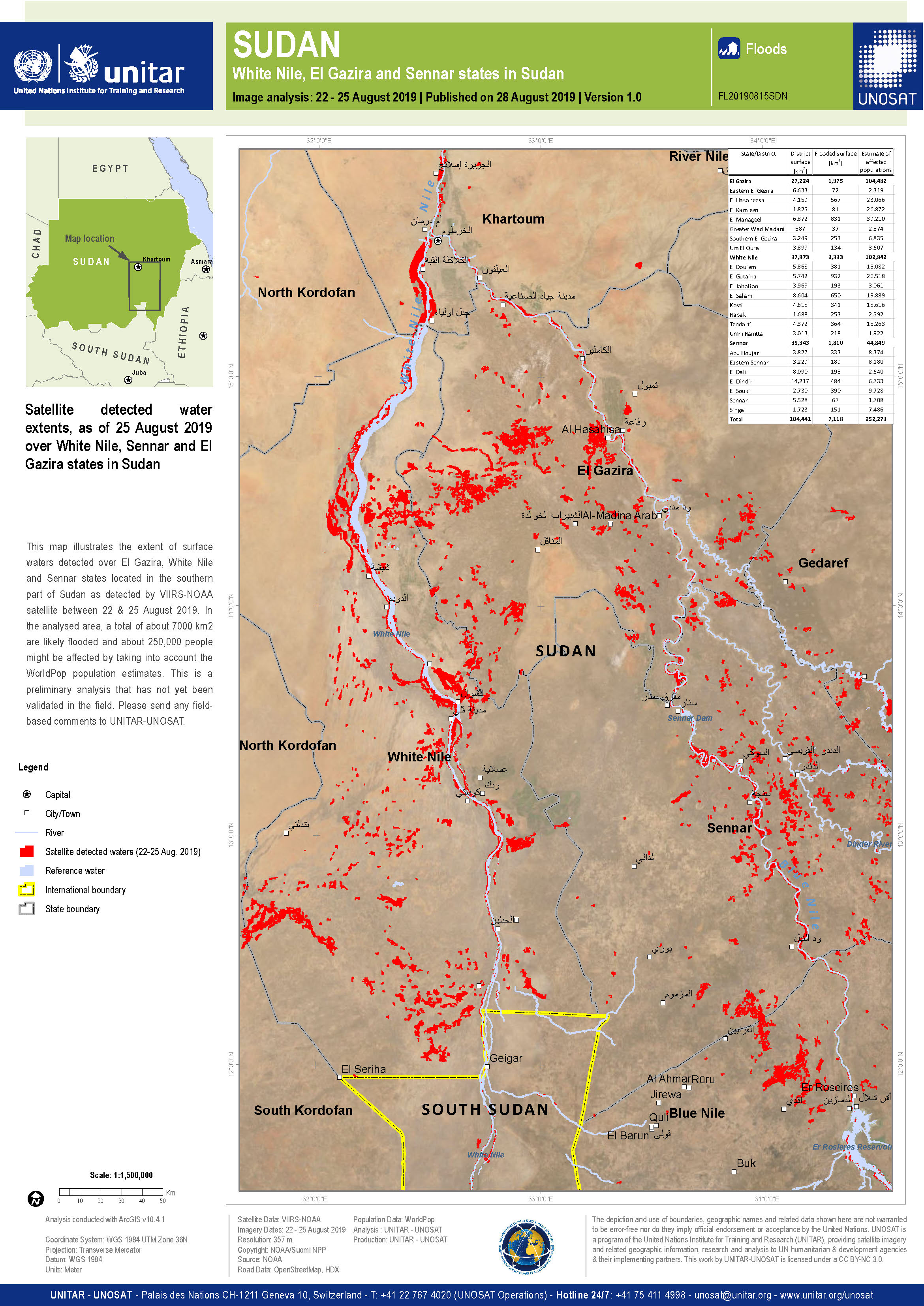
Surface water extent in the White Nile, El Gazira and Sennar States of Sudan
版权: NOAA
Map produced by UNITAR/UNOSAT
Information about the Product
已获得: 22/08/2019 - 25/08/2019
源: Suomi NPP
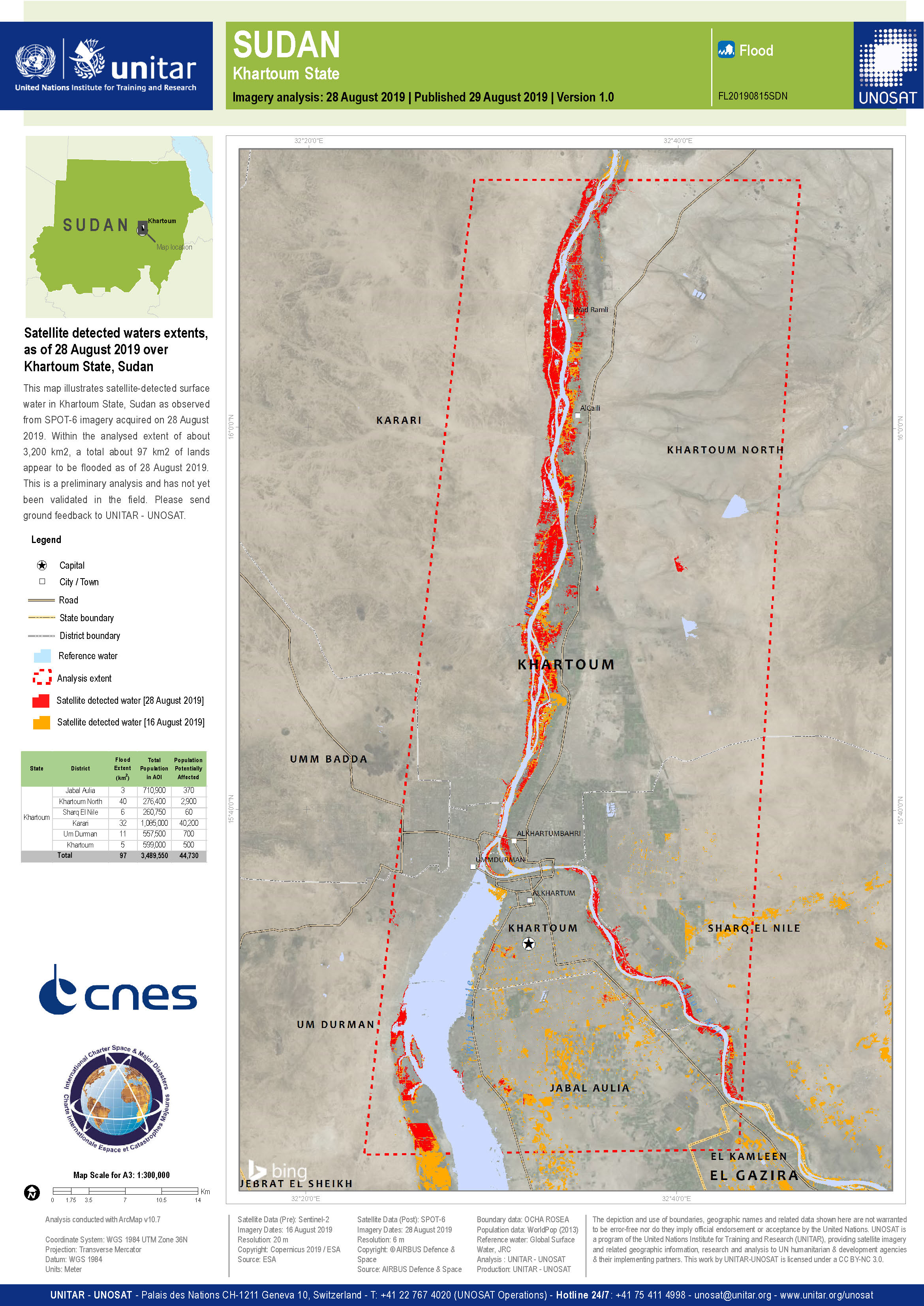
Preliminary satellite derived flood assessment in Khartoum, Red Sea, River Nile and White Nile in Sudan
Download the full report
版权: Report produced by UNITAR/UNOSAT
Information about the Product
已获得: 06/08/2019 - 25/08/2019
源: Sentinel-2
 返回完整的响应档案

