 English
 Spanish
 French
 Chinese
 Russian
 Portuguese
 最新宪章启动
Charter activations
Flood in Laos
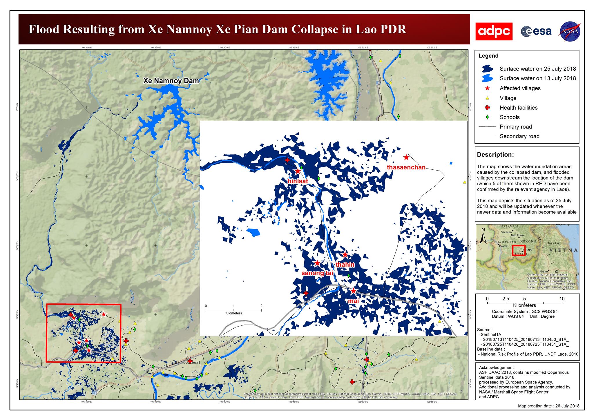
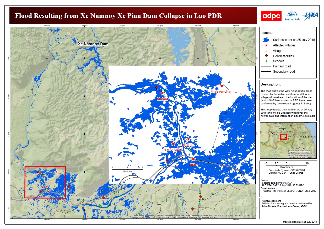
Monsoon rain caused a hydroelectric dam to collapse in Laos on 23 July. Flood waters inundated six villages in Attapeu province and left more than 6000 homeless and hundreds unaccounted for.
The Xe-Pian Xe-Namnoy dam in the southern-most part of the country was under construction at the time of the disaster and was expected to be finished next year. It has been reported that the collapse of the dam - specifically a subsidiary dam called "Saddle Dam D" - released 5 billion cubic metres of water which destroyed hundreds of homes in the province and has already claimed several lives.
Affected residents are being evacuated to emergency shelters.
Related News and Resources
- Floods in Laos - Reports and Infographics (reliefweb)
- Impact Report for Floods in Laos (GDACS)
- Flash Floods and Dam Emergency: Daily Map of 25 July (ERCC)
- BBC reports on Flooding in Laos (BBC)
- Laos dam collapse: View of flooded villages – Video (Guardian)
- Sentinel-1 maps flash floods in Laos (ESA)
- Xe-Namnoy lake dam failure (CESBIO)
- Live Map: Floods in Laos (UNOSAT)
- JRC analysis assists response to Laos dam collapse (EU Science Hub)
| 事件类型: | Flood |
| 事件地点: | Laos People's Democratic Republic |
| 启动宪章的日期: | 2018-07-24 |
| 宪章启动时间: | 14:31 |
| 宪章启动时区: | UTC+02:00 |
| 宪章要求者: | UNITAR - UNOSAT on behalf of World Food Programme (WFP) and UNOOSA on behalf of the Ministry of Science and Technology and Department of Disaster Management and Climate of Laos |
| 启动ID: | 578 |
| 项目经理: | UNITAR / UNOSAT |
Products
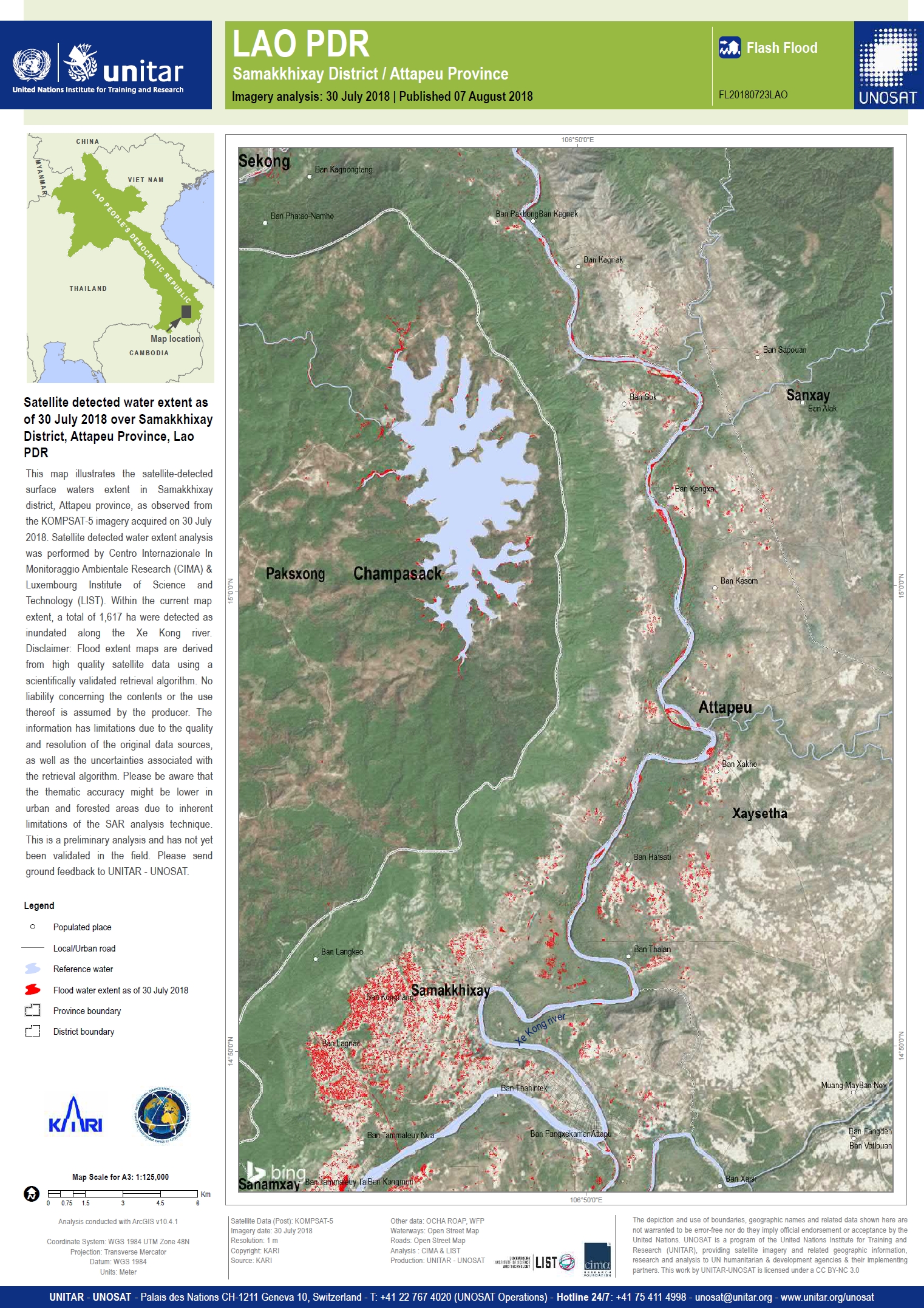
Satellite detected water extent as of 30 July 2018 over Samakkhixay District, Attapeu Province, Laos
版权: KOMPSAT-5 © KARI (2018)
Map produced by UNITAR/UNOSAT
Information about the Product
已获得: 30/07/2018
源: KOMPSAT-5
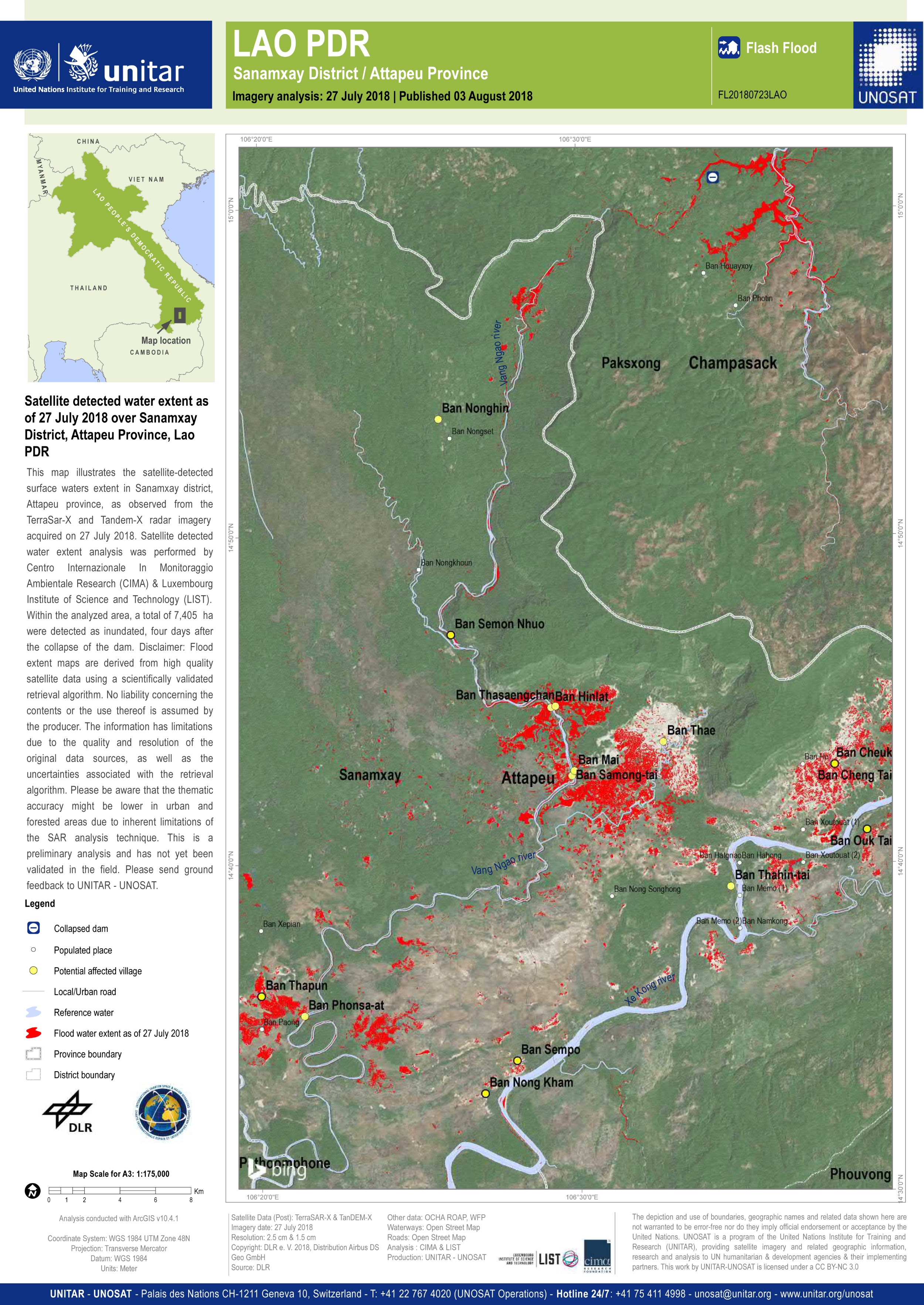
Satellite detected water extent as of 27 July 2018 over Sanamxay District, Attapeu Province, Laos
版权: TerraSAR-X © DLR e. V. 2018, Distribution: Airbus DS Geo GmbH
Map produced by UNITAR/UNOSAT
Information about the Product
已获得: 27/07/2018
源: TerraSAR-X
Potentially affected villages along Vang Ngao River and Xe Kong River, Laos
Download the full report
版权: © Copernicus Sentinel data (2018)
Report produced by UNITAR/UNOSAT
Information about the Product
已获得: 25/07/2018 & 29/07/2018
源: Sentinel-1
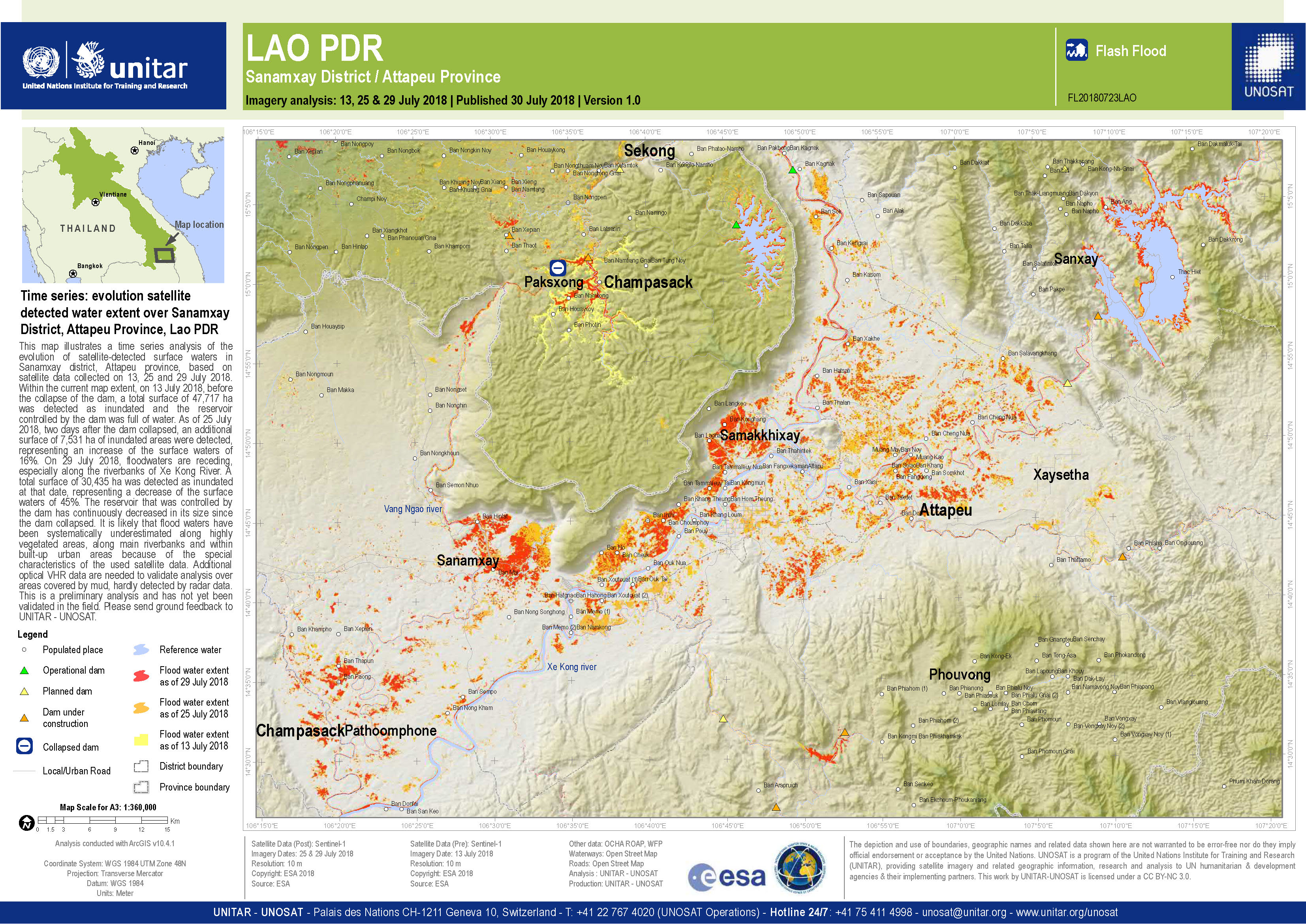
Time series: Evolution satellite detected water extent over Sanamxay District, Laos
版权: © Copernicus Sentinel data (2018)
Map produced by UNITAR/UNOSAT
Information about the Product
已获得: 13/07/2018, 25/07/2018 & 29/07/2018
源: Sentinel-1
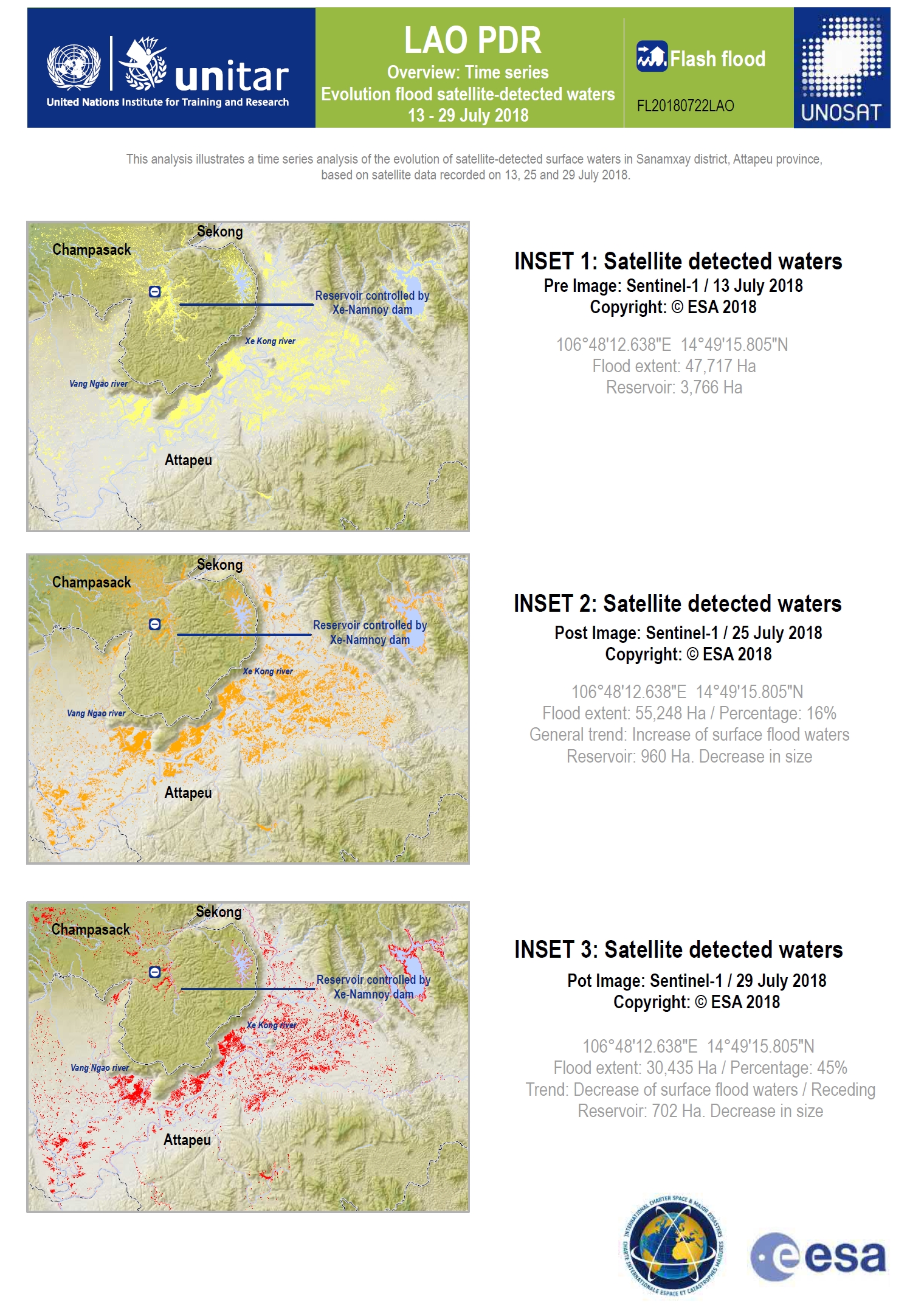
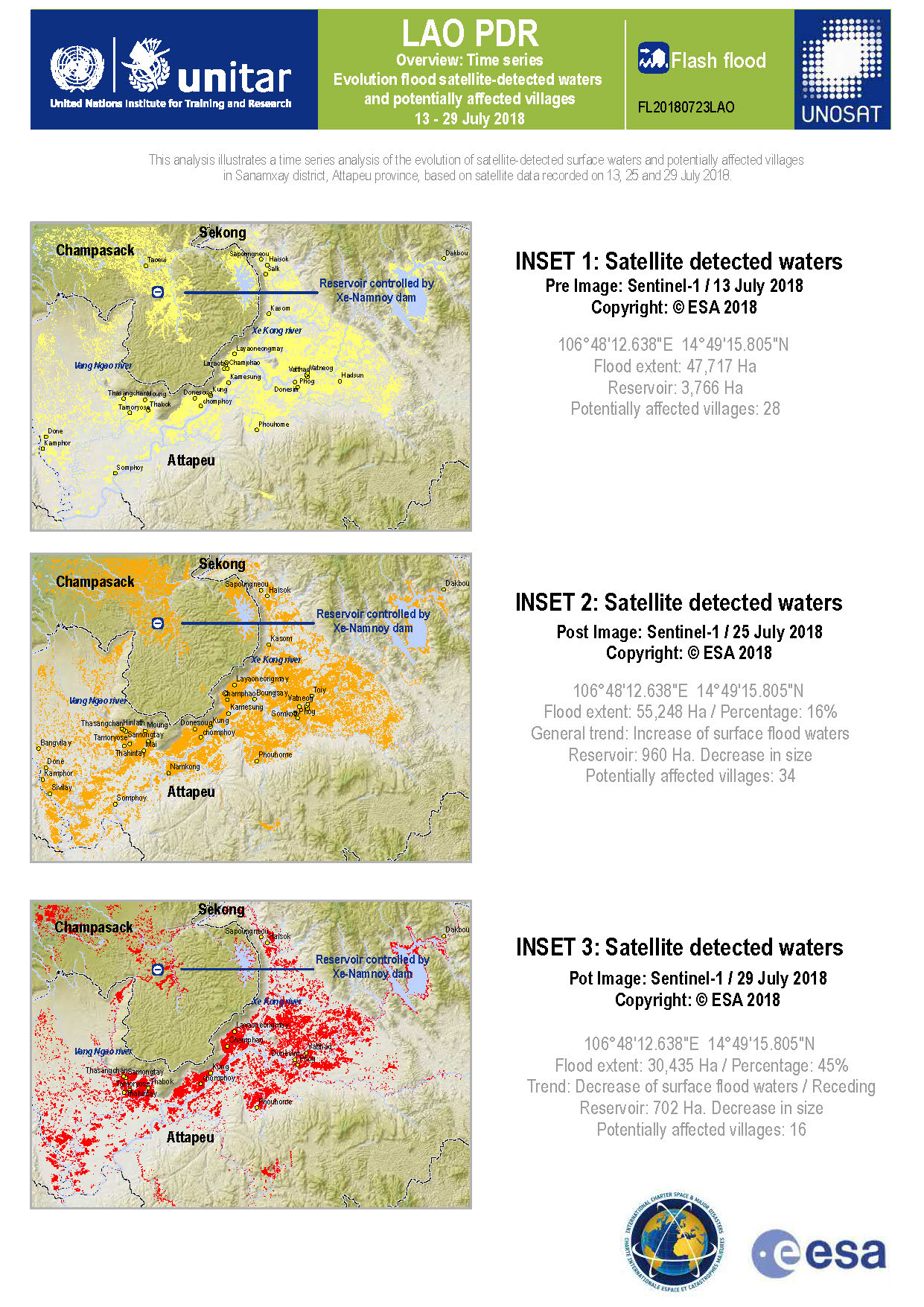
Time series: Evolution flood satellite detected waters, Laos
版权: © Copernicus Sentinel data (2018)
Map produced by UNITAR/UNOSAT
Information about the Product
已获得: 13/07/2018, 25/07/2018 & 29/07/2018
源: Sentinel-1
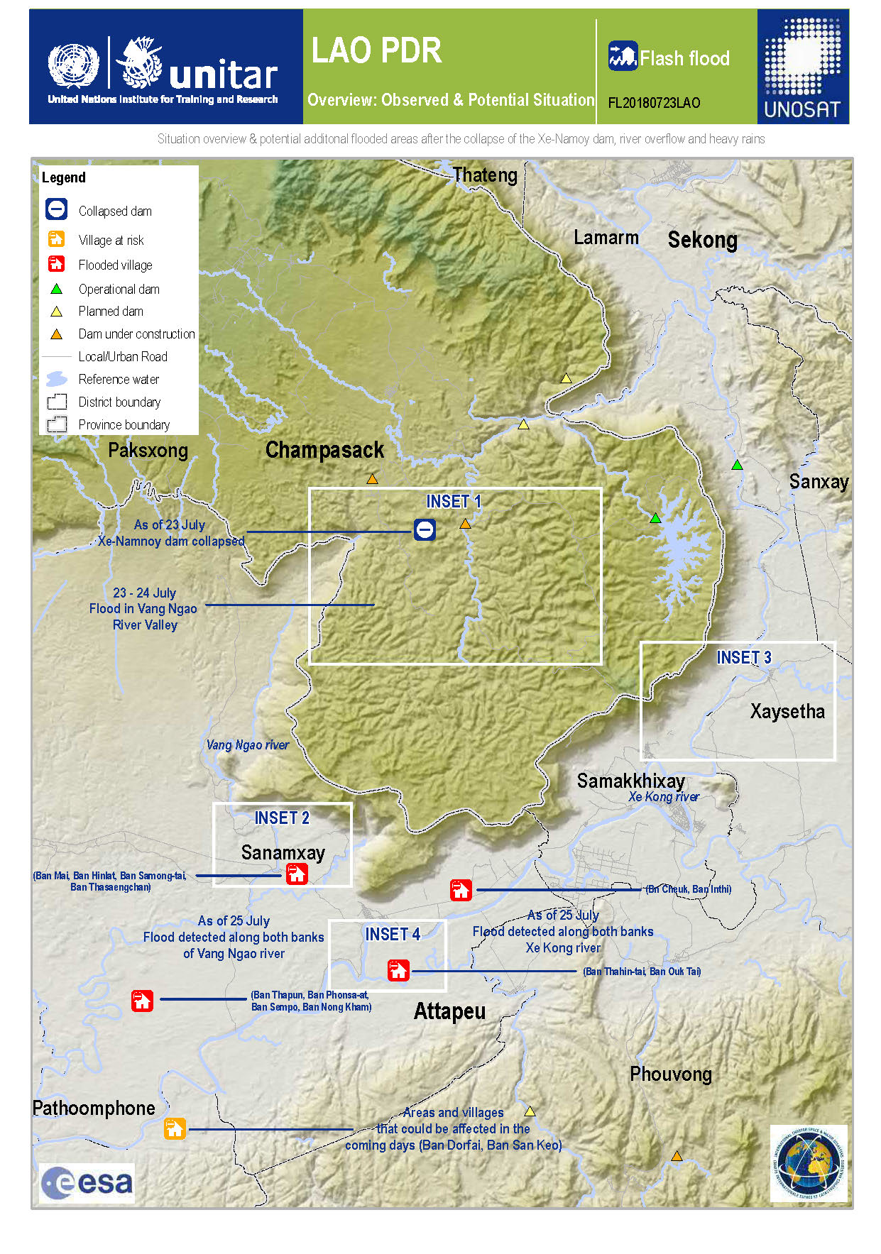
Overview and potentially flooded areas after collapse of the Xe-Namnoy dam
Download the full report
版权: Sentinel-1 © Copernicus Sentinel data (2018)
Report produced by UNITAR/UNOSAT
Information about the Product
已获得: Pre-disaster: 13/07/2018
Post-disaster: 25/07/2018
源: Sentinel-1
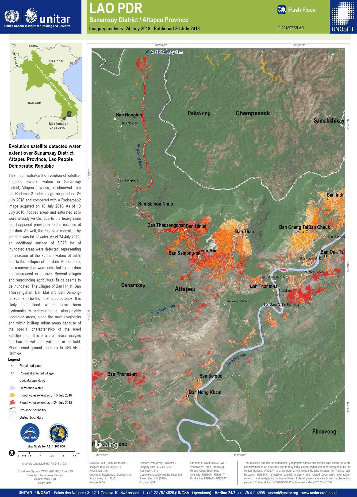
Evolution satellite detected water extent over Sanamxay District, Attapeu Province, Lao People Democratic Republic
版权: RADARSAT-2 Data and Products © Maxar Technologies Ltd. (2018) - All Rights Reserved. RADARSAT is an official trademark of the Canadian Space Agency.
Map produced by UNITAR / UNOSAT
Information about the Product
已获得: Pre-Disaster: 10/07/2018
Post-Disaster: 24/07/2018
源: RADARSAT-2

Satellite detected water extent over Sanamxay District, Attapeu Province, Lao People Democratic Republic
版权: RADARSAT-2 Data and Products © Maxar Technologies Ltd. (2018) - All Rights Reserved. RADARSAT is an official trademark of the Canadian Space Agency.
Map produced by UNITAR / UNOSAT
Information about the Product
已获得: 24/07/2018
源: RADARSAT-2
 返回完整的响应档案

