 English
 Spanish
 French
 Chinese
 Russian
 Portuguese
 Latest Activation
Charter activations
Tsunami, Indonesia and Thailand
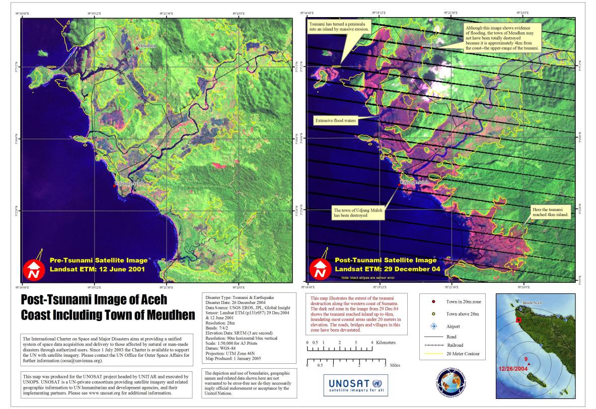
On December 26, 2004, an earthquake of magnitude 9.0 struck off the west coast of Sumatra in the Indonesian Archipelago. This earthquake triggered a devastating tsunami and caused tremors that killed over 104,000 people in Indonesia and over 5,000 in Thailand.
Indonesia was the worst affected followed by Sri Lanka, India, Thailand, Somalia, Maldives, Malaysia and Myanmar.
| Type of Event: | Tsunami, Earthquake |
| Location of Event: | Indonesia and Thailand |
| Date of Charter Activation: | 27/12/2004 |
| Charter Requestor: | UNOOSA on behalf of UNOPS |
| Project Management: | UNOSAT |
Products


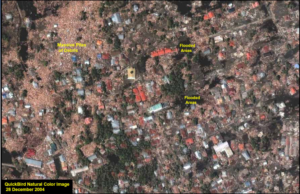
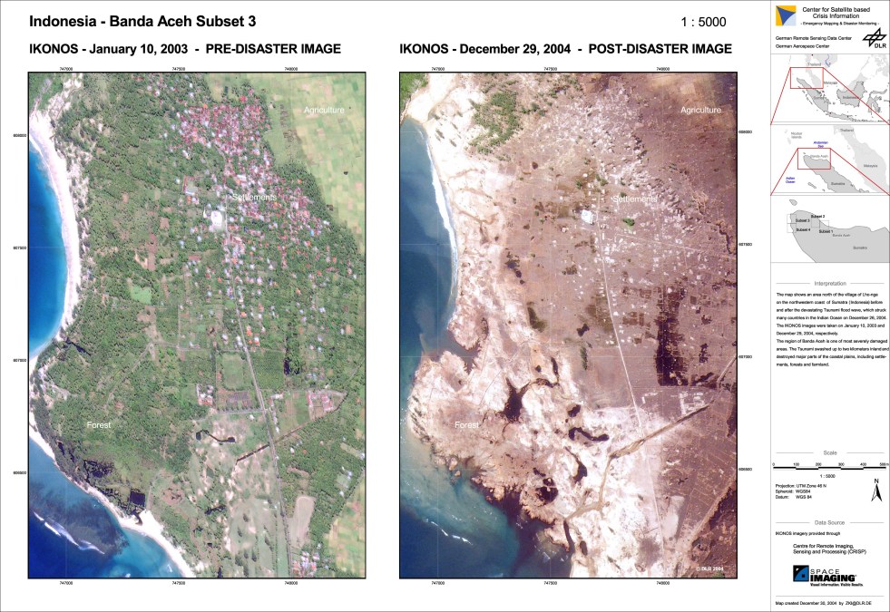
Indonesia Aceh
Copyright: German Remote Sensing Data Centre, DLR - German Aerospace Center Ikonos imagery provided through Center for Remote Imaging, Sensing and Processing, Space Imaging.
Map created 30 December 2004 by zki@dlr.de
Information about the Product
Acquired: 30/01/2003 and 29/12/2004
Source: Scale 1:5000 Ikonos images, 30/01/2003 and 29/12/2004, before and after the devastating tsunami. Scale 1:12.500


Indonesia Aceh, Scale 1:5000, before and after the devastating tsunami.
Copyright: Map created 30 December 2004 by zki@dlr.de German Remote Sensing Data Centre, DLR - German Aerospace Center Ikonos imagery provided through Center for Remote Imaging, Sensing and Processing, Space Imaging.
Information about the Product
Acquired: 30/01/2003 and 29/12/2004
Source: Ikonos


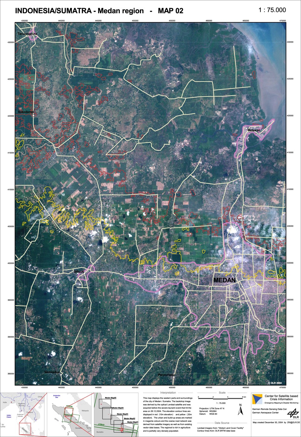
Medan, Scale 1:75,000
Copyright: German Remote Sensing Data Centre, DLR - German Aerospace Center
Ikonos imagery provided through Center for Remote
Imaging, Sensing and Processing, Space Imaging.
Scale 1:12.500 Map created 30 December 2004 by zki@dlr.de
Information about the Product
Acquired: 30/01/2003 and 29/12/2004
Source: Ikonos images, 30/01/2003 and 29/12/2004, before and after the devastating tsunami.


Satellite map of Banda Aceh region, scale: 1:200,000.
Copyright: Landsat ETM data acquired 8 May 2000, bands 7/4/2, 28 m resolution Elevation data: SRTM (3 arc seconds). Shows coastal areas under 30 meters elevation.
Information about the Product
Acquired: 8 Mai 2000
Source: GLCF, JPL, Global Insight.

Thailand Khao Lak north
Copyright: Remote Sensing Data Centre, DLR - German Aerospace Center Ikonos imagery provided through Center for Remote Imaging, Sensing and Processing, Space Imaging.
Scale 1:12.500 Map created 30 December 2004 by zki@dlr.de
--
Information about the Product
Acquired: 30/01/2003 and 29/12/2004
Source: Ikonos images, 30/01/2003 and 29/12/2004, before and after the devastating tsunami.


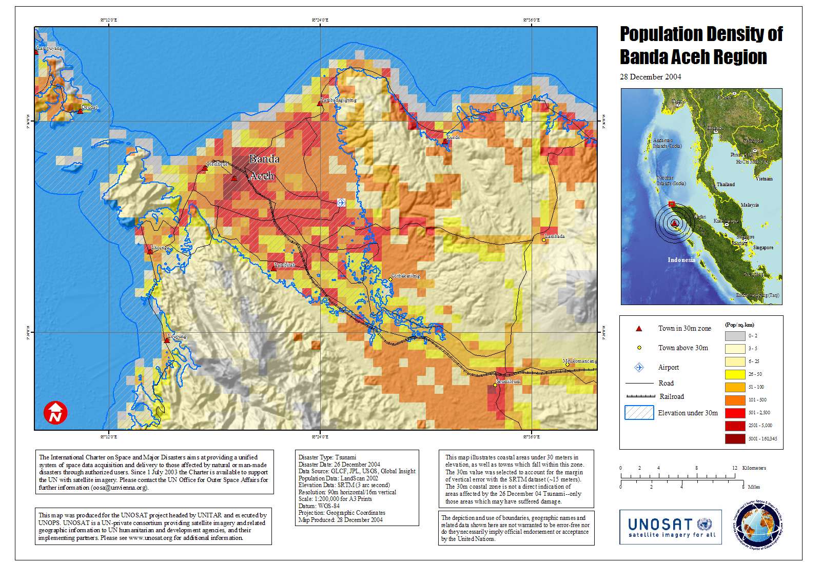
Population density map of Banda Aceh region, scale: 1:200,000.
Copyright: Map produced 28/12/2004 by UNOSAT.
--
Information about the Product
Acquired: --
Source: GLCF, JPL, Global Insight. Elevation data: SRTM (3 arc seconds). Population data: LandScan 2002. Shows coastal areas under 30 meters elevation.


Indonesia Aceh, Scale 1:5000
Copyright: German Remote Sensing Data Centre, DLR - German Aerospace Center
Ikonos imagery provided through Center for Remote
Imaging, Sensing and Processing, Space Imaging.
Scale 1:12.500 Map created 30 December 2004 by zki@dlr.de
Information about the Product
Acquired: 30/01/2003 and 29/12/2004
Source: Ikonos images, 30/01/2003 and 29/12/2004, before and after the devastating tsunami.

Satellite map of Phuket Island, scale: 1:100,000.
Copyright: Map produced 29/12/2004 by UNOSAT.
--
Information about the Product
Acquired: 8 Jan 2002
Source: GLCF, JPL, Global Insight. Landsat ETM data acquired 8 Jan 2002, bands 7/4/2, 28 m resolution Elevation data: SRTM (3 arc seconds). Shows coastal areas under 20 meters elevation.


 Back to the full activation archive

