 English
 Spanish
 French
 Chinese
 Russian
 Portuguese
 Latest Activation
Charter activations
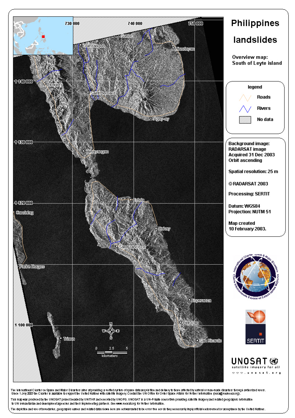
Philippines Landslide
A request of assistance reached the Charter through the United Nations system, after a landslide which affected the Philippines on 19 December.
Incessant rain over a period of days triggered landslides in Southern Leyte province in central eastern Philippines. Death toll is reported to be around 200.
| Tipo de evento: | Landslide |
| Local do evento: | Philippines |
| Data da Ativação da Carta: | 21/12/2003 |
| Requisitante da Carta: | UNOOSA on behalf of UNOPS / Red Cross |
| Gerenciamento de projeto: | UNOSAT |
Products


 Voltar ao arquivo completo da Ativação

