 English
 Spanish
 French
 Chinese
 Russian
 Portuguese
 Latest Activation
Charter activations
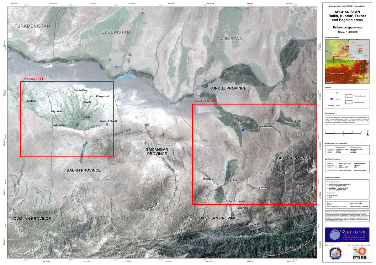
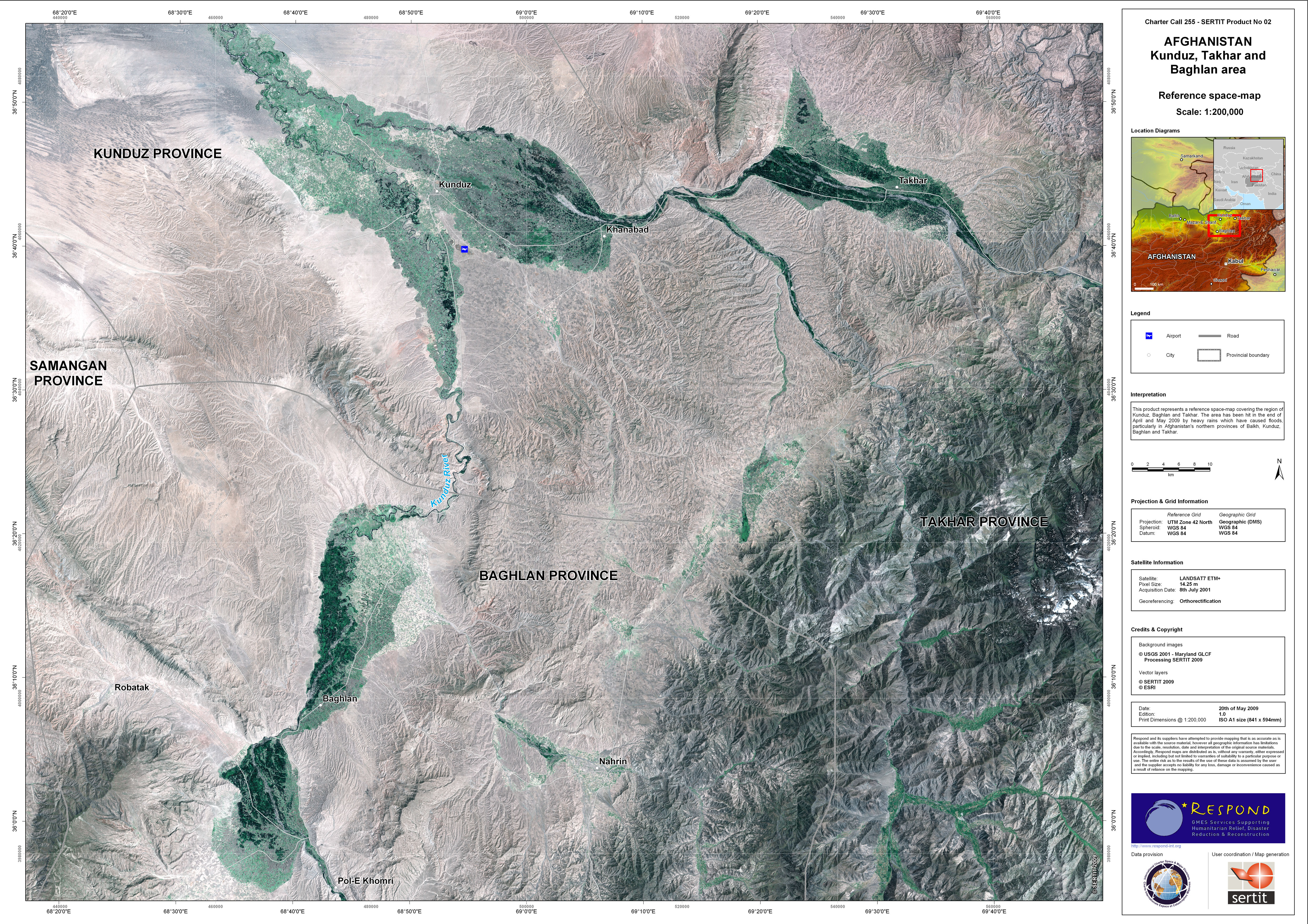
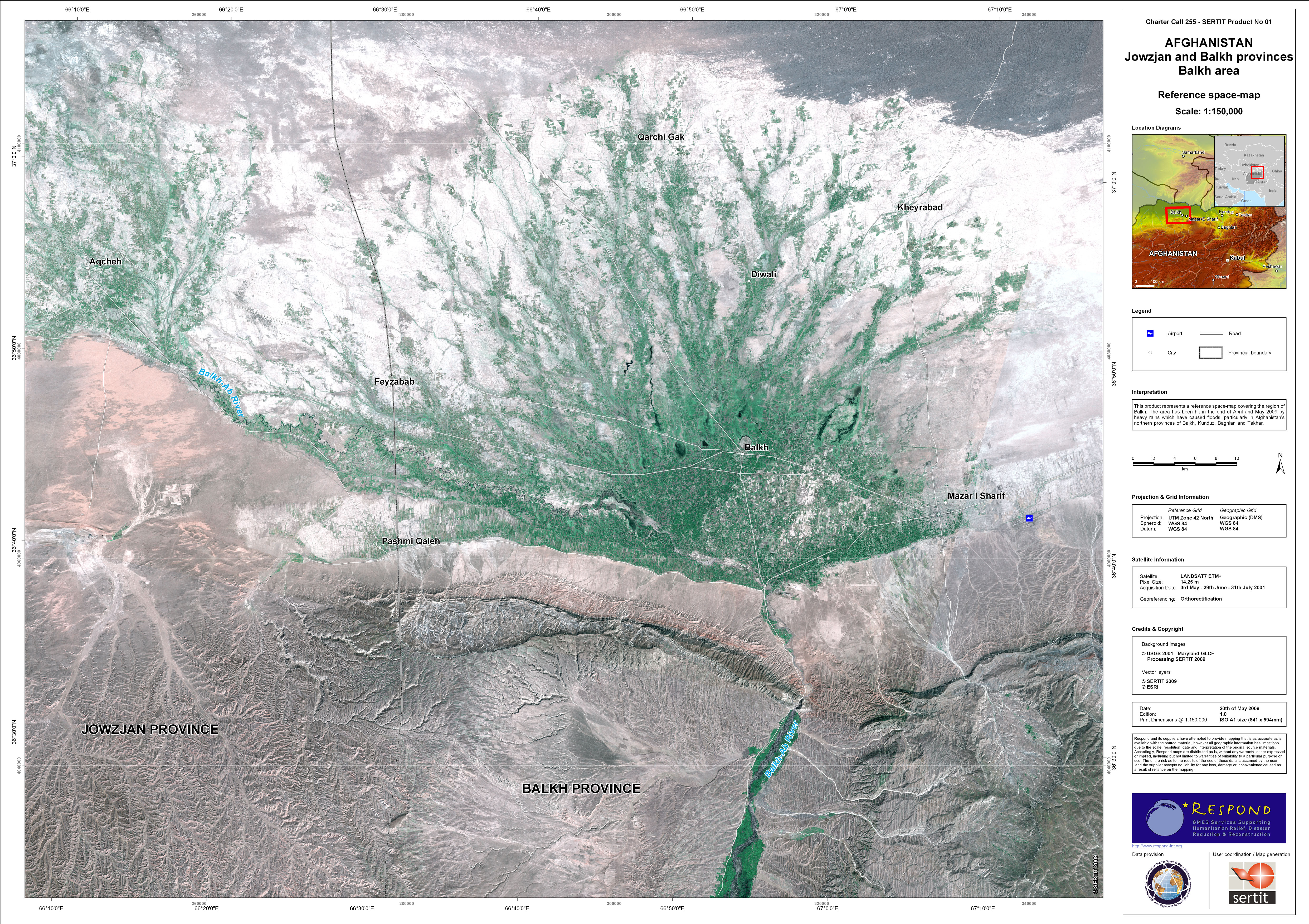
Flood in Afghanistan
According to assessments conducted to date, floods have affected approximately 10,000 households in five provinces in the Northern region (Jawzjan, Faryab, Balkh, Samangan and Sari Pul) and four provinces in the Northeastern region (Kunduz, Baghlan, Takhar and Badakhshan). Flooding in the north and northeast is expected to continue and worsen, due to heavy rains and to snow melting.
| Type of Event: | Flood |
| Location of Event: | Afghanistan |
| Date of Charter Activation: | 19/05/2009 |
| Charter Requestor: | UNOOSA on behalf of OCHA Afghanistan |
| Project Management: | SERTIT |
Products
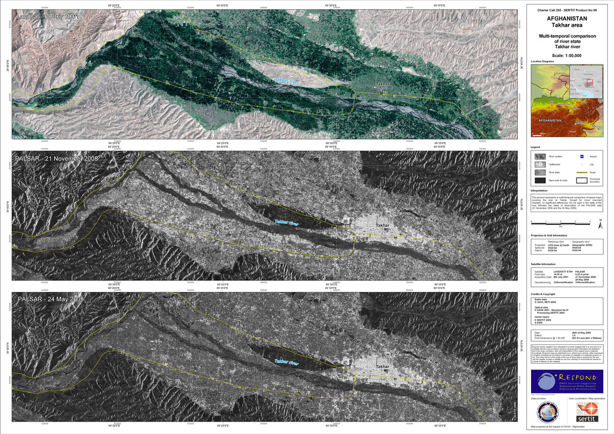
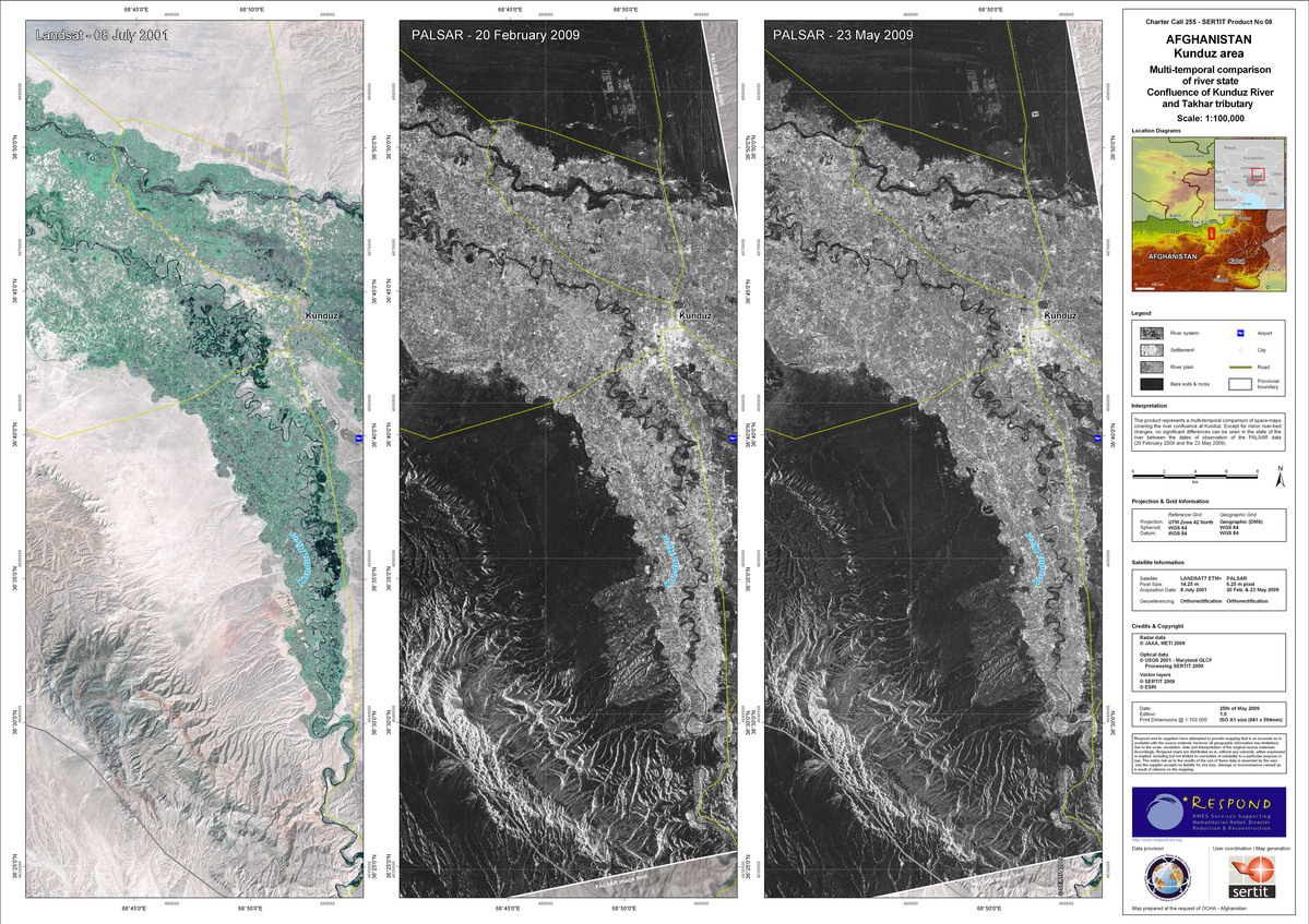
Afghanistan - Kunduz area, confluence of Kunduz River and Takhar tributary
Copyright: JAXA, METI 2009, USGS 2001, SERTIT 2009, ESRI Image processing, map created 25/05/2009 by SERTIT
Information about the Product
Acquired: 08/07/2001, 20/02/2009, 23/05/2009
Source: LANDSAT7 ETM+, 14.25m/pixel, PALSAR 6.25m/pixel
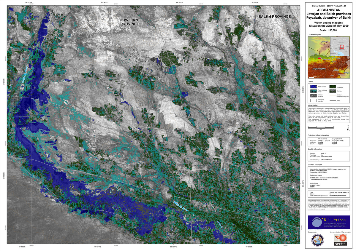


Afghanistan - Jowzjan and Balkh provinces Balkh area
Copyright: CNES 2009, SPOT IMAGE SA, SERTIT 2009, ESRI, USGS 2001 Image processing, map created 22/05/2009 by SERTIT
Information about the Product
Acquired: 31/07/2001, 03/05/2009, 21/05/2009, 29/06/2009
Source: SPOT 5, 5m/pixel, LANDSAT7 ETM+, 14.25m/pixel

 Back to the full activation archive

