 English
 Spanish
 French
 Chinese
 Russian
 Portuguese
 Latest Activation
Charter activations
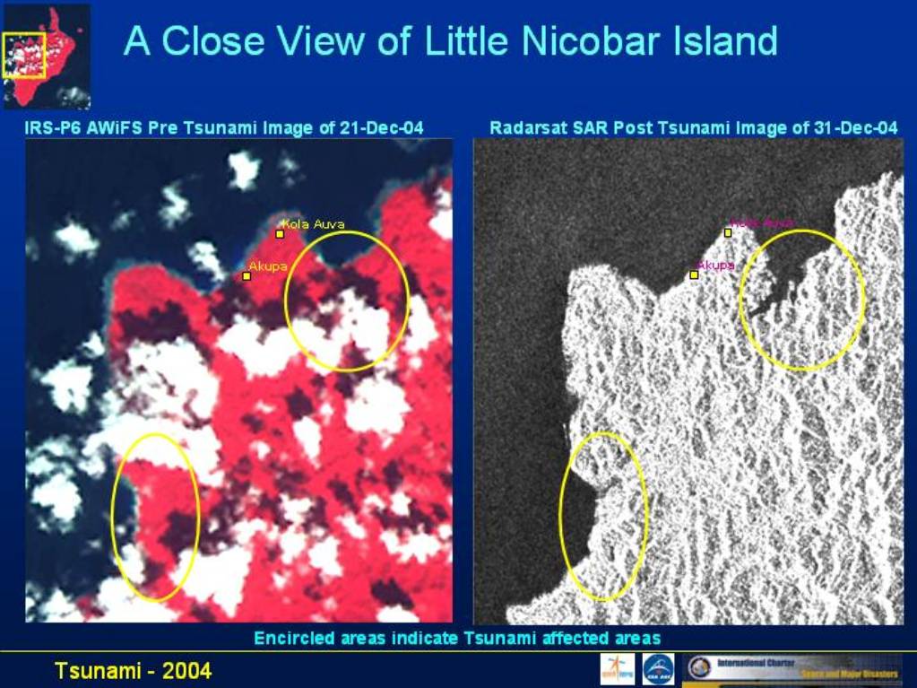
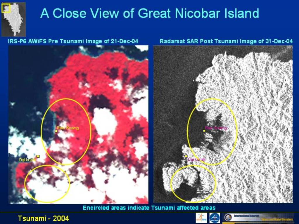
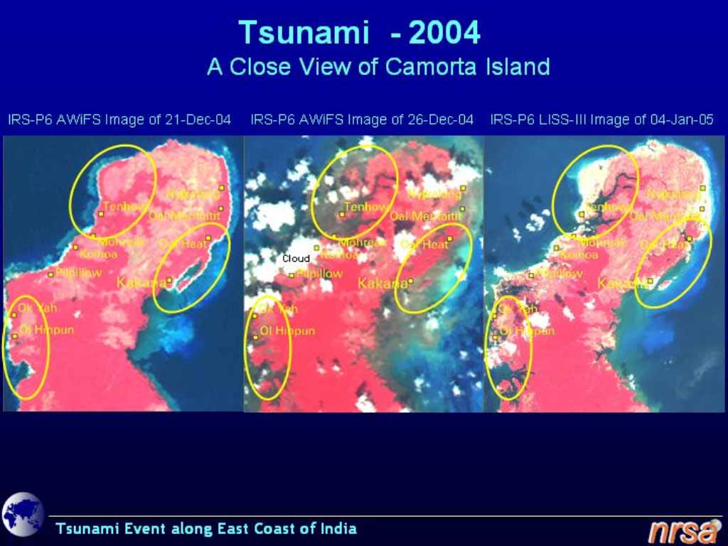
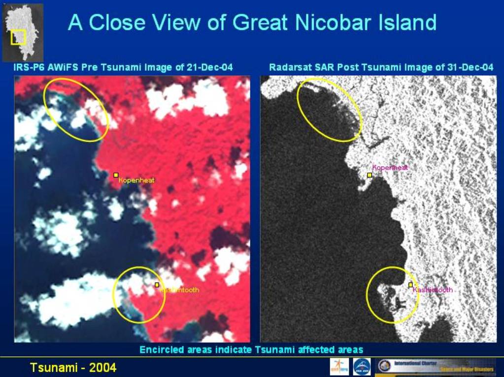
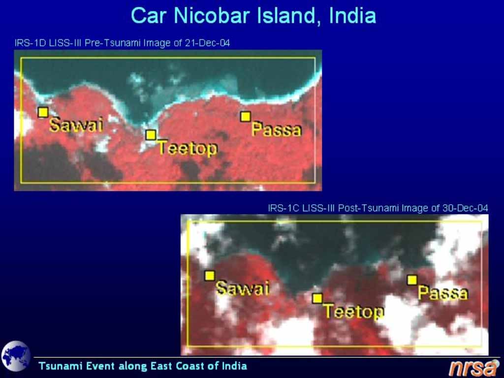
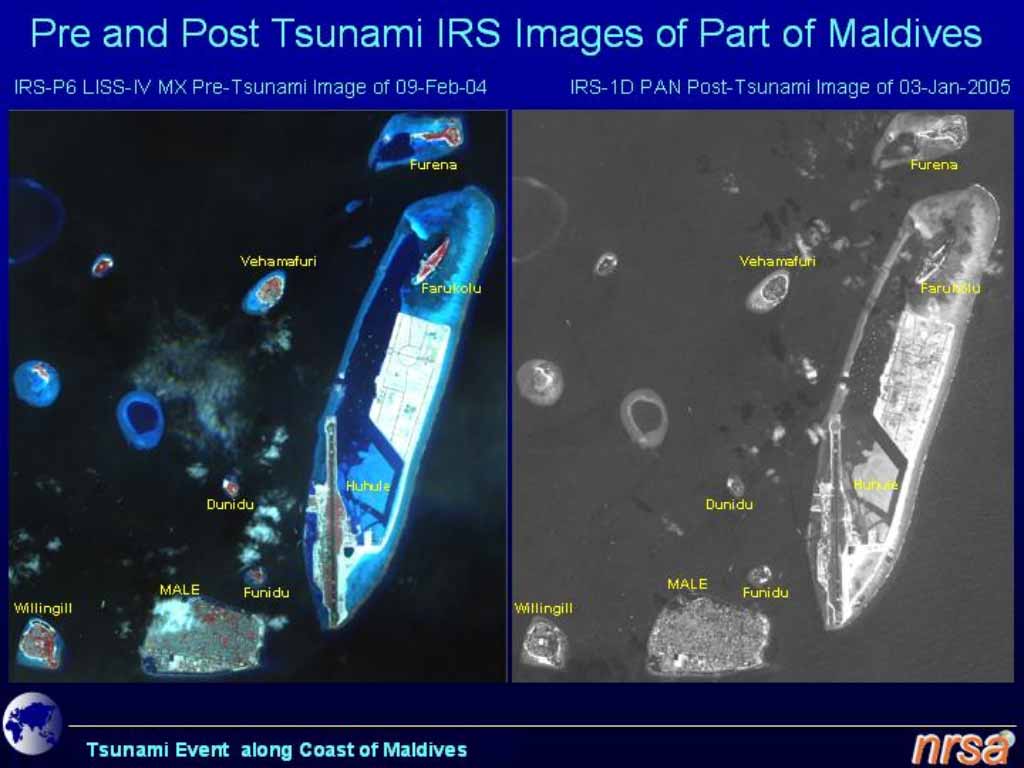
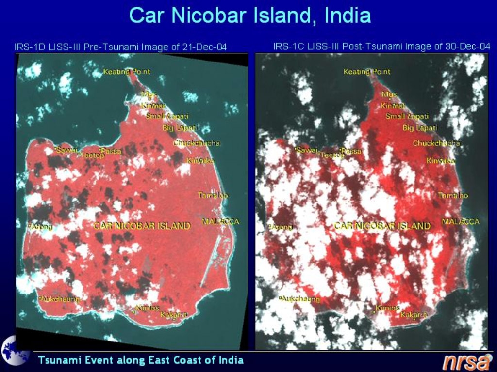
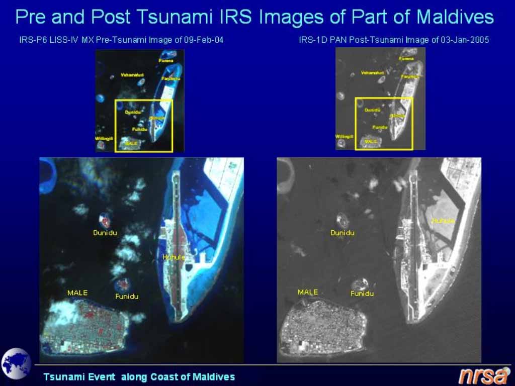
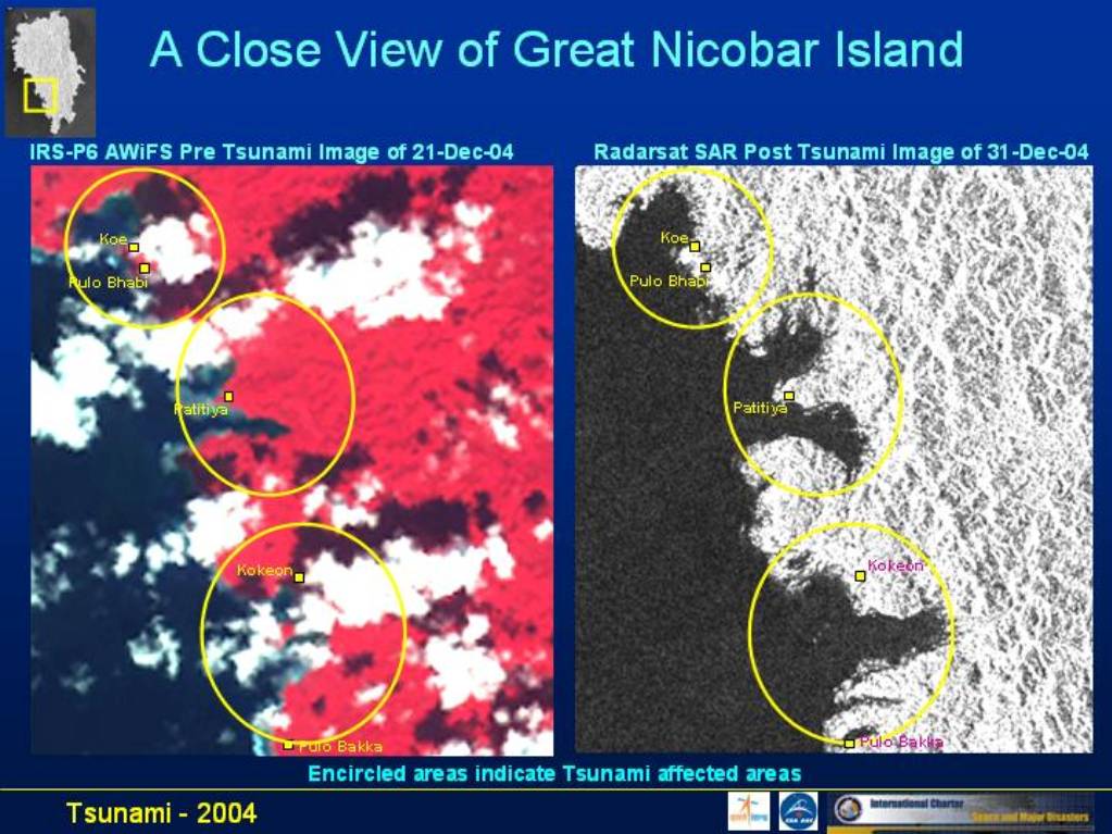
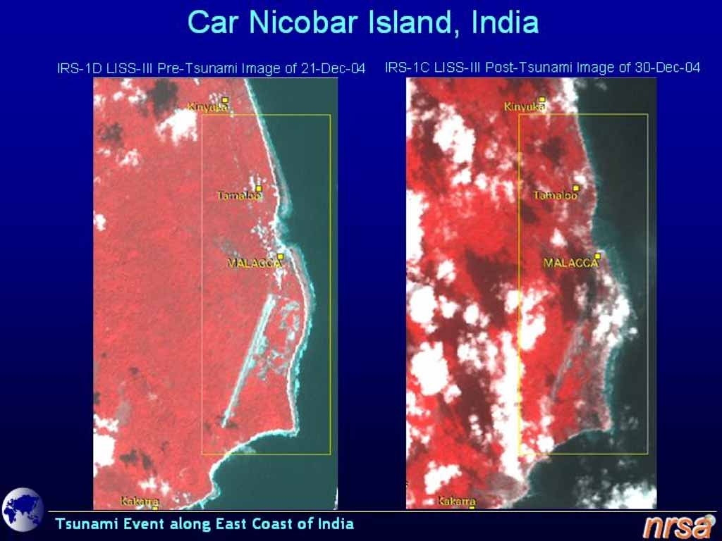
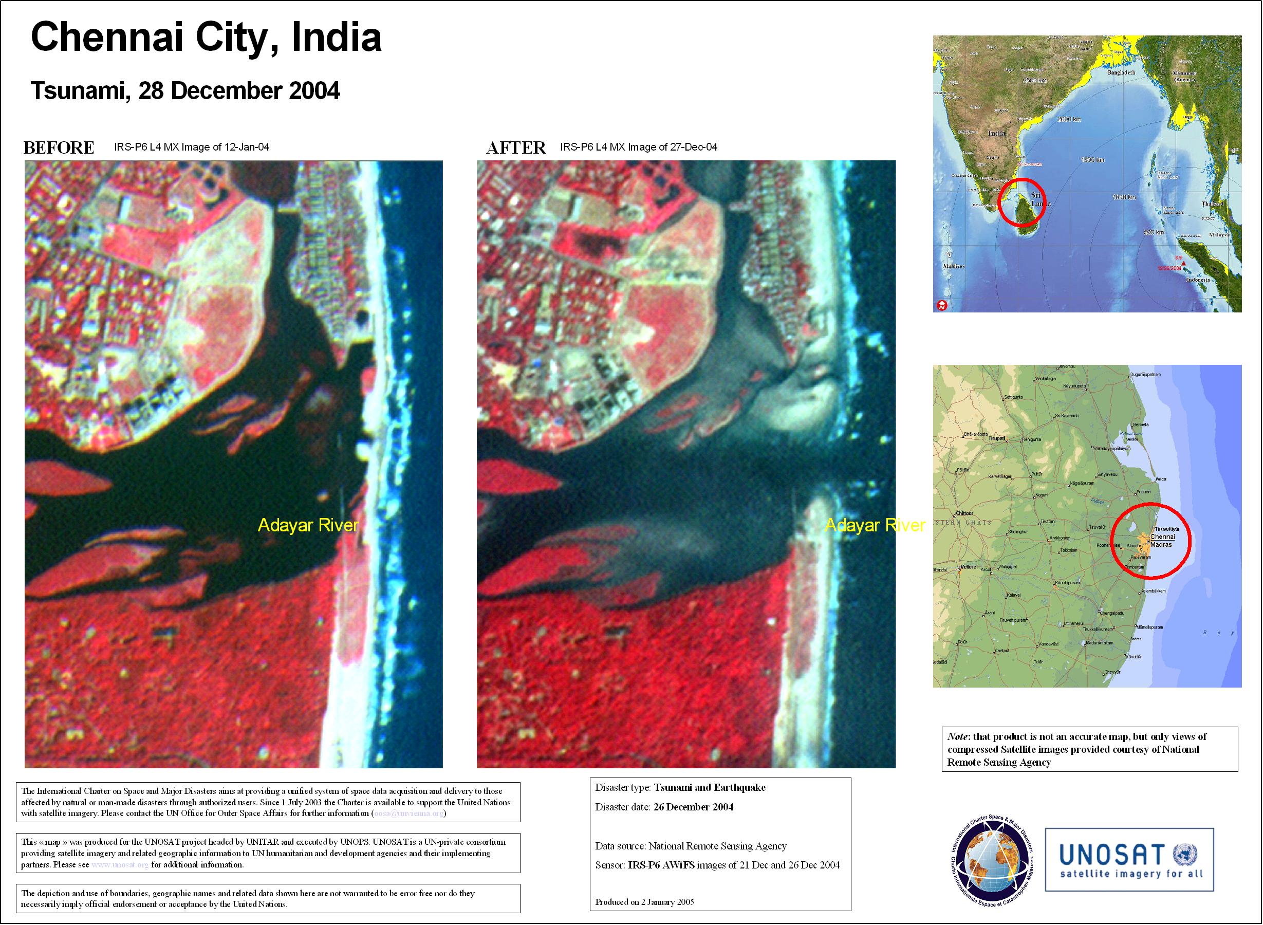
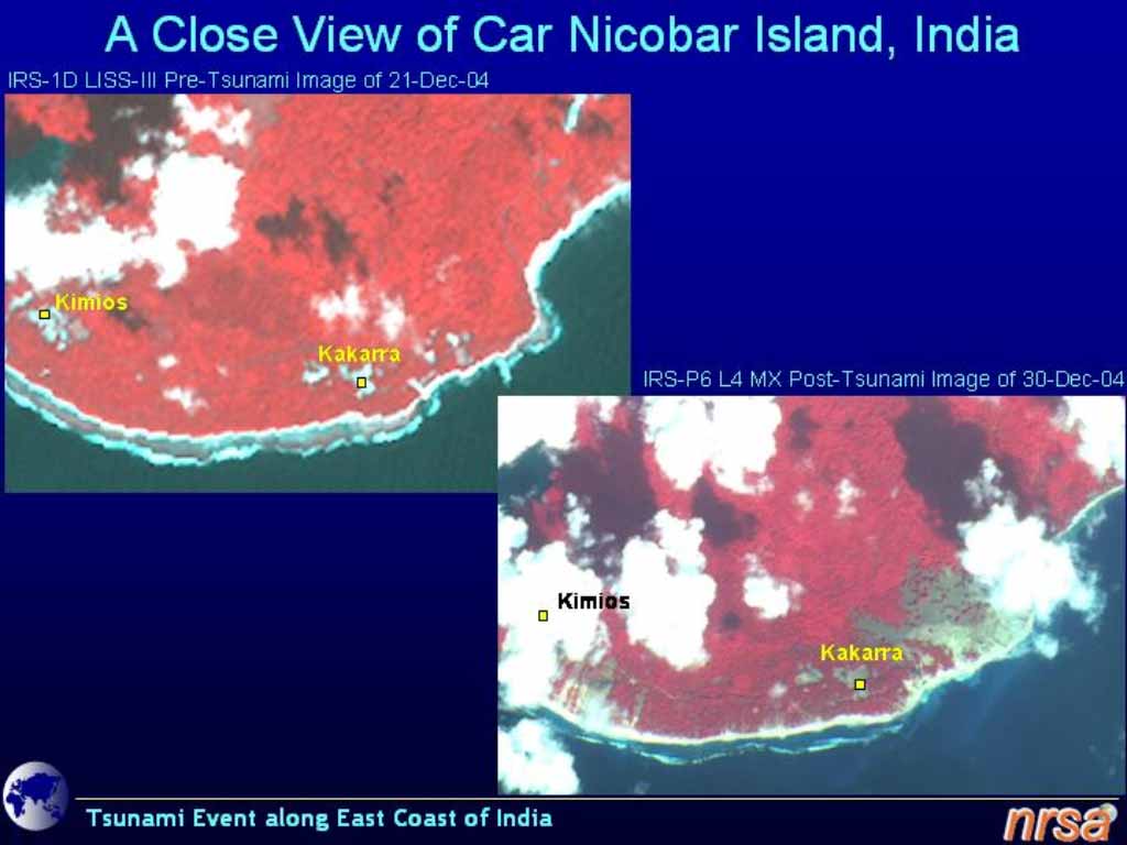
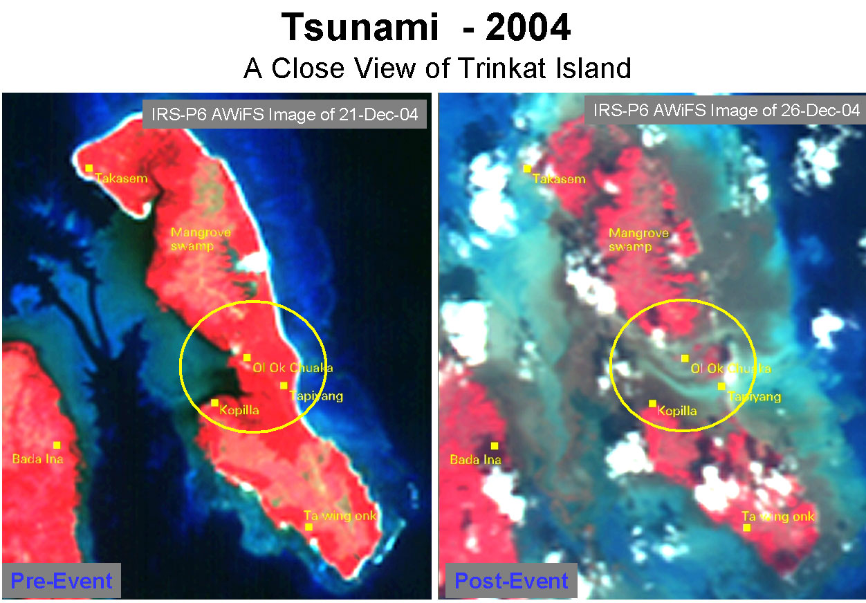
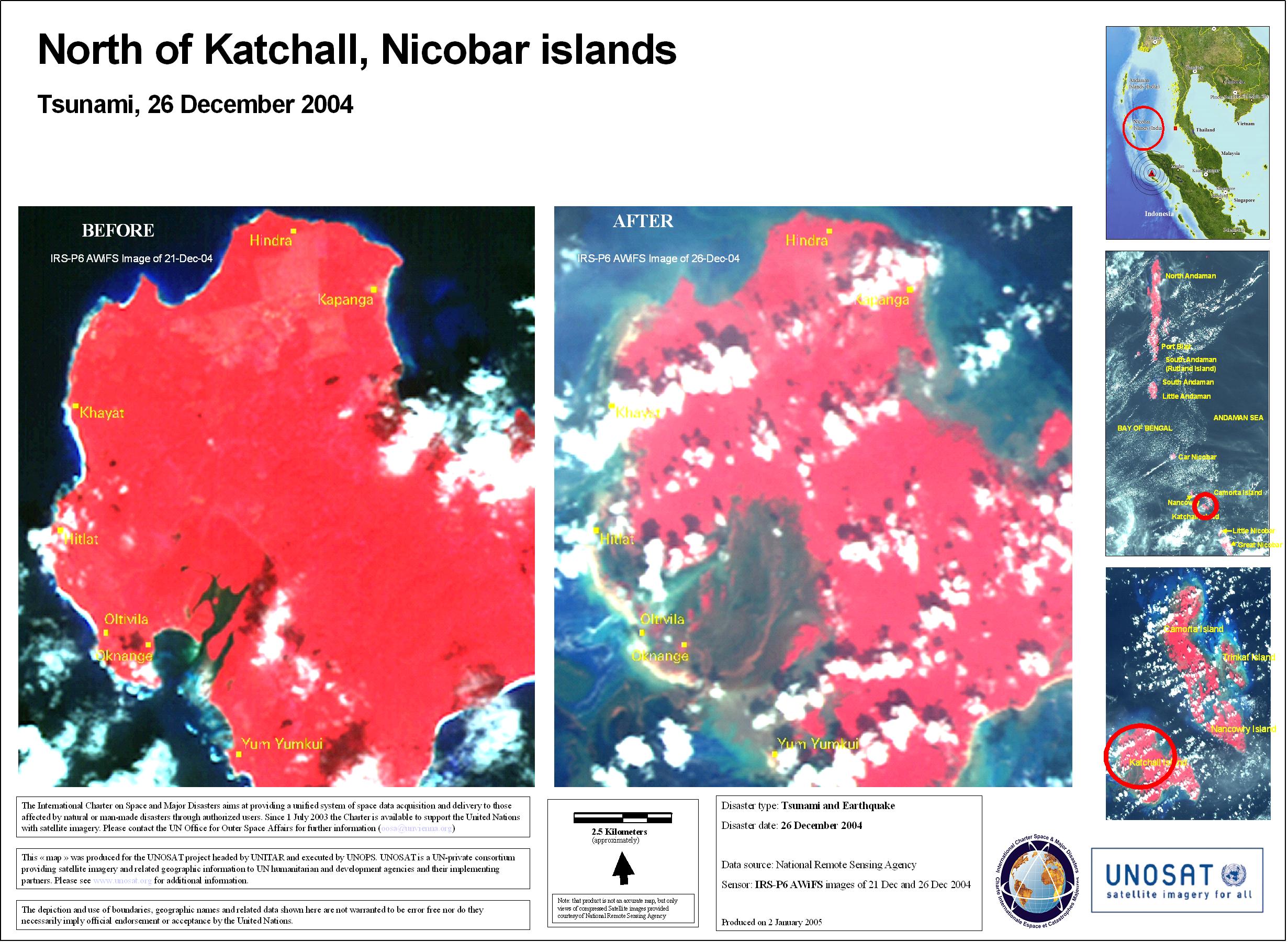
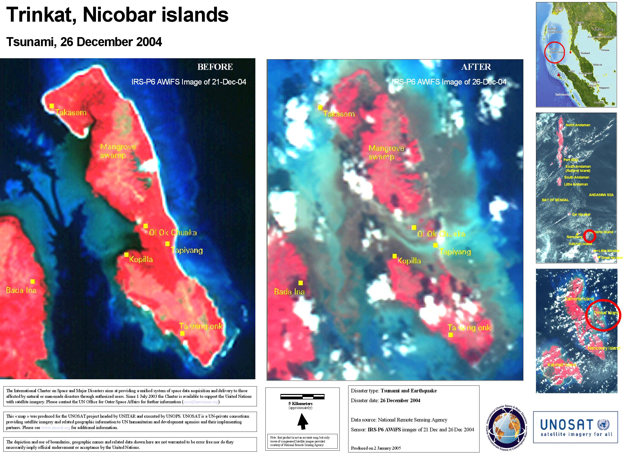
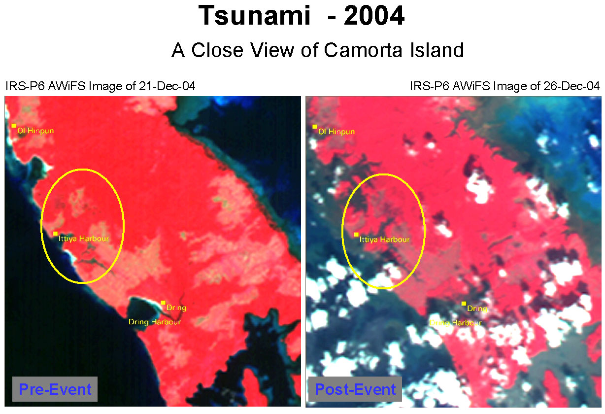
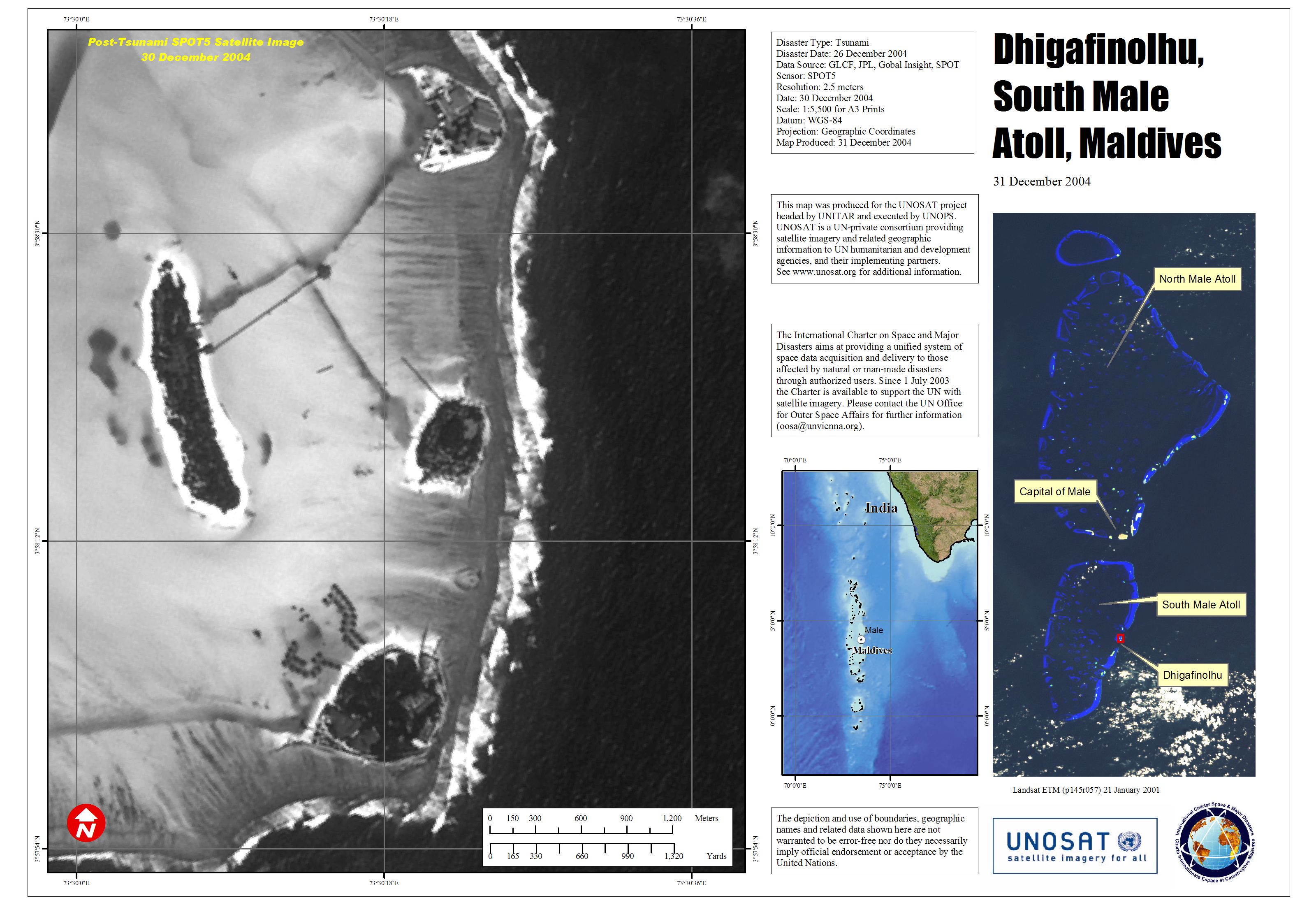
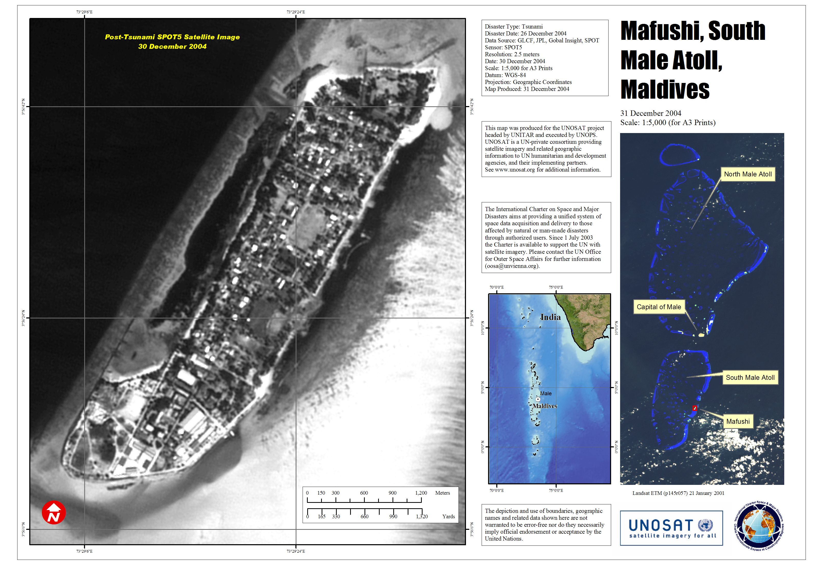
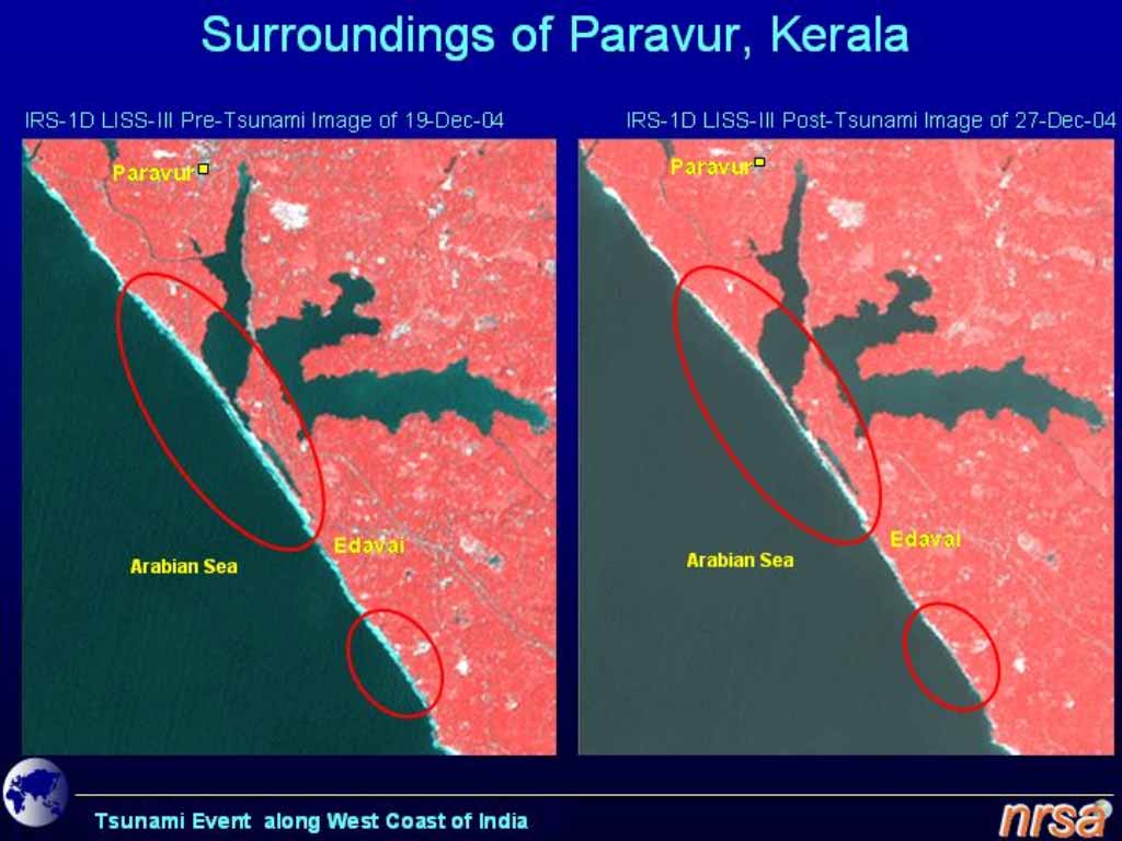
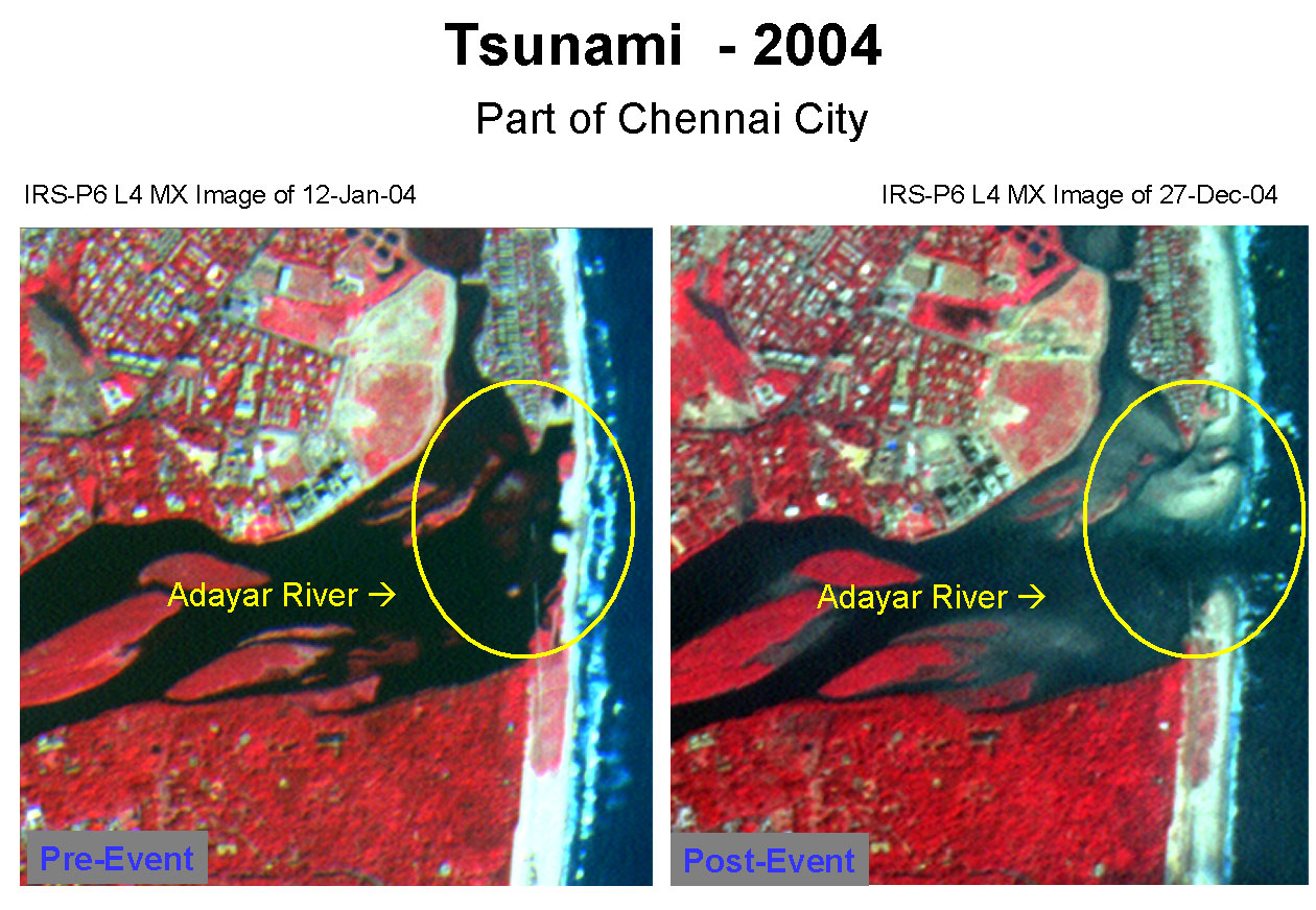
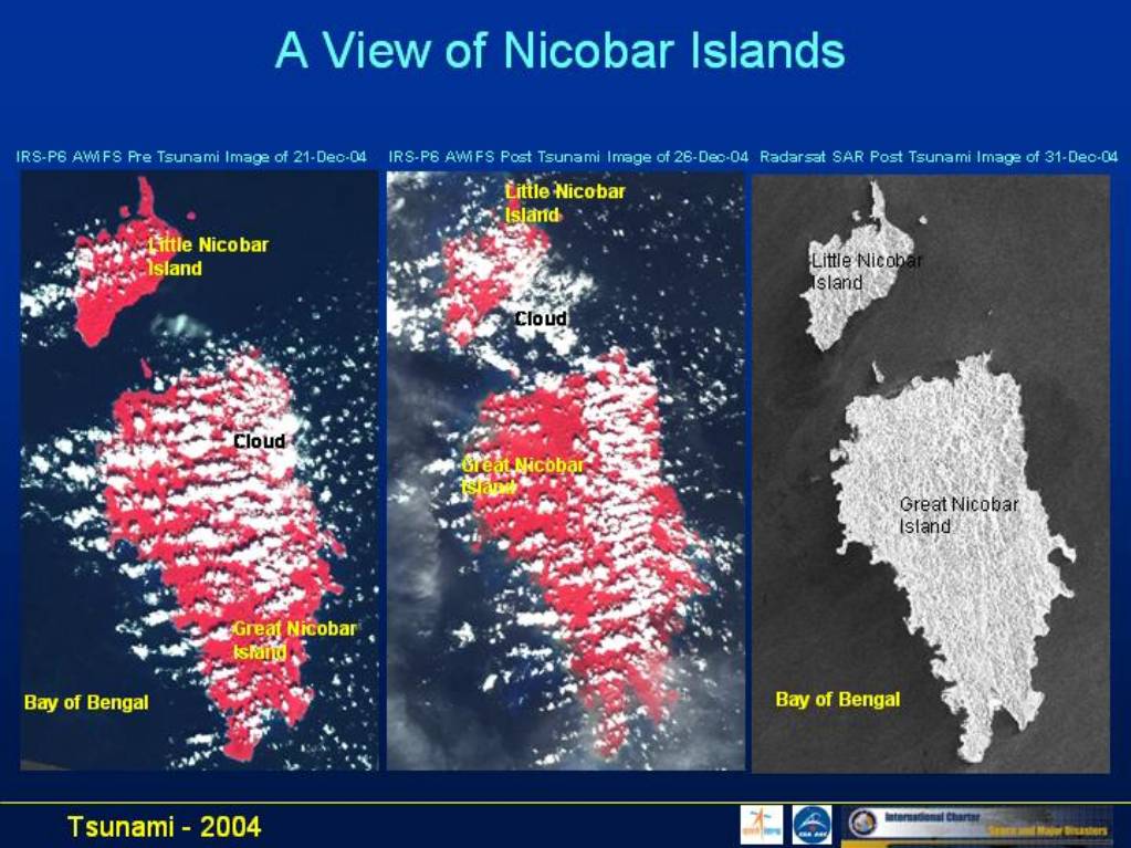
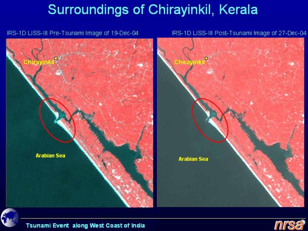
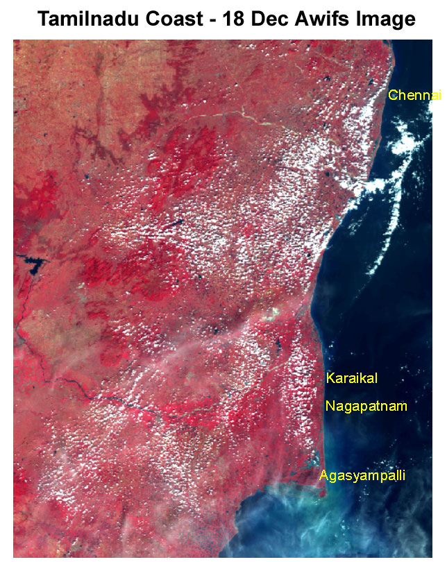
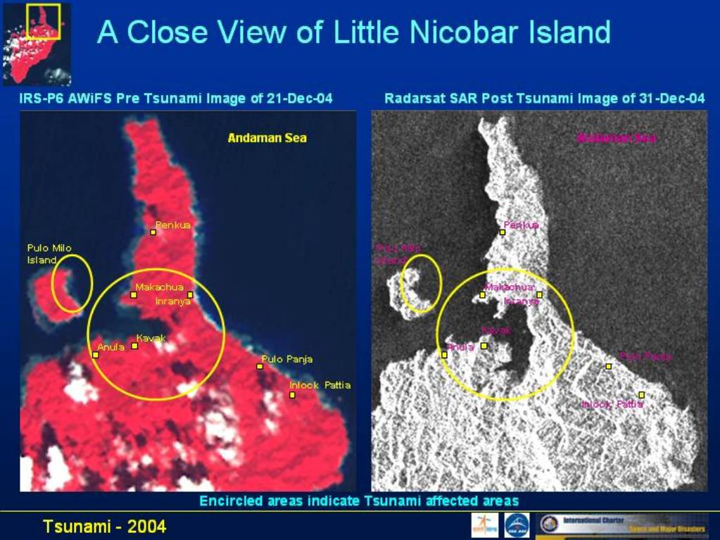
Earthquake, Tsunami in Southern Asia
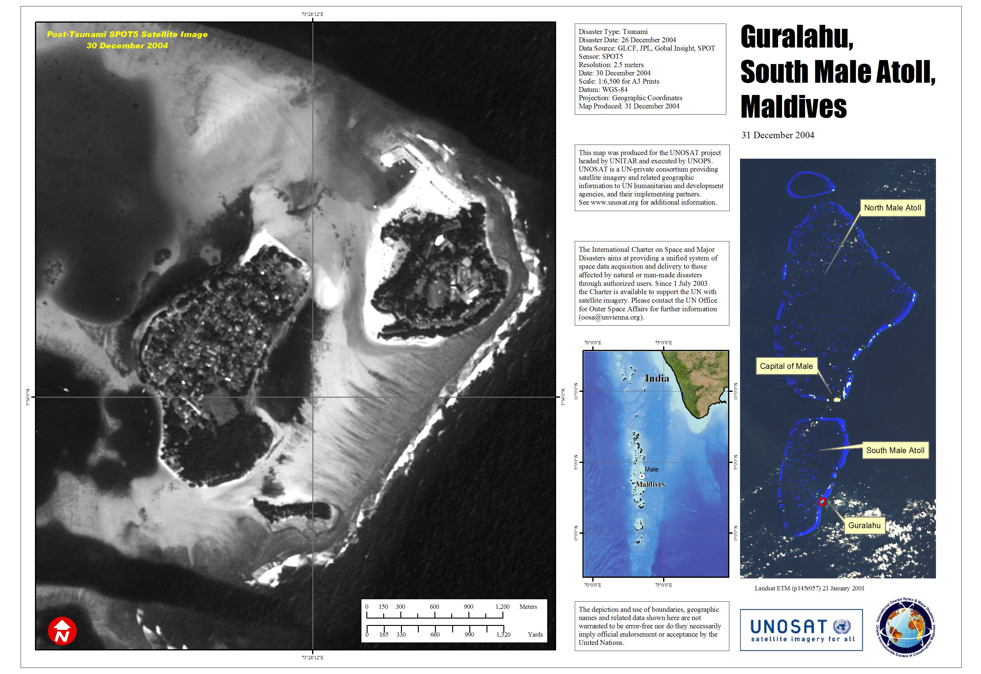
A high-magnitude earthquake, 9.0 on the Richter scale, struck southern Asia at 00:58 UTC, 6:58 AM local time. The epicentre was 320 km west of Medan, just off the west coast of the Indonesian island of Sumatra. The earthquake was followed by tsunamis that killed nearly a quarter of a million people, mostly in Indonesia, Sri Lanka, and India. The coastal regions of India, Sri Lanka, Thailand, Indonesia, Maldives, Malaysia, and Myanmar were all severely affected. Bangladesh, the Seychelles, Somalia, Kenya, and Tanzania also suffered damage and loss of life.
Products
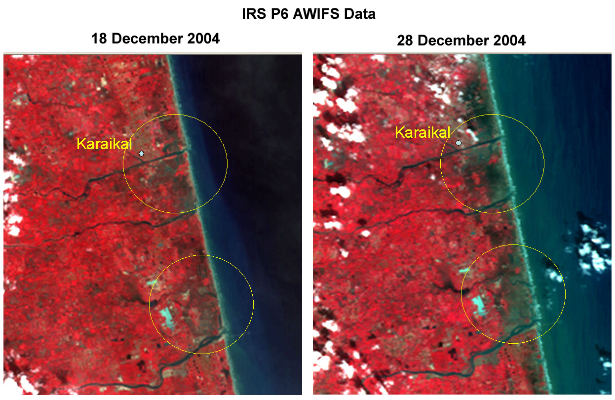

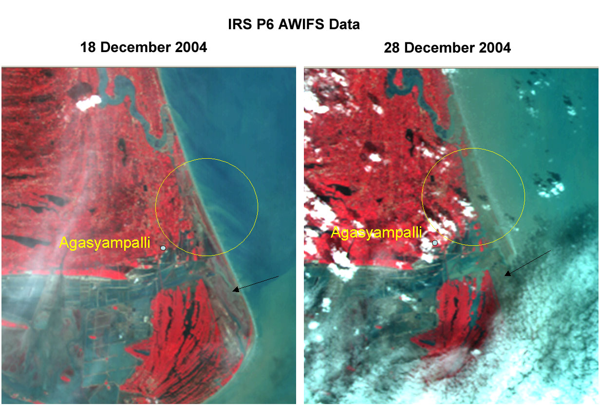

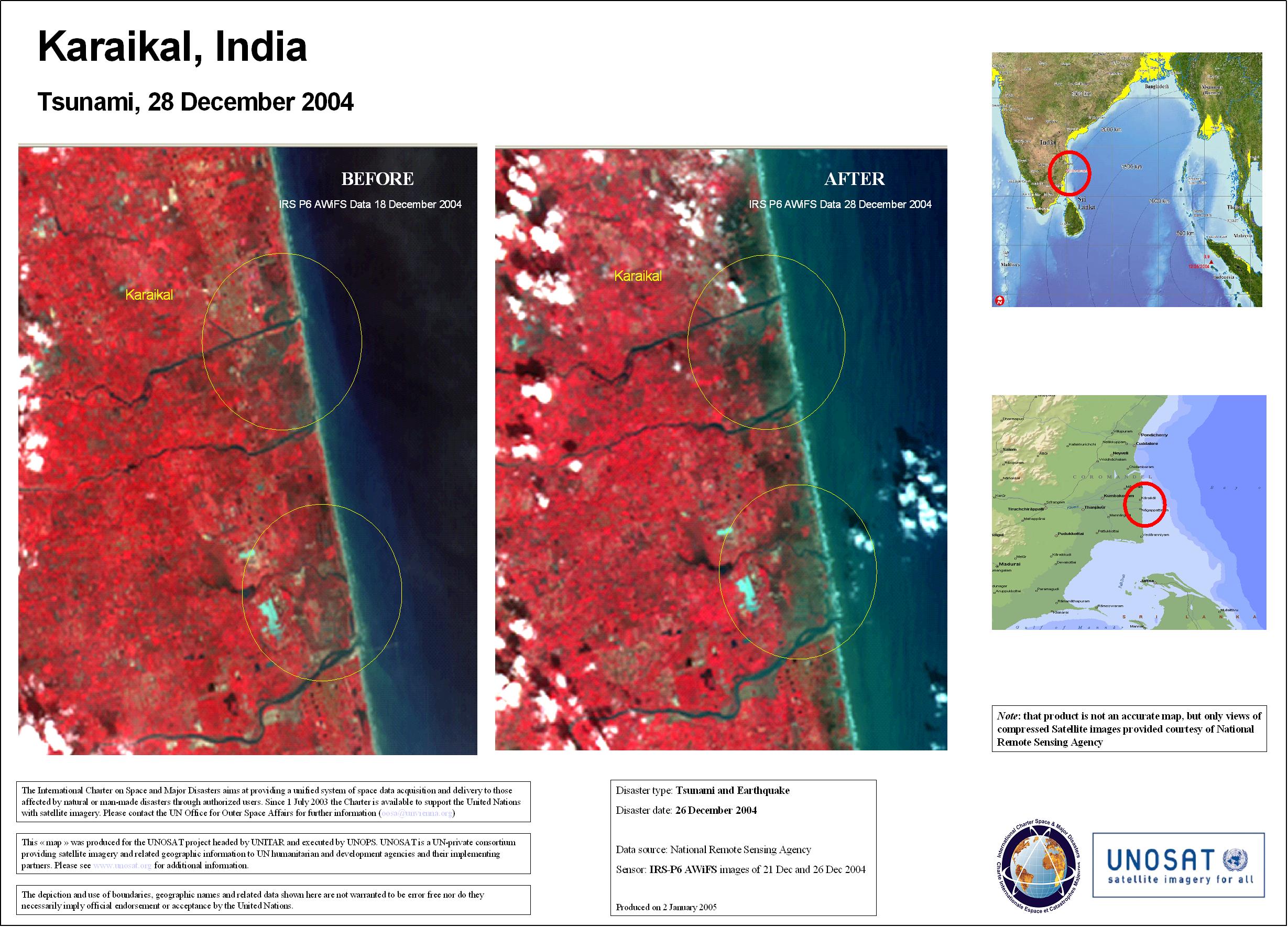
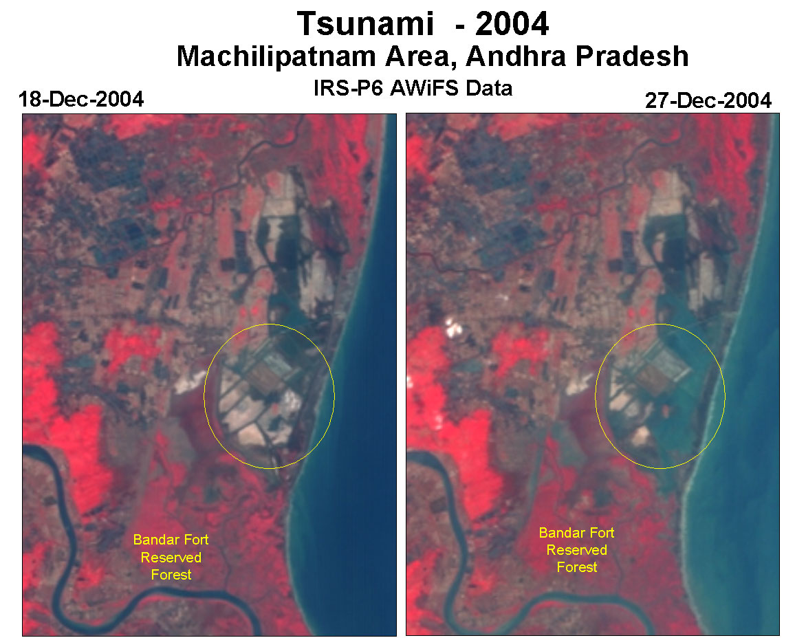


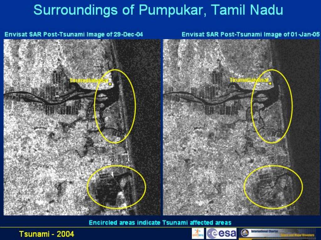

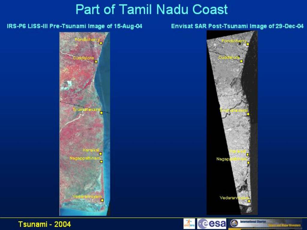


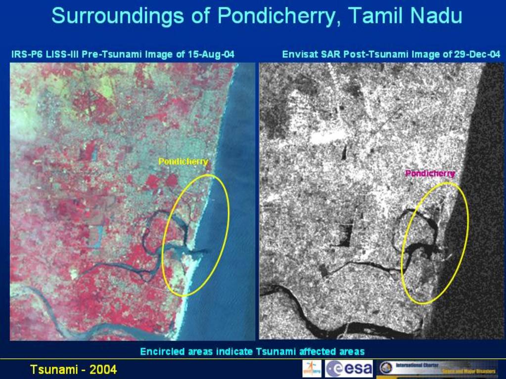

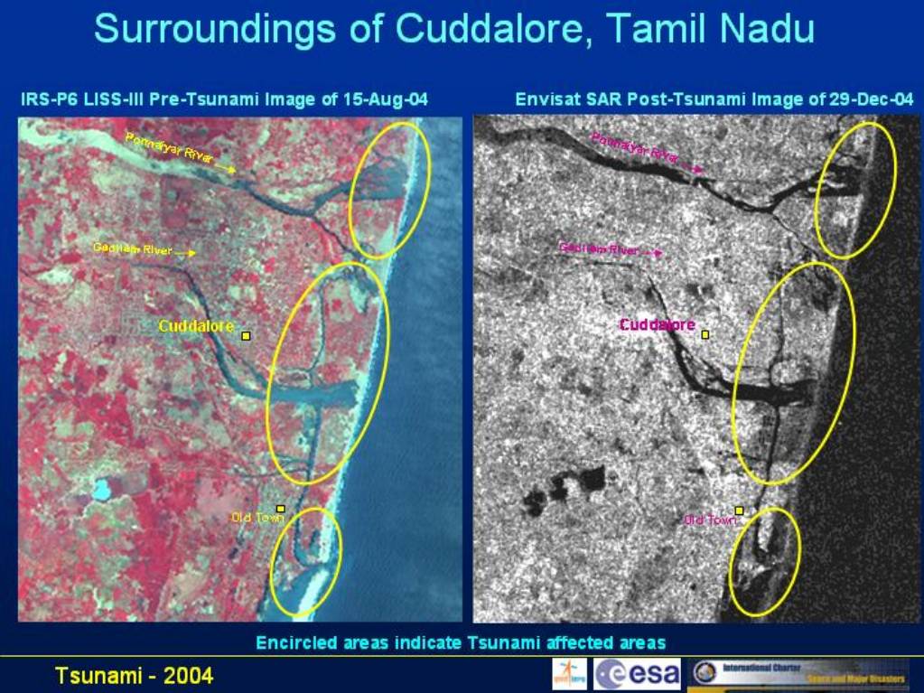
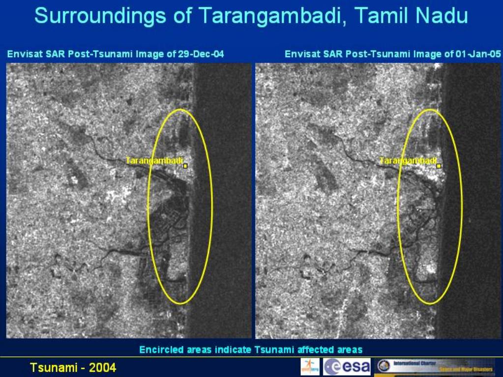
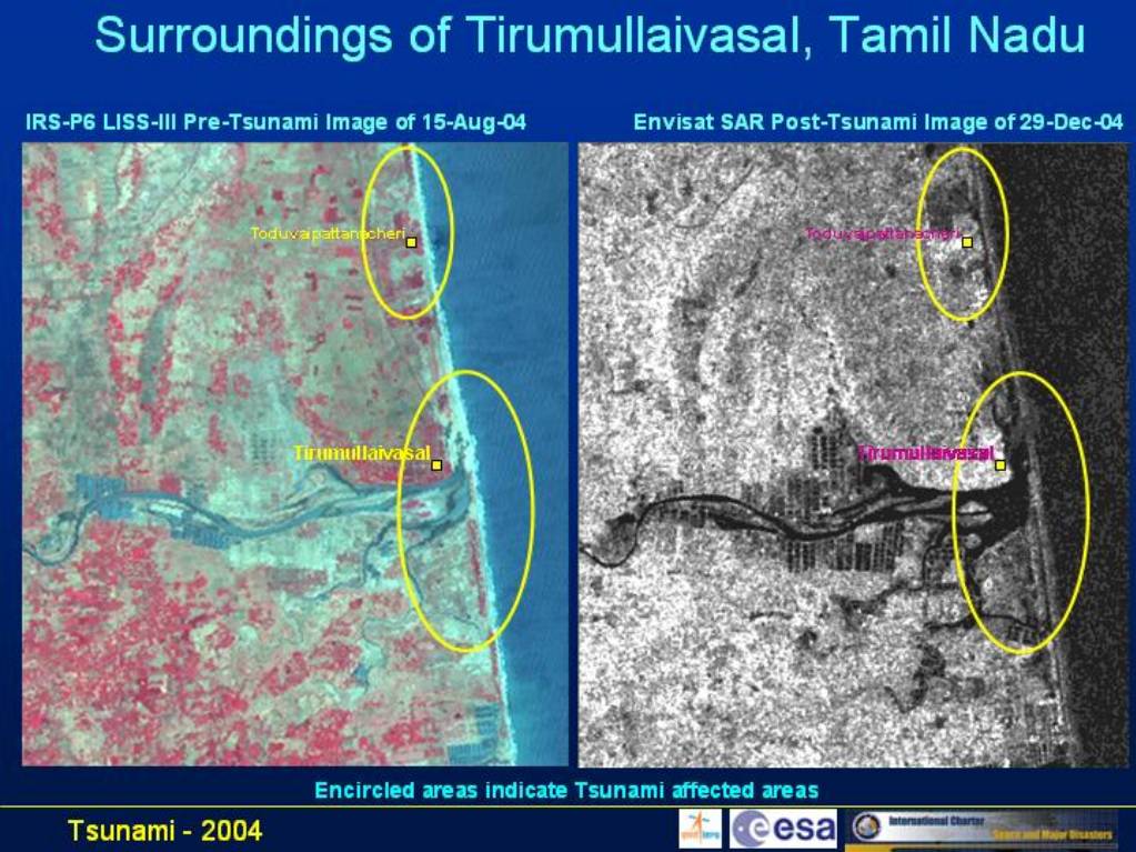
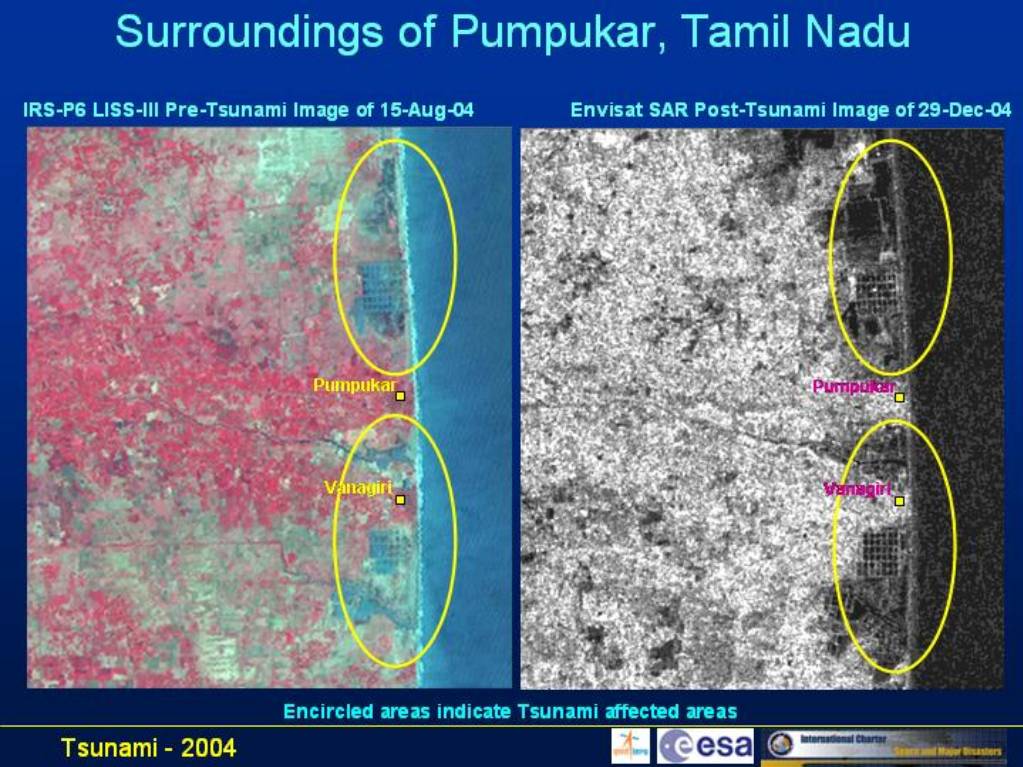


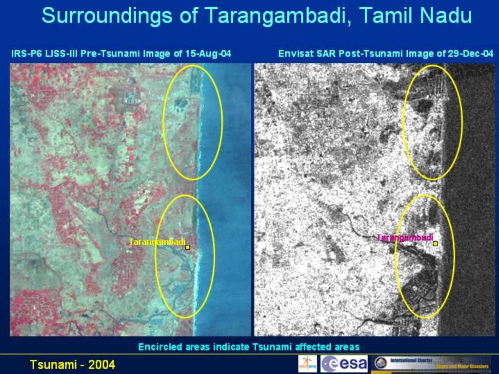


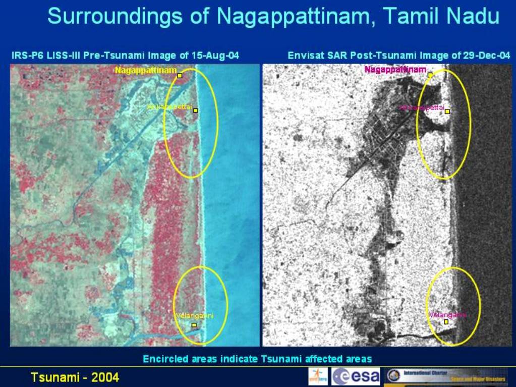
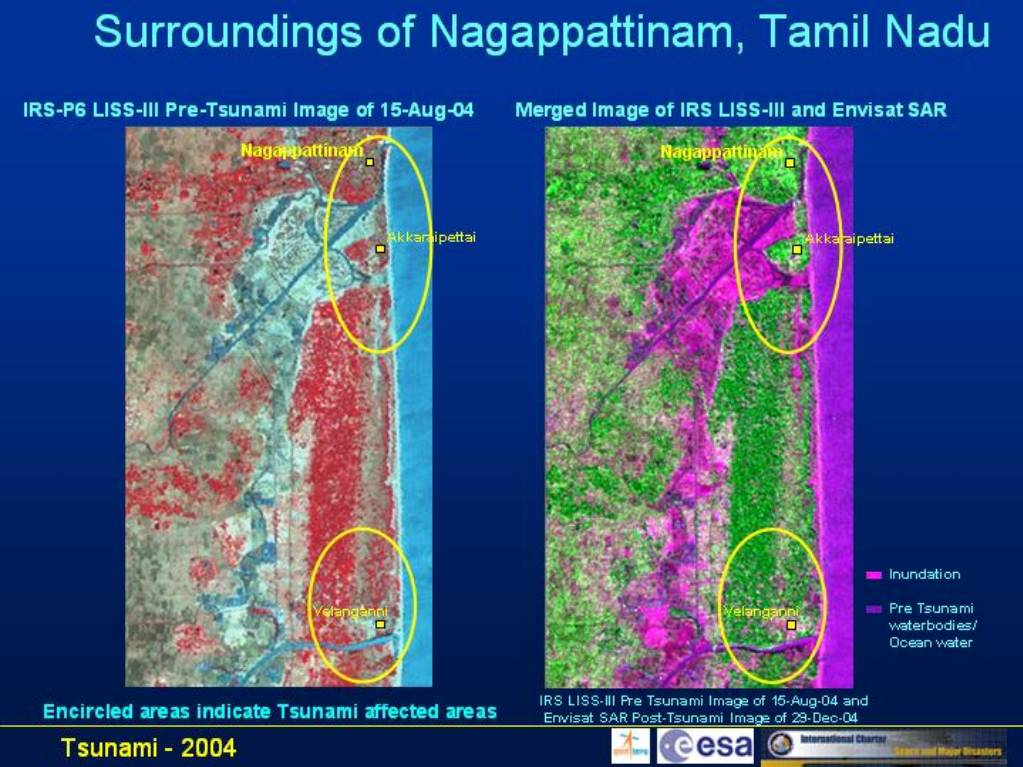
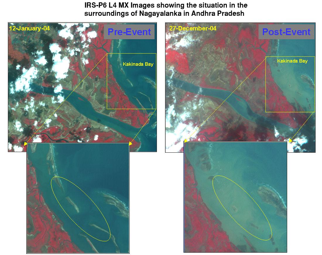
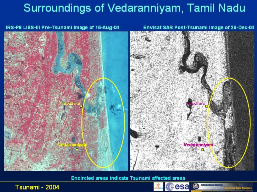
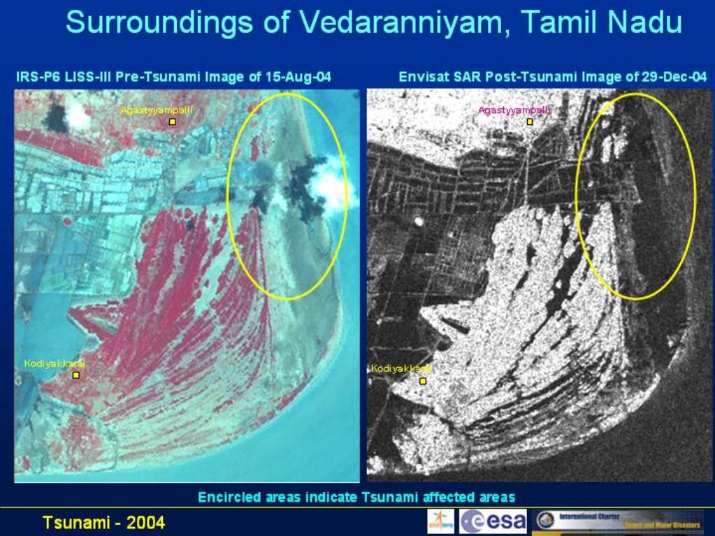
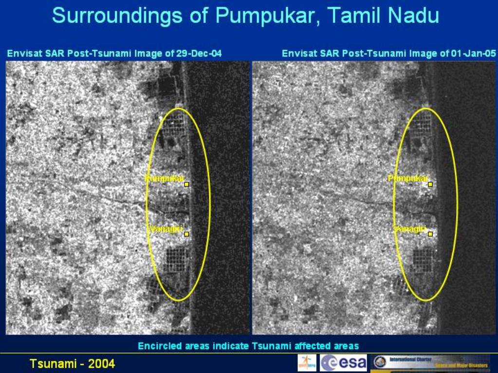
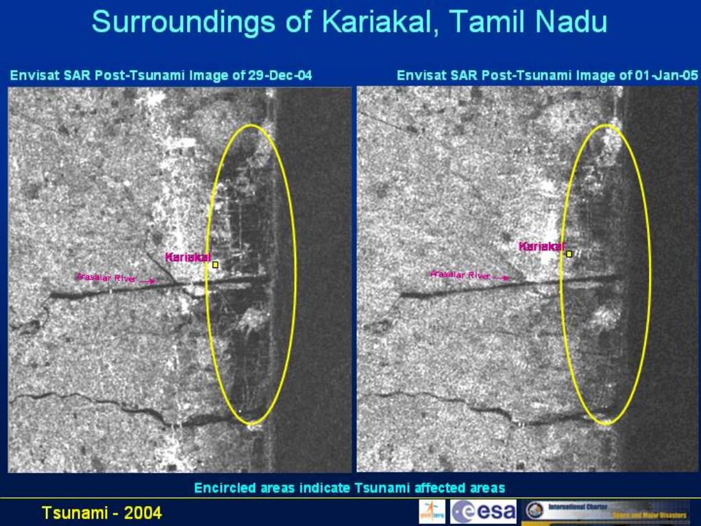
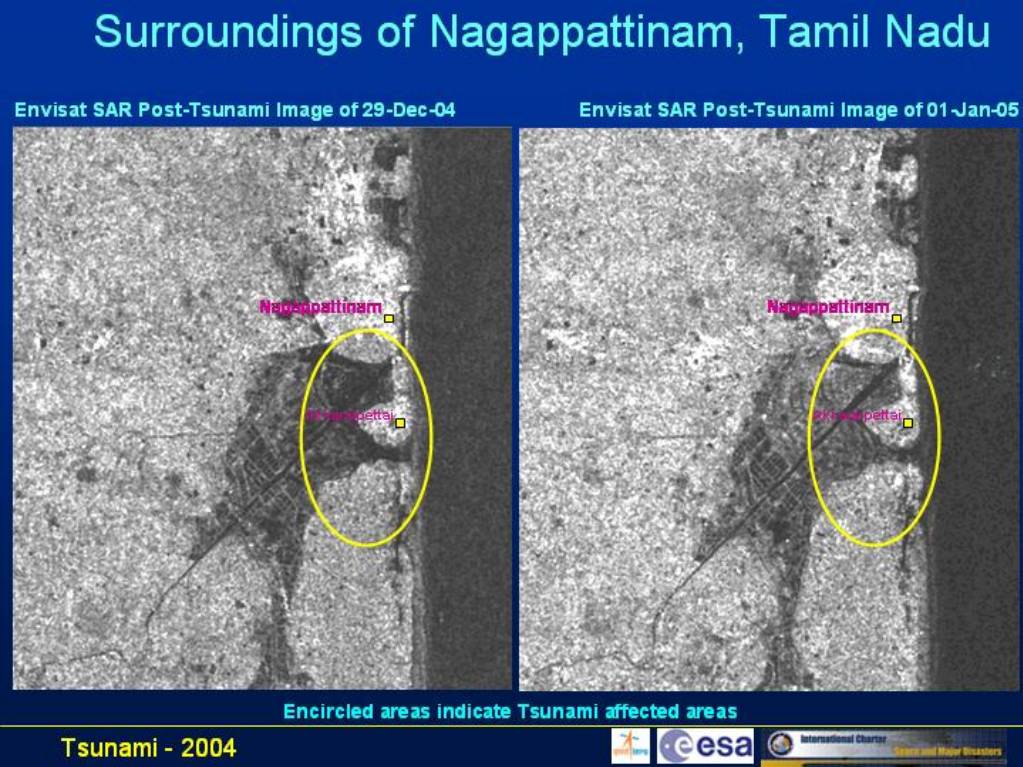
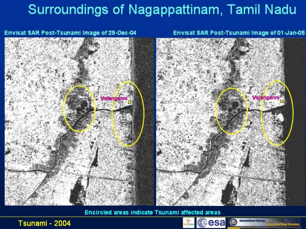
Before and after tsunami satellite images, Nagappattinam Surroundings Tamil Nadu
Copyright: Courtesy National Remote Sensing Agency, Govt. of India
Information about the Product
Acquired: 29/12/04
Source: IRS-P6 LISS-III data, 15/08/04 and merged image IRS LISS-III, 15/08/04 and Envisat SAR data, 29/12/04

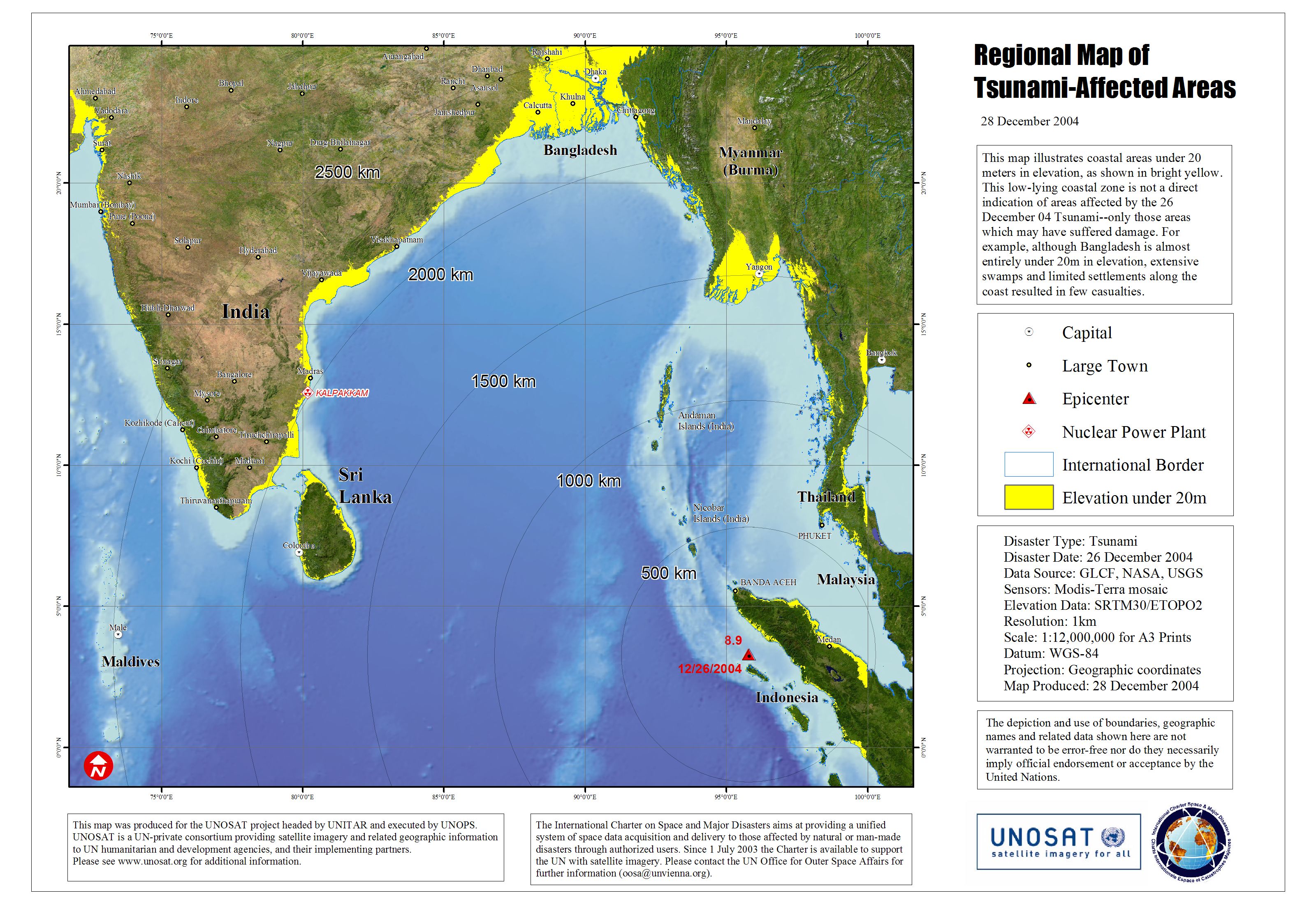
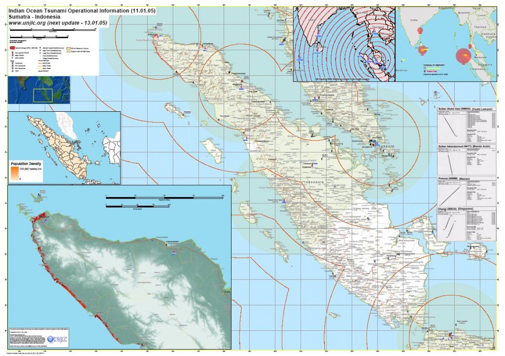
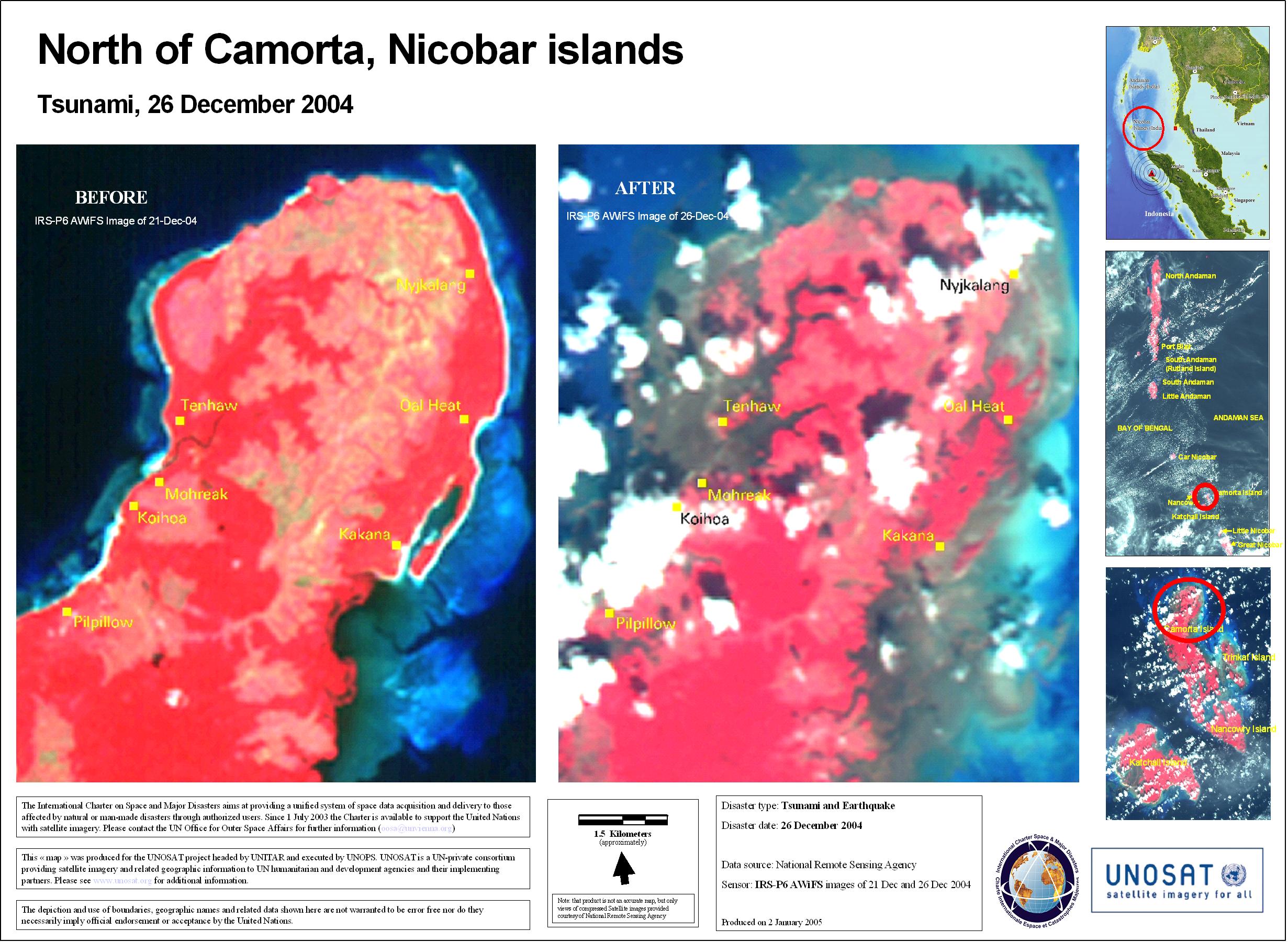
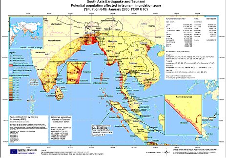
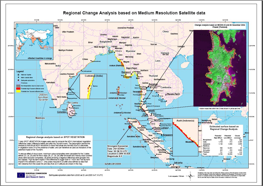
Regional map of tsunami-affected areas, scale: 1:12,000,000
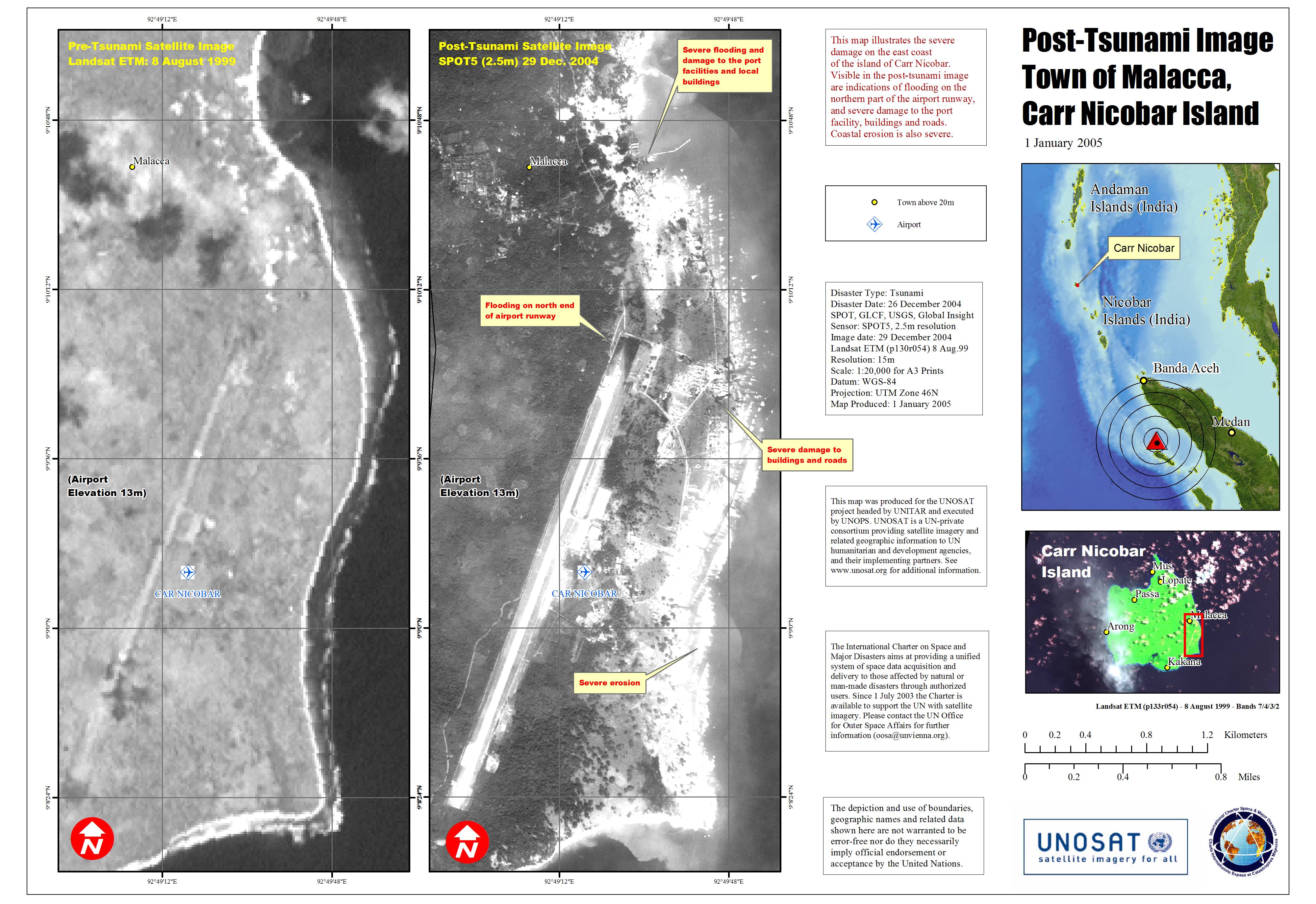
Elevation data: SRTM (3 arc seconds). Shows coastal areas under 20 meters elevation. Map produced 28/12/2004 by UNOSAT.
Information about the Product
Source: GLCF, NASA, USGS. MODIS-Terra Mosaic SRTM (3 arc seconds). Shows coastal areas under 20 meters elevation. Map produced 28/12/2004 by UNOSAT.


 Back to the full activation archive

