 English
 Spanish
 French
 Chinese
 Russian
 Portuguese
 Flood in Sulawesi, Indonesia
« Назад
Flood in Sulawesi, Indonesia
Charter activations
Flood in Sulawesi, Indonesia
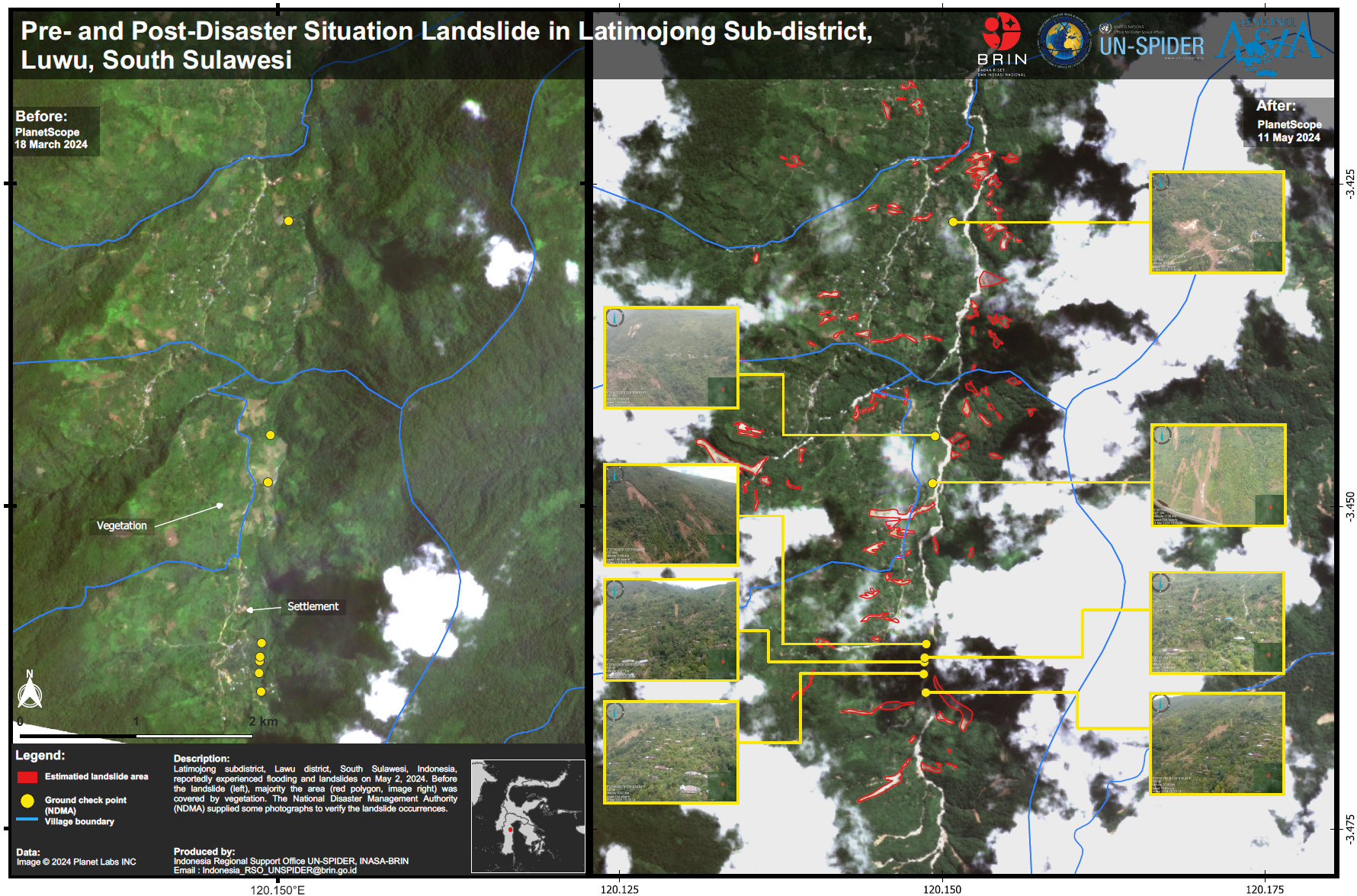
Hours of torrential rain created flash floods and triggered landslides in the southern region of Sulawesi Island.
Floods reaching as high as 3 meters have covered 13 sub-districts with water and mud. More than 1,000 houses were damaged, including 42 of them being completely swept off their foundations.14 deaths have been reported. Among other vehicles used in rescue and evacuation attempts, rubber boats were used to evacuate residents, with numbers reaching 115 displaced. People have sought refuge in mosques and relative homes outside of the affected area.
Additionally, Sumatra Island was also affected by the heavy rain, leading to damaging floods.
Related Resources:
| Тип события: | Flood |
| Место события: | Indonesia |
| Date of Charter Activation: | 2024-05-12 |
| Время активации Хартии: | 19:51 |
| TЧасовой пояс в районе активации Хартии: | UTC+09:00 |
| Запрос на активацию поступил от: | ADRC on behalf of National Research and Innovation Agency (BRIN) |
| Номер активации: | 877 |
| Менеждер проекта от: | Kholifatul Aziz (National Research and Innovation Agency (BRIN)) |
| act-value-adders: | Yenni Vetrita (National Research and Innovation Agency (BRIN)) |
Products

 Вернуться к полному архиву активаций
