 English
 Spanish
 French
 Chinese
 Russian
 Portuguese
 Последняя Активация
Charter activations
La Soufrière Volcano eruption in Saint Vincent And The Grenadines
A volcano in the southern Caribbean that had been dormant for decades erupted in a billowing blast of gray smoke on Friday, spewing clouds of ash for miles and forcing thousands to evacuate.
The volcano, known as La Soufrière, on the northern tip of the main island of St. Vincent, in St. Vincent and the Grenadines, had started showing signs of renewed activity in late December.
Emergency officials described the landscape as a "battle zone" and said more damage and destruction was likely.
Nemo is urging people to "be careful on the roads, which have become treacherous as a result of the ash flow". Prime Minister Ralph Gonsalves said water supplies to most of the island had been cut off and its airspace closed because of the smoke and thick plumes of volcanic ash moving through the atmosphere.
Related News and Resources
| Тип события: | Volcano |
| Место события: | Saint Vincent And The Grenadines |
| Date of Charter Activation: | 2021-04-09 |
| Время активации Хартии: | 19:44 |
| TЧасовой пояс в районе активации Хартии: | UTC+02:00 |
| Запрос на активацию поступил от: | UNITAR on behalf of WFP |
| Номер активации: | 703 |
| Менеждер проекта от: | UNITAR |
Products
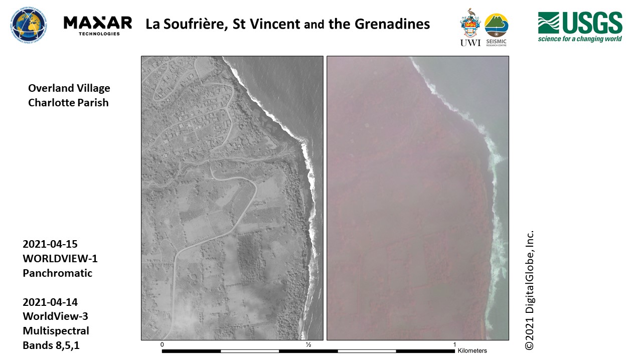
Images of the area near Overland Village, Charlotte Parish
Авторские права: © 2021 DigitalGlobe, Inc., Longmont CO USA 80503. DigitalGlobe and the DigitalGlobe logos are trademarks of DigitalGlobe, Inc. The use and/or dissemination of this data and/or of any product in any way derived there from are restricted. Unauthorized use and/or dissemination is prohibited
Map produced by USGS
Information about the Product
Получено: WorldView-1: 15/04/2021
WorldView-3: 14/04/2021
Источник: WorldView-1 / WorldView-3
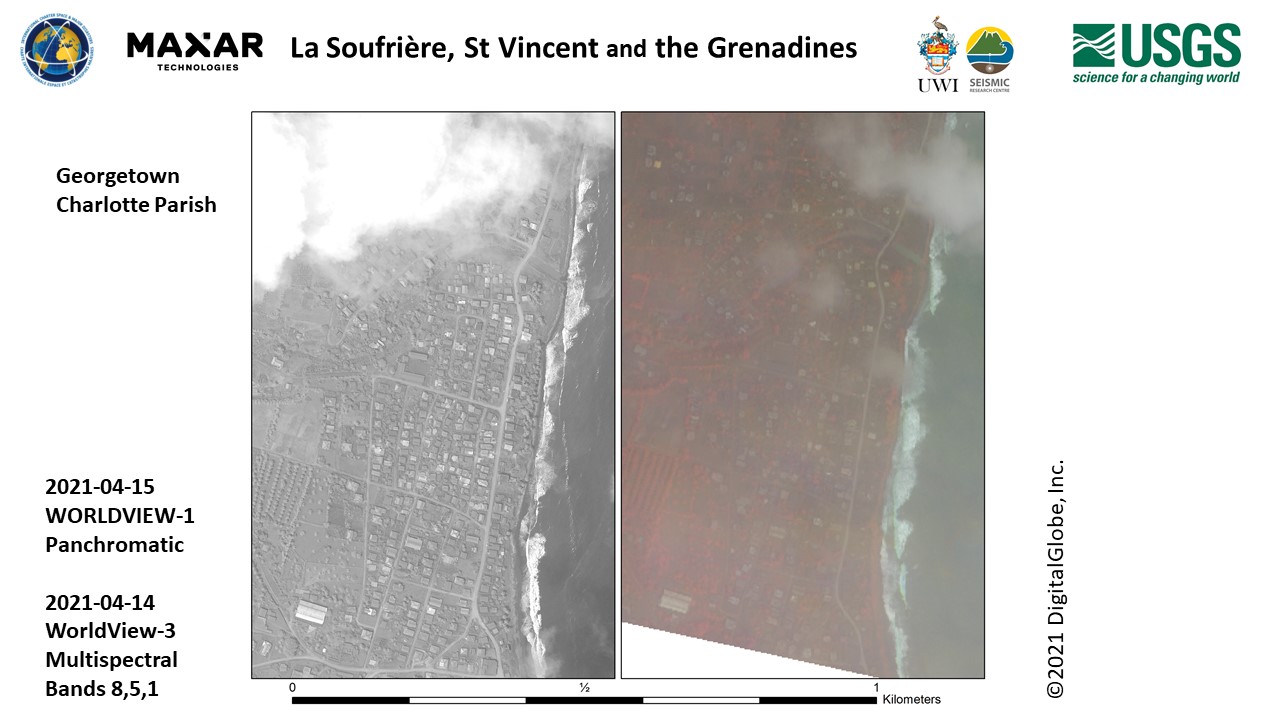
Images of area near Georgetown, Charlotte Parish
Авторские права: © 2021 DigitalGlobe, Inc., Longmont CO USA 80503. DigitalGlobe and the DigitalGlobe logos are trademarks of DigitalGlobe, Inc. The use and/or dissemination of this data and/or of any product in any way derived there from are restricted. Unauthorized use and/or dissemination is prohibited
Map produced by USGS
Information about the Product
Получено: WorldView-1: 15/04/2021
WorldView-3: 14/04/2021
Источник: WorldView-1 / WorldView-3
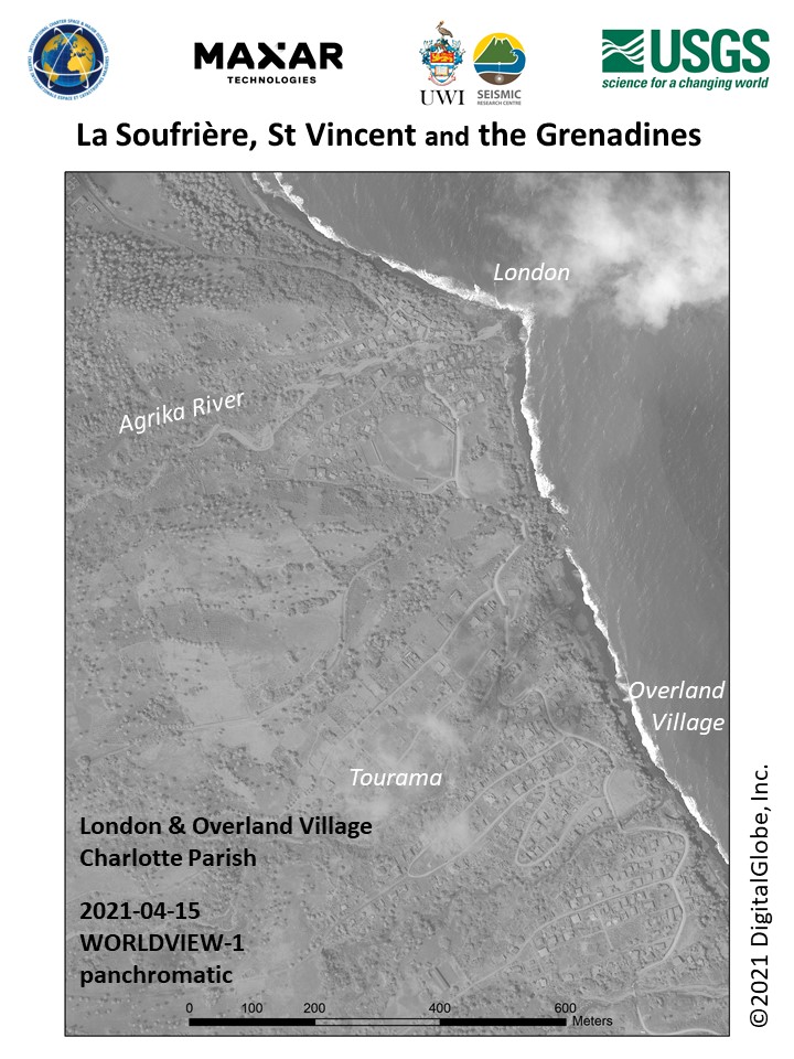
Panchromatic image of London and Overland Village, Charlotte Parish, St Vincent and the Grenadines
Авторские права: © 2021 DigitalGlobe, Inc., Longmont CO USA 80503. DigitalGlobe and the DigitalGlobe logos are trademarks of DigitalGlobe, Inc. The use and/or dissemination of this data and/or of any product in any way derived there from are restricted. Unauthorized use and/or dissemination is prohibited
Map produced by USGS
Information about the Product
Получено: WorldView-1: 15/04/2021
Источник: WorldView-1
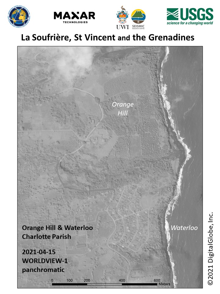
Panchromatic image of Orange Hill and Waterloo, Charlotte Parish, St Vincent and the Grenadines
Авторские права: © 2021 DigitalGlobe, Inc., Longmont CO USA 80503. DigitalGlobe and the DigitalGlobe logos are trademarks of DigitalGlobe, Inc. The use and/or dissemination of this data and/or of any product in any way derived there from are restricted. Unauthorized use and/or dissemination is prohibited
Map produced by USGS
Information about the Product
Получено: WorldView-1: 15/04/2021
Источник: WorldView-1
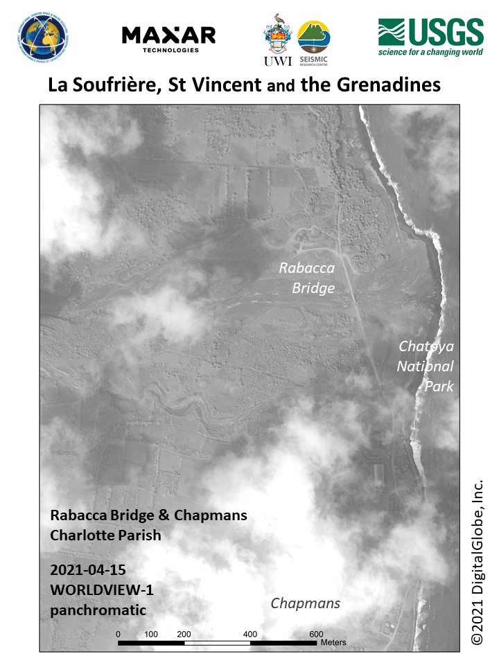
Panchromatic image of the Rabacca Bridge and Chapmans, Charlotte Parish, St Vincent and the Grenadines
Авторские права: © 2021 DigitalGlobe, Inc., Longmont CO USA 80503. DigitalGlobe and the DigitalGlobe logos are trademarks of DigitalGlobe, Inc. The use and/or dissemination of this data and/or of any product in any way derived there from are restricted. Unauthorized use and/or dissemination is prohibited
Map produced by USGS
Information about the Product
Получено: WorldView-1: 15/04/2021
Источник: WorldView-1

Panchromatic image of Georgetown, Charlotte Parish, St Vincent and the Grenadines
Авторские права: © 2021 DigitalGlobe, Inc., Longmont CO USA 80503. DigitalGlobe and the DigitalGlobe logos are trademarks of DigitalGlobe, Inc. The use and/or dissemination of this data and/or of any product in any way derived there from are restricted. Unauthorized use and/or dissemination is prohibited
Information about the Product
Получено: WorldView-1: 15/04/2021
Источник: WorldView-1
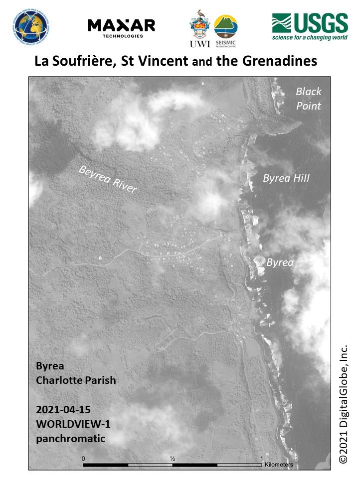
Panchromatic image of Byrea, Charlotte Parish, St Vincent and the Grenadines
Авторские права: © 2021 DigitalGlobe, Inc., Longmont CO USA 80503. DigitalGlobe and the DigitalGlobe logos are trademarks of DigitalGlobe, Inc. The use and/or dissemination of this data and/or of any product in any way derived there from are restricted. Unauthorized use and/or dissemination is prohibited
Map produced by USGS
Information about the Product
Получено: WorldView-1: 15/04/2021
Источник: WorldView-1

Panchromatic image of the area south of Tourama Point and north of Orange Hill, Charlotte Parish, St Vincent and the Grenadines
Авторские права: © 2021 DigitalGlobe, Inc., Longmont CO USA 80503. DigitalGlobe and the DigitalGlobe logos are trademarks of DigitalGlobe, Inc. The use and/or dissemination of this data and/or of any product in any way derived there from are restricted. Unauthorized use and/or dissemination is prohibited
Map produced by USGS
Information about the Product
Получено: WorldView-1: 15/04/2021
Источник: WorldView-1
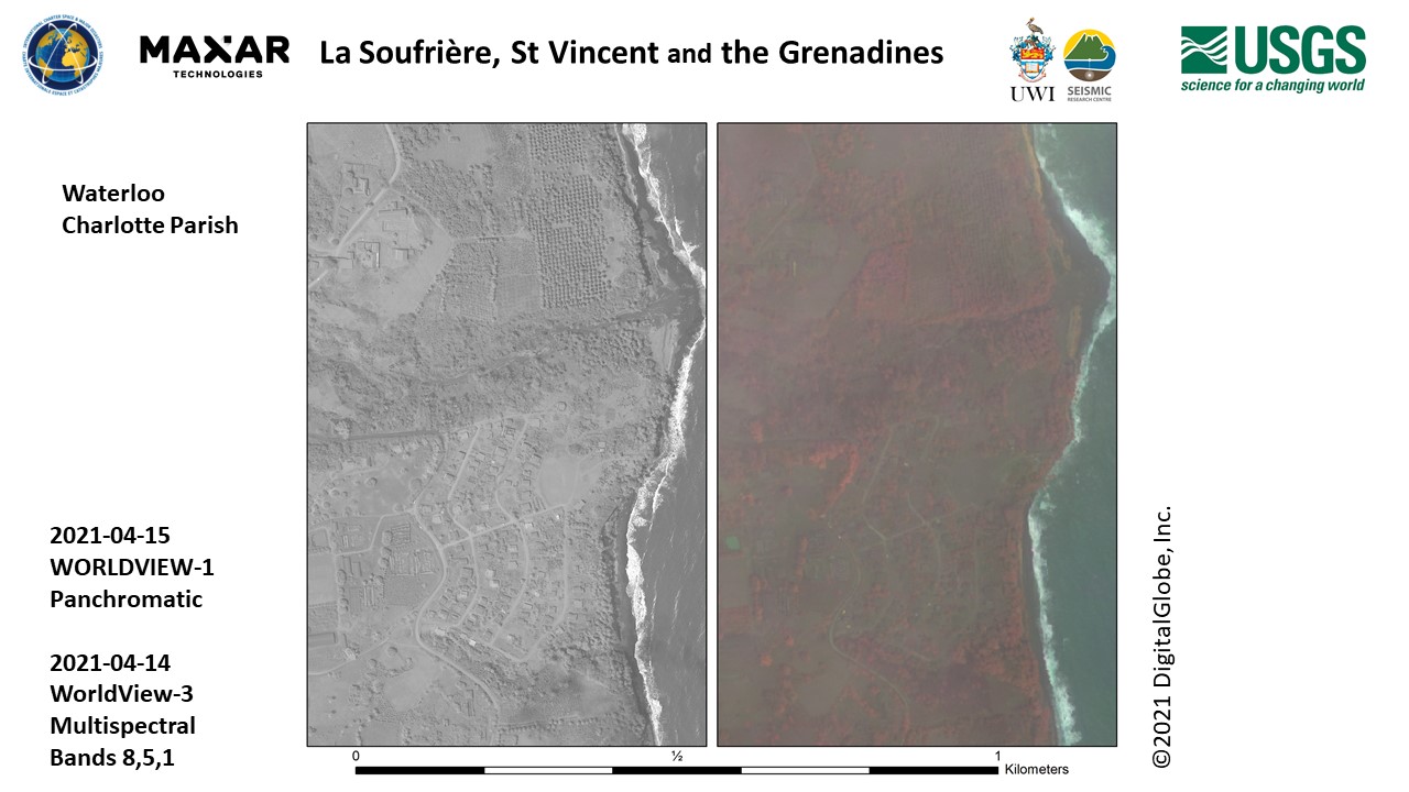
Images of the area near Waterloo, Charlotte Parish
Авторские права: © 2021 DigitalGlobe, Inc., Longmont CO USA 80503. DigitalGlobe and the DigitalGlobe logos are trademarks of DigitalGlobe, Inc. The use and/or dissemination of this data and/or of any product in any way derived there from are restricted. Unauthorized use and/or dissemination is prohibited
Map produced by USGS
Information about the Product
Получено: WorldView-3: 14/04/2021
WorldView-1: 15/04/2021
Источник: WorldView-3 / WorldView-1
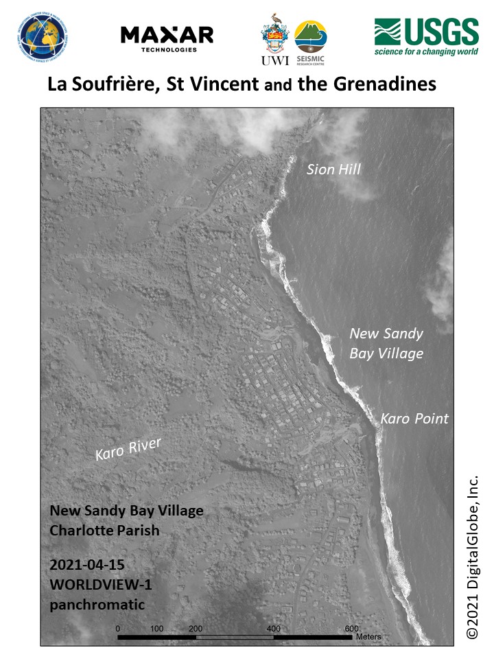
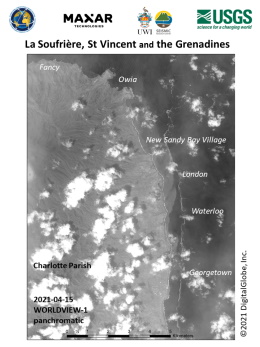
Panchromatic image of New Sandy Bay Village, Charlotte Parish, St Vincent and the Grenadines
Авторские права: © 2021 DigitalGlobe, Inc., Longmont CO USA 80503. DigitalGlobe and the DigitalGlobe logos are trademarks of DigitalGlobe, Inc. The use and/or dissemination of this data and/or of any product in any way derived there from are restricted. Unauthorized use and/or dissemination is prohibited
Map produced by USGS
Information about the Product
Получено: WorldView-1: 15/04/2021
Источник: WorldView-1
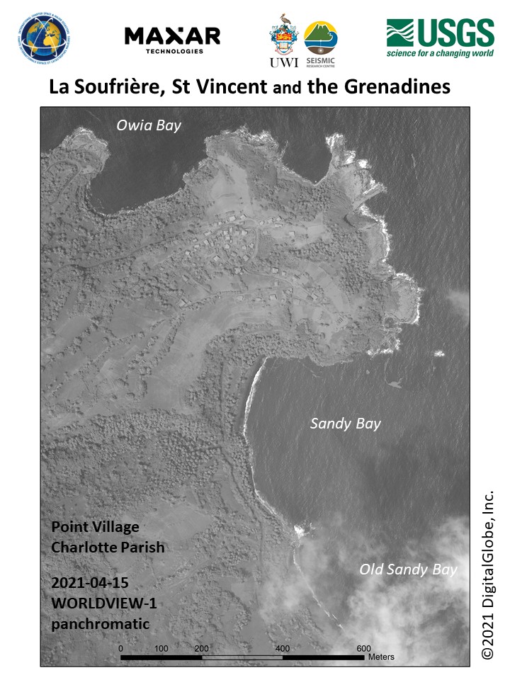
Panchromatic image of Point Village, Charlotte Parish, St Vincent and the Grenadines
Авторские права: © 2021 DigitalGlobe, Inc., Longmont CO USA 80503. DigitalGlobe and the DigitalGlobe logos are trademarks of DigitalGlobe, Inc. The use and/or dissemination of this data and/or of any product in any way derived there from are restricted. Unauthorized use and/or dissemination is prohibited
Map produced by USGS
Information about the Product
Получено: WorldView-1: 15/04/2021
Источник: WorldView-1
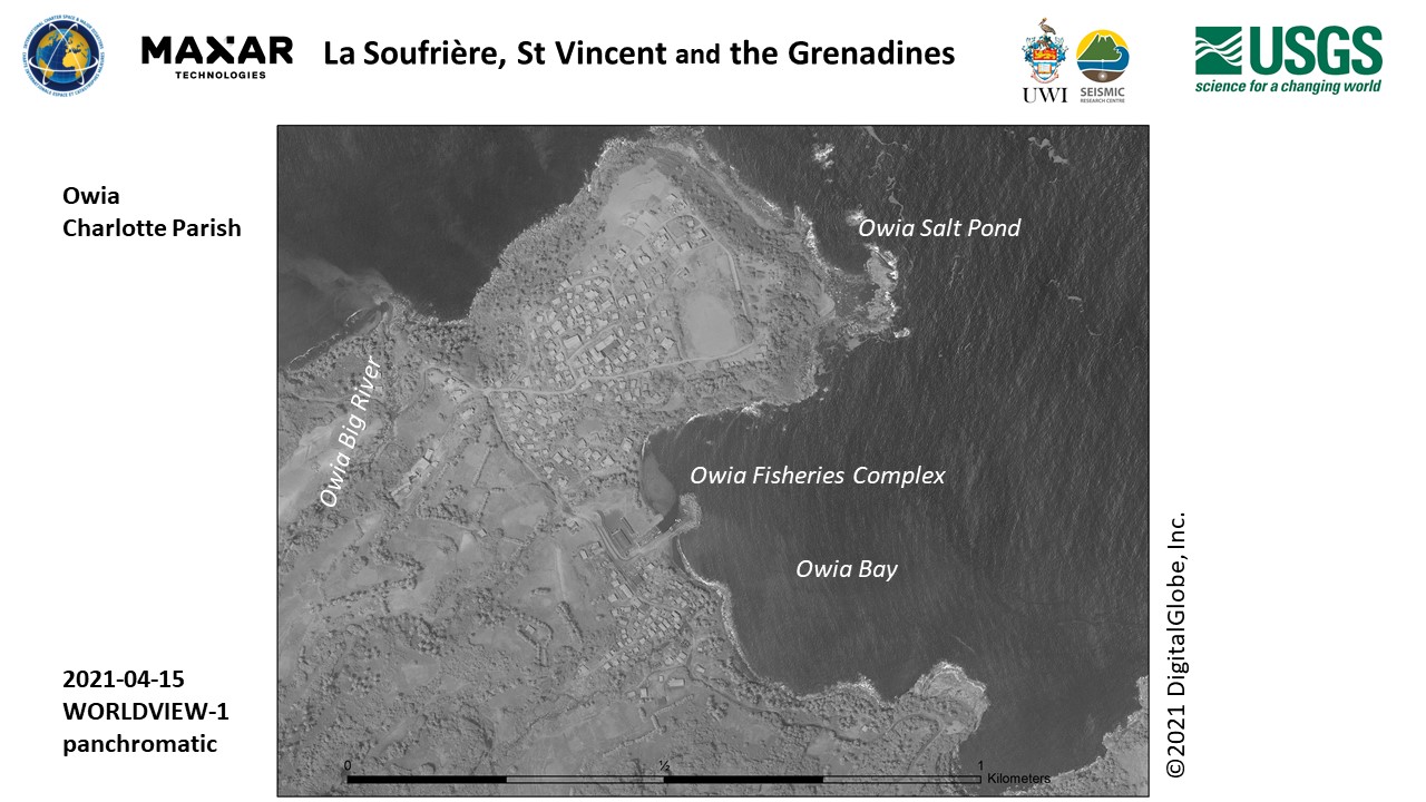
Panchromatic image of Owia, Charlotte Parish, St Vincent and the Grenadines
Авторские права: © 2021 DigitalGlobe, Inc., Longmont CO USA 80503. DigitalGlobe and the DigitalGlobe logos are trademarks of DigitalGlobe, Inc. The use and/or dissemination of this data and/or of any product in any way derived there from are restricted. Unauthorized use and/or dissemination is prohibited
Map produced by USGS
Information about the Product
Получено: WorldView-1: 15/04/2021
Источник: WorldView-1

Panchromatic image of the coastline to the west and north of La Soufriere, St Vincent and the Grenadines
Авторские права: © 2021 DigitalGlobe, Inc., Longmont CO USA 80503. DigitalGlobe and the DigitalGlobe logos are trademarks of DigitalGlobe, Inc. The use and/or dissemination of this data and/or of any product in any way derived there from are restricted. Unauthorized use and/or dissemination is prohibited
Map produced by USGS
Information about the Product
Получено: WorldView-1: 15/04/2021
Источник: WorldView-1
Panchromatic image of the coastline to the north and east of La Soufriere, St Vincent and the Grenadines
Авторские права: © 2021 DigitalGlobe, Inc., Longmont CO USA 80503. DigitalGlobe and the DigitalGlobe logos are trademarks of DigitalGlobe, Inc. The use and/or dissemination of this data and/or of any product in any way derived there from are restricted. Unauthorized use and/or dissemination is prohibited
Map produced by USGS
Information about the Product
Получено: WorldView-1: 15/04/2021
Источник: WorldView-1

Panchromatic image of Fancy, Charlotte Parish, St Vincent and the Grenadines
Авторские права: © 2021 DigitalGlobe, Inc., Longmont CO USA 80503. DigitalGlobe and the DigitalGlobe logos are trademarks of DigitalGlobe, Inc. The use and/or dissemination of this data and/or of any product in any way derived there from are restricted. Unauthorized use and/or dissemination is prohibited
Map produced by USGS
Information about the Product
Получено: WorldView-1: 15/04/2021
Источник: WorldView-1
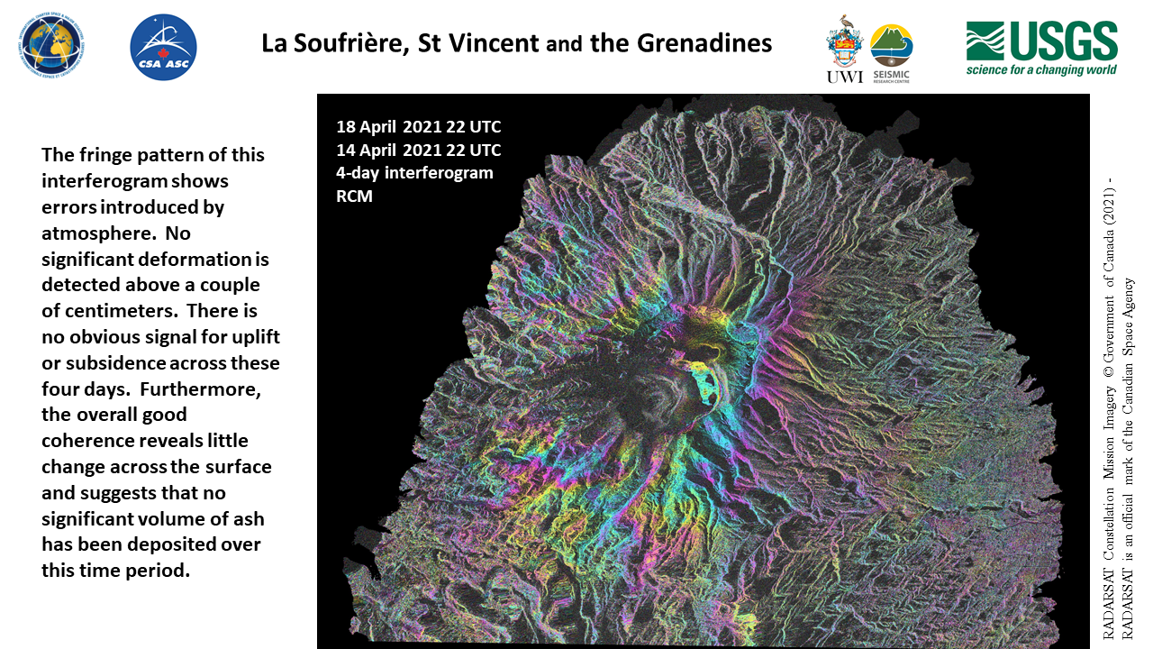
Interferogram spanning four days, 14-18 April, of La Soufriere, St Vincent and the Grenadines
Авторские права: RADARSAT Constellation Mission Imagery © Government of Canada (2021) - RADARSAT is an official mark of the Canadian Space Agency
Map produced by USGS
Information about the Product
Получено: RCM-1: 18/04/2021
RCM-3: 14/04/2021
Источник: RCM

No significant changes to the crater and no obvious sign of a new dome at La Soufriere, St Vincent and the Grenadines
Авторские права: RADARSAT Constellation Mission Imagery © Government of Canada (2021) - RADARSAT is an official mark of the Canadian Space Agency
Map produced by USGS
Information about the Product
Получено: 18/04/2021
Источник: RCM
Crater changes and ongoing pyroclastic flows at La Soufriere, St Vincent and the Grenadines
Авторские права: RADARSAT Constellation Mission Imagery © Government of Canada (2021) - RADARSAT is an official mark of the Canadian Space Agency
Map produced by USGS
Information about the Product
Получено: 16/04/2021
Источник: RCM


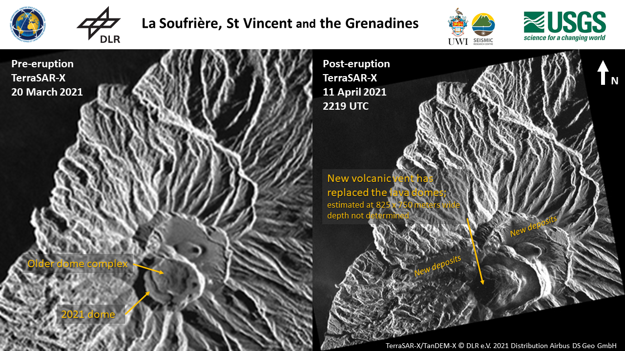
Changes at the crater vent at La Soufriere, St Vincent and the Grenadines
Авторские права: RADARSAT Constellation Mission Imagery © Government of Canada (2021) - RADARSAT is an official mark of the Canadian Space Agency
Map produced by USGS
Information about the Product
Получено: 13/04/2021 and 14/04/2021
Источник: RCM


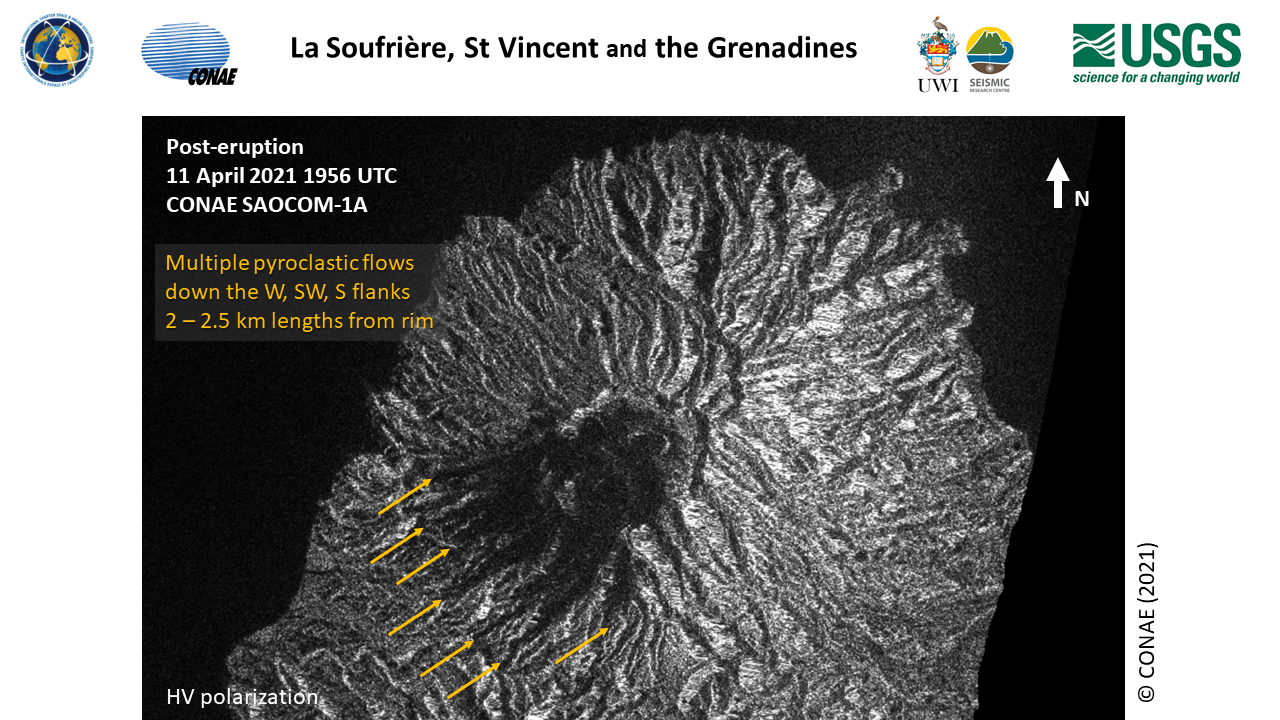
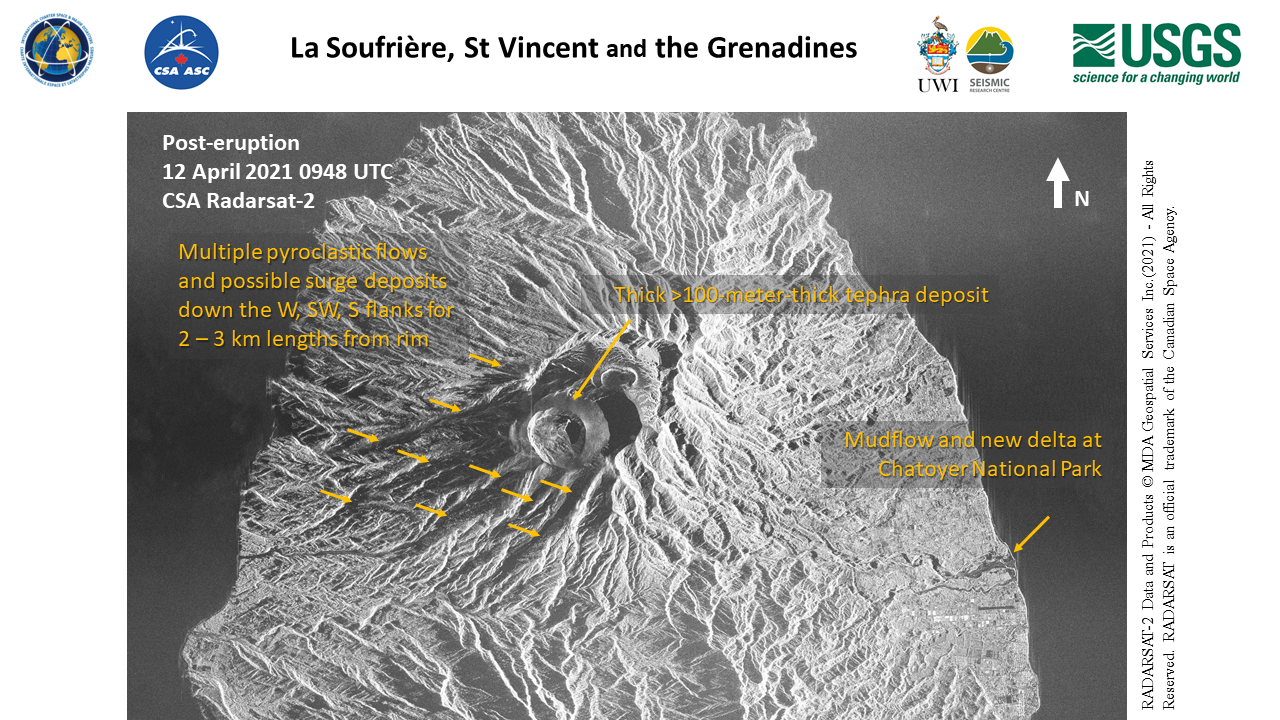
Volcanic eruption changes as of 12 April 2021 at La Soufriere, St Vincent and the Grenadines
Авторские права: RADARSAT-2 Data and Products © Maxar Technologies Ltd. (2021) – All Rights Reserved. RADARSAT is an official mark of the Canadian Space Agency
Map produced by USGS
Information about the Product
Получено: 12/04/2021
Источник: RADARSAT-2
 Вернуться к полному архиву активаций
