Flooding in Armenia
« Voltar
Flooding in Armenia
Charter activations
Flooding in Armenia
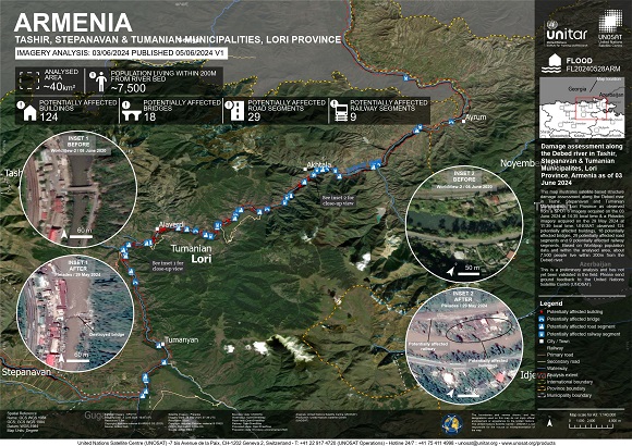
Torrential rains have caused flooding in Armenia in the country's worst flooding in decades.
The most affected areas have been the provinces of Lori and Tavush, where the rivers Debed, Aghstev and Tashir all burst their banks washing away roads, bridges, parts of a railway and flooding towns and villages located along them.
Three people have been confirmed dead, and many others have had to be evacuated from the affected areas.
Rescue efforts are ongoing along with emergency food and clean water deliveries.
| Tipo de evento: | Flood |
| Local do evento: | Armenia |
| Data da Ativação da Carta: | 2024-05-29 |
| Tempo de Ativação da Carta: | 14:41 |
| Zona de Tempo da Ativação da Carta: | UTC+02:00 |
| Requisitante da Carta: | Ministry of Internal Affairs on behalf of Ministry of Internal Affairs |
| ID da Ativação: | 886 |
| Gerenciamento de projeto: | Armine Hayrapetyan (Ministry of Internal Affairs of the RA) |
| act-value-adders: | Teodoro Hunger (UNITAR/UNOSAT) |
Products
 Voltar ao arquivo completo da Ativação

 English
 Spanish
 French
 Chinese
 Russian
 Portuguese


