 English
 Spanish
 French
 Chinese
 Russian
 Portuguese
 Latest Activation
Charter activations
Flood in India
Almost 300 people have died in southern India following devastating floods which have affected thousands of people.
The floods follow days of torrential rain along the coast of southern India facing the Bay of Bengal.
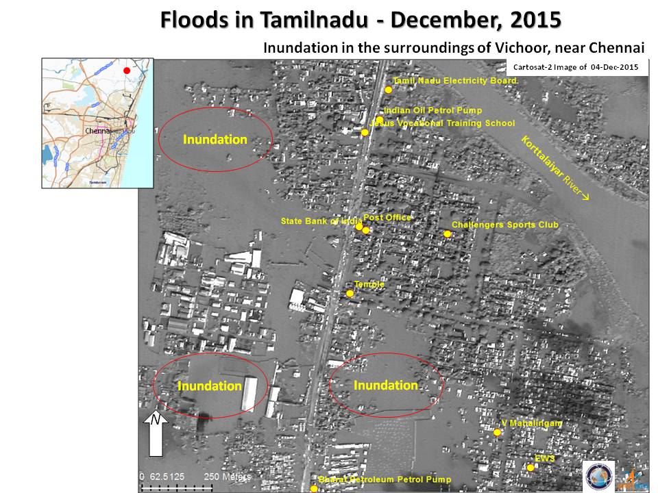
The city of Chennai in Tamil Nadu state has been heavily affected, and over two thousand people have been evacuated from the city after they were left stranded by the floods. Homes and other public buildings have been inundated, and roads and railways have been left impassable by the flood. Power has been shut down for most of the city and train and air services are suspended until the situation clears.
In order to help relieve the city, the Indian government has begun releasing water from the Chembarambakkam reservoir near Chennai. Residents living along the Adyar River have also been advised to retreat to safer locations.
In addition to Chennai, the nearby cities of Puducherry and Adyar have also suffered from the flooding.
| Tipo de evento: | Flood |
| Local do evento: | India |
| Data da Ativação da Carta: | 2 December 2015 |
| Tempo de Ativação da Carta: | 11:00:00 |
| Zona de Tempo da Ativação da Carta: | UTC+05:30 |
| Requisitante da Carta: | ISRO |
| Gerenciamento de projeto: | ISRO |
Products
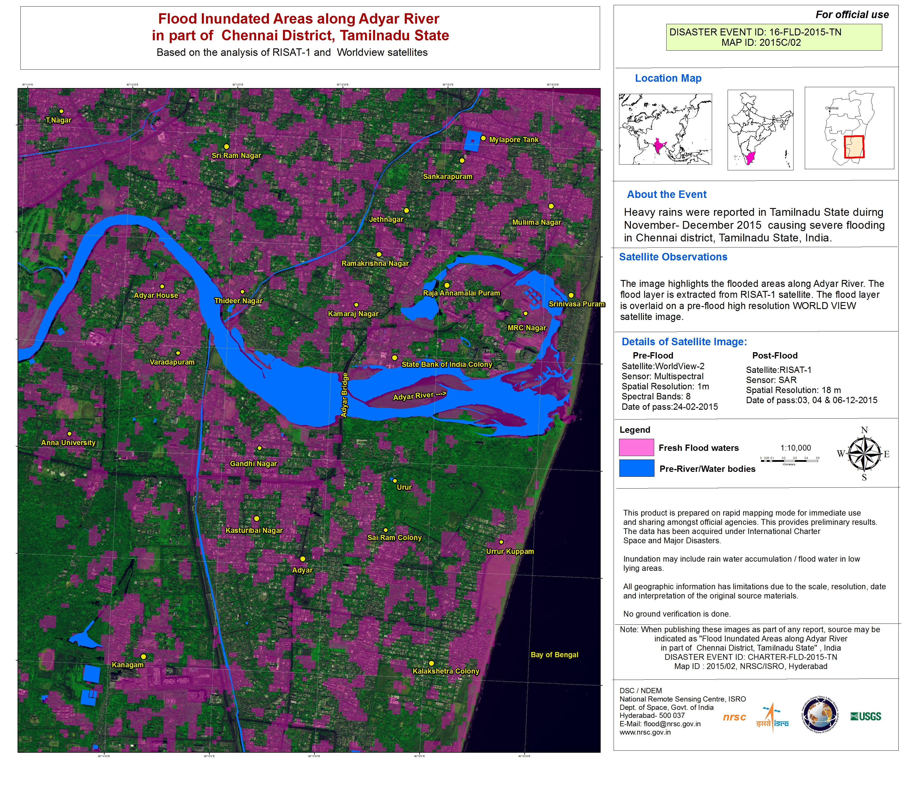
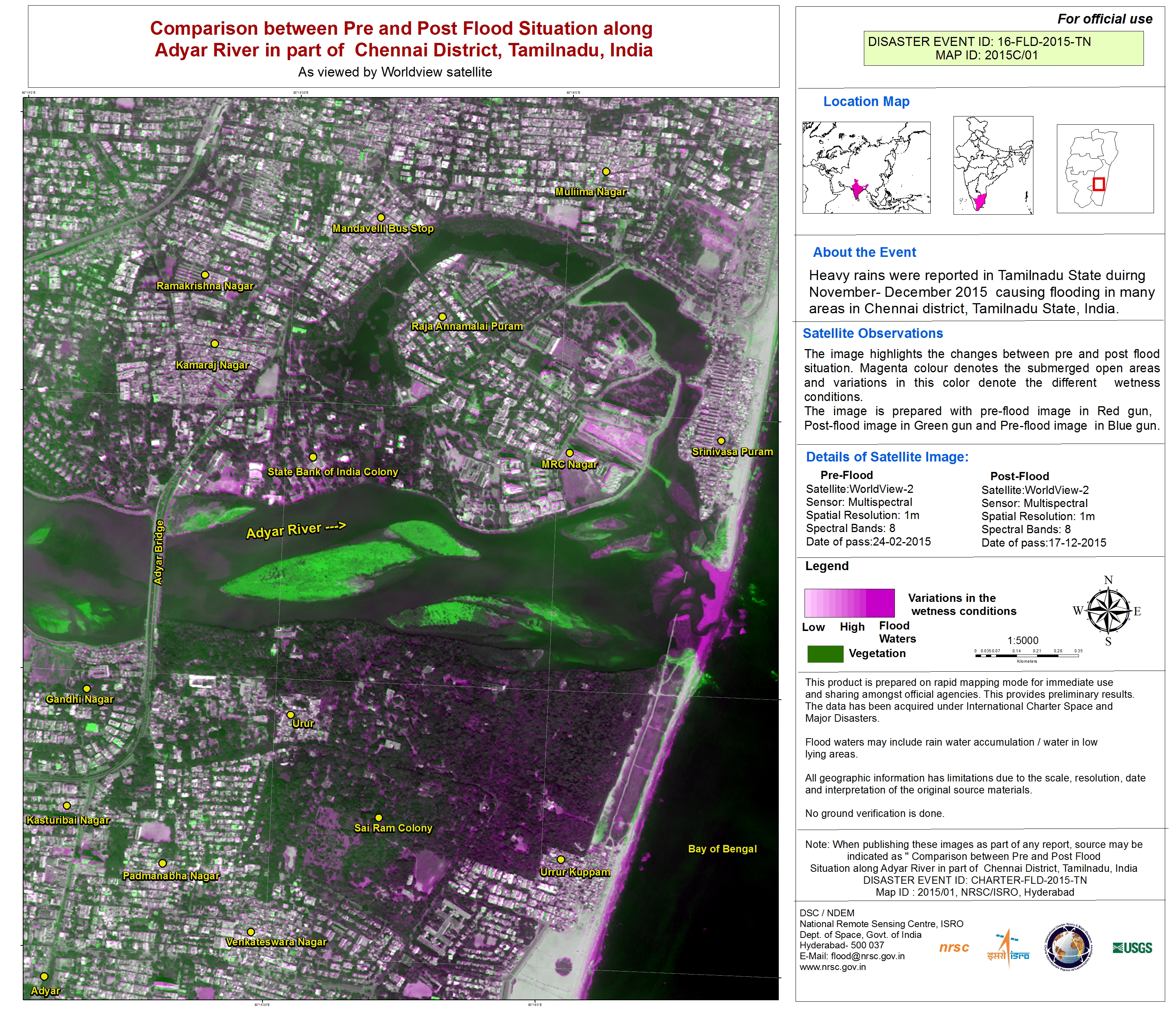
Inundated areas along the Adyar River in part of Chennai in India
Direitos autorais: WorldView-2 © DigitalGlobe 2015
RISAT-1 data and products © ISRO (2015) - All rights reserved
Map produced by NRSC/ISRO
Information about the Product
Adquirida: WorldView-2: 24/02/2015
RISAT-1: 03/12/2015, 04/12/2015 and 06/12/2015
Fonte: WorldView-2 / RISAT-1
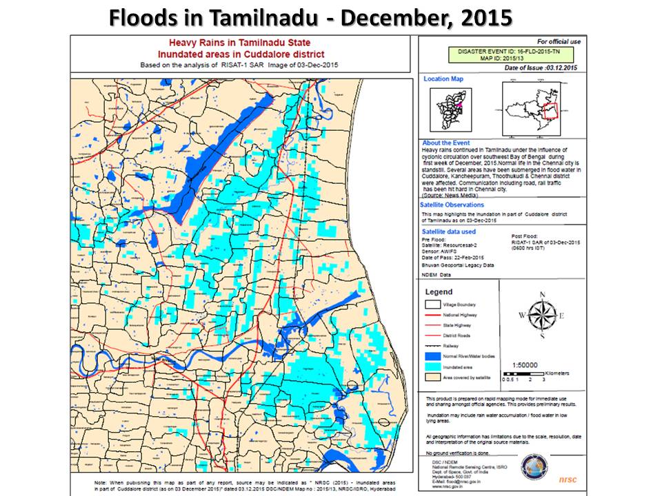
Inundated areas in Cuddalore district, India
Direitos autorais: ResourceSat-2 data and products © ISRO (2015) - All rights reserved
RISAT-1 data and products © ISRO (2015) - All rights reserved
Map produced by NRSC, ISRO
Information about the Product
Adquirida: ResourceSat-2: 22/02/2015
RISAT-1: 03/12/2015
Fonte: ResourceSat-2 / RISAT-1

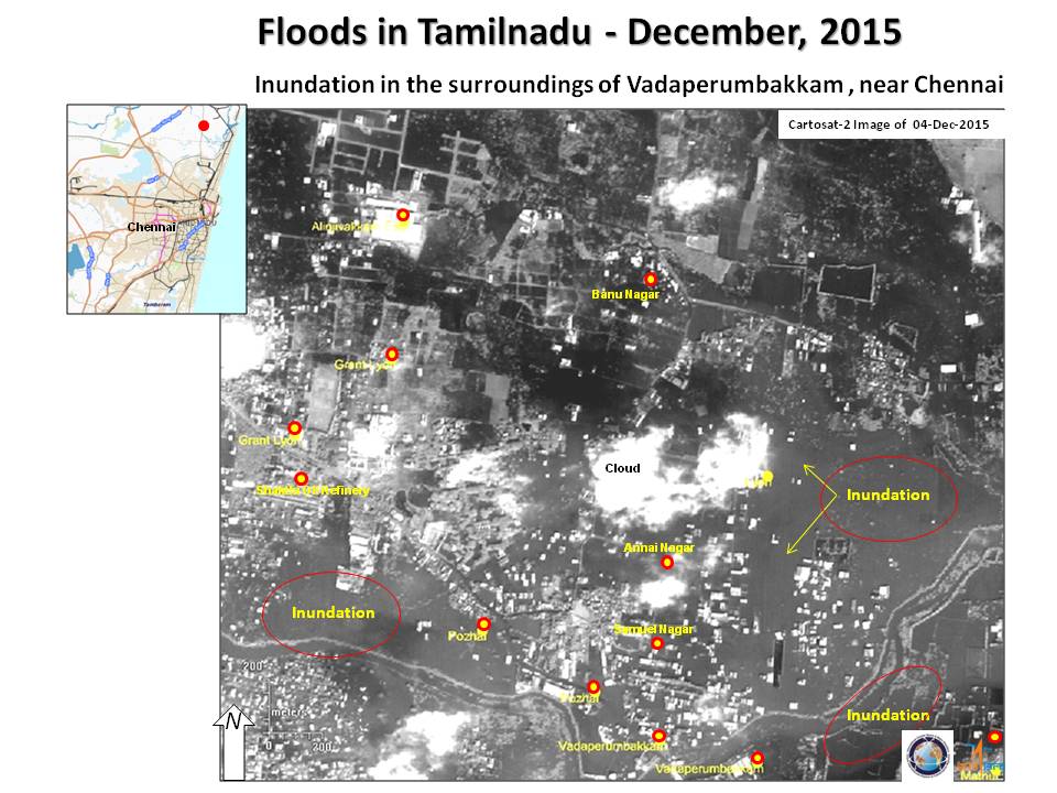

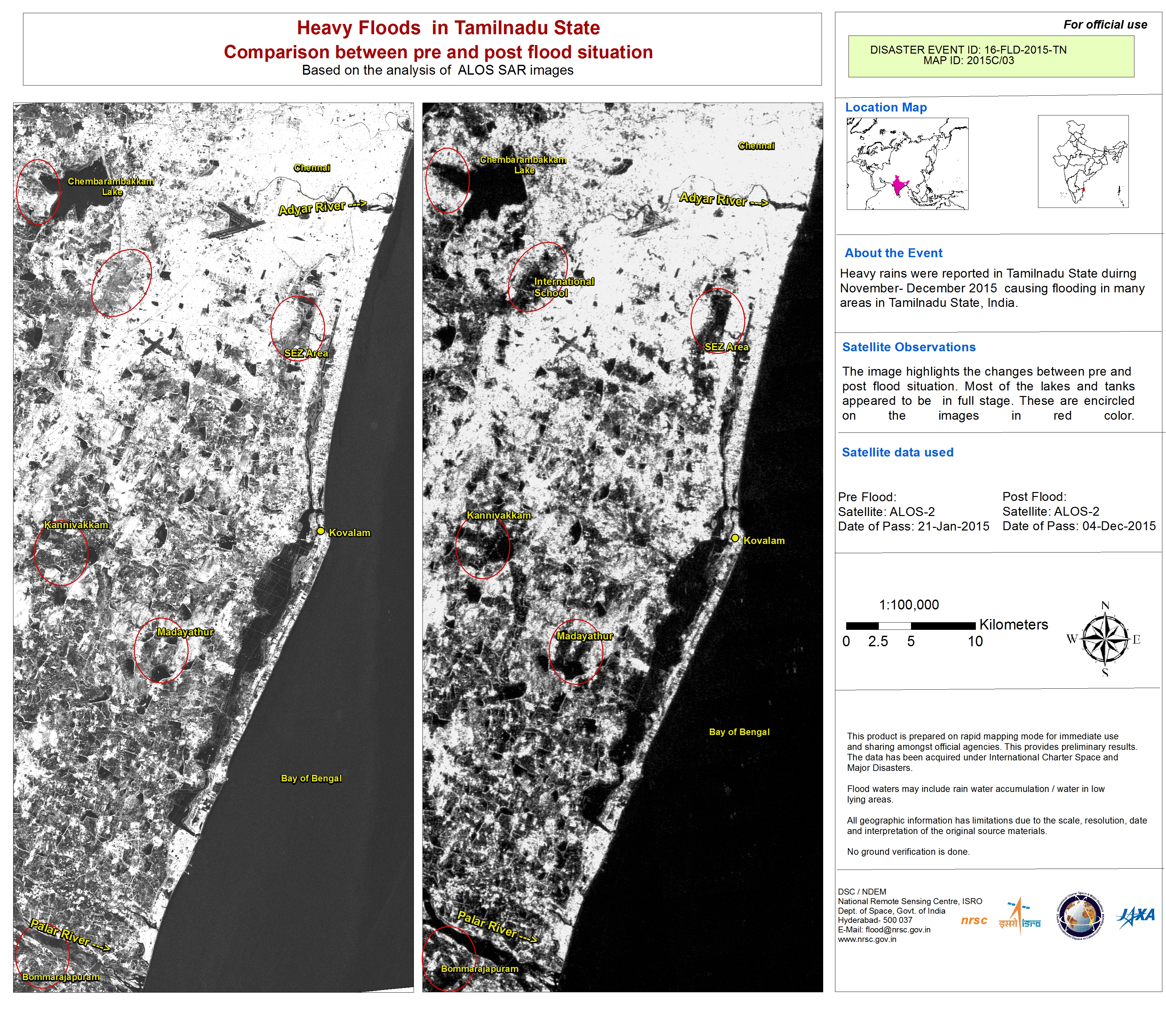
Flood recession at Chennai in Tamilnadu State, India
Direitos autorais: RISAT-1 data and products © ISRO (2015) - All rights reserved
ResourceSat-2 data and products © ISRO (2015) - All rights reserved
RADARSAT-2 Data and Products © MacDonald, Dettwiler and Associates Ltd. (2015) - All Rights Reserved. RADARSAT is an official trademark of the Canadian Space Agency.
Map produced by NRSC, ISRO
Information about the Product
Adquirida: ResourceSat-2: 22/02/2015
RISAT-1: 03/12/2015 and 04/12/2015
RADARSAT-2: 04/12/2015
Fonte: RISAT-1 / ResourceSat-2 / RADARSAT-2
 Voltar ao arquivo completo da Ativação

