Charter activations
Landslide in Uganda
A landslide occured in Eastern Uganda after heavy rains, which has killed at least 41 people. The death toll could increase as rescue teams are still searching the Mount Elgon and eastern Bududa district area for the many people still missing.
Rivers on high ground burst their banks, sending water, mud and rock cascading below and sweeping homes away. The landslide also brought large boulders and trees down onto roads blocking routes for relief workers.
The densely populated agicultural Elgon area, contains rich volcanous soils, but combined with steep rocky slopes it increases the likelihood of landslides with minimal rainfall.
Local weather forecasts predict further rain in the coming days, keeping the area on high alert.
| Local do evento: | Uganda |
| Data da Ativação da Carta: | 2018-10-12 |
| Tempo de Ativação da Carta: | 17:48 |
| Zona de Tempo da Ativação da Carta: | UTC+02:00 |
| Requisitante da Carta: | UNITAR-UNOSAT on behalf of UNDP |
| ID da Ativação: | 589 |
| Gerenciamento de projeto: | United Nations Institute for Training and Research (UNITAR / UNOSAT) |
Products
Preliminary Landslides/Mudflows Analysis in Mbale District, Uganda
Download the full report
Direitos autorais: Pleiades © CNES (2018) - Distribution: Airbus Defence and Space, all rights reserved
Report Produced by UNITAR / UNOSAT
Information about the Product
Adquirida: 13/10/2018
Fonte: Pleiades
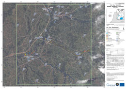
Mudflow situation map, West Kufu, Uganda
Direitos autorais: Pleiades © CNES (2018) - Distribution: Airbus Defence and Space, all rights reserved
Map produced by Copernicus EMS
Information about the Product
Adquirida: Pre-disaster: 05/10/2018
Post-disaster: 13/10/2018
Fonte: Pleiades
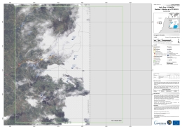
Mudflow situation map, East Kufu, Uganda
Direitos autorais: Pleiades © CNES (2018) - Distribution: Airbus Defence and Space, all rights reserved
Map produced by Copernicus EMS
Information about the Product
Adquirida: Pre-disaster: 05/10/2018
Post-disaster: 13/10/2018
Fonte: Pleiades
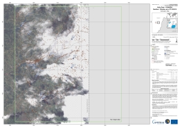
Mudflow situation map, East Kufu, Uganda
Direitos autorais: Pleiades © CNES (2018) - Distribution: Airbus Defence and Space, all rights reserved
Map produced by Copernicus EMS
Information about the Product
Adquirida: Pre-disaster: 05/10/2018
Post-disaster: 13/10/2018
Fonte: Pleiades
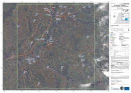
Mudflow situation map, West Kufu, Uganda
Direitos autorais: Pleiades © CNES (2018) - Distribution: Airbus Defence and Space, all rights reserved
Map produced by Copernicus EMS
Information about the Product
Adquirida: Pre-disaster: 05/10/2018
Post-disaster: 13/10/2018
Fonte: Pleiades
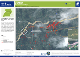
Landslides/Mudflow Assessment in Mbale District, Eastern Region, Uganda
Direitos autorais: Pleiades © CNES (2018), Distribution: Airbus DS
Map produced by UNITAR/UNOSAT
Information about the Product
Adquirida: 13/10/2018
Fonte: Pleiades
 Voltar ao arquivo completo da Ativação

 English
 Spanish
 French
 Chinese
 Russian
 Portuguese


