 English
 Spanish
 French
 Chinese
 Russian
 Portuguese
 Latest Activation
Charter activations
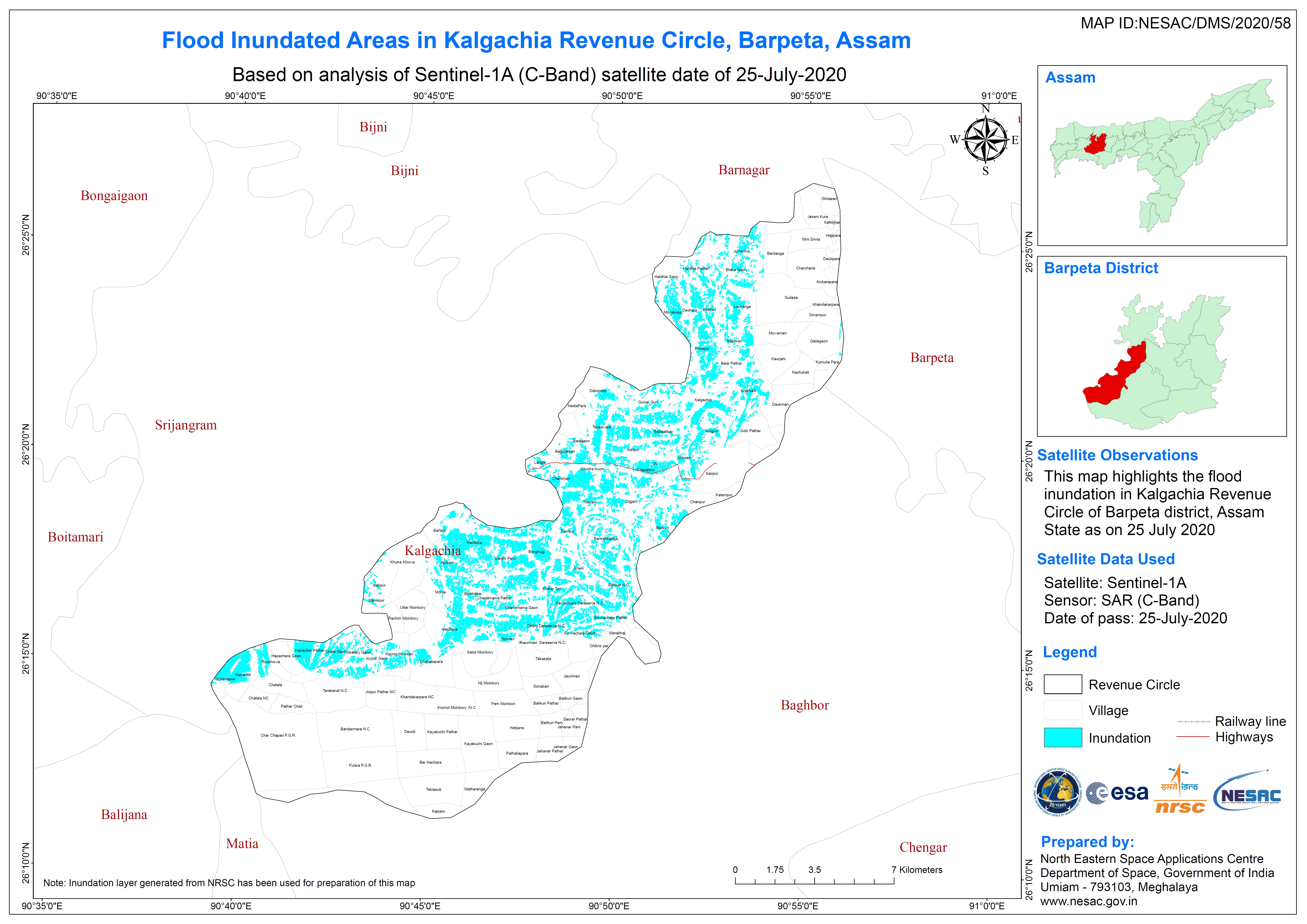
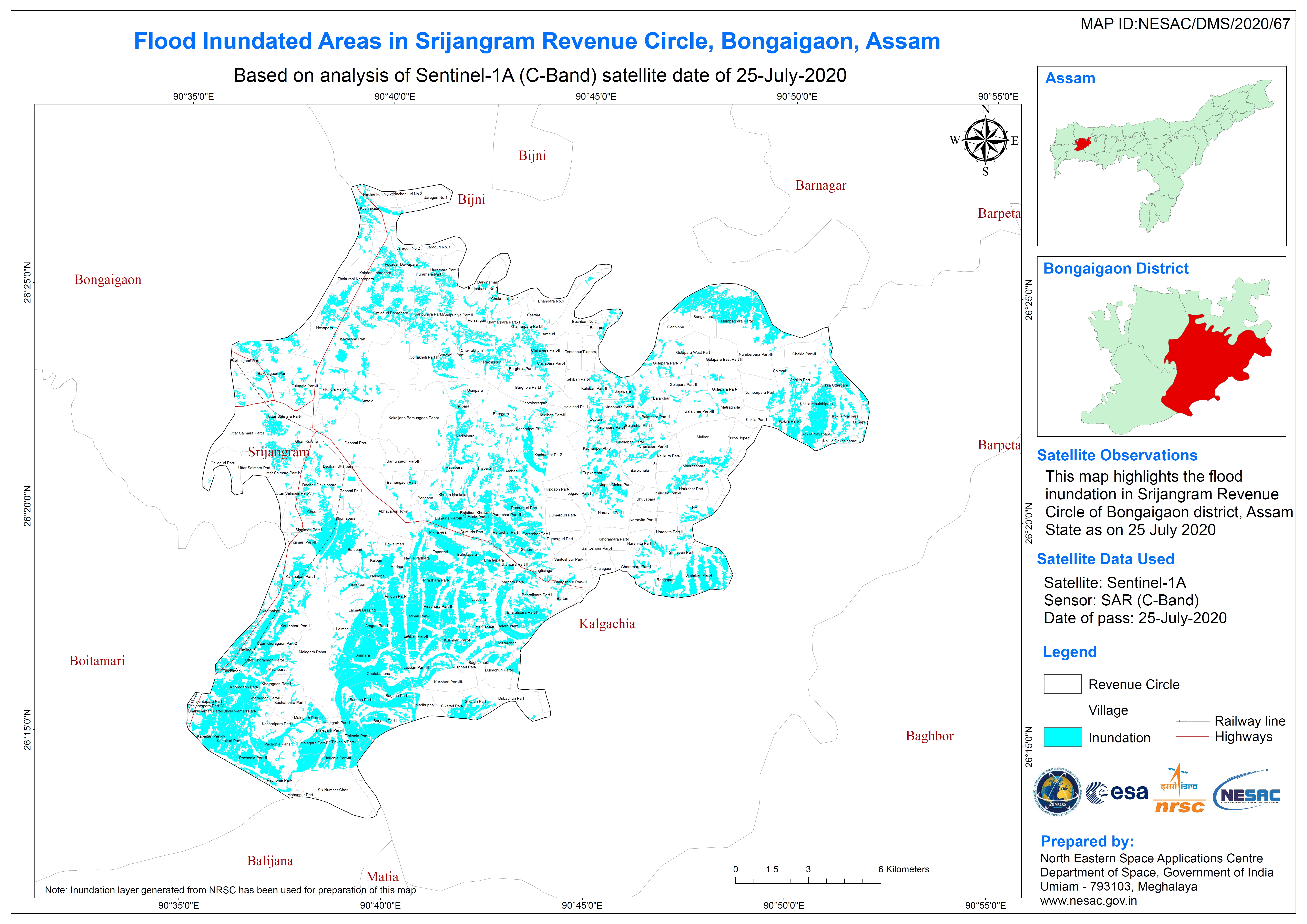
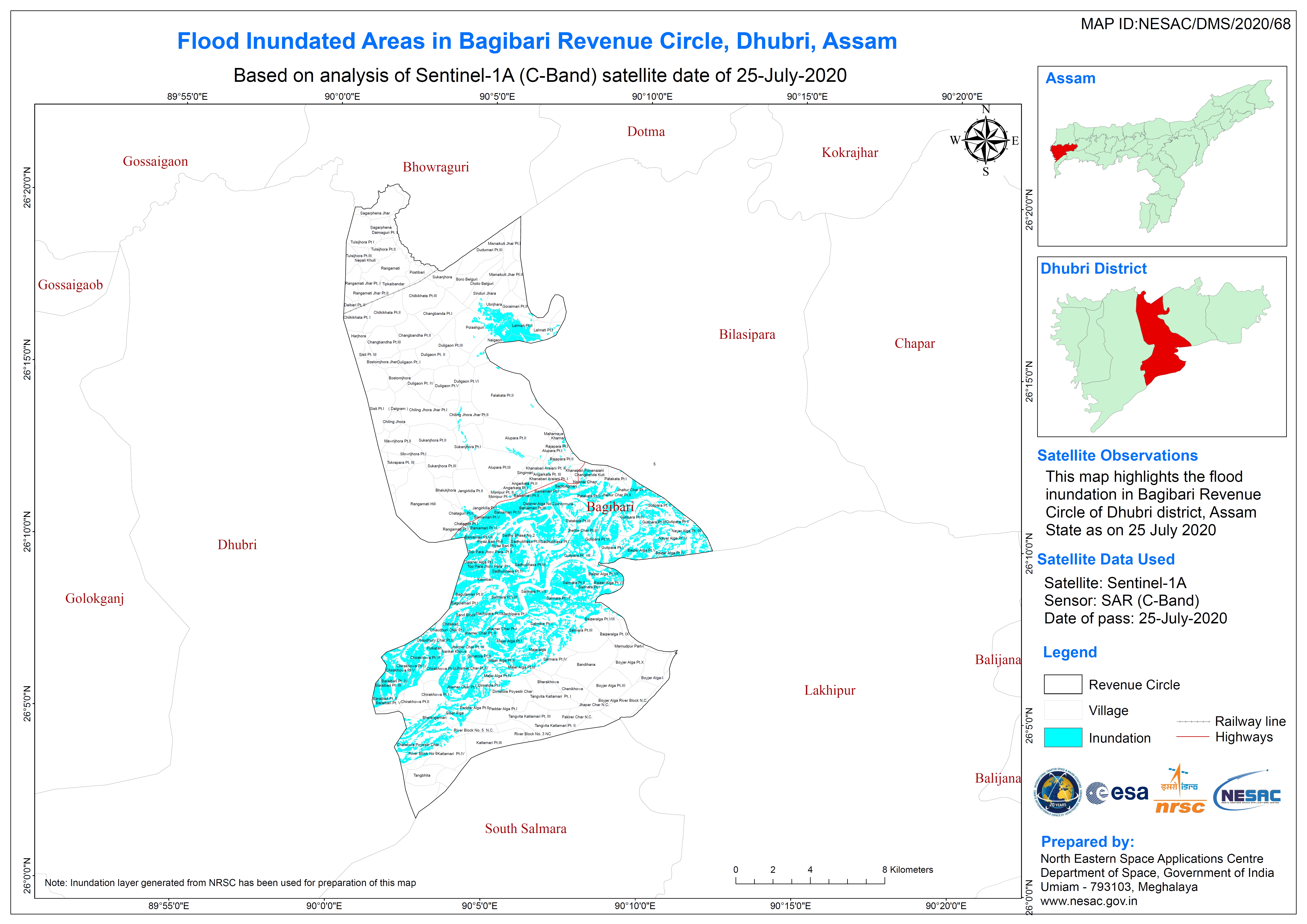
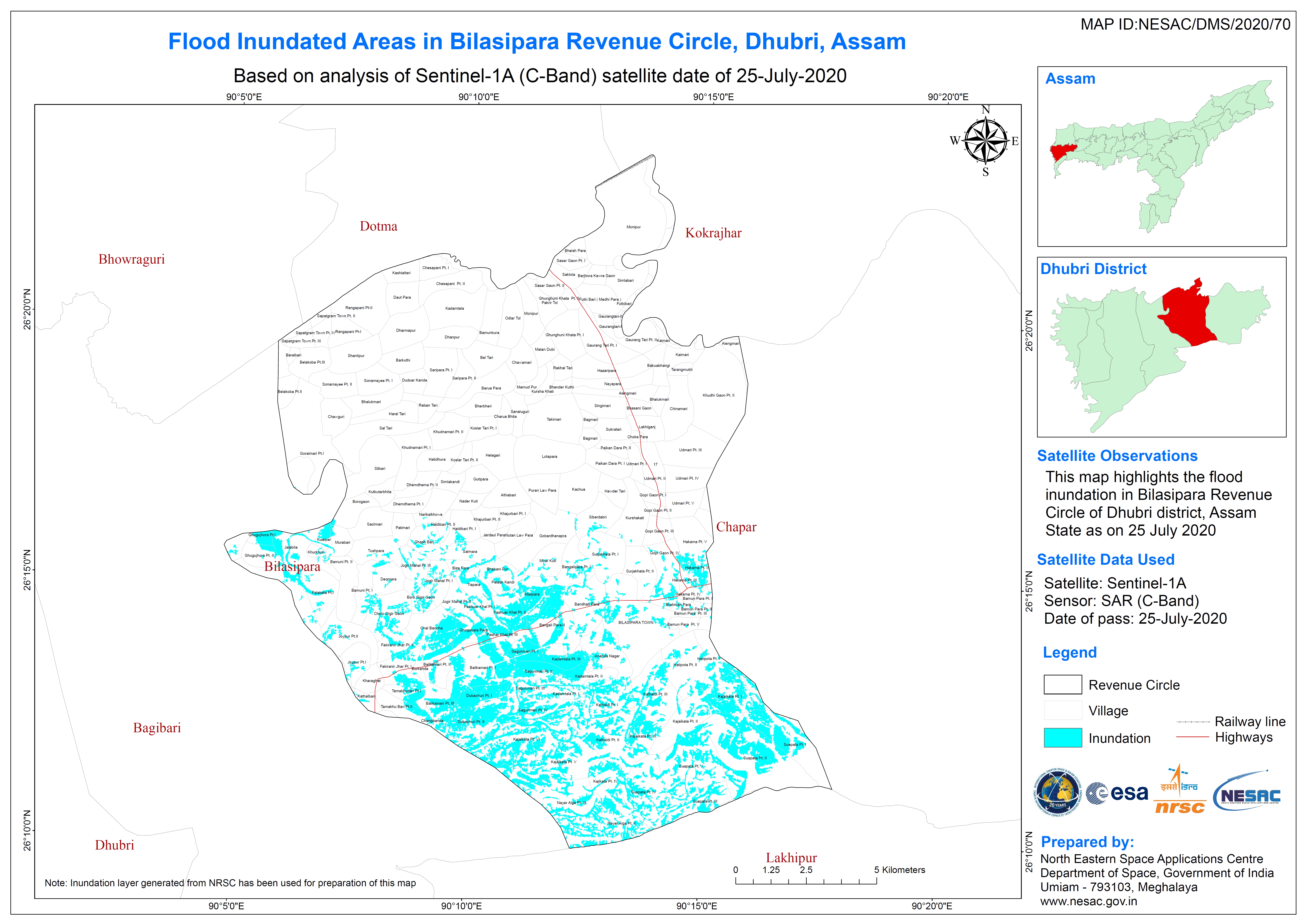
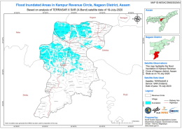
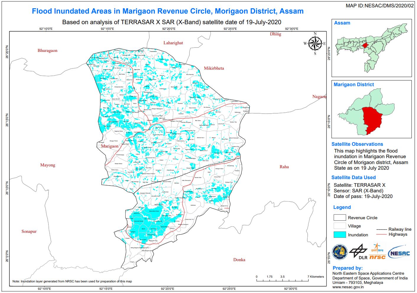
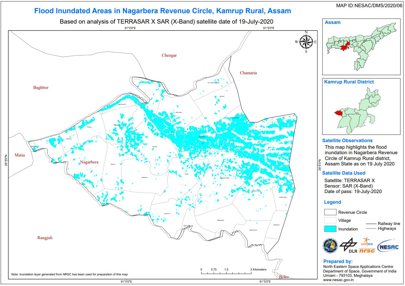
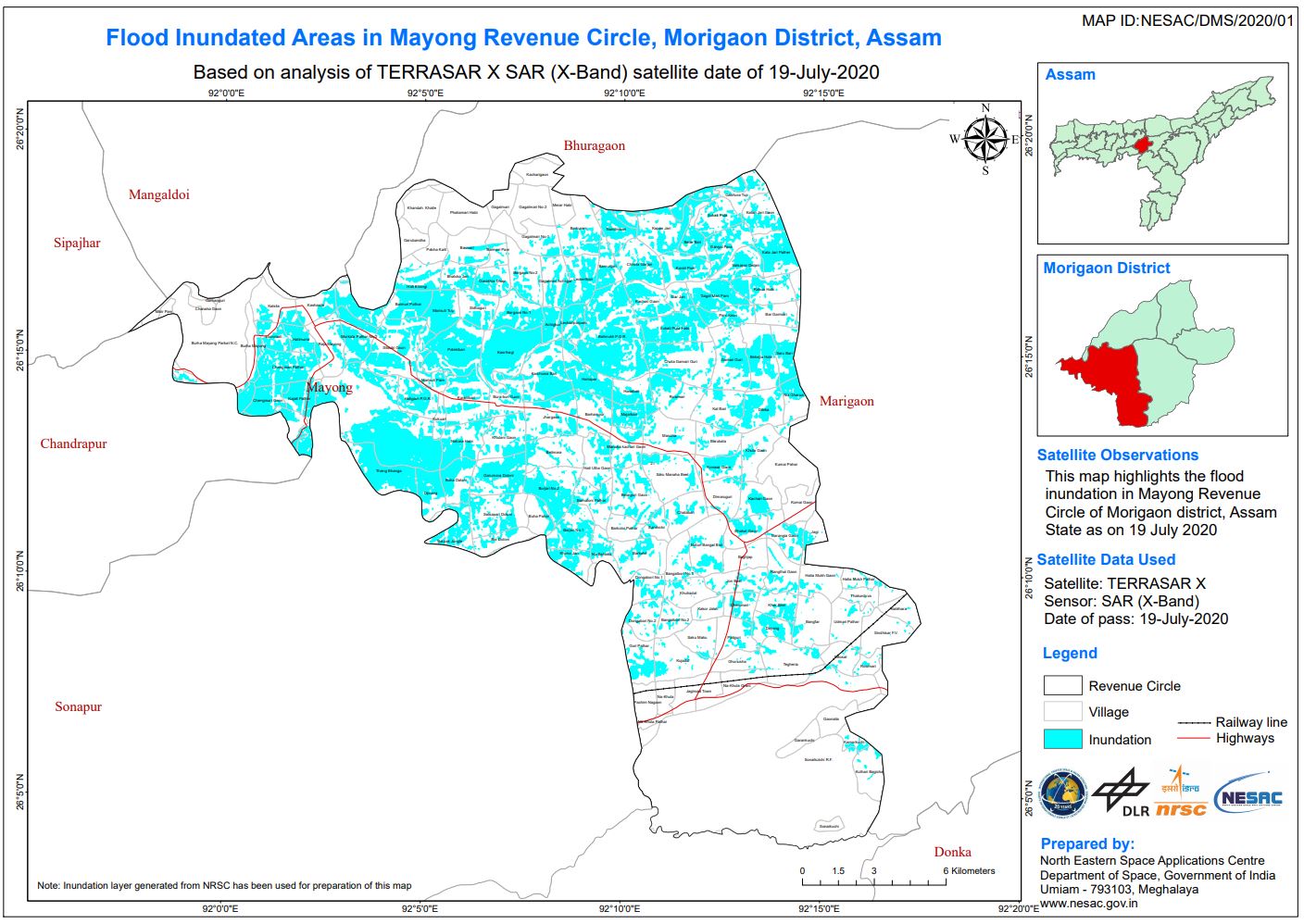
Flood in India
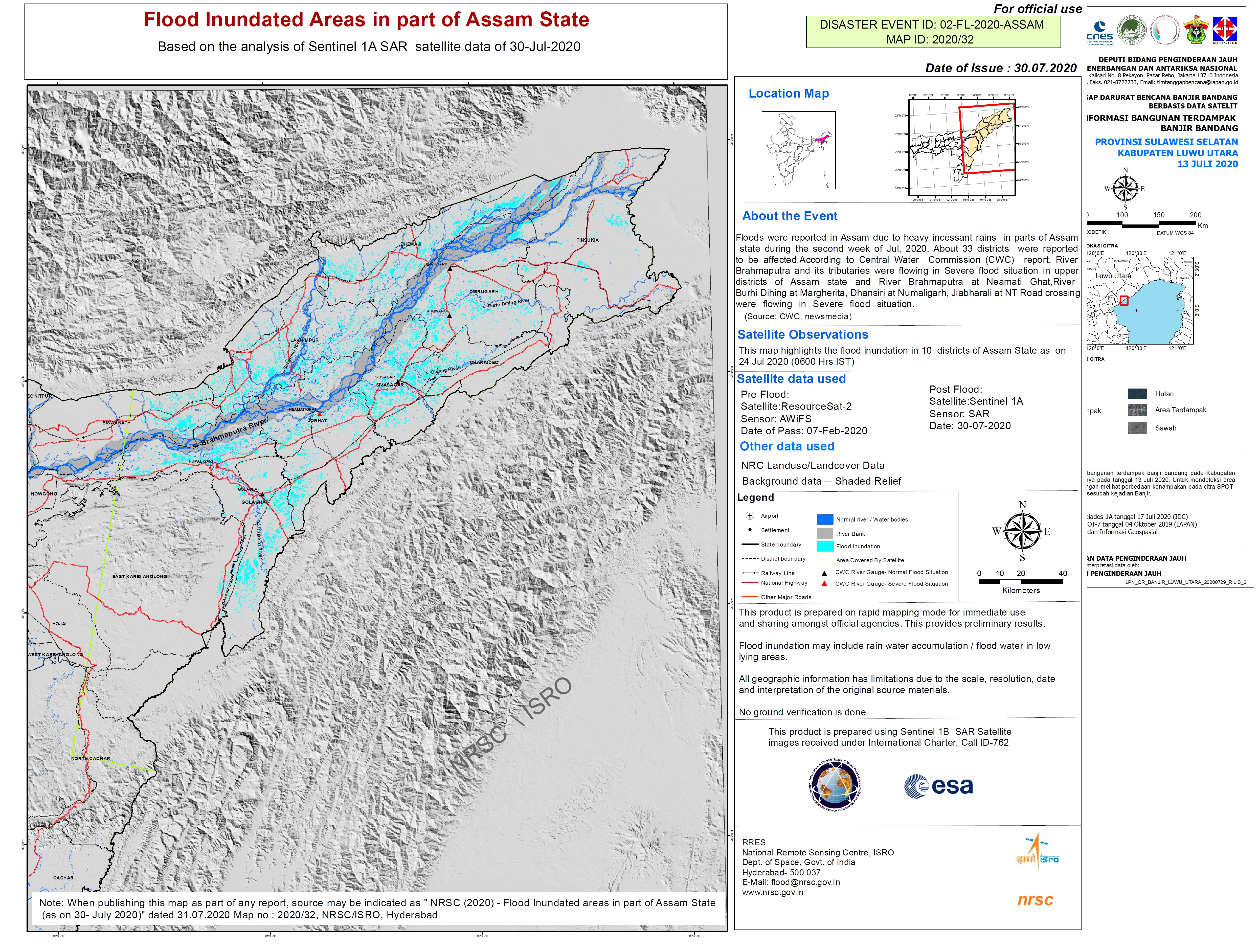
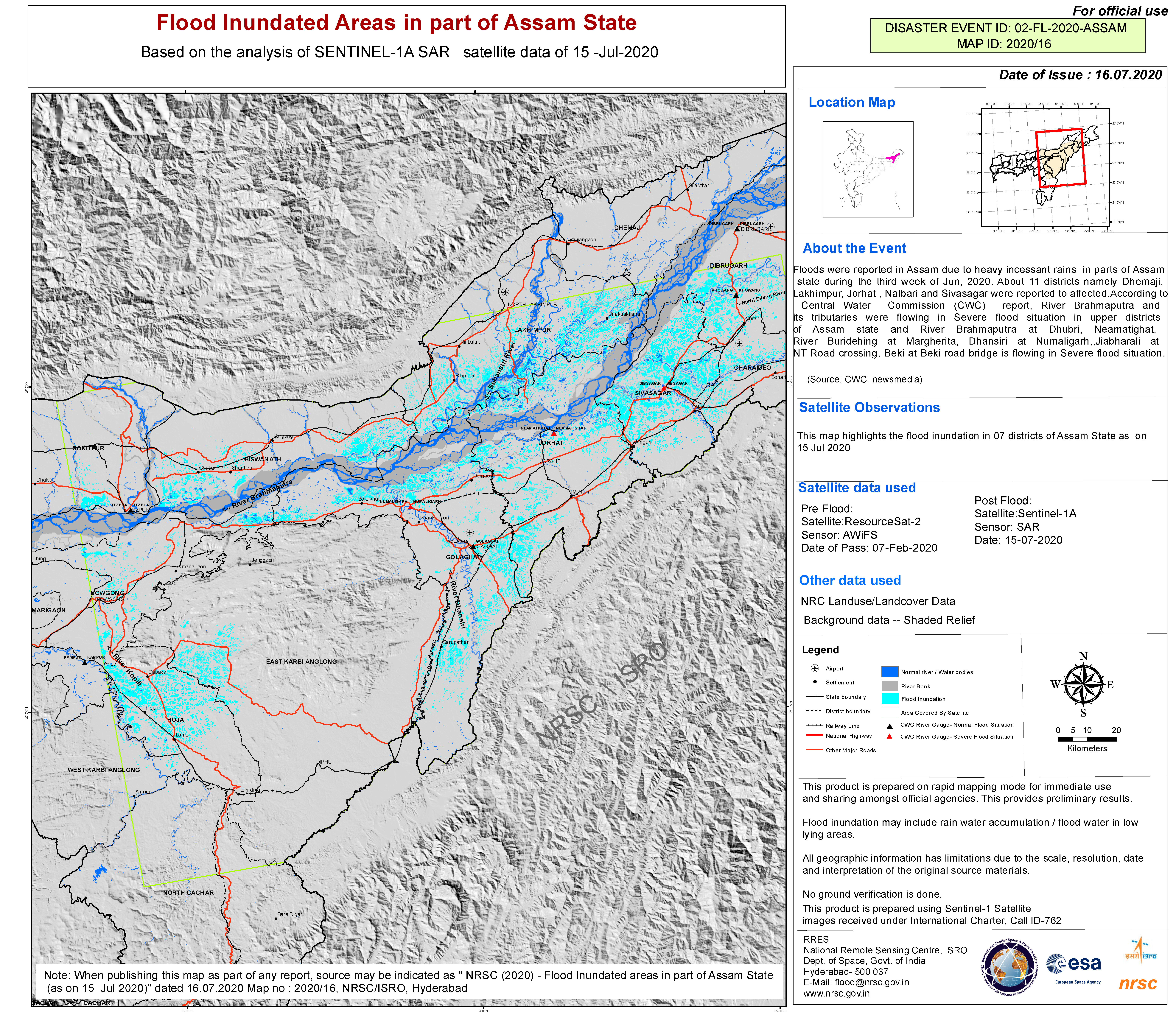
Heavy rainfall has caused widespread flooding in the north-eastern Indian state of Assam. Over 2 million people have been affected and at least 50 died.
Authorities have set up 480 relief camps across 20 districts, providing temporary shelter for more than 60,000 people as thousands of homes were submerged.
Officials reported that swathes of the Kaziranga National Park in the state had been flooded and at least 51 wild animals had died with over a hundred more being rescued.
Monsoon rains in the region are common, but this year Covid-19 has affected aid responses. Assam State Disaster Management Authority (ASDMA) reported the situation could improve in the coming days, with water levels beginning to stabilise.
| Tipo de evento: | Floods |
| Local do evento: | India |
| Data da Ativação da Carta: | 2020-07-15 |
| Tempo de Ativação da Carta: | 15:52 |
| Zona de Tempo da Ativação da Carta: | UTC+05:30 |
| Requisitante da Carta: | ISRO |
| ID da Ativação: | 661 |
| Gerenciamento de projeto: | NRSC |
Products


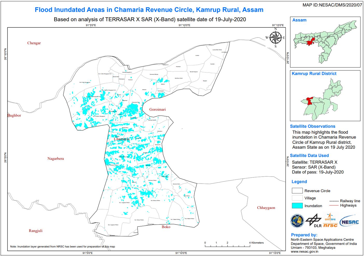
Kharif crop inundation in Golaghat District, Assam, India
Direitos autorais: KOMPSAT-5 © KARI (2020)
SAOCOM-1 © CONAE (2020)
TerraSAR-X © DLR e.V. (2020), Distribution Airbus DS Geo GmbH
Map produced by NRSC/ISRO
Information about the Product
Adquirida: KOMPSAT-5: 17/07/2020 and 22/07/2020
SAOCOM-1: 16/07/2020 and 22/07/2020
TerraSAR-X: 19/07/2020
Fonte: KOMPSAT-5 / SAOCOM-1 / TerraSAR-X
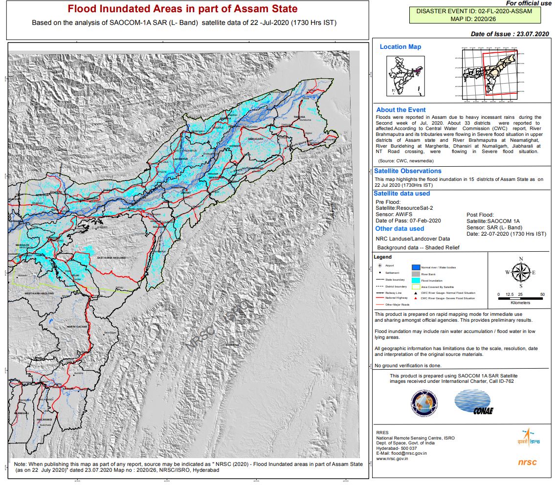
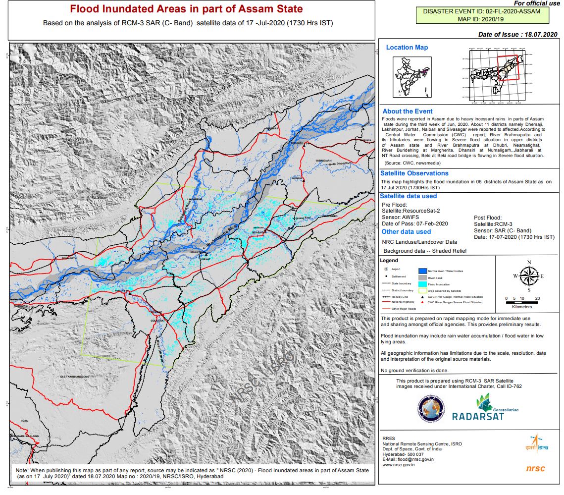
Flood affected areas in part of Assam State, India
Direitos autorais: Contains modified Copernicus Sentinel data (2020)
ResourceSat-2 data and products © ISRO (2020) - All rights reserved
Map produced by NRSC/ISRO
Information about the Product
Adquirida: Sentinel-1: 23/07/2020
ResourceSat-2: 07/02/2020
Fonte: Sentinel-1 / ResourceSat-2

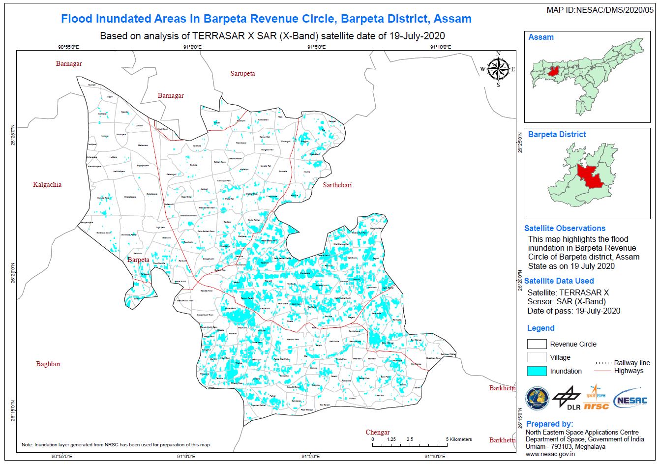
Kharif crop inundation in Barpeta District, Assam, India
Direitos autorais: SAOCOM-1 © CONAE (2020)
TerraSAR-X © DLR e.V. (2020), Distribution Airbus DS Geo GmbH
ALOS © JAXA (2020) All rights reserved
RADARSAT-2 Data and Products © Maxar Technologies Ltd. (2020) - All Rights Reserved. RADARSAT is an official trademark of the Canadian Space Agency.
Map produced by NRSC/ISRO
Information about the Product
Adquirida: RADARSAT-2:15/07/2020
SAOCOM-1: 16/07/2020 and 22/07/2020
ALOS-2:18/07/2020
TerraSAR-X: 19/07/2020
Fonte: SAOCOM-1 / TerraSAR-X / ALOS-2 / RADARSAT-2


Disaster extent overview in Assam State, India
Direitos autorais: Contains modified Copernicus Sentinel data (2020)
© DLR e.V. (2020), Distribution Airbus DS Geo GmbH
Map produced by DLR
Information about the Product
Adquirida: Sentinel-2: 29/03/2020, 11/04/2020, 13/04/2020 and 09/05/2020
TerraSAR-X: 18/07/2020
TanDEM-X: 19/07/2020
Fonte: Sentinel-2 / TanDEM-X / TerraSAR-X

Disaster extent overview in Assam State, India
Direitos autorais: Contains modified Copernicus Sentinel data (2020)
Map Produced by DLR
Information about the Product
Adquirida: Sentinel-2A: 09/05/2020, 13/04/2020
Sentinel-2B: 29/03/2020, 11/04/2020
Sentinel-1A: 10/07/2020
Fonte: Sentinel-1 / Sentinel-2

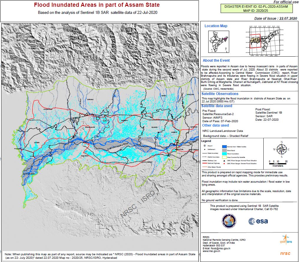
Flood affected areas in Part of Assam State, India
Direitos autorais: © DLR e.V. (2020), Distribution Airbus DS Geo GmbH
Map produced by NRSC/ISRO
Information about the Product
Adquirida: ResourceSat-2: 07/02/2020
TerraSAR-X: 18/07/2020
TanDEM-X: 19/07/2020
Fonte: TerraSAR-X / TanDEM-X / ResourceSat-2

Cumulative flood inundated areas in Assam State, India
Direitos autorais: Contains modified Copernicus Sentinel data (2020)
© CONAE (2020)
RADARSAT Constellation Mission Imagery © Government of Canada (2020) - RADARSAT is an official mark of the Canadian Space Agency
Map produced by NRSC/ISRO
Information about the Product
Adquirida: ResourceSat-2: 07/02/2020
SAOCOM-1A: 16/07/2020
Sentinel-1: 10/07/2020
RCM: 16/07/2020, 17/07/2020
Fonte: ResourceSat-2 / Sentinel-1 / SAOCOM-1 / RCM

Flood affected areas in Part of Assam State, India
Direitos autorais: RADARSAT Constellation Mission Imagery © Government of Canada (2020) - RADARSAT is an official mark of the Canadian Space Agency
Map produced by NRSC/ISRO
Information about the Product
Adquirida: ResourceSat-2: 07/02/2020
RCM: 17/07/2020
Fonte: ResourceSat-2 / RCM
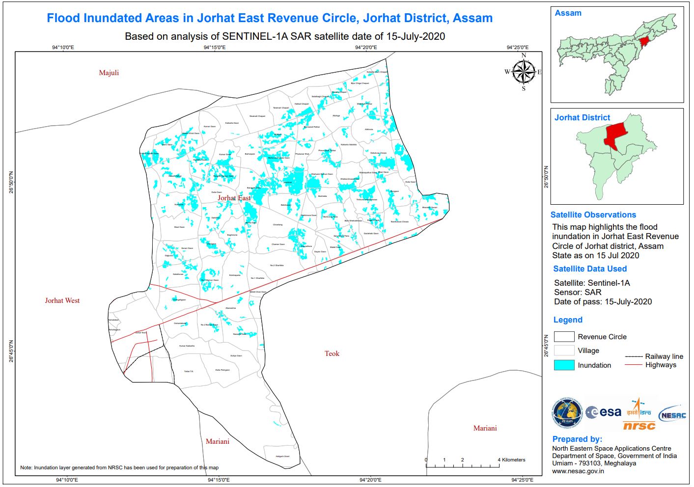


Flood affected areas in Assam State, India
Direitos autorais: RADARSAT Constellation Mission Imagery © Government of Canada (2020) - RADARSAT is an official mark of the Canadian Space Agency
Map produced by NRSC/ISRO
Information about the Product
Adquirida: RCM:16/07/2020
ResourceSat-2: 07/02/2020
Fonte: RCM / ResourceSat-2:
 Voltar ao arquivo completo da Ativação

