 English
 Spanish
 French
 Chinese
 Russian
 Portuguese
 Latest Activation
Charter activations
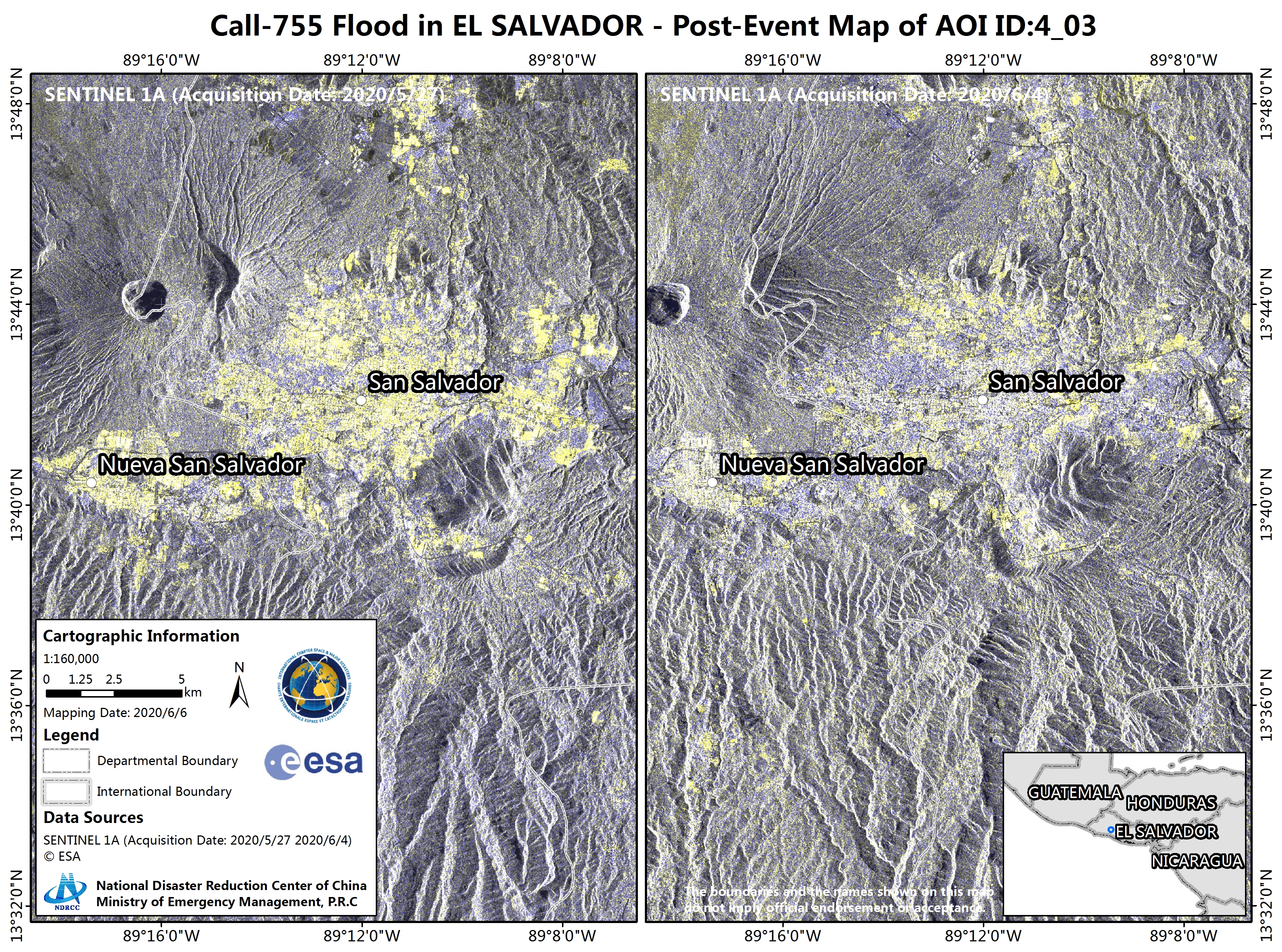
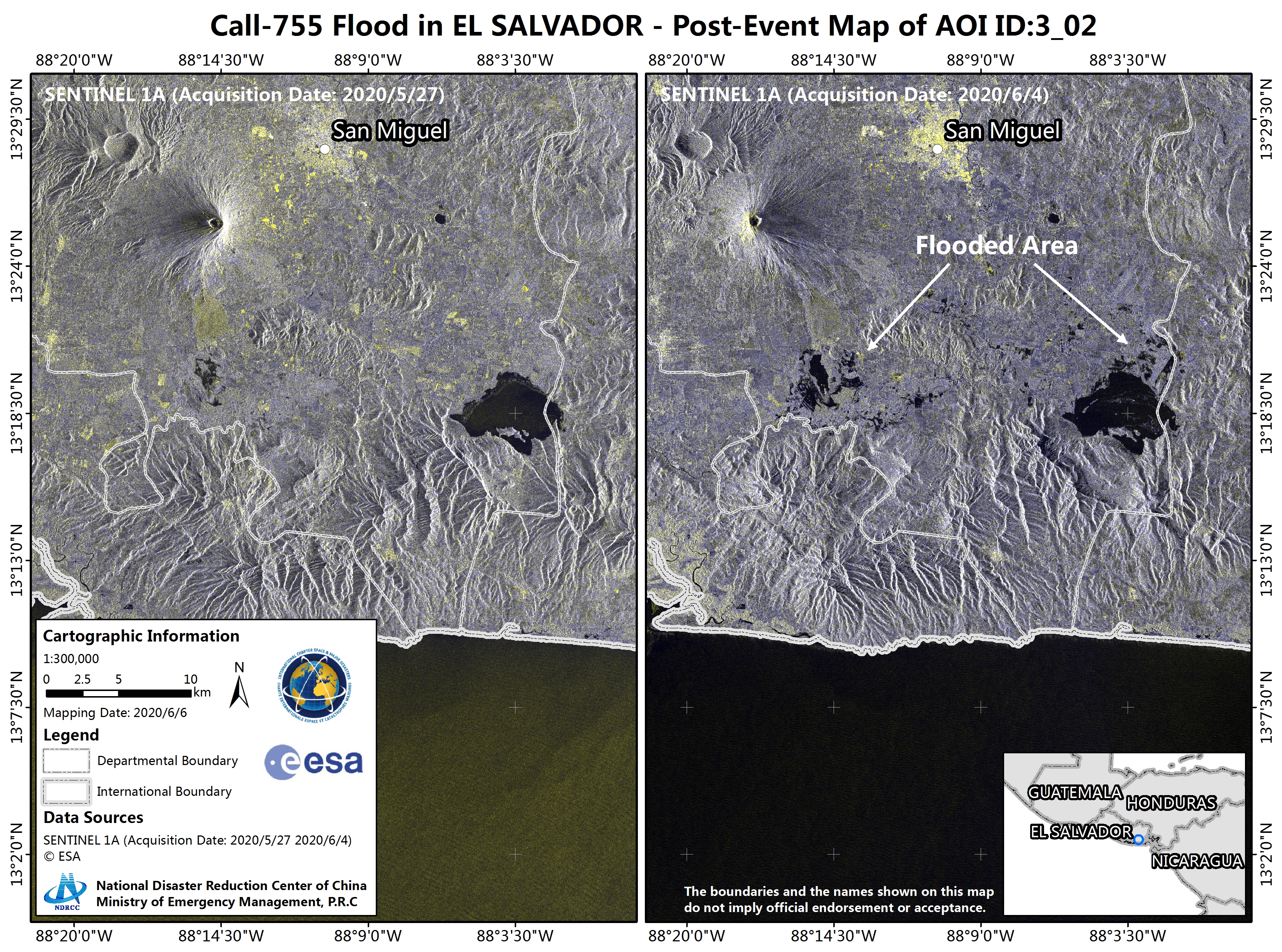
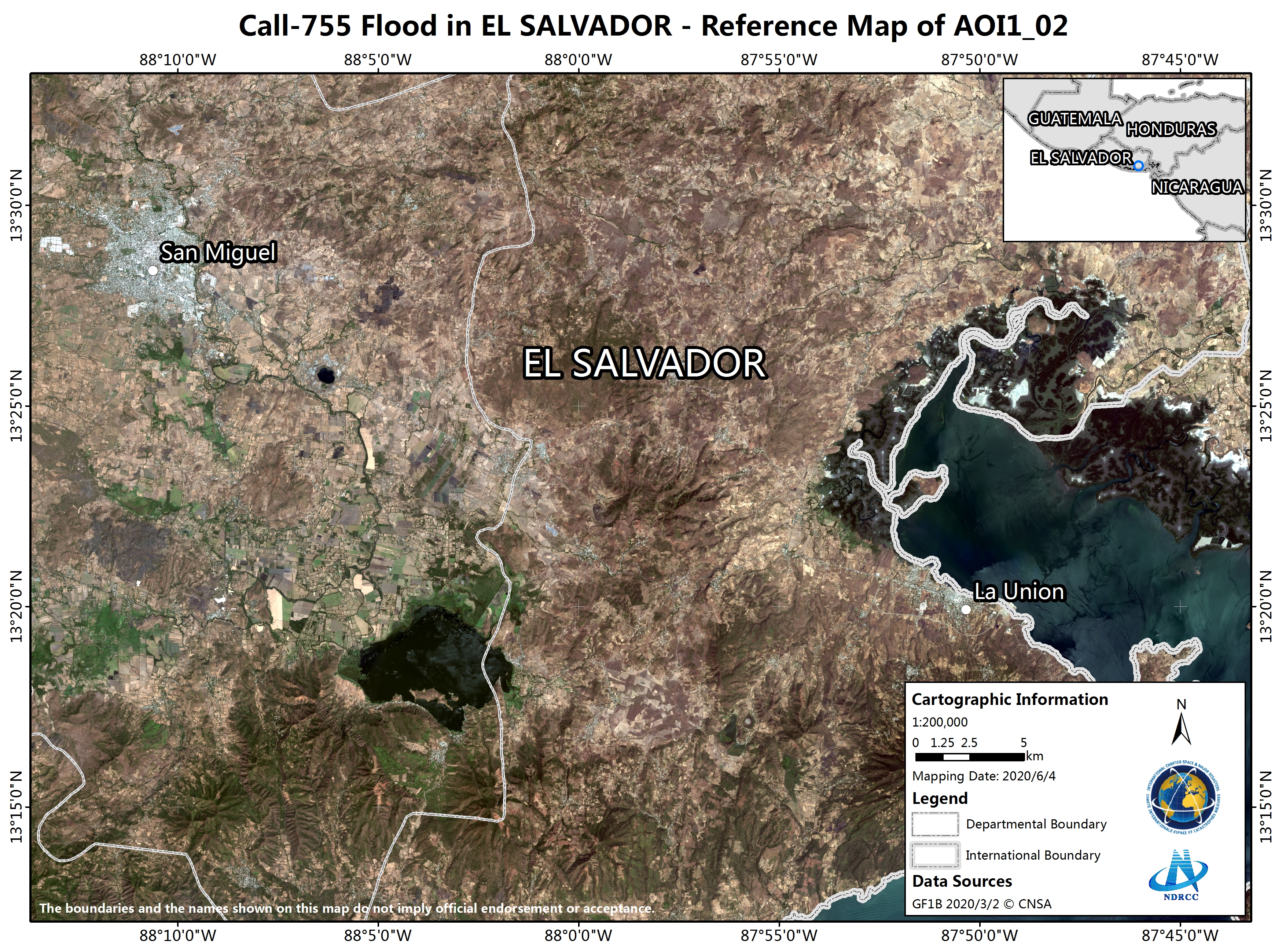
Flood in El Salvador
Heavy rainfall has caused severe flooding in El Salvador as Tropical Storm Amanda passed over Central America. At least 15 people have been killed and the President has declared a state of emergency.
Amanda is the first tropical storm of the season and brought sustained winds of 40 mph and persistent heavy rainfall which triggered flooding as rivers overflowed, some landslides were also reported.
San Salvador Mayor reported 50 houses had been destroyed in the capital and 2000 people have been evacuated and placed in temporary shelters across the country.
Storm Amanda quickly moved across El Salvador and into Guatemala, where the National Hurricane Center said 10 to 15 inches of rainfall are expected.
| Tipo de evento: | Floods |
| Local do evento: | El Salvador |
| Data da Ativação da Carta: | 2020-06-02 |
| Tempo de Ativação da Carta: | 12:59 |
| Zona de Tempo da Ativação da Carta: | UTC-06:00 |
| Requisitante da Carta: | Environmental Observatory of Ministry of Environment and Natural Resources |
| ID da Ativação: | 654 |
| Gerenciamento de projeto: | National Disaster Reduction Centre of China |
Products


 Voltar ao arquivo completo da Ativação

