 English
 Spanish
 French
 Chinese
 Russian
 Portuguese
 Latest Activation
Charter activations
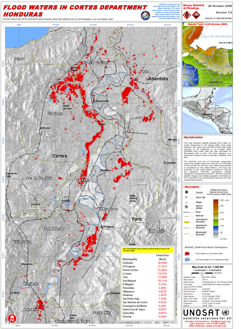
Flood in Honduras
The central and western part of Honduras - mainly the district of Francisco Morazán and the Ulua River in Yoro - were affected by floods and a great number of landslides. According to officials, 33 deaths were reported, some 270,000 persons have been affected, 100,000 hectares of crops have been lost and approximately 50% of the roads are damaged or destroyed. The Government has formally requested humanitarian assistance.
| Tipo de evento: | Flood |
| Local do evento: | Honduras |
| Data da Ativação da Carta: | 27/10/2008 |
| Requisitante da Carta: | UNITAR/UNOSAT on behalf of UN OCHA |
| Gerenciamento de projeto: | ESA |
 Voltar ao arquivo completo da Ativação

