Charter activations
Flood in Chile
It was reported that several cities would be at risk of heavy rainfall and consequent flooding, including La Serena and Santiago in Chile. Local authorities predicted that the capital of Santiago would have 25-50mm that is about 1-2 inches of rain on 12 May.
However, that prediction was an understatement and on 13 May, Santiago, a city on the west coast was hit by heavy flooding; resulting from heavy rain and winds, due to a storm spinning in the Pacific Ocean. The country faced wet weather earlier in the week which intensified on 11 May causing heavy flooding over the weekend.
Following this catastrophic event, it has been reported that two people have died and over 3000 people were forced to leave their homes. Several cars and other vehicles had been wrecked on the waterlogged streets as a result of the Salado River banks overflowing into the town and dividing it into two.
| Tipo de evento: | Flood |
| Local do evento: | Chile |
| Data da Ativação da Carta: | 13 May 2017 |
| Tempo de Ativação da Carta: | 13:59:00 |
| Zona de Tempo da Ativação da Carta: | UTC-03:00 |
| Requisitante da Carta: | ONEMI |
| ID da Ativação: | 530 |
| Gerenciamento de projeto: | CNES |
Products
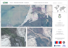
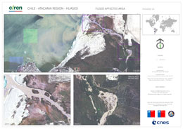
Change analysis of the flood at Huasco in the Atacama Region
Direitos autorais: KOMPSAT-3 © KARI 2015
Pleiades © CNES (2017) - Distribution: Airbus Defence and Space, all rights reserved
Map produced by CIREN
Information about the Product
Adquirida: KOMPSAT-3: 13/03/2016 Pleiades: 14/05/2017
Fonte: KOMPSAT-3 / Pleiades
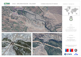
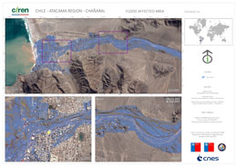
Change analysis of the flood at Vallenar in the Atacama Region
Direitos autorais: KOMPSAT-3 © KARI 2015
Pleiades © CNES (2017) - Distribution: Airbus Defence and Space, all rights reserved
Map produced by CIREN
Information about the Product
Adquirida: KOMPSAT-3: 20/12/2015
Pleiades: 14/05/2017
Fonte: KOMPSAT-3 / Pleiades
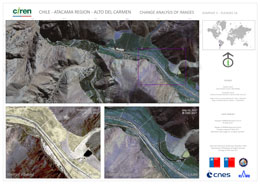
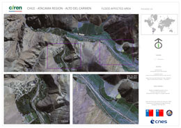
Change analysis of the flood at Alto del Carmen in the Atacama Region
Direitos autorais: KOMPSAT-3 © KARI 2015
Pleiades © CNES (2017) - Distribution: Airbus Defence and Space, all rights reserved
Map produced by CIREN
Information about the Product
Adquirida: KOMPSAT-3: 30/11/2015
Pleiades: 14/05/2017
Fonte: KOMPSAT-3 / Pleiades
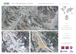
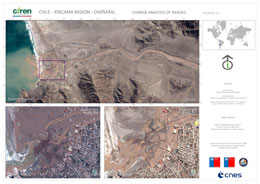
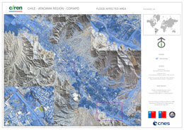
Change analysis of the flood at Copiapo in the Atacama Region
Direitos autorais: KOMPSAT-3 © KARI 2015
Pleiades © CNES (2017) - Distribution: Airbus Defence and Space, all rights reserved
Map produced by CIREN
Information about the Product
Adquirida: KOMPSAT-3: 17/05/2015
Pleiades: 14/05/2017
Fonte: KOMPSAT-3 / Pleiades
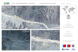
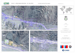
Flood extent in Atacama Region, El Salado
Direitos autorais: KOMPSAT-3 © KARI 2016
Pleiades © CNES (2017) - Distribution: Airbus Defence and Space, all rights reserved
Map produced by CIREN
Information about the Product
Adquirida: Pre-disaster: KOMPSAT-3 - 24/09/2016
Post-disaster: Pleiades - 14/05/2017
Fonte: KOMPSAT-3 / Pleiades-1A
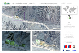
Flood in Atacama Region, El Salado
Direitos autorais: KOMPSAT-3 © KARI 2016
Pleiades © CNES (2017) - Distribution: Airbus Defence and Space, all rights reserved
Map produced by CIREN
Information about the Product
Adquirida: Pre-disaster: KOMPSAT-3 - 24/09/2016
Post-disaster: Pleiades - 14/05/2017
Fonte: KOMPSAT-3 / Pleiades-1A
 Voltar ao arquivo completo da Ativação

 English
 Spanish
 French
 Chinese
 Russian
 Portuguese
