 English
 Spanish
 French
 Chinese
 Russian
 Portuguese
 Latest Activation
Charter activations
Flood in Argentina
A week of heavy rain has caused flooding in four provinces of Argentina, affecting thousands of people.
It is believed that the weather is the result of the El Niño effect, and months' worth of rain fell in a matter of days.
The provinces of Corrientes, Formosa, Entre Rios and Santa Fe have been impacted by the floods, and it is estimated that 10,000 people have been evacuated in these four provinces. Weather emergency alerts have been issued due to the situation, and strong winds have also caused damage to some areas.
Entre Rios and Corrientes have suffered the worst of the floods, and 80% of the city of Esquina in Corrientes is reportedly under 350mm of water. The city is not alone in experiencing such conditions, with other cities and towns inundated.
In Formosa and Santa Fe, there were still thousands of evacuees from the floods which occurred several months ago. These latest floods have now forced more to leave their homes until the situation improves. There are also concerns that the relentless rain will harm agriculture, with some crops at risk of being lost.
The torrential rain has pushed water levels in rivers and streams to overflow, leaving some rural areas isolated by the flood waters.
The rain and storms are forecast to last for several more days, but some forecasts indicate that it may resume again as more weather systems move into the area. Once the storms do end, it will still take time for the flood waters to recede, offering little short-term relief for the many affected by the weather.
| Tipo de evento: | Flood |
| Local do evento: | Argentina |
| Data da Ativação da Carta: | 7 April 2016 |
| Tempo de Ativação da Carta: | 20:12:38 |
| Zona de Tempo da Ativação da Carta: | UTC+02:00 |
| Requisitante da Carta: | DNPC SIFEM |
| Gerenciamento de projeto: | CONAE |
Products
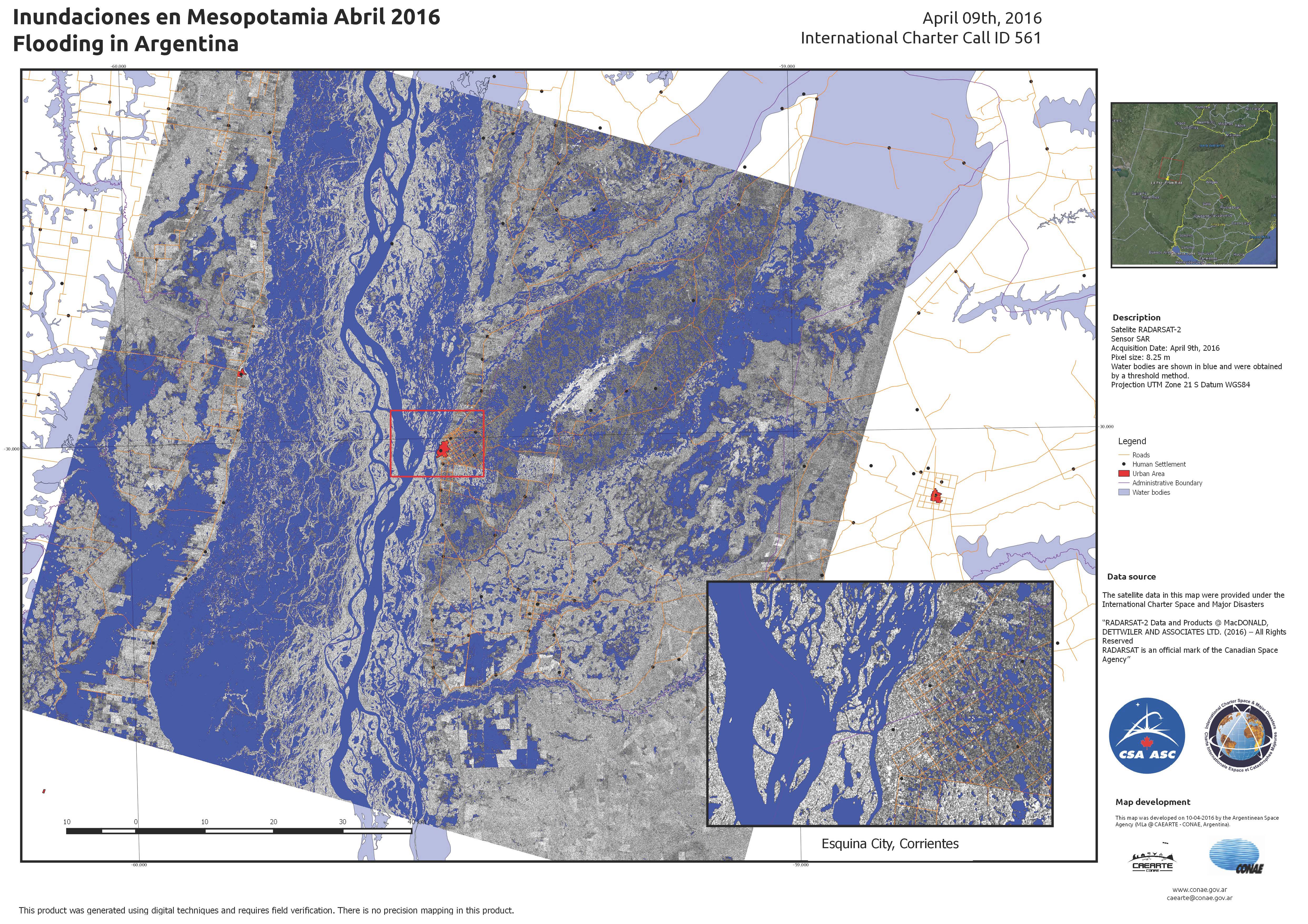
Flooding at Esquina City, in Corrientes Province, Argentina
Direitos autorais: RADARSAT-2 Data and Products © MacDonald, Dettwiler and Associates Ltd. (2016) - All Rights Reserved. RADARSAT is an official trademark of the Canadian Space Agency.
Map produced by CONAE
Information about the Product
Adquirida: 09/04/2016
Fonte: RADARSAT-2
 Voltar ao arquivo completo da Ativação
