 English
 Spanish
 French
 Chinese
 Russian
 Portuguese
 Latest Activation
Charter activations
Flooding in Ecuador
Six rivers have overflowed and more than 500 people have been evacuated from their homes following 12 hours of rainfall in Ecuador.
Esmeraldas Canton, in particular, has been severely hit, with vast areas submerged under water. Rescue services are working hard to help those in need and there are no reports of any dead or missing.
| Tipo de evento: | Floods |
| Local do evento: | Ecuador |
| Data da Ativação da Carta: | 2023-06-05 |
| Tempo de Ativação da Carta: | 09:33 |
| Zona de Tempo da Ativação da Carta: | UTC-05:00 |
| Requisitante da Carta: | SERVICIO NACIONAL DE GESTIÓN DE RIESGOS Y EMERGENCIAS (SNGRE) |
| ID da Ativação: | 822 |
| Gerenciamento de projeto: | Martha Villagomez (IGM(Militar Geographic Insitute)) |
| act-value-adders: | Terradue |
Products
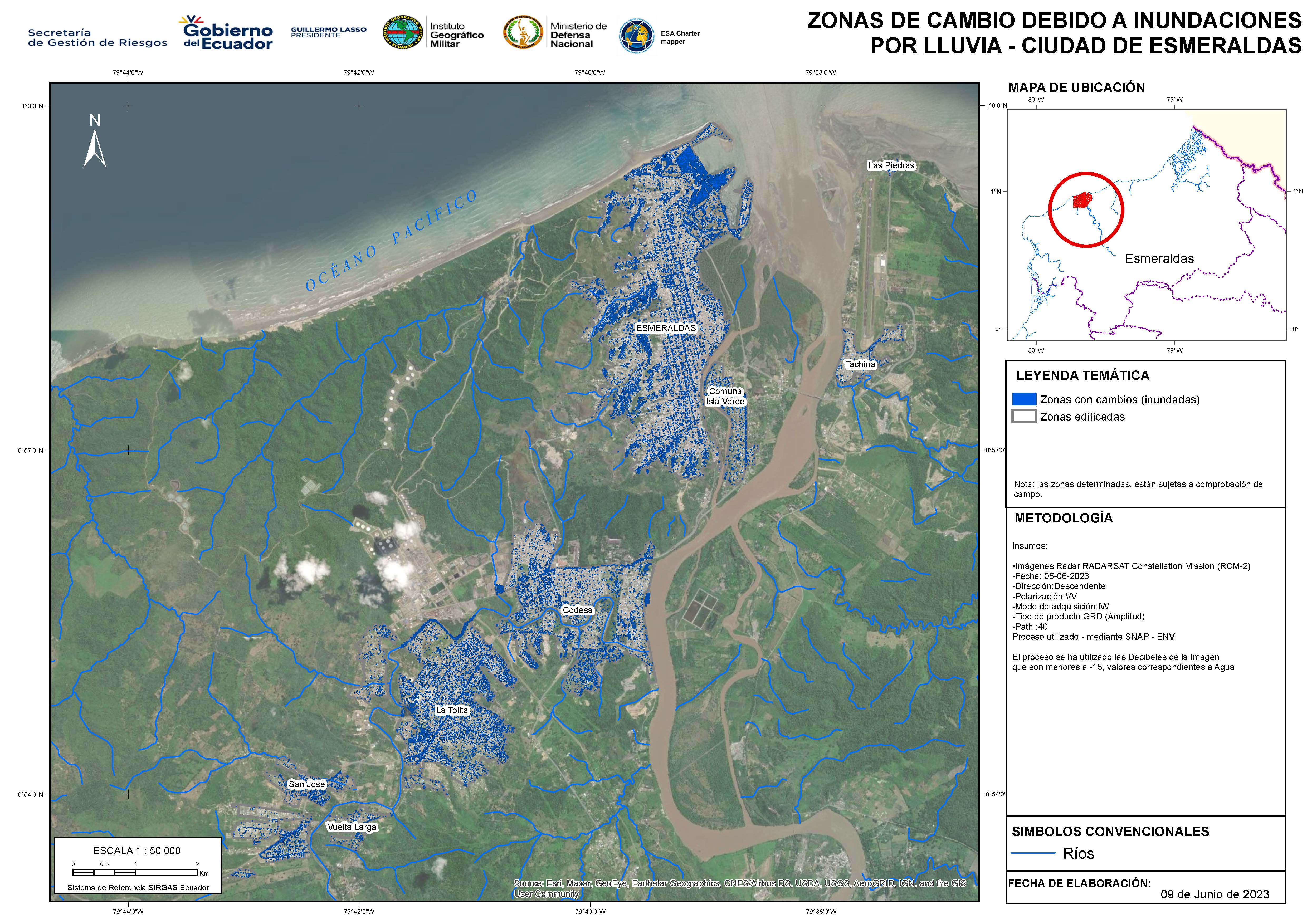
Areas affected by excessive rainfall in Esmeraldas, Ecuador
Direitos autorais: RADARSAT Constellation Mission Imagery © Government of Canada (2023) - RADARSAT is an official mark of the Canadian Space Agency
Map produced by The Military Geographic Institute.
Information about the Product
Adquirida: 06/06/2023
Fonte: RCM
Categoria: Delineation Map
 Voltar ao arquivo completo da Ativação

