English
 Spanish
 French
 Chinese
 Russian
 Portuguese
Charter activation for Noto earthquake in Japan
News
20 Março 2024
Charter activation for Noto earthquake in Japan
On January 1, 2024, at 4:10 pm (Local Time, 07:10 UTC), a magnitude 7.6 earthquake struck the Noto peninsula of Ishikawa prefecture, Japan. The quake was centered around 30 kilometers east-northeast of Wajima, Ishikawa prefecture, with a provisional depth of 16 km. As of February 6, the quake and subsequent tremors left 240 people dead, 12 people missing, and damaged buildings across wide areas. Also, the quake led to landslides and the collapse of multiple buildings, sparked a large-scale fire in several places, and triggered a tsunami warning for the length of the nation's west coast. There were more than 46,000 houses in the prefecture severely damaged or destroyed.
ADRC (Asian Disaster Reduction Center) requested to activate the International Charter Space and Major Disasters as an escalation of Sentinel Asia. Dr. Masahiko Nagai of Yamaguchi University took the role of Project Manager (PM) of the activation, and 13 Value Adders (VAs) were nominated to produce maps assessing the impact of the disaster. These VAs are from the network of universities and public institutions in Japan who typically respond to major disasters in the country.
The Charter provided 353 satellite data products from 18 satellites, including optical and SAR satellites, which were delivered to the end users to support their response to the earthquake. Value added products produced from these data are available on the Charter activation page, and examples of these follow:
Yamaguchi University produced this delineation map of Mauramachi, in Ishikawa, using a satellite image of GeoEye-1 captured on January 2nd. The red polygons show detected landslide areas.
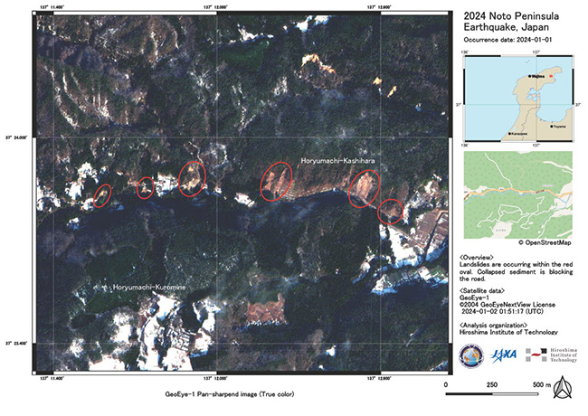
This delineation map produced by the Hiroshima Institute of Technology shows affected areas by landslides at Suzu City detected by GeoEye-1.
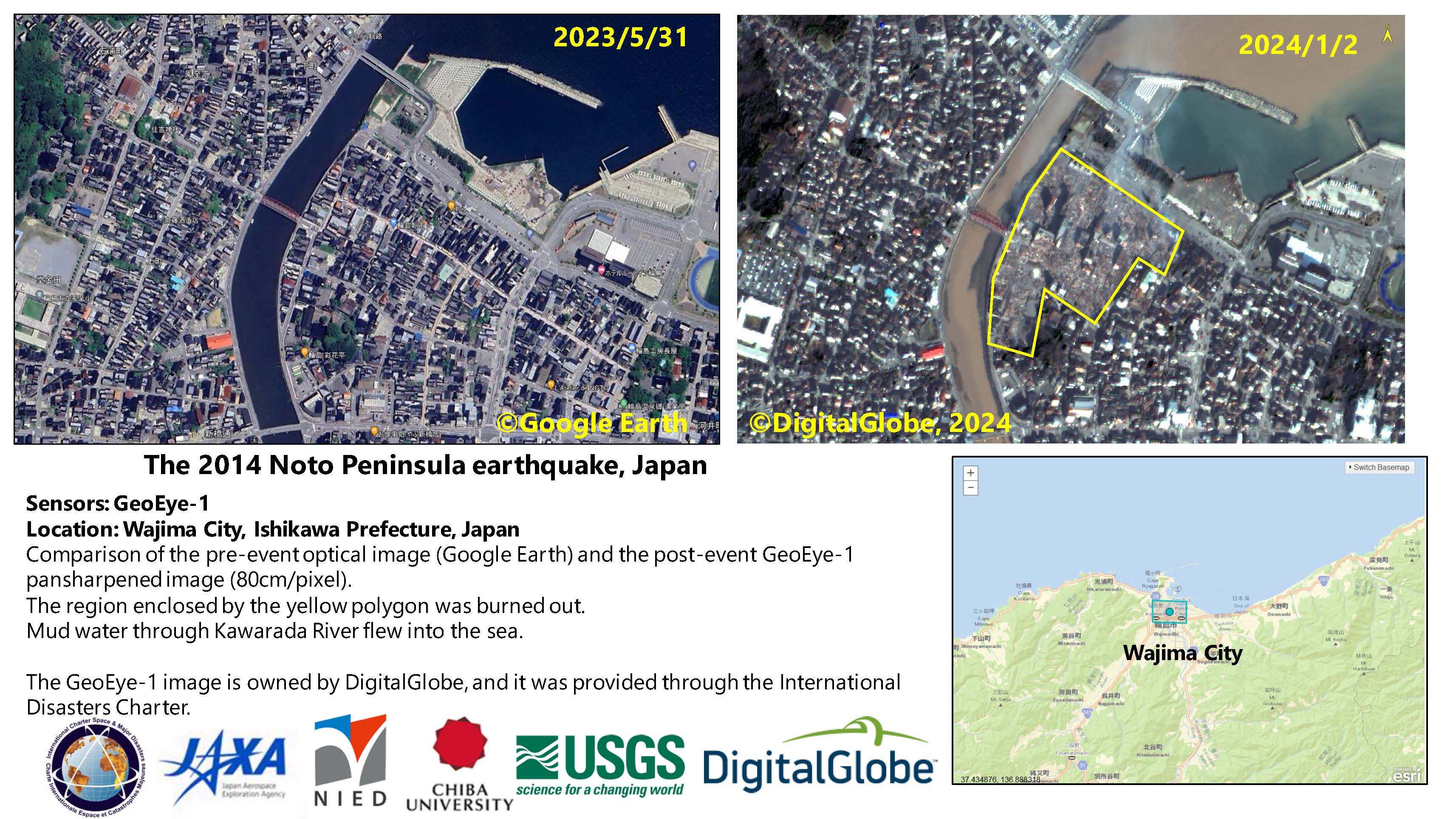
Chiba University produced a delineation map by utilizing a GeoEye-1 image of Wajima City, and compared it to a pre-disaster image of the same location. The yellow polygon indicates an estimated area that was burnt in a fire following the earthquake. In the map, mud displaced by landslides upstream, can be seen flowing through the Kawarada River out into the sea.
Observation data from Disasters Charter satellites, in addition to satellite images and value-added products from Sentinel Asia, supported monitoring damage caused by the quake. The escalation mechanism from Sentinel Asia to the Charter continues to respond to disasters in the Asia and Pacific region, demonstrating both organization's ongoing commitment to provide international support for humanitarian purposes in times of major disasters.

Notícias relacionadas