 English
 Spanish
 French
 Chinese
 Russian
 Portuguese
 Flooding in the Dominican Republic
Flooding in the Dominican Republic
Charter activations
Flooding in the Dominican Republic
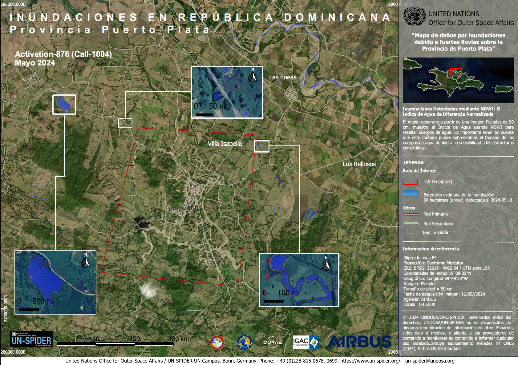
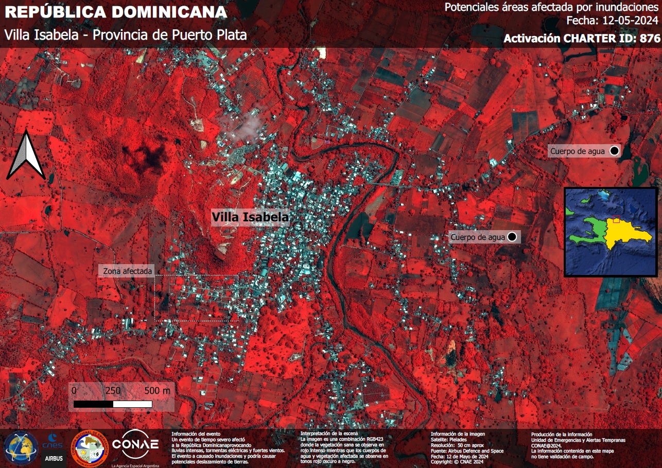
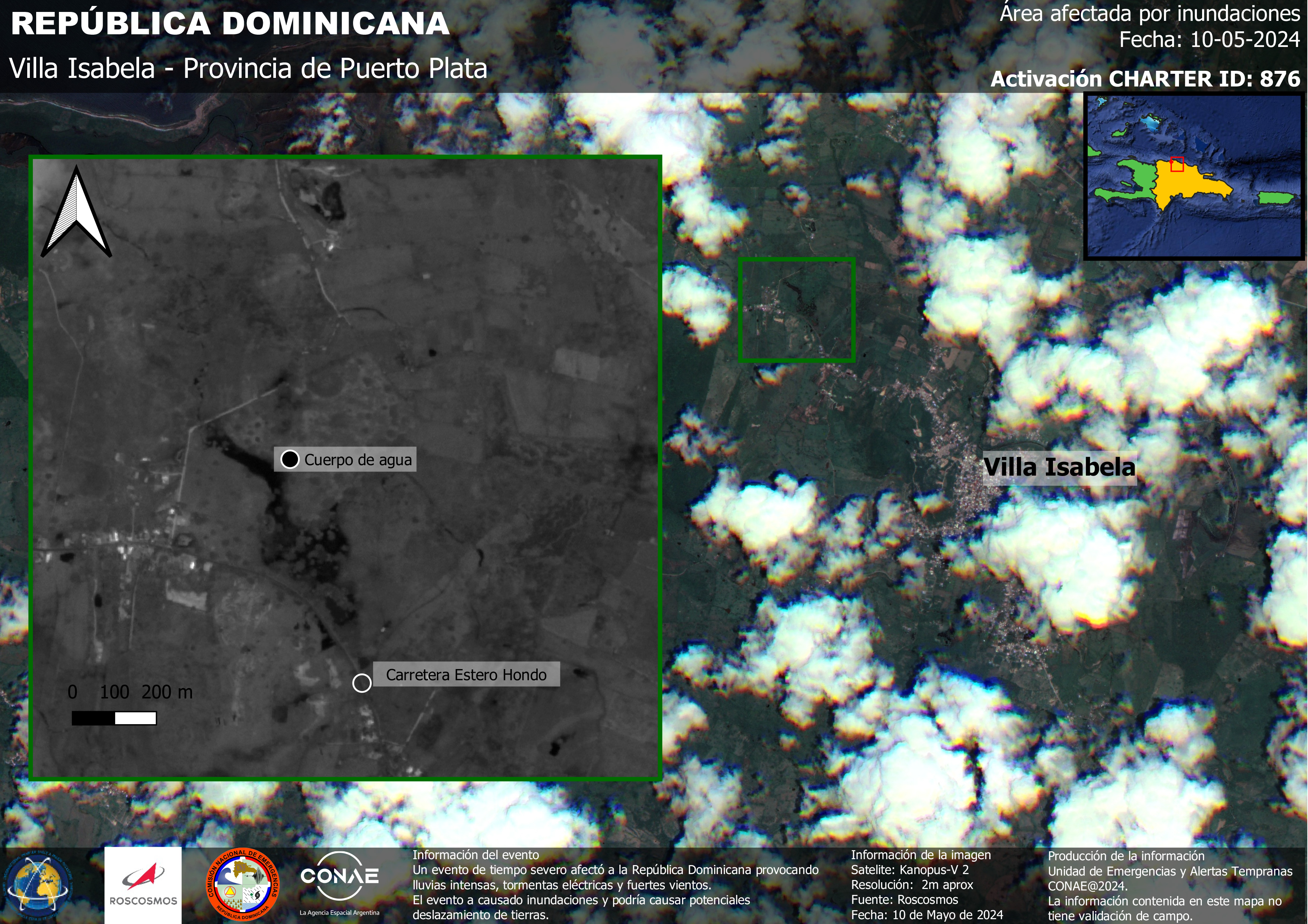
Severe weather affected the Dominican Republic, caused by a trough that brought heavy rainfall, thunderstorms, and strong winds across the region. The weather resulted in flooding and there was the potential for landslides. There was a particular concern for low-lying communities, which were at risk of being badly affected by debris from these potential landslides.
The country's National Office of Meteorology (ONAMET) issued weather warnings (the highest level on a two-tier scale) for Duarte, El Seibo, Elias Pina, Espaillat, Hato Mayor, La Vega, Maria Sanchez Trinidad, Monsenor Nouel, Monte Plata, Puerto Plata, San Cristobal, Sanchez Ramirez, Santiago, Santiago Rodriguez, and Santo Domingo (including the Distrito Nacional) provinces.
Infrastructure such as electricity and telecommunications services were at risk due to the potential impact that significant flooding or landslides may have on utility networks.
A trough is an elongated area of relatively low pressure extending from the center of a region of low pressure and is associated with stormy weather.
| Type of Event: | Flood |
| Location of Event: | Dominican Republic |
| Date of Charter Activation: | 2024-05-08 |
| Time of Charter Activation: | 10:36 |
| Time zone of Charter Activation: | UTC-04:00 |
| Charter Requestor: | Comisión Nacional de Emergencias (CNE) |
| Activation ID: | 876 |
| Project Management: | UNSPIDER |
| act-value-adders: | Andres Lighezzolo (CONAE) AlejandraMaria RojasGonzalez (Escuela de Ingeniería de Biosistemas Universidad de Costa Rica) |
Products


 Back to the full activation archive
