 English
 Spanish
 French
 Chinese
 Russian
 Portuguese
 Dernière activation
Charter activations
Flood in Ecuador
Intense rain and flooding caused by the El Niño climate pattern affected seventeen provinces in Ecuador since 20 February 2024. Provinces mostly impacted included Esmeraldas, Manabi, Santa Elena, Guayas, Santo Domingo de los Tsáchilas, Los Ríos, and El Oro along the coastal region.
One person died in Santo Domingo de los Tsachilas province, after a vehicle fell into a sinkhole on the La Concordia-Monterrey-Las Villegas Highway. Homes, roads, and bridges were damaged or destroyed due to the rapid rise in water levels. Four deaths from dengue fever were reported by the Ministry of Health as flooding increased the threat of disease outbreaks such as stagnant pools were becoming breeding grounds for mosquitoes and bacteria, increasing the incidence of insect- and water-borne diseases. Crops were submerged, impacting local farmers and food production.
Emergency services worked tirelessly to rescue stranded individuals and provide aid. Authorities considered issuing mandatory evacuation orders for flood-prone communities.
| Type of Event: | Flood |
| Location of Event: | Ecuador |
| Date of Charter Activation: | 2024-02-20 |
| Time of Charter Activation: | 15:09 |
| Time zone of Charter Activation: | UTC-05:00 |
| Charter Requestor: | SECRETARÍA DE GESTION DE RIESGOS (SGR) |
| Activation ID: | 862 |
| Project Management: | IGM (Militar Geographic Institute) |
| act-value-adders: | Instituto Geográfico Militar NOAA VA (NOAA) |
Products


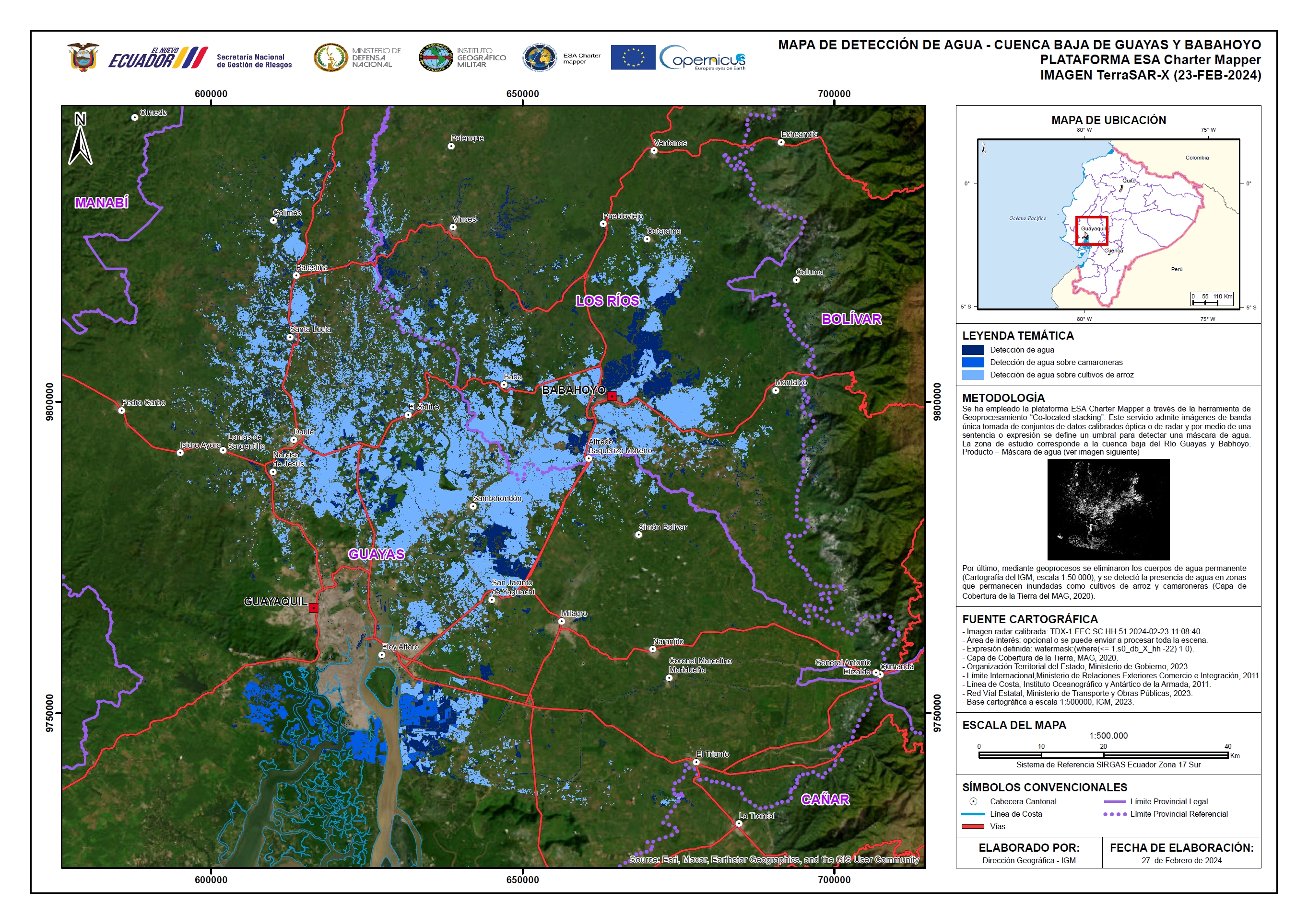
Water Detection Map of the Lower Basin of the Rio Guayas River and Babahoyo, Ecuador
Copyright: Contains modified Copernicus Sentinel data (2024)
Map produced by the Geographic Directorate - IGM.
Information about the Product
Acquired: 25/01/2024 and 18/02/2024
Source: Sentinel-1
Category: Reference Map


 Back to the full activation archive

