Charter activations
Fire in Australia
Bushfires have spread across two states of Australia burning over a million hectares of land. Australian authorities have placed 'catastrophic' threat levels in place across Queensland and New South Wales.
Around 150 fires have fed off tinder-dry conditions coupled with high temperatures, unpredictable winds and lightning. Over 200 homes have been destroyed and bushfires approached within 15km of Sydney's city centre. A Firefighting aeroplane dropped pink fire retardant to halt the spread to protect the suburbs of Sydney.
Over 3000 firefighters are tackling bushfires, assisted by personnel from New Zealand and the Australian Defence Force. Crews have been battling a front spanning 1,000km along the north coast of New South Wales. Police are also investigating several reports suggesting some of the fires were started deliberately.
Communities have been urged to stay away from bushland in areas susceptible to more fires, and more than 600 schools have closed. The weather forecast has predicted further hot weather and little to no rain.
| Type of Event: | Fire |
| Location of Event: | Australia |
| Date of Charter Activation: | 2019-11-13 |
| Time of Charter Activation: | 15:05 |
| Time zone of Charter Activation: | UTC+09:30 |
| Charter Requestor: | Geoscience Australia on behalf of Emergency Management Australia Crisis Coordination Centre (CCC) and New South Wales Rural Fire Service (NSWRFS) |
| Activation ID: | 631 |
| Project Management: | Geoscience Australia |
Products

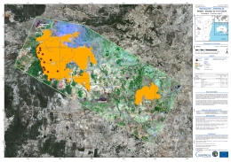
Wildfire Situation at Wandsworth, Australia
Copyright: Sentinel-2 © Contains modified Copernicus Sentinel data (2019)
Landsat 8 data and products © USGS (2019) - All rights reserved
Map produced by Copernicus EMS
Information about the Product
Acquired: Sentinel-2: 02/09/2019
Landsat 8: 13/11/2019
Source: Sentinel-2 / Landsat 8

Wildfire Situation at Torrington, Australia
Copyright: Sentinel-2 © Contains modified Copernicus Sentinel data (2019)
Landsat 8 data and products © USGS (2019) - All rights reserved
Map produced by Copernicus EMS
Information about the Product
Acquired: Sentinel-2: 02/09/2019
Landsat 8: 13/11/2019
Source: Sentinel-2 / Landsat 8

Wildfire Situation at Bendemeer, Australia
Copyright: Sentinel-2 © Contains modified Copernicus Sentinel data (2019)
Landsat 8 data and products © USGS (2019) - All rights reserved
Map produced by Copernicus EMS
Information about the Product
Acquired: Sentinel-2: 22/10/2019
Landsat 8: 13/11/2019
Source: Sentinel-2 / Landsat 8
 Back to the full activation archive

 English
 Spanish
 French
 Chinese
 Russian
 Portuguese


