Fire in Syrian Arab Republic
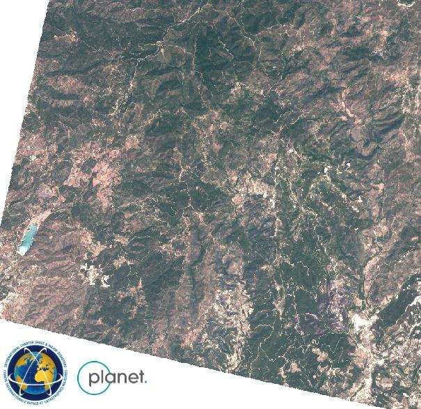
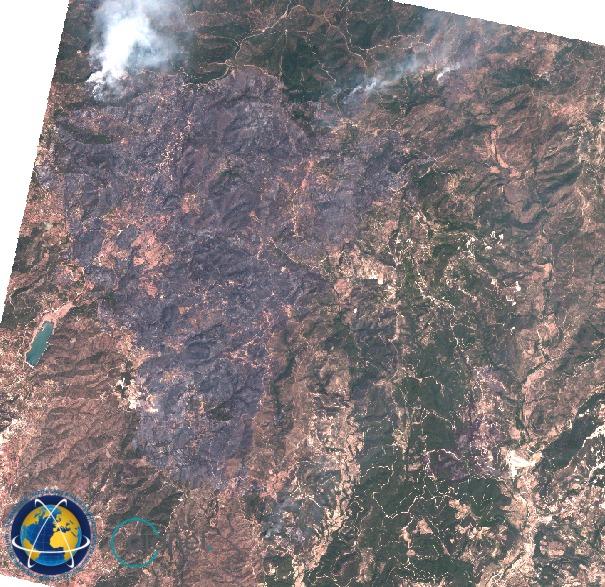
Since 3 July 2025, massive wildfires swept across Syria’s Latakia province, burning approximately 10,000 hectares (100 km²) of forest and farmland. Fueled by extreme heat, drought, and strong winds, the fires raged for nearly a week and forced hundreds of families to evacuate villages such as Qastal Ma‘af and Kansaba. Efforts to contain the blazes were hampered by rugged terrain and unexploded ordnance left over from the civil war.
More than 100 firefighting teams, supported by Jordanian helicopters, Turkish aircraft, and UN coordination, battled 28 active hotspots in what officials described as a catastrophic environmental emergency.
Related Resources:
- Type d'événement
- Incendie
- Lieu de l'événement
- Syrian Arab Republic
- Date d'activation de la Charte
- 2025-07-07
- Heure d’activation de la location
- 10:54
- Fuseau horaire d'activation de la Charte
- UTC+07:00
- Demandeur de charte
- UNOSAT on behalf of UNOCHA
- Identifiant d'activation
- 971
- Gestion de projet
- UNITAR
- Valeur ajoutée
- Rapid Mapping Service SERTIT (ICube SERTIT),
- Leo Martinon (European Response Crisis Centre (ERCC)),
- Copernicus EMS (Copernicus EMS)