 English
 Spanish
 French
 Chinese
 Russian
 Portuguese
 最新宪章启动
Charter activations
美国基拉韦厄火山的地震和火山爆发
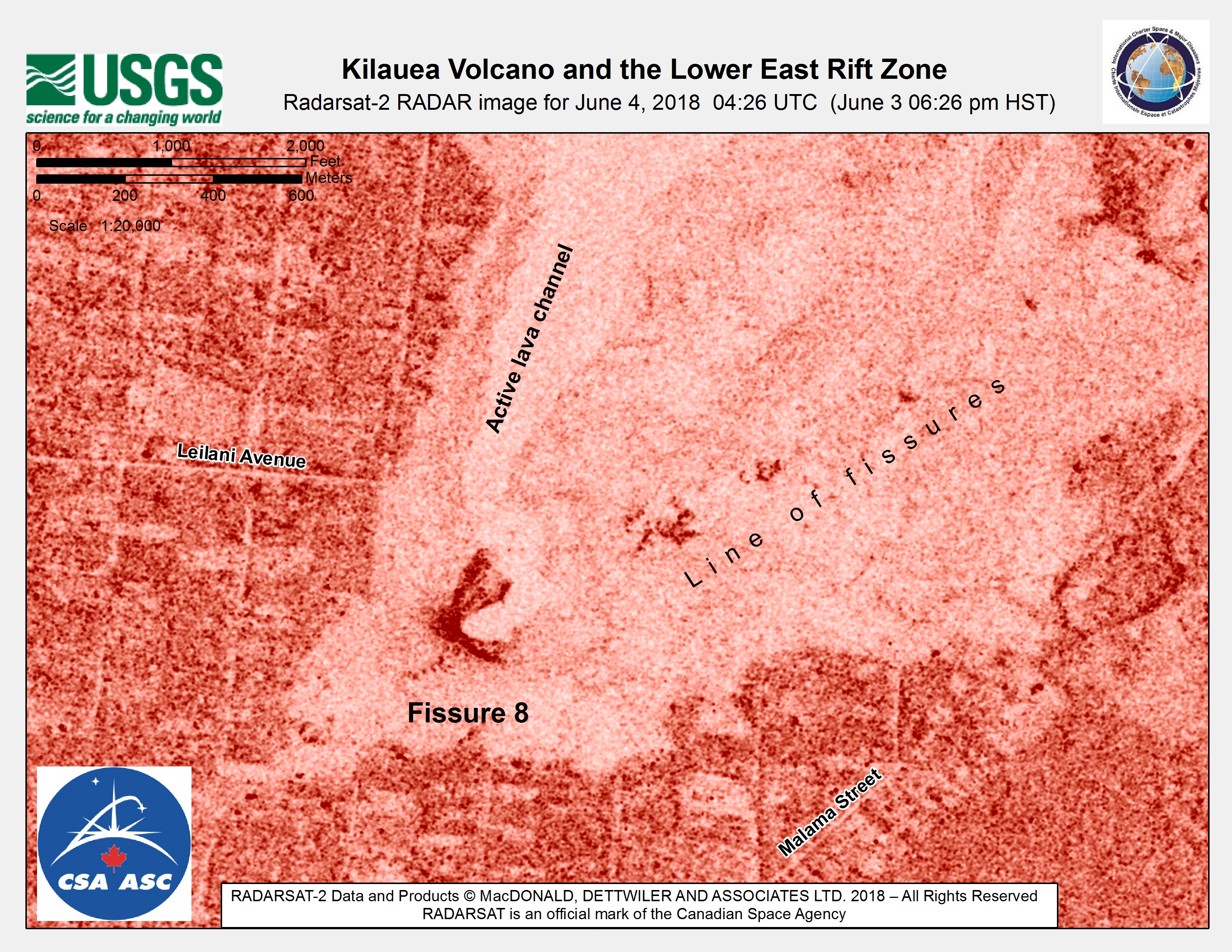
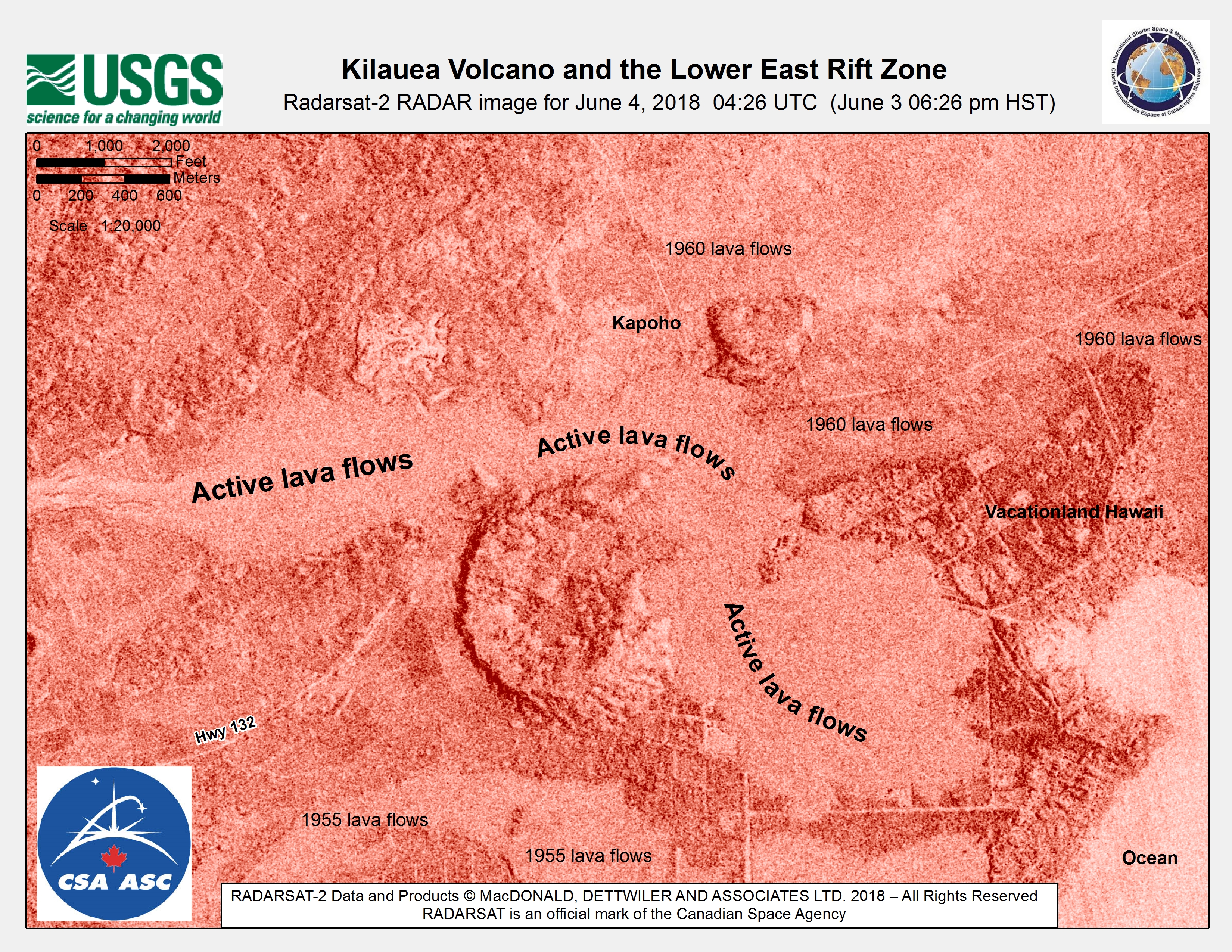
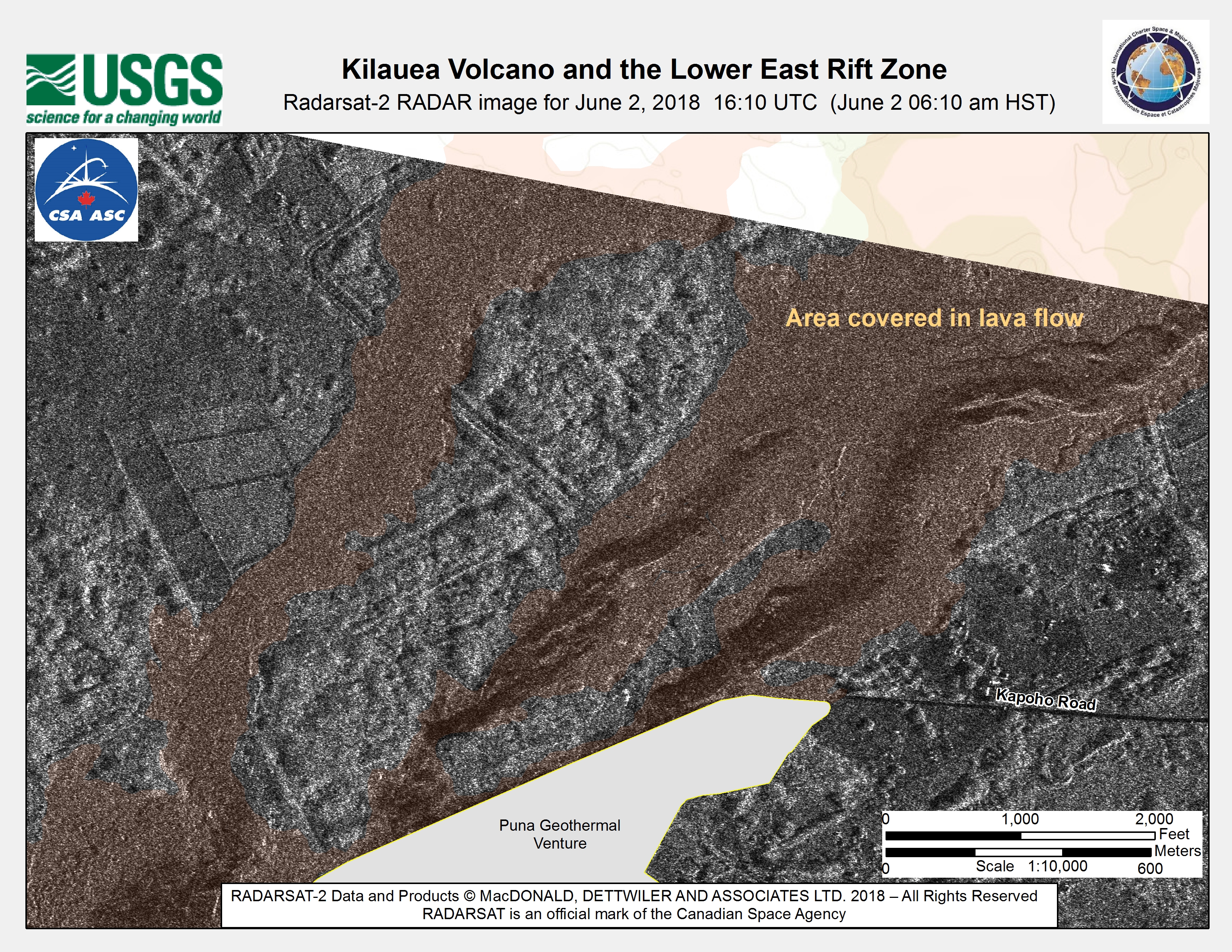
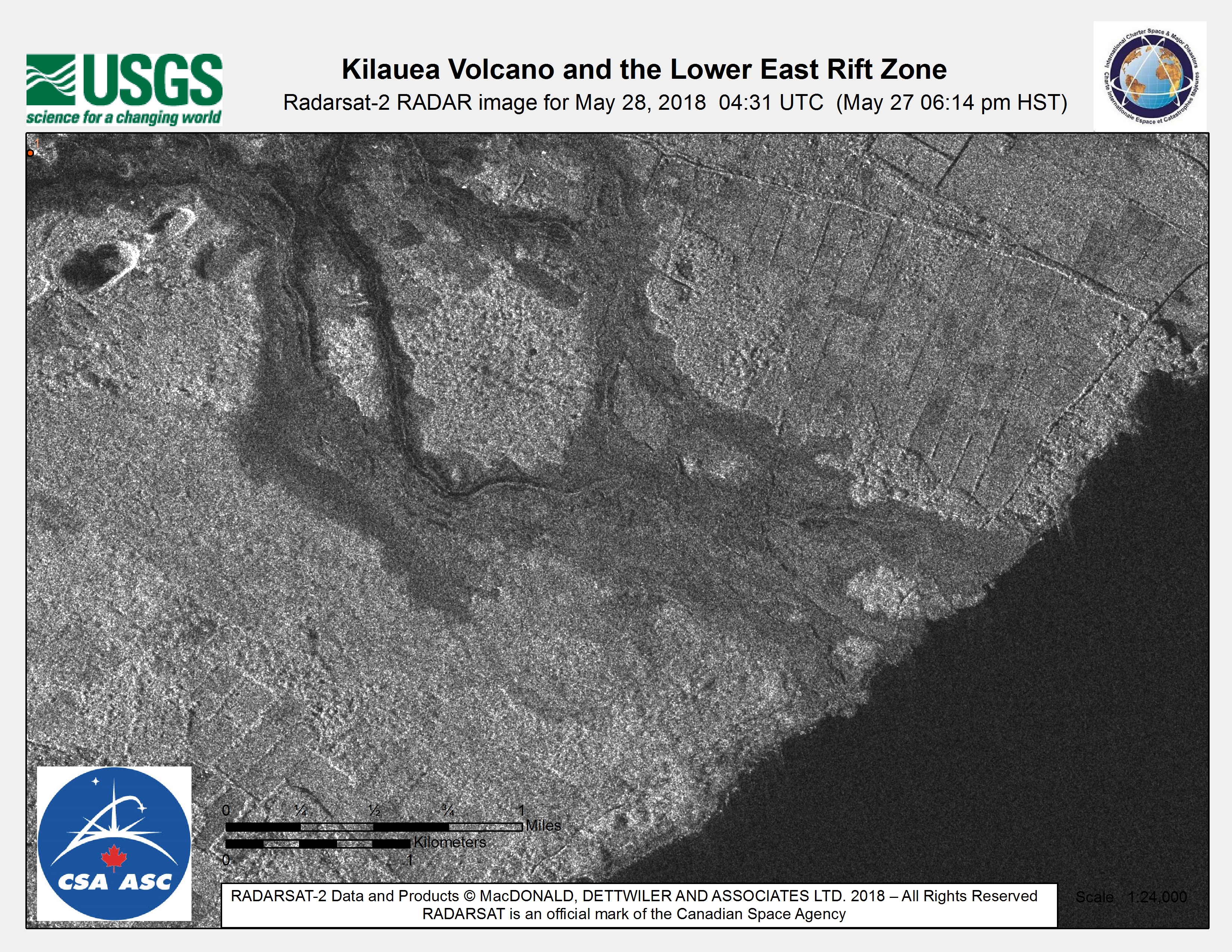
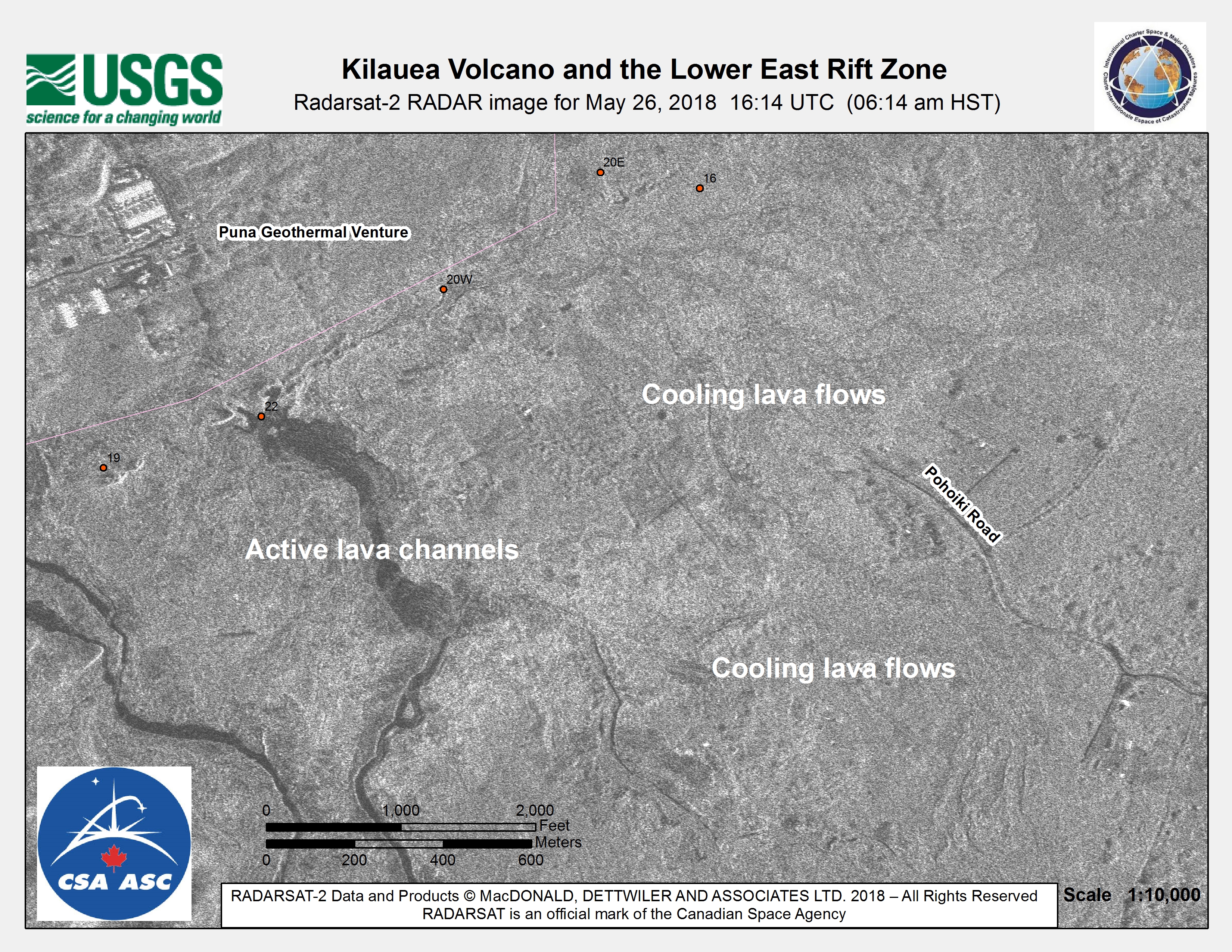
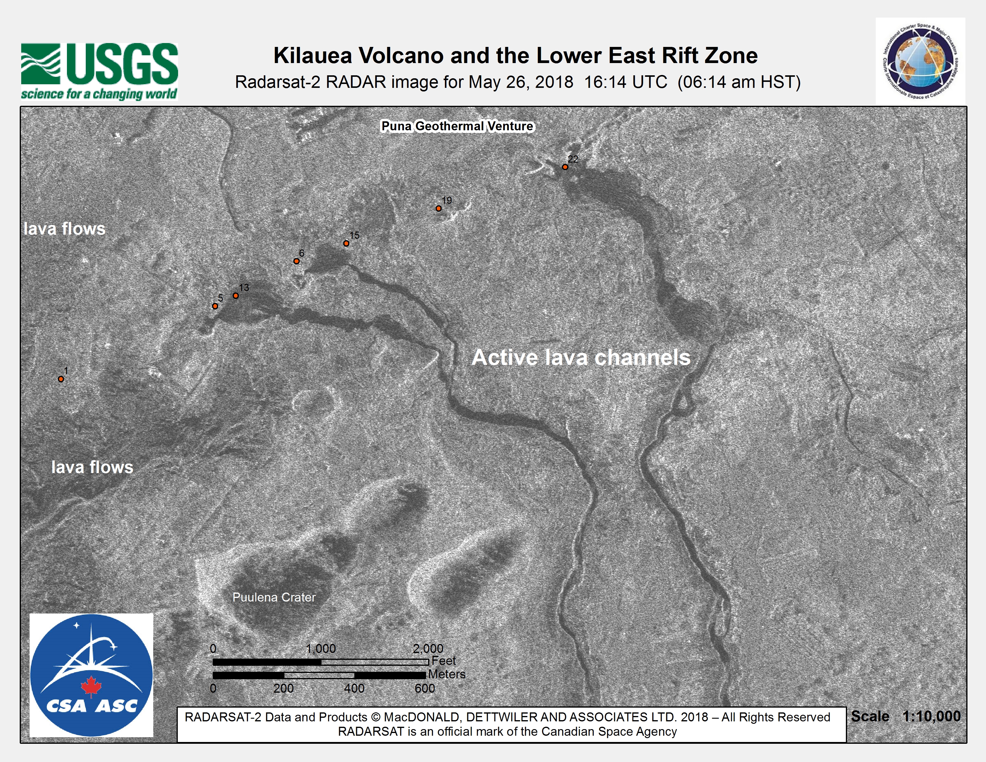
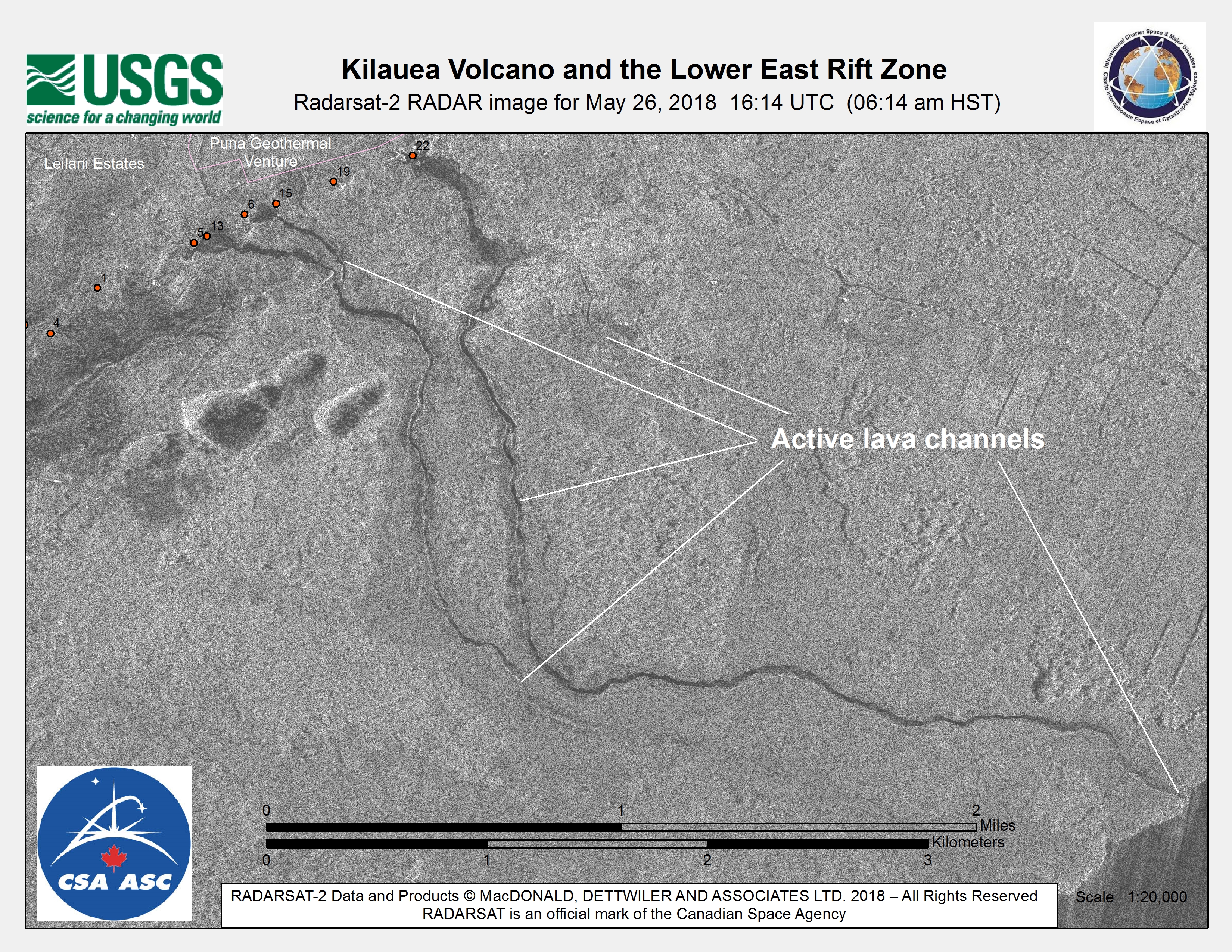
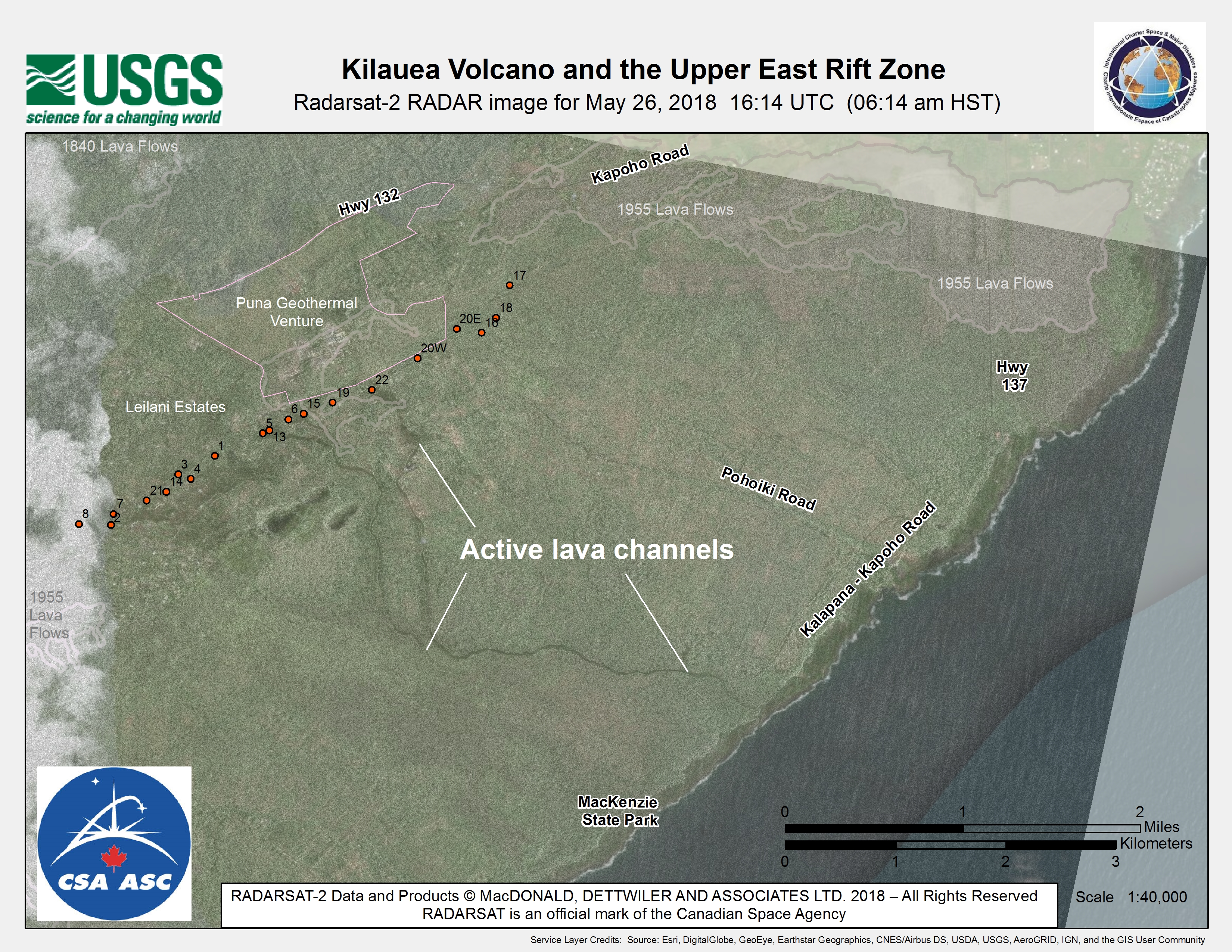
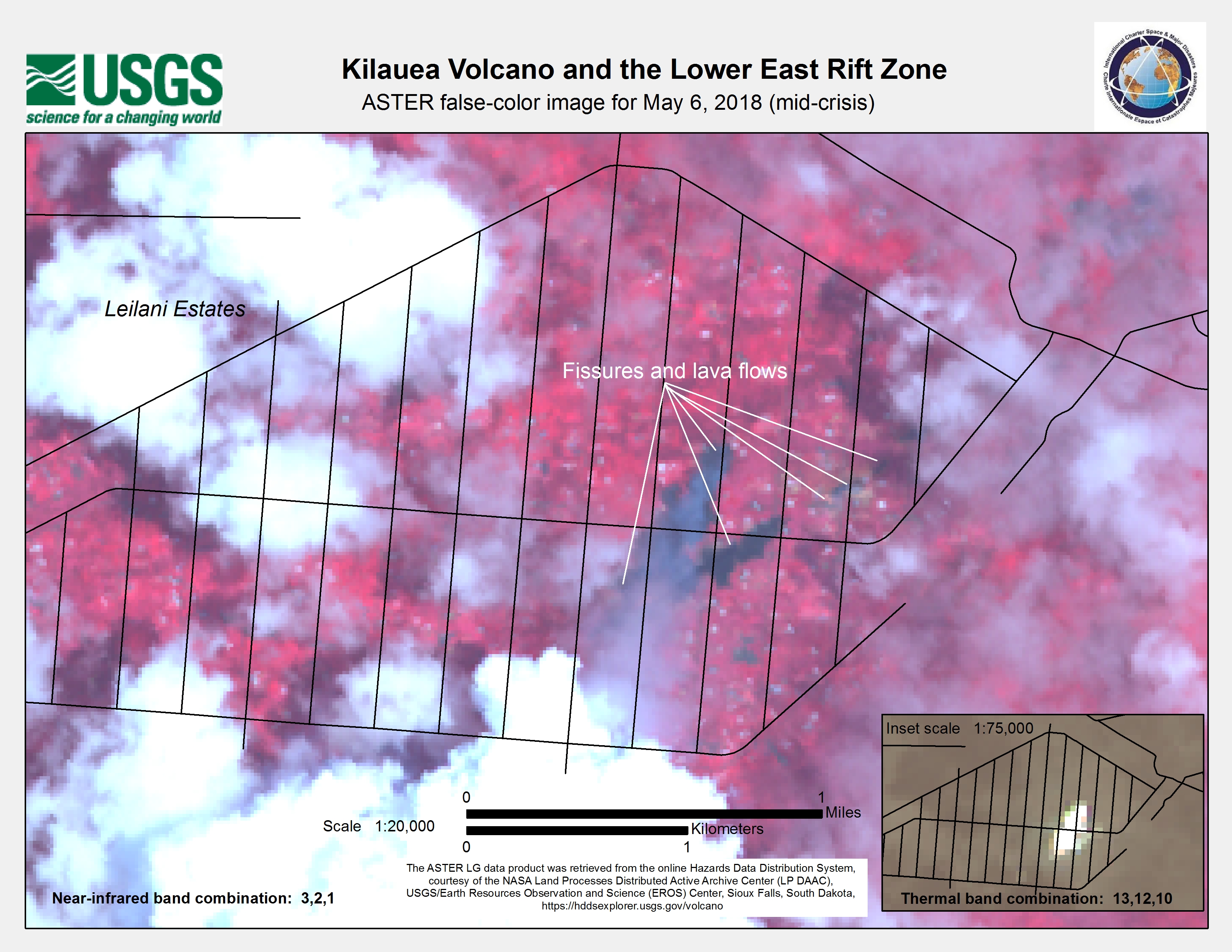
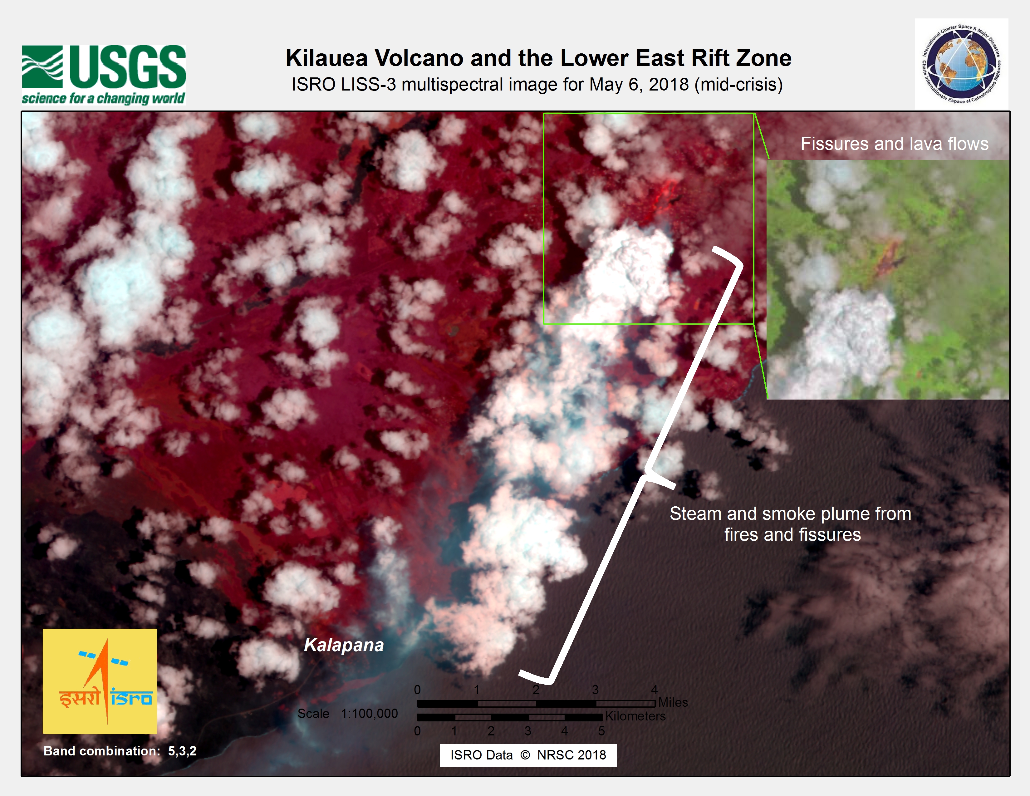
夏威夷的基拉韦厄火山于5月4日爆发,该岛也在同一天发生了6.9级地震。从该地区撤离了2000人,火山爆发路径上的数百所房屋面临危险,但没有人员伤亡报告。
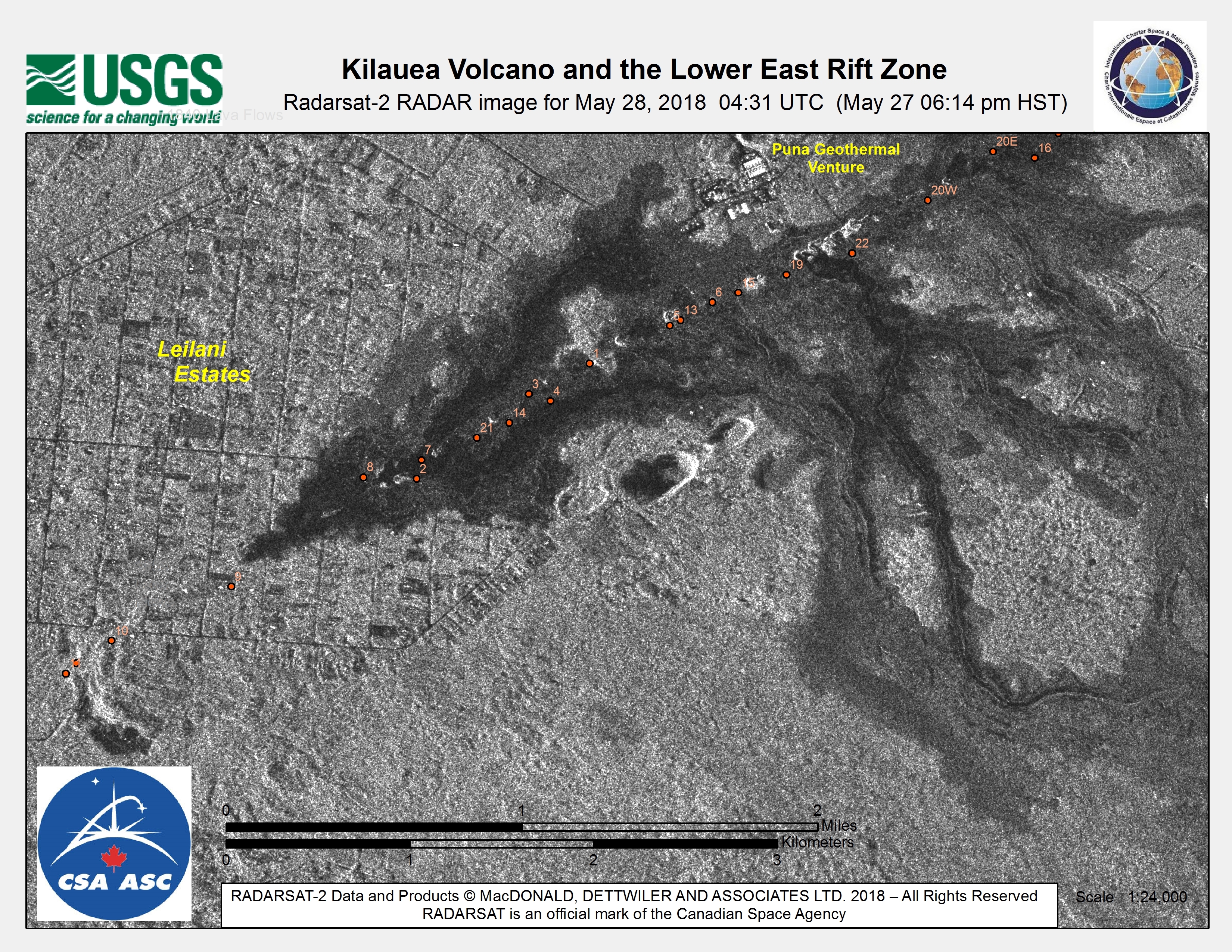
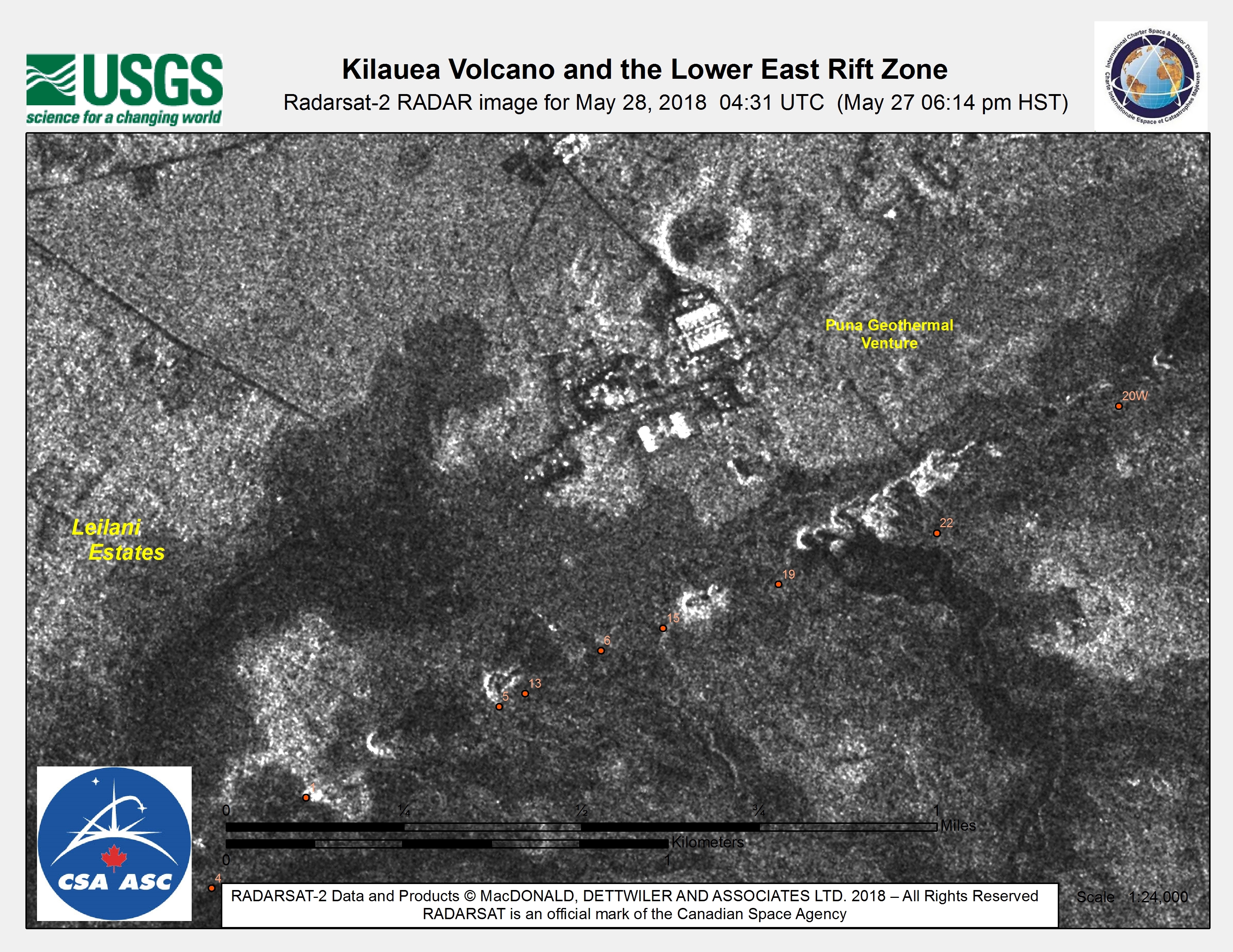
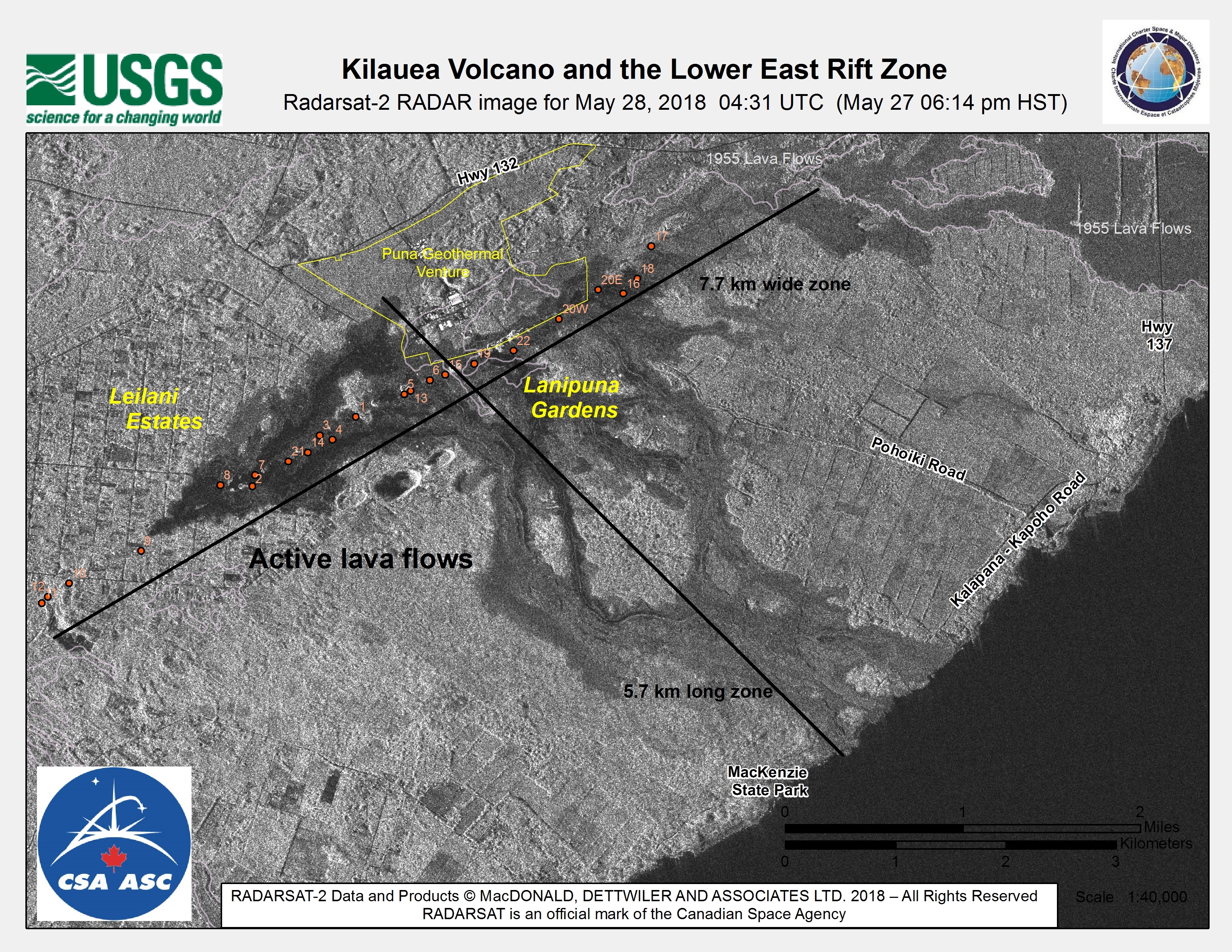
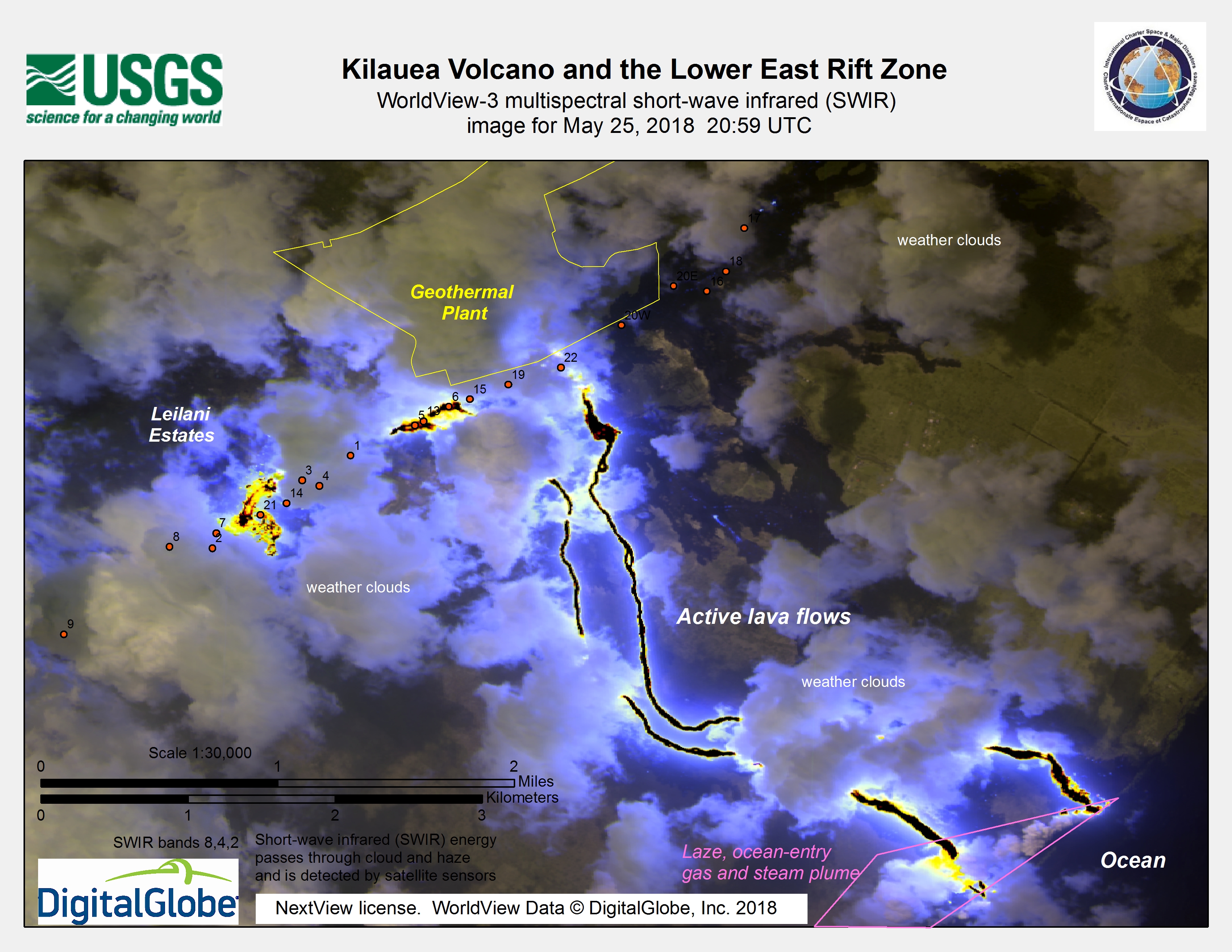
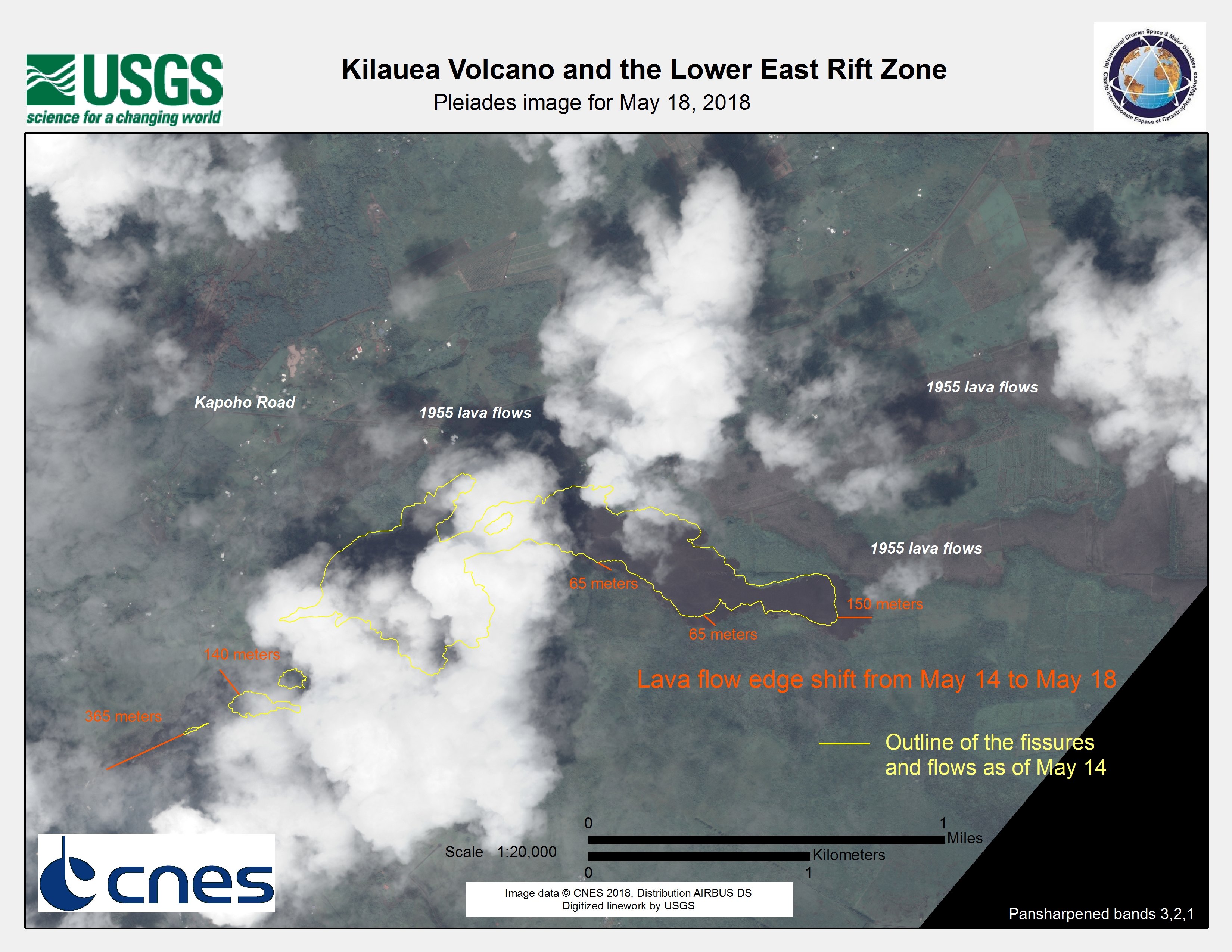
这座火山位于夏威夷的大岛上,并且已经活跃了数十年。当局报告说,在莱拉尼庄园和拉尼普拿花园地区已经摧毁了35座建筑物,在该火山的东裂谷地区开辟了12个裂缝和火山口。熔岩从某些地区的通风口喷出高达70米,并使熔岩流过街道。据报道,在最活跃的裂缝处,熔岩的范围为36,000平方米。
来自火山的大量二氧化硫对居民构成了另一种危害,因为气体对呼吸有毒。在情况有所改善之前,已敦促居民不要返回受影响地区。
6.9级地震后发生了多次余震,但据报道活动正在减少。
关注来自美国地质调查局的基拉韦厄状态的最新更新。
| 事件类型: | 火山和地震 |
| 事件地点: | 美国 |
| 启动宪章的日期: | 2018年5月7日 |
| 宪章启动时间: | 15:14 |
| 宪章启动时区: | UTC-05:00 |
| 宪章要求者: | 美国地质调查局代表USGS夏威夷火山观测站/瀑布火山观测站 |
| 启动ID: | 571 |
| 项目经理: | 美国地质调查局 |
Products

Kīlauea Volcano and the Lower East Rift Zone
版权: TerraSAR-X © DLR e. V. 2018, Distribution: Airbus DS Geo GmbH
RADARSAT-2 Data and Products © Maxar Technologies Ltd. (2018) - All Rights Reserved. RADARSAT is an official trademark of the Canadian Space Agency.
Map produced by USGS
Information about the Product
已获得: TerraSAR-X: 02/04/2018
RADARSAT-2: 04/04/2018
源: RADARSAT-2 & TerraSAR-X


Kīlauea Volcano and the Halema'uma'u Crater
版权: Sentinel-2 © Contains modified Copernicus Sentinel data (2018)
RADARSAT-2 Data and Products © Maxar Technologies Ltd. (2018) - All Rights Reserved. RADARSAT is an official trademark of the Canadian Space Agency.
Map produced by USGS
Information about the Product
已获得:
RADARSAT-2: 19/052018
Sentinel-2: 29/05/2018
源: Sentinel-2 / RADARSAT-2


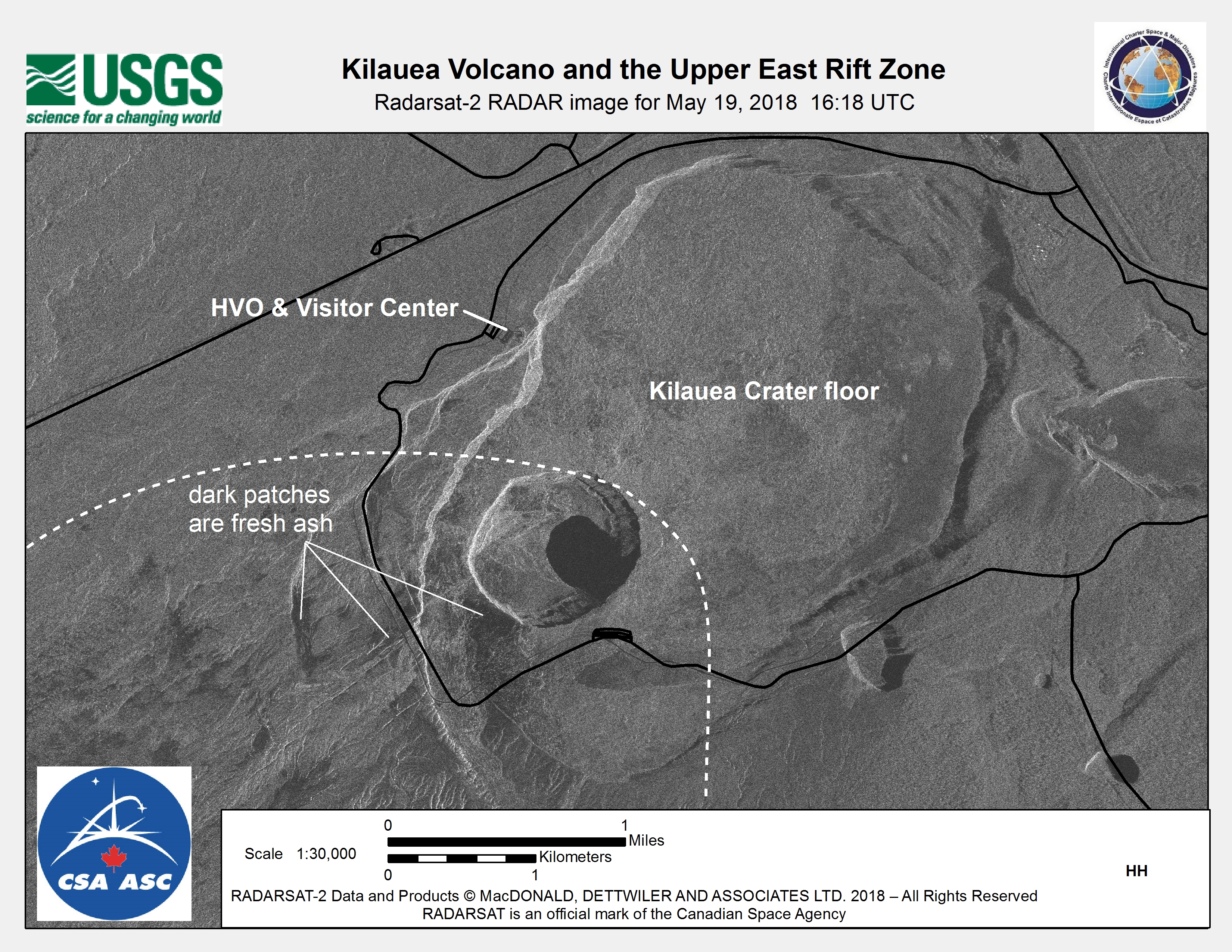
Damage assessment map of Kīlauea Volcano and the upper east rift zone
版权: RADARSAT-2 Data and Products © Maxar Technologies Ltd. (2018) - All Rights Reserved. RADARSAT is an official trademark of the Canadian Space Agency.
Map produced by USGS
Information about the Product
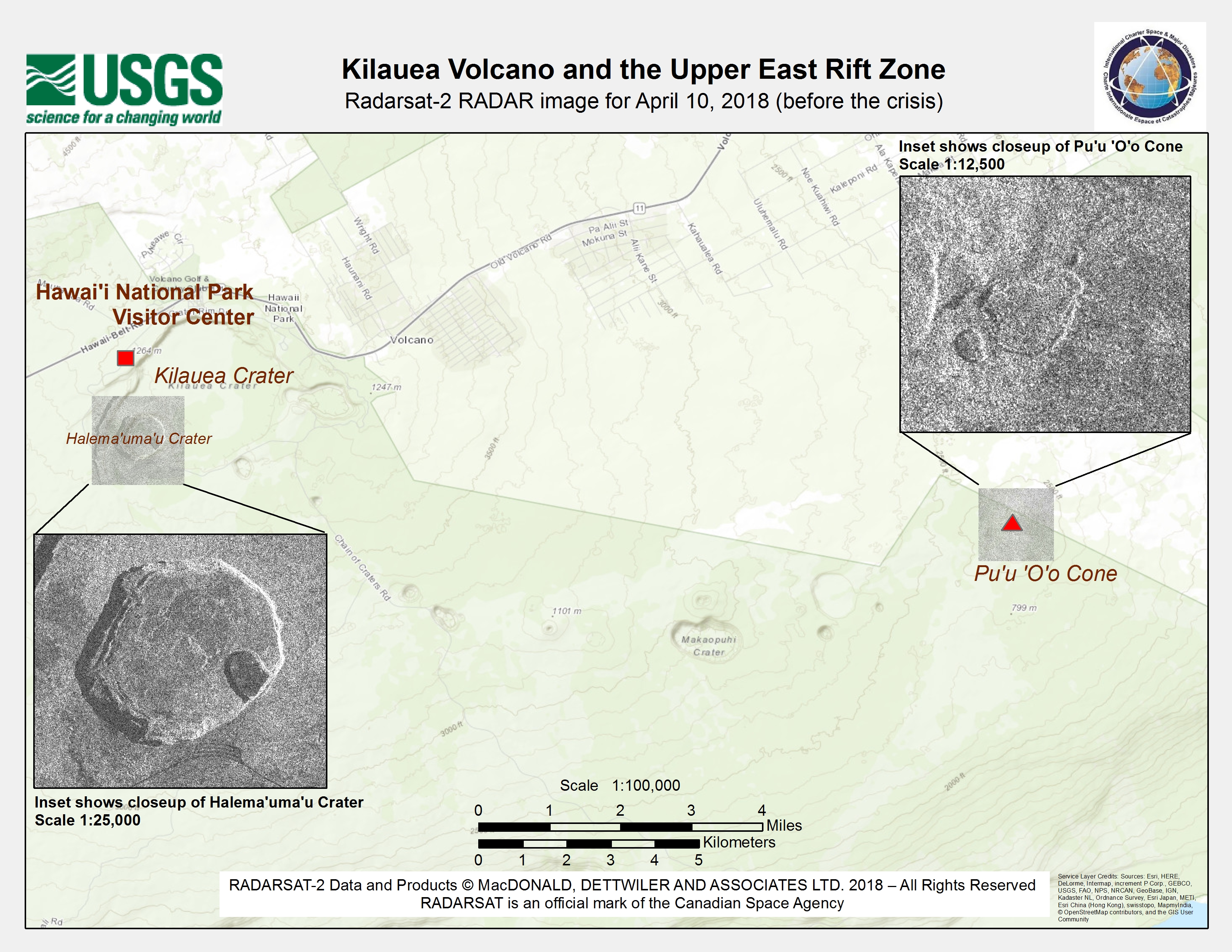
已获得: 10/04/2018
源: RADARSAT-2


Damage assessment map of Kīlauea Volcano and the upper east rift zone
版权: TerraSAR-X © DLR e. V. 2018, Distribution: Airbus DS Geo GmbH
RADARSAT-2 Data and Products © Maxar Technologies Ltd. (2018) - All Rights Reserved. RADARSAT is an official trademark of the Canadian Space Agency.
Map produced by USGS
Information about the Product
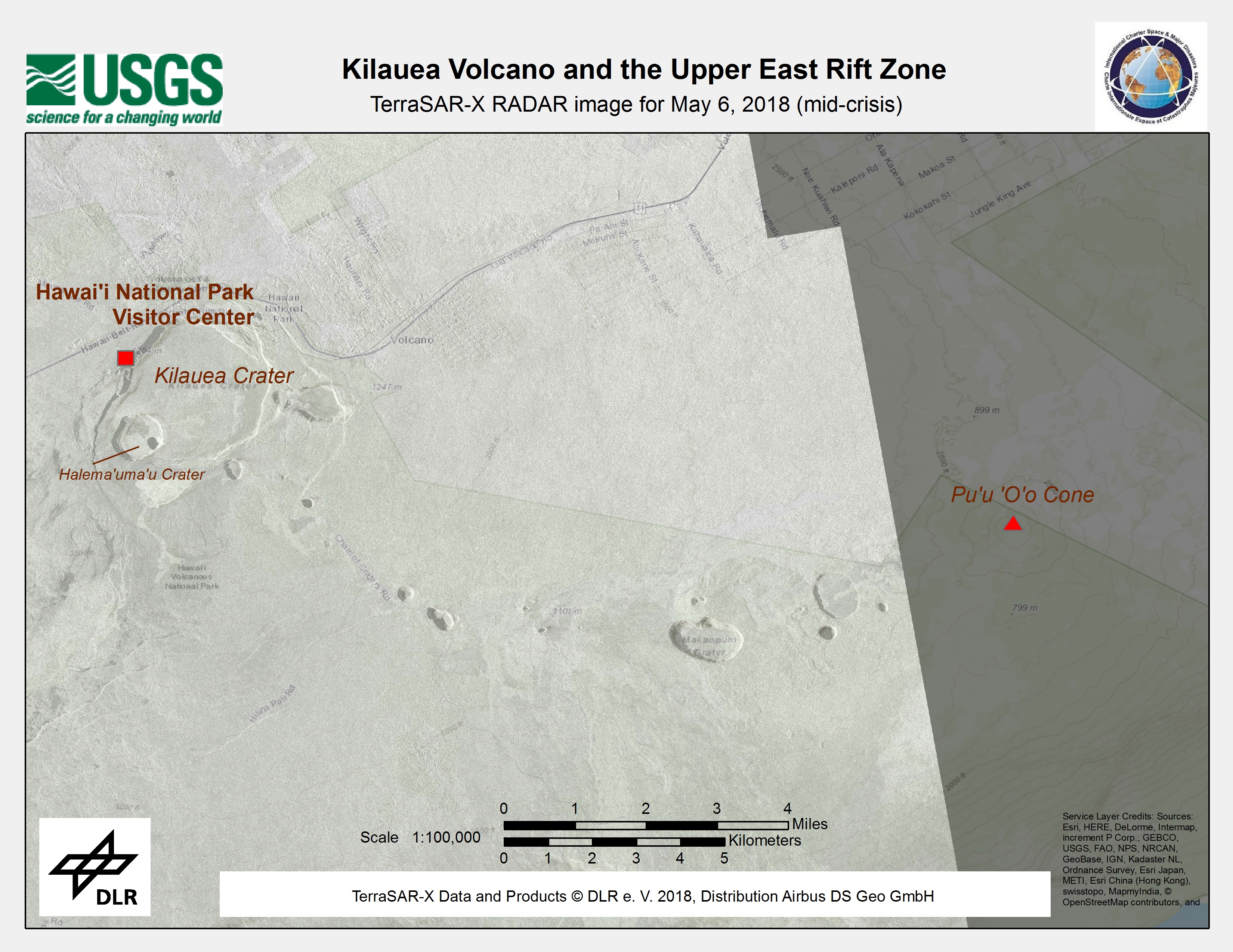
已获得: TerraSAR-X : 06/05/2018
RADARSAT-2: 19/05/2018
源: TerraSAR-X / RADARSAT-2
Damage assessment map of Kīlauea Volcano and the upper east rift zone
版权: RADARSAT-2 Data and Products © Maxar Technologies Ltd. (2018) - All Rights Reserved. RADARSAT is an official trademark of the Canadian Space Agency.
Map produced by USGS
Information about the Product
已获得: 19/05/2018
源: RADARSAT-2

 返回完整的响应档案

