 English
 Spanish
 French
 Chinese
 Russian
 Portuguese
 最新宪章启动
Charter activations
Cyclone Freddy in Madagascar
A resurgent Tropical Cyclone Freddy struck Madagascar again on 13 March with heavy rains and strong winds, leaving four people dead nearly two weeks after the storm's initial destructive passage through the island nation.
The storm took an unusual path across the Indian Ocean before initially making landfall in Madagascar on 21 February. It proceeded to Mozambique afterwards, but after making landfall there it maintained enough strength to re-emerge over the Mozambique channel and returned to Madagascar. Though it didn't make landfall on its second visit, Freddy still caused further floods to Madagascar.
The total death toll in both Madagascar and Mozambique now stands at 21. Freddy will continue to maintain its rotation as it once again heads toward Mozambique, where it will make its third overall landfall and second in the country.
Freddy became the longest-lasting tropical cyclone in recorded history on 9 March, reaching 32 days since formation. The old record of 31 days was held by Typhoon John in 1994.
Related News and Resources
| 事件类型: | Cyclone |
| 事件地点: | Madagascar |
| 启动宪章的日期: | 2023-03-10 |
| 宪章启动时间: | 16:24 |
| 宪章启动时区: | UTC+03:00 |
| 宪章要求者: | Bureau National de Gestion des Risques et des Catastrophes (BNGRC) |
| 启动ID: | 812 |
| 项目经理: | Teodoro Hunger (UNITAR/UNOSAT) |
| act-value-adders: | Yeji Kim (KARI) |
Products
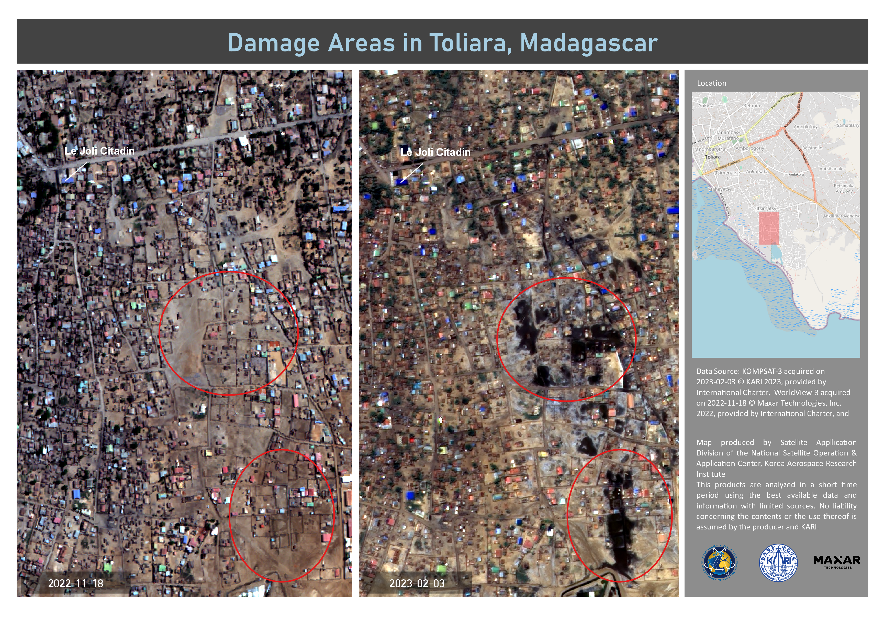
Flooded Areas in Toliara, Madagascar
版权: © (2022) DigitalGlobe, Inc., Longmont CO USA 80503. DigitalGlobe and the DigitalGlobe logos are trademarks of DigitalGlobe, Inc. The use and/or dissemination of this data and/or of any product in any way derived there from are restricted. Unauthorized use and/or dissemination is prohibited
© KARI (2023).
Map produced by KARI
Information about the Product
已获得: WorldView-3:18/11/2022
KOMPSAT-3: 03/02/2023
源: WorldView-3 / KOMPSAT-3
类别: Delineation Map
Quickviews
Quickviews are produced for illustration purposes only and do not contain any verified analysis of the disaster.
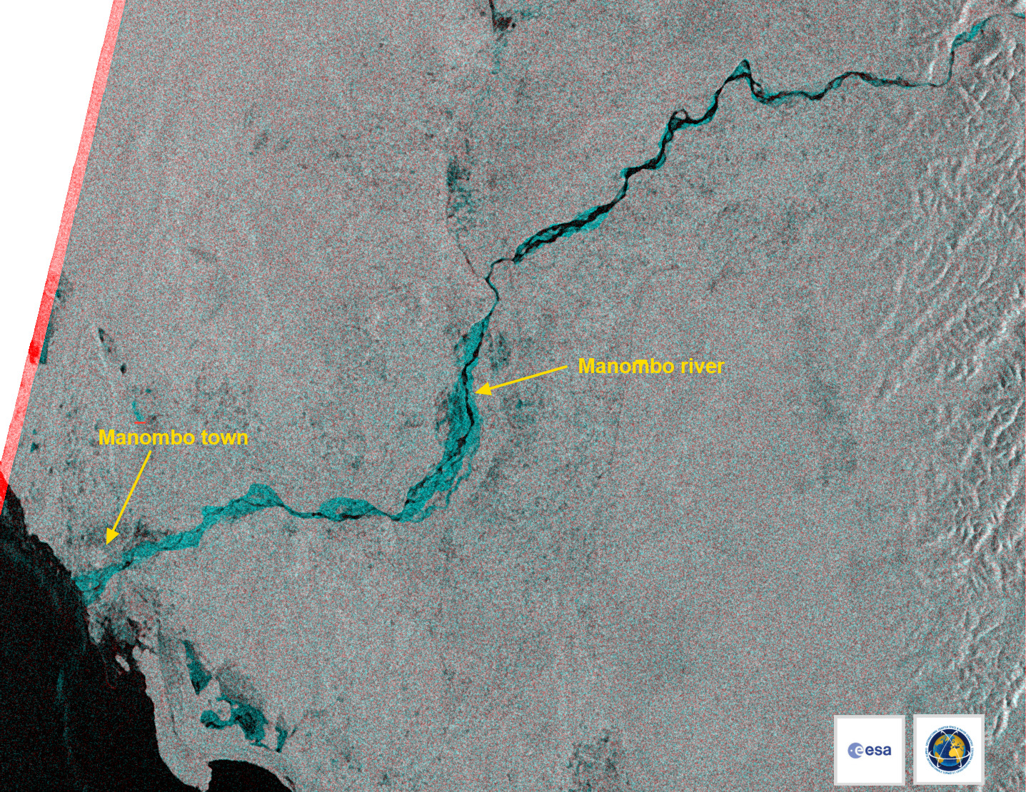
This multitemporal image generated from two Sentinel-1 SAR images (acquired on 4 and 16 March 2023) shows the flooded areas in cyan. The areas in black on the river show the normal size of the river, as seen before Cyclone Freddy.
Copyrights: Contains modified Copernicus Sentinel data (2023)
Information about the Quickview
Acquired: 4 and 16 March 2023
Source(s): Sentinel-1 SAR

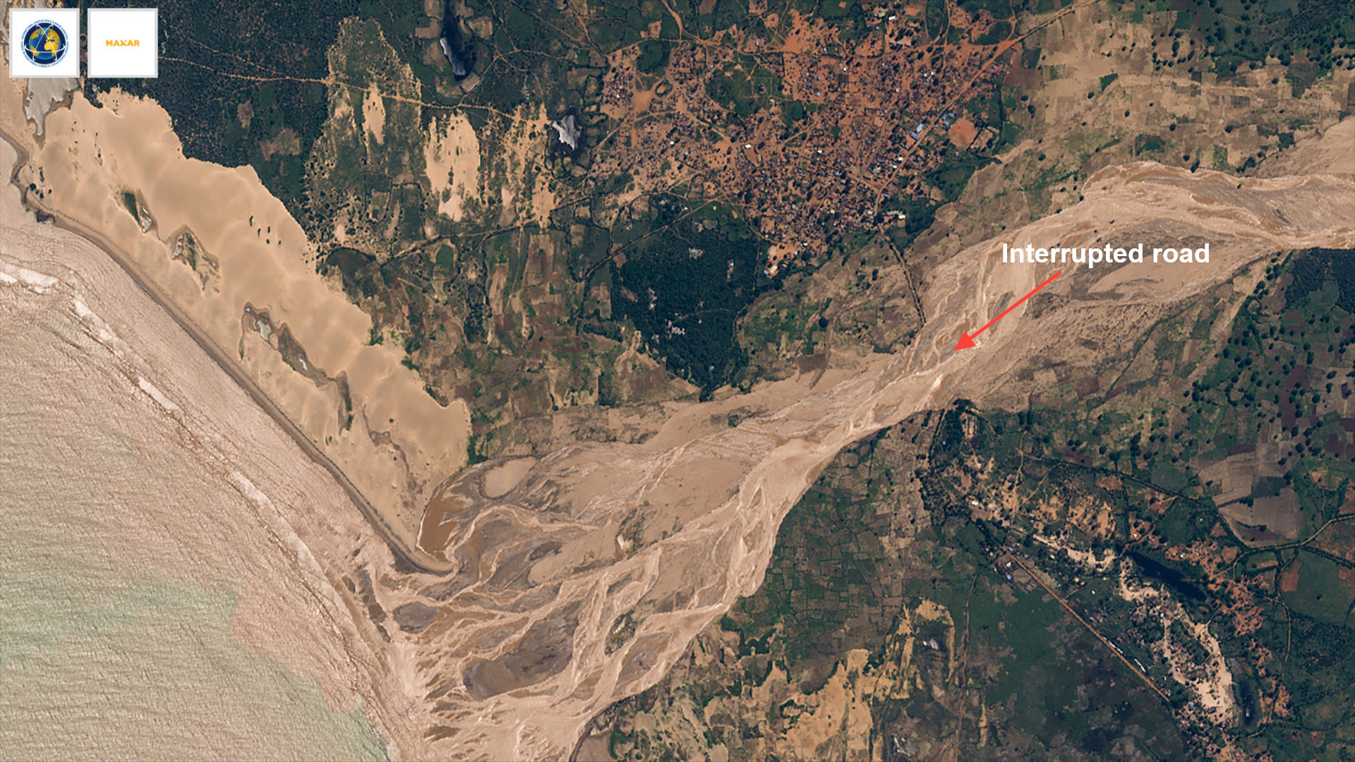
In this comparison, two WorldView-2 images (acquired on 16 December 2022 and 24 March 2023) show flooding of the Manombo river. The road connecting Manombo town to the South was blocked by the floods. A large mud flow and sediments pouring into the ocean are also clearly visible. The difference in the greener parts are due to the different season of the year.
Copyrights: © Maxar 2023
Information about the Quickview
Acquired: 16 December 2022 / 24 March 2023
Source(s): WorldView-2
 返回完整的响应档案

