 English
 Spanish
 French
 Chinese
 Russian
 Portuguese
 最新宪章启动
Charter activations
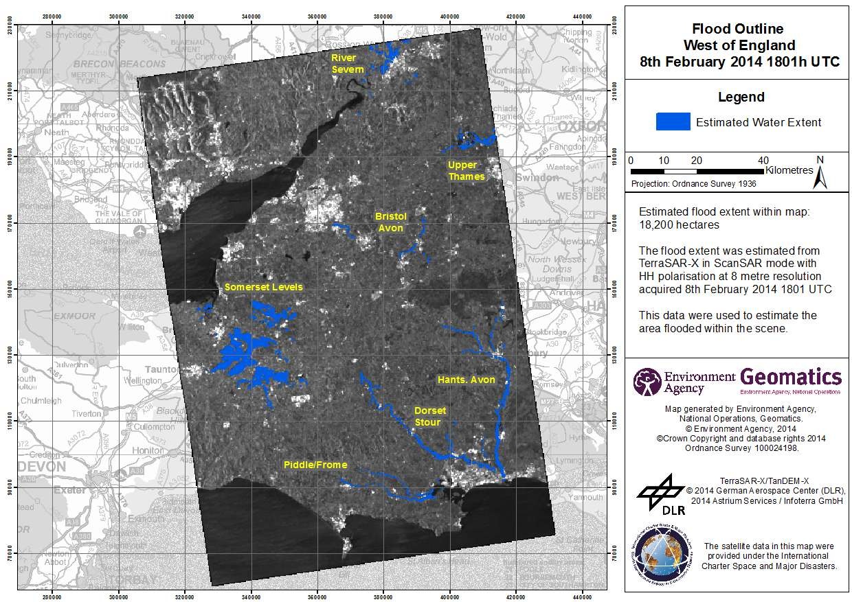
英格兰西南部洪水
自2014年1月31日起,持续的暴风雨和强降雨致使英格兰南部发生进一步的洪灾。一些主要河流有的正发洪水,有的存在未来五天至十天内发洪水的风险。
自从2013年12月起,英国就一直遭受暴风雨的袭击。相关信息,请参照之前的两个灾害活动编号:469和472。
英格兰南部的一些地区,如萨默塞特郡(Somerset Levels)和摩尔(Moors),现在已经被水淹没超过5周。据估计,全国各地413所住宅已被洪水淹没,持续的强降雨天气仍没有任何缓解的迹象,致使许多农田被摧毁。由于地面已经饱和,进一步的降雨将会导致更多的损失。
一些受灾最严重地区的人们已经撤离了他们的家园,牲畜也已被转移到安全地点。
环境局已经针对最新的风暴发布了两条洪水预警,并持续更新他们的洪水预警图。
现有的防洪设施在一定程度上有效减少了损失,据估计,超过一百万的建筑已得到这些当地基础设施的保护。军队提供援助和减灾行动来补充全国范围内个人以及志愿者的紧急服务。
| 事件类型: | 洪水 |
| 事件地点: | 英国英格兰南部 |
| 启动宪章的日期: | 2014年2月6日 |
| 宪章要求者: | 环境局(英格兰和威尔士) |
| 项目经理: | 环境局(英格兰和威尔士) |
Products

Flood outline - Midlands West Gloucester - Tewkesbury
版权: RADARSAT-2 Data and Products © MacDonald, Dettwiler and Associates Ltd. (2014) - All Rights Reserved. RADARSAT is an official trademark of the Canadian Space Agency.
Map produced by Environment Agency Geomatics
Information about the Product
已获得: 11/02/2014
源: RADARSAT-2
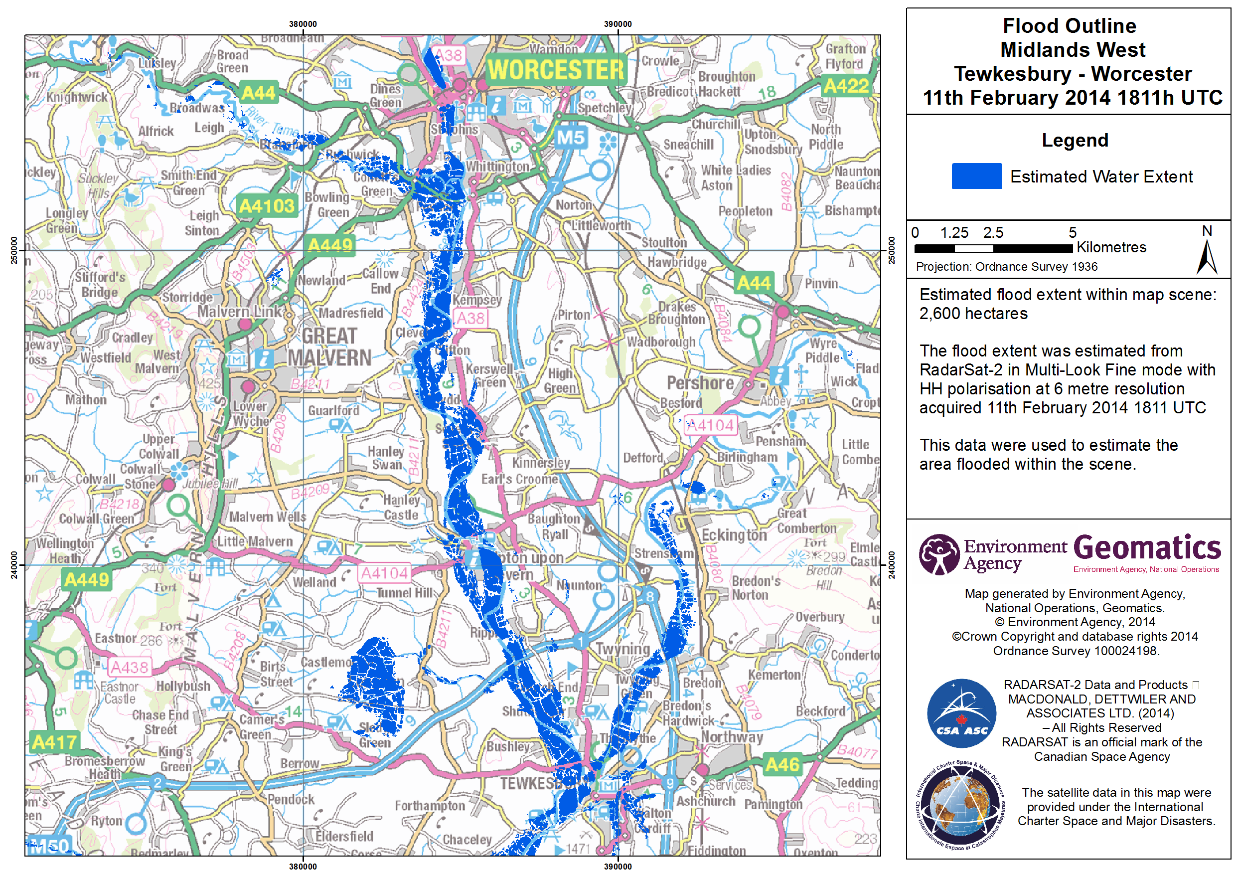
Flood outline - Midlands West Tewkesbury - Worcester
版权: RADARSAT-2 Data and Products © MacDonald, Dettwiler and Associates Ltd. (2014) - All Rights Reserved. RADARSAT is an official trademark of the Canadian Space Agency.
Map produced by Environment Agency Geomatics
Information about the Product
已获得: 11/02/2014
源: RADARSAT-2
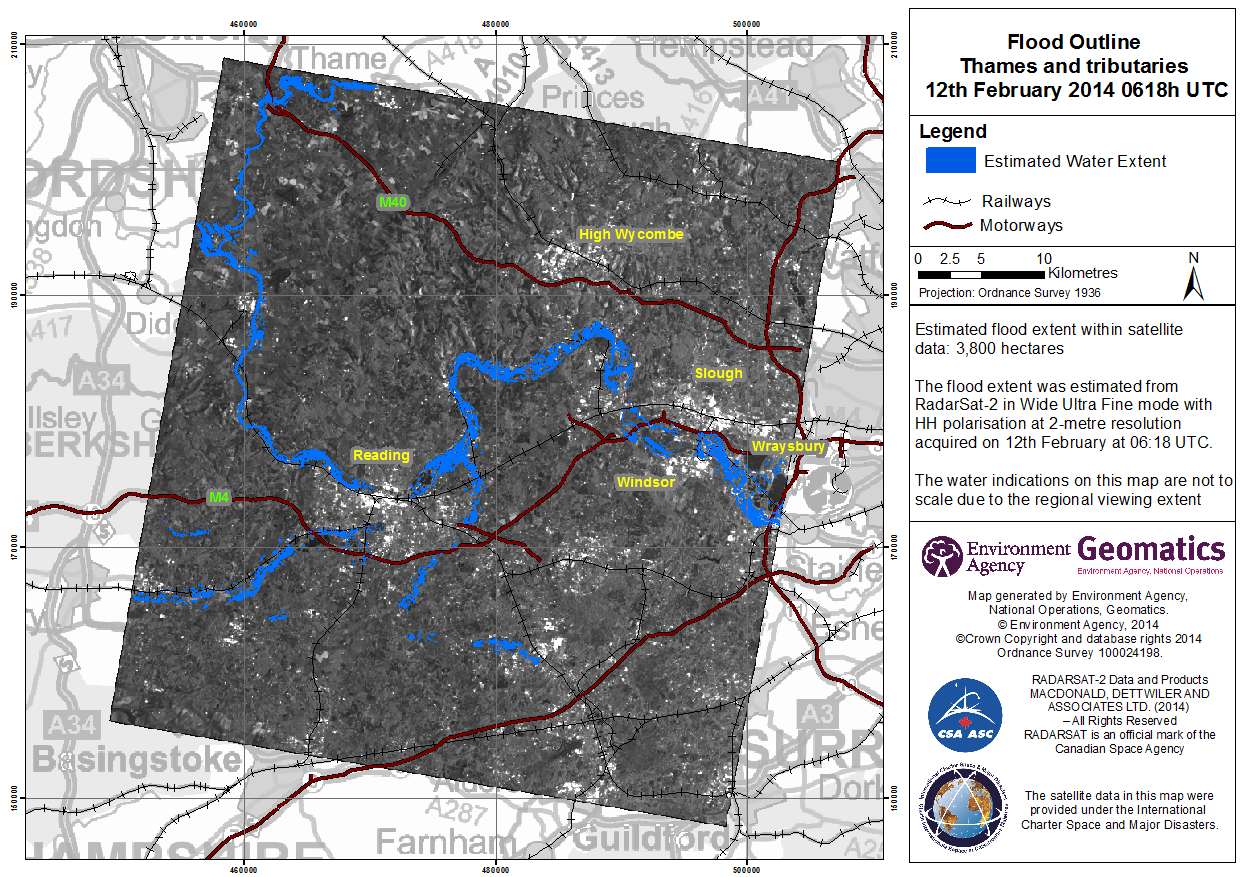
Flood outline - Thames and tributaries
版权: RADARSAT-2 Data and Products © MacDonald, Dettwiler and Associates Ltd. (2014) - All Rights Reserved. RADARSAT is an official trademark of the Canadian Space Agency.
Map produced by Environment Agency Geomatics
Information about the Product
已获得: 12/02/2014
源: RADARSAT-2
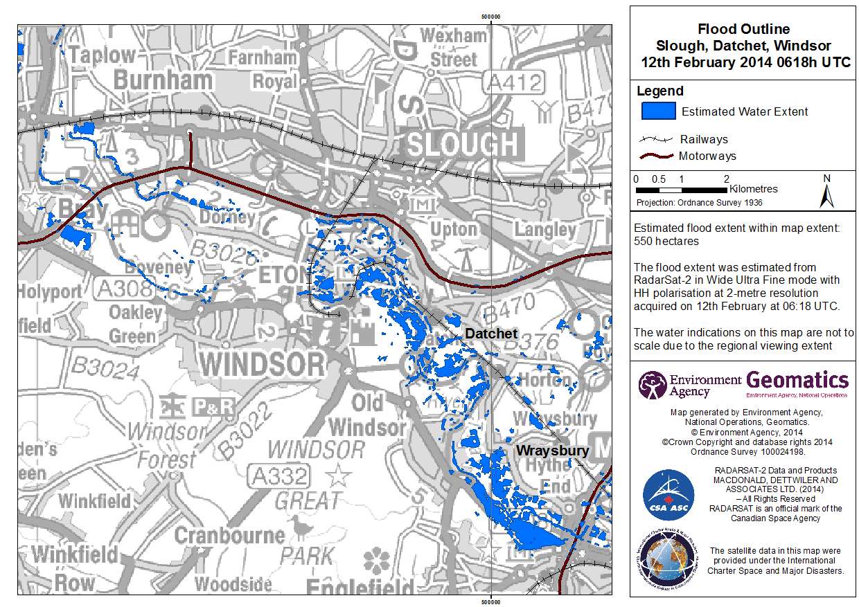
Flood outline - Slough, Datchet, Windsor
版权: RADARSAT-2 Data and Products © MacDonald, Dettwiler and Associates Ltd. (2014) - All Rights Reserved. RADARSAT is an official trademark of the Canadian Space Agency.
Map produced by Environment Agency Geomatics
Information about the Product
已获得: 12/02/2014
源: RADARSAT-2


 返回完整的响应档案

