 English
 Spanish
 French
 Chinese
 Russian
 Portuguese
 最新宪章启动
Charter activations
Earthquake in Iraq
A 7.3 magnitude earthquake struck the northern border of Iraq at 18:18 UTC on 12 November.
The epicentre of the earthquake was in the Kermanshah Province of neighbouring Iran, but it was in close proximity to the border and impacted the Kurdistan region of Iraq.
It is estimated that nine people have died in Kurdistan, and the town of Darbandikhan was particularly affected. Hundreds more are reported to be injured.
This is a mostly mountainous region, and rescue operations have been disrupted by landslides.
7.3 is on the higher end of the Richter scale, and indicates an earthquake that can cause major damage. According to USGS, the earthquake was shallow at a depth of approximately 25 km.
| 事件类型: | Earthquake |
| 事件地点: | Iraq |
| 启动宪章的日期: | 2017-11-12 |
| 宪章启动时间: | 23:41 |
| 宪章启动时区: | UTC+05:30 |
| 宪章要求者: | UNITAR/UNOSAT on behalf of UN OCHA |
| 启动ID: | 558 |
| 项目经理: | UNITAR/UNOSAT |
Products

Damage assessment in Darbandikhan city and dam, Sulaymaniyah province
版权: Pleiades © CNES (2017) - Distribution: Airbus Defence and Space, all rights reserved
Map produced by UNITAR / UNOSAT
Information about the Product
已获得: 15/11/2017
源: Plediades
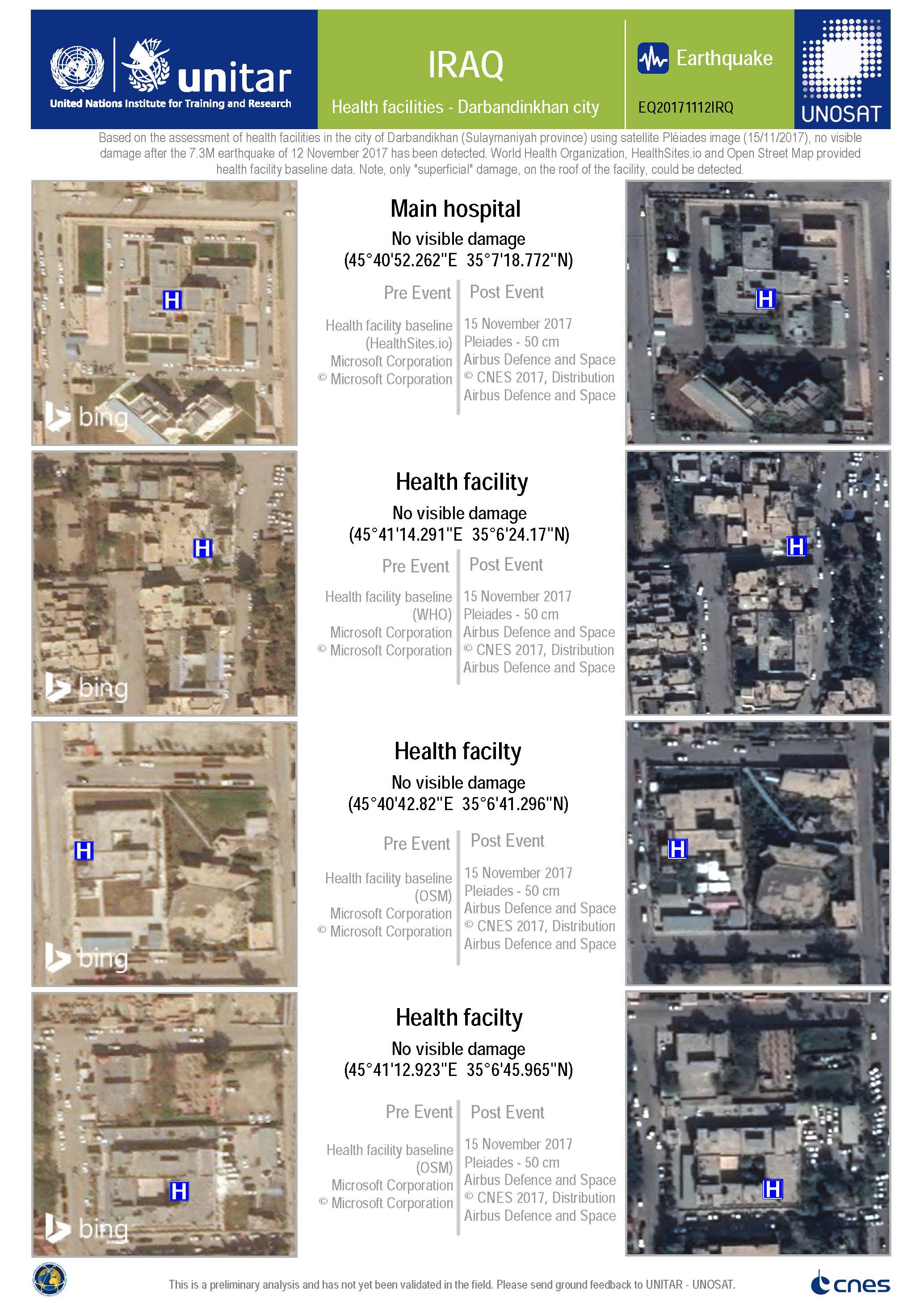
Damage assessment of health facilities in Darbandikhan city
版权: Pleiades © CNES (2017) - Distribution: Airbus Defence and Space, all rights reserved
Map produced by UNITAR / UNOSAT
Information about the Product
已获得: 15/11/2017
源: Pleiades
 返回完整的响应档案

