 English
 Spanish
 French
 Chinese
 Russian
 Portuguese
 Flood in Kenya
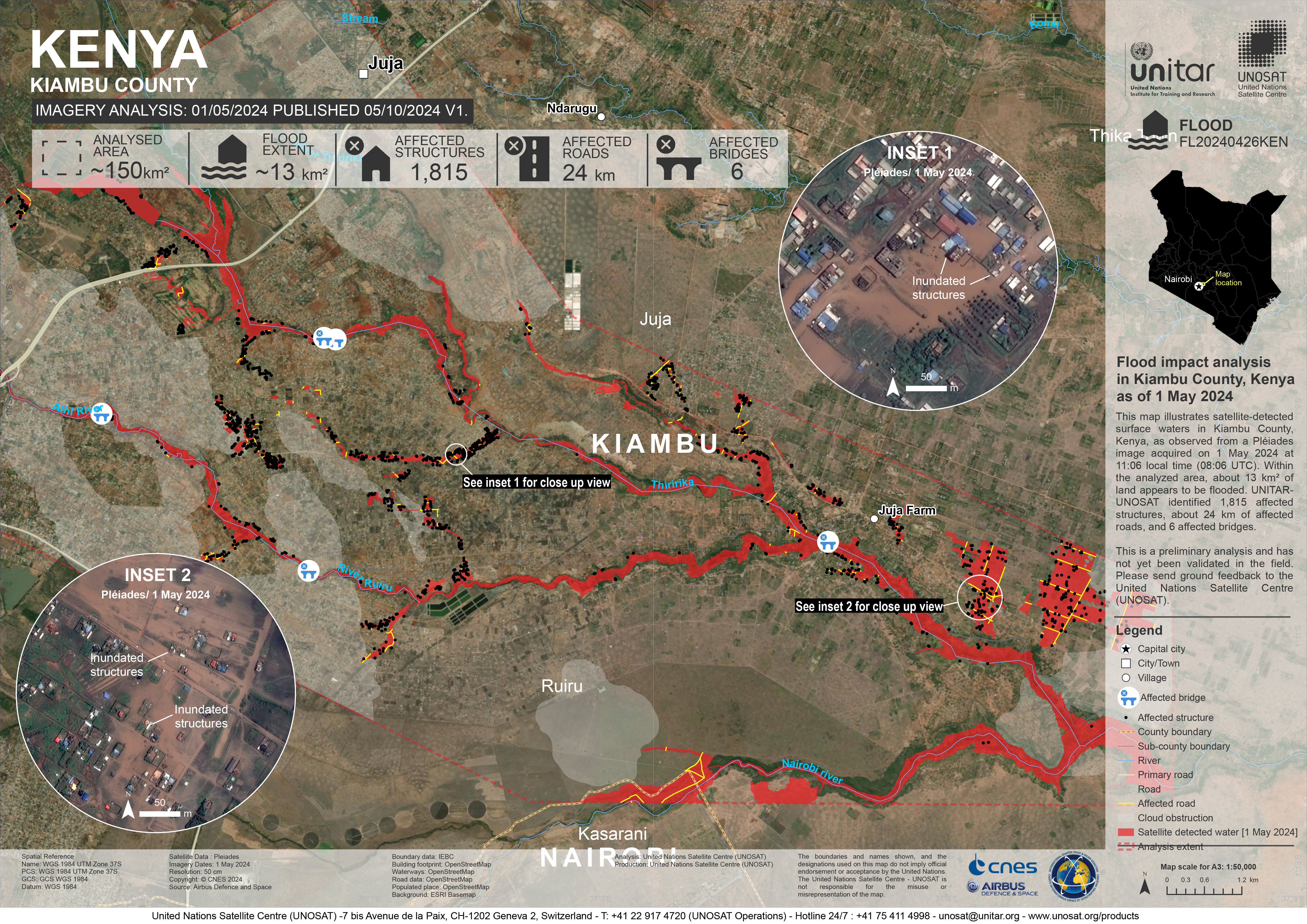
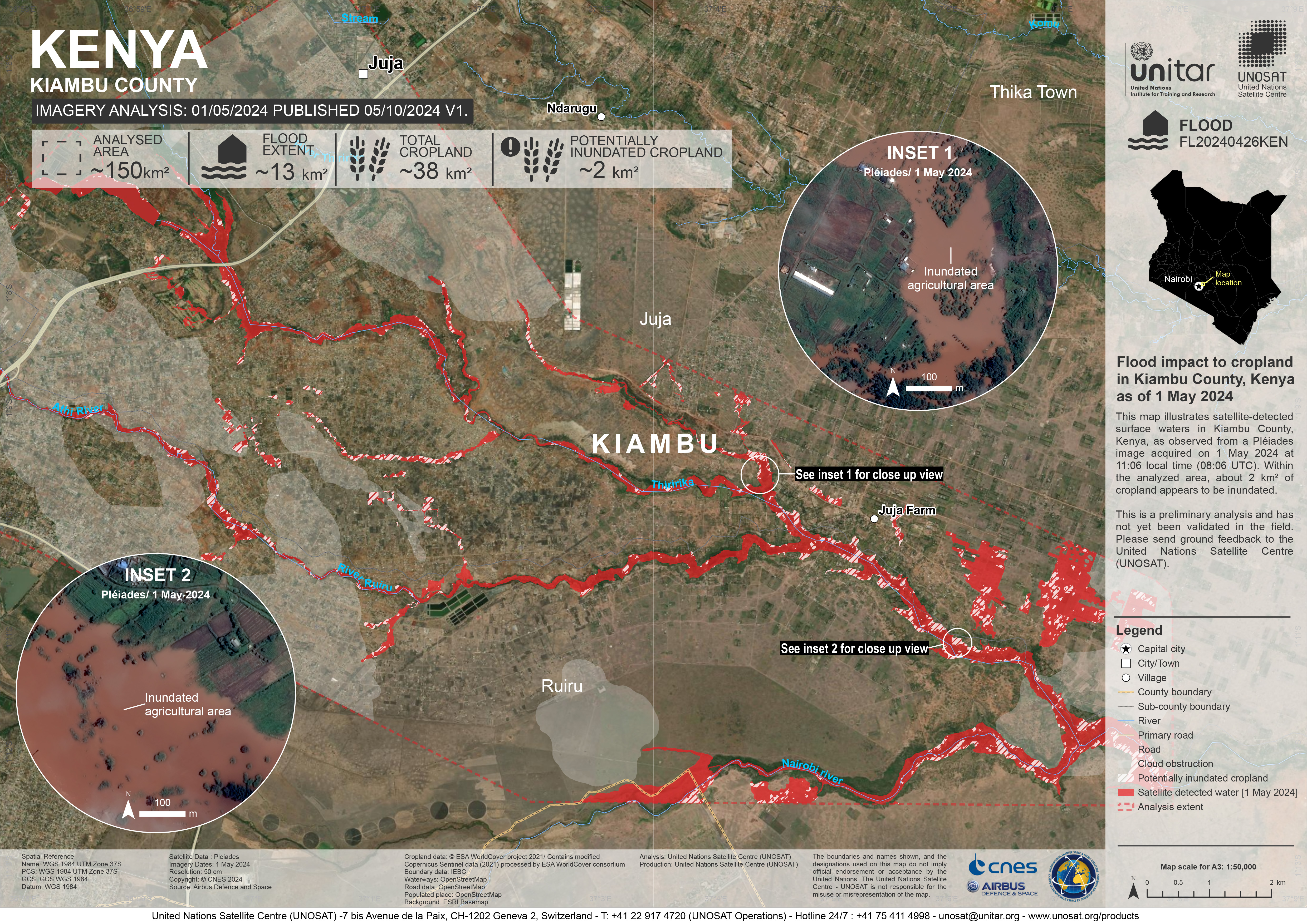
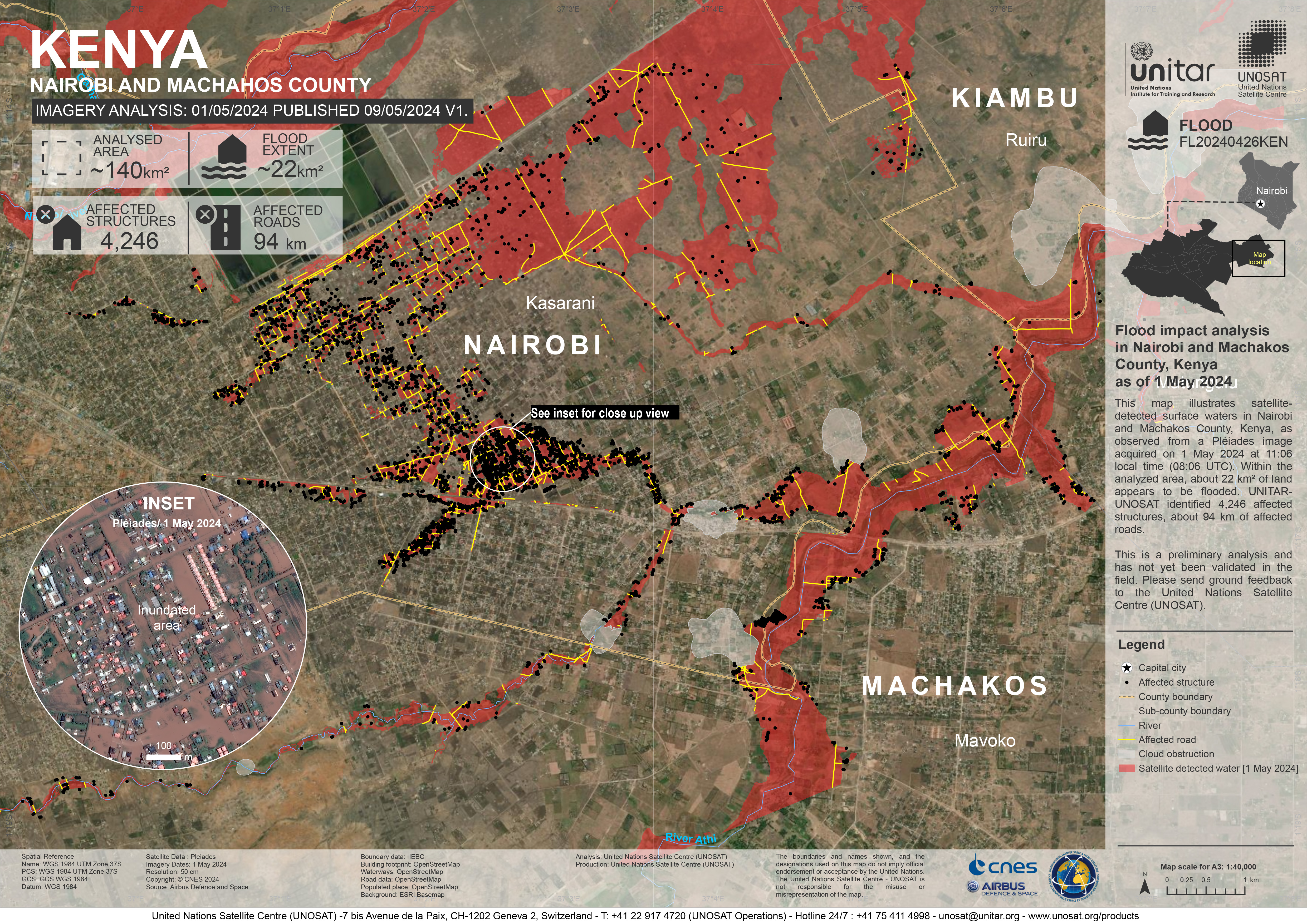
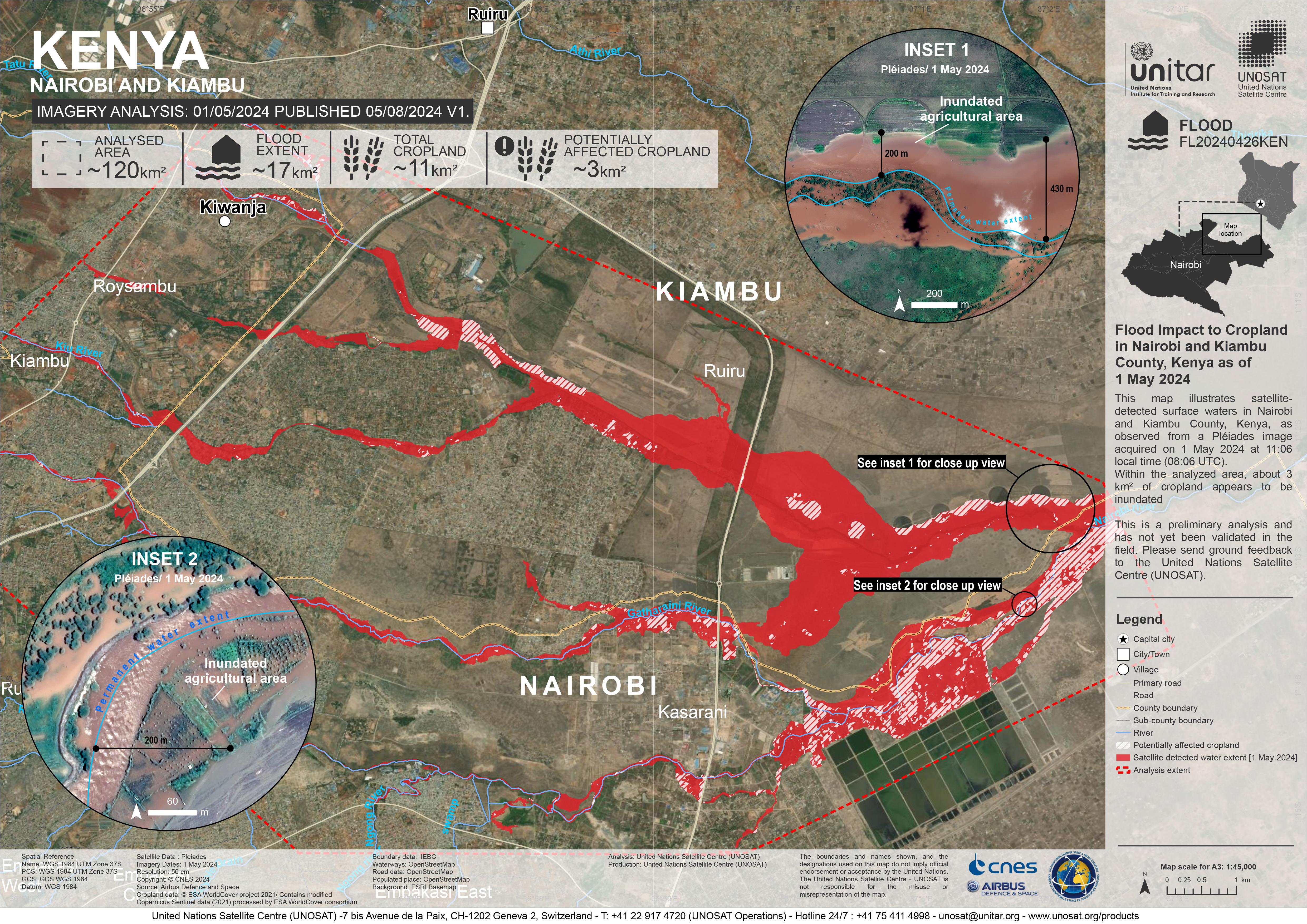
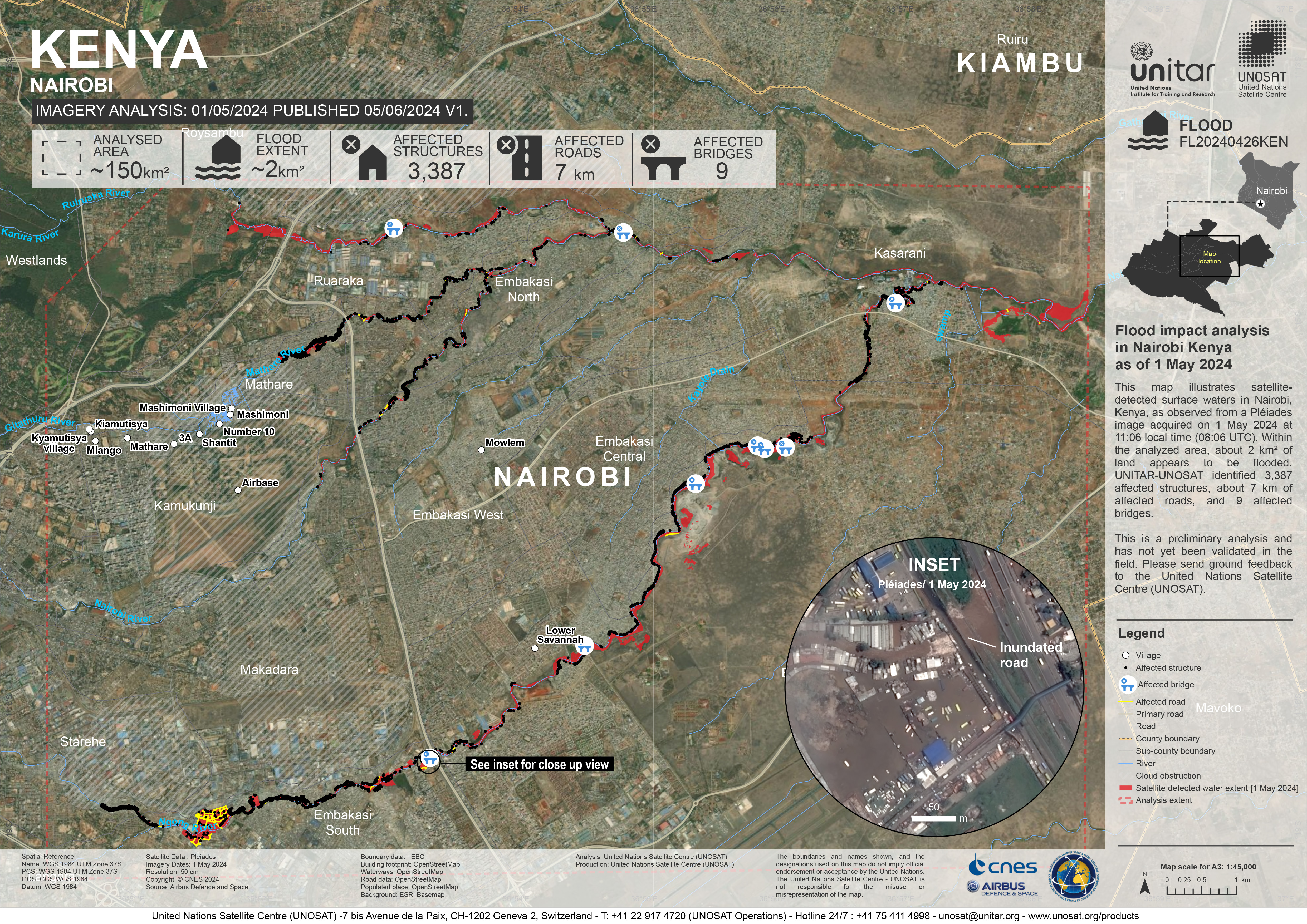
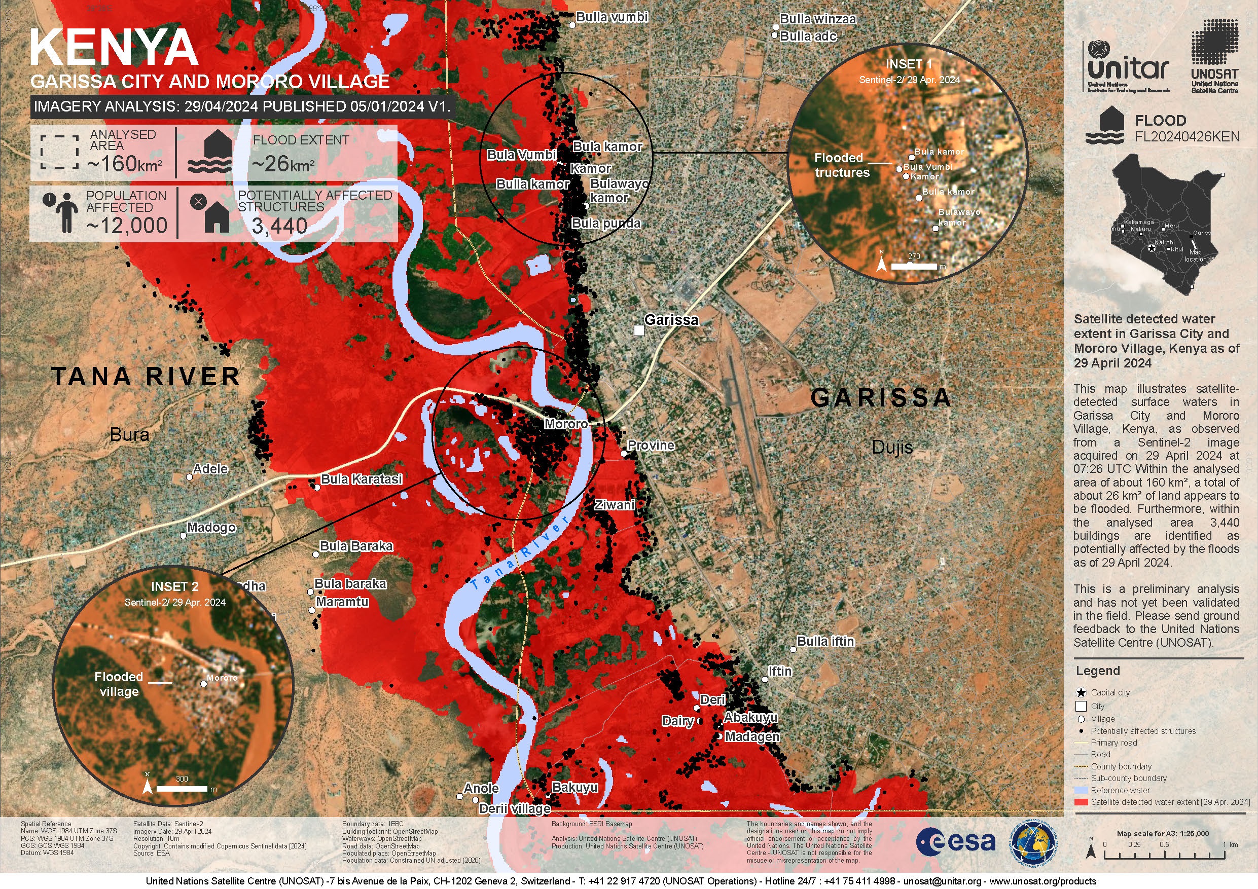
Flood in Kenya
Charter activations
Flood in Kenya
During the early hours of 29 April, a powerful flood surged downstream. The Old Kijabe Dam, located in the Mai Mahiu area of the Great Rift Valley region in Kenya, burst its banks due to heavy rainfall.
The force of the flood swept away villagers at night without warning while they slept in their homes. Fifty deaths have been recorded. Some villagers claimed to have woken from the sound of roaring water heading towards them. Rescue efforts are ongoing, but there are fears that the death toll may increase.
The impacted areas are now covered in mud, uprooted trees, and crushed houses. The Kenya Red Cross has organized search and rescue operations. They have also set up a desk at a local school to help families find lost relatives.
Related Resources:
| Type of Event: | Flood |
| Location of Event: | Kenya |
| Date of Charter Activation: | 2024-04-30 |
| Time of Charter Activation: | 18:14 |
| Time zone of Charter Activation: | UTC+07:00 |
| Charter Requestor: | UNOSAT on behalf of United Nations Environment Programme |
| Activation ID: | 874 |
| Project Management: | Jakrapong Tawala (UNITAR) |
| Value Adding: | National Disaster Operations Center of Kenya Dalia Laoubi (CSA) WASDI |
Products


 Back to the full activation archive
