English
 Spanish
 French
 Chinese
 Russian
 Portuguese
 Storms
Storms
Storms are weather phenomena which form over the ocean through the release of energy generated by evaporation and saturation of water on the ocean's surface. This process results in heavy rain and strong winds and when these storms approach land they can cause damage and flooding to inhabited areas. 20% of Charter activations are a result of storms.
Storms are referred to with different terms depending on where they originate:
- Storms which form in the Atlantic and northeast Pacific Oceans are called Hurricanes - These often affect the Caribbean region and east coast of North and Central America. The majority of hurricanes occur from 1 June to 30 November, though there are rare instances when the storms form outside of this period.
- Storms which form in the Indian and south Pacific Oceans are called Cyclones - These often affect India, Bangladesh, Sri Lanka and islands in the region. Cyclones most regularly occur from October to May.
- Storms which form in the northwest Pacific Ocean are called Typhoons - These often affect the Philippines and other islands in the region, but some storms occasionally reach as far as Japan and China. Typhoons occur throughout the year.
Weather systems which intensify enough to become storms are given names by designated weather centres, and these names alternate between male and female in alphabetical order. In the 2018 hurricane season for the Atlantic, for example, those names started with: Alberto, Beryl, Chris, and Debby.
The strength of storms is classified on different scales according to region, an example of which is the Saffir-Simpson Scale that classifies hurricanes. It uses five levels to indicate the intensity of wind in the storm, with Category 5 being the strongest; a storm which exceeds 252 km per hour. Other regions also classify storms by wind intensity and use scales ranging from five to seven categories.
Observations from space have been used monitor storms since the 1960s, and with decades of experience and study to call upon, scientists can use spaceborne data to track the formation and progress of storms. Satellite can be used to reveal changes in the structure of the storm, the wind speed and the patterns of clouds around the eye; the intensity may also be witnessed in the affect on waves around the storm and data can be used to measure the sea surface temperature and sea surface height. Optical and radar imagery may also be used in the aftermath of a storm to assess the situation on the ground, providing key information to first responders.
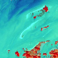
Damage assessment of eastern Nuku-alofa, Tongatapu Island
Acquired: Pleiades: 15/02/2018
WorldView-3: 12/01/2018
Source: Pleiades / WorldView-3
${media-credit-description.data}
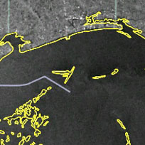
Comparison of Dominica before and after Hurricane Maria
Acquired: Pre-disaster: 25/01/2017
Post-disaster: 21/09/2017
Source: Resurs-P
${media-credit-description.data}
Related Charter Activations
29 March 2024
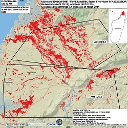
Cyclone Gamane in Madagascar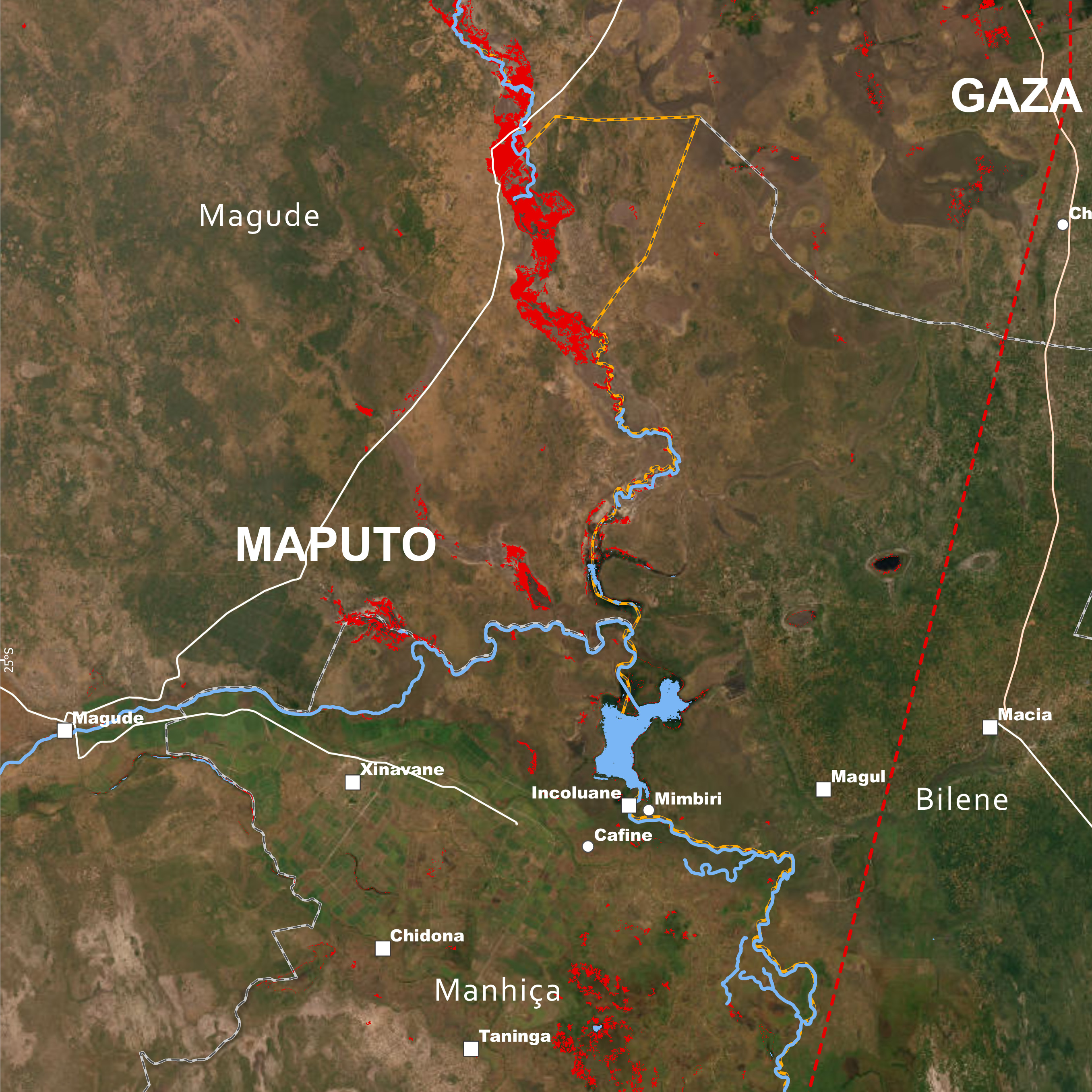
15 March 2024
Cyclone Filipo in Mozambique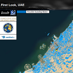
08 March 2024
Storm in United Arab Emirates
27 December 2023
Storm in Eswatini
23 October 2023
Tropical Cyclone Lola in the Solomon Islands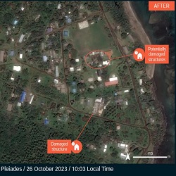
23 October 2023
Tropical Cyclone Lola in Vanuatu
Web Content Display
Other types of disaster monitored by the Charter