 English
 Spanish
 French
 Chinese
 Russian
 Portuguese
 Latest Activation
Charter activations
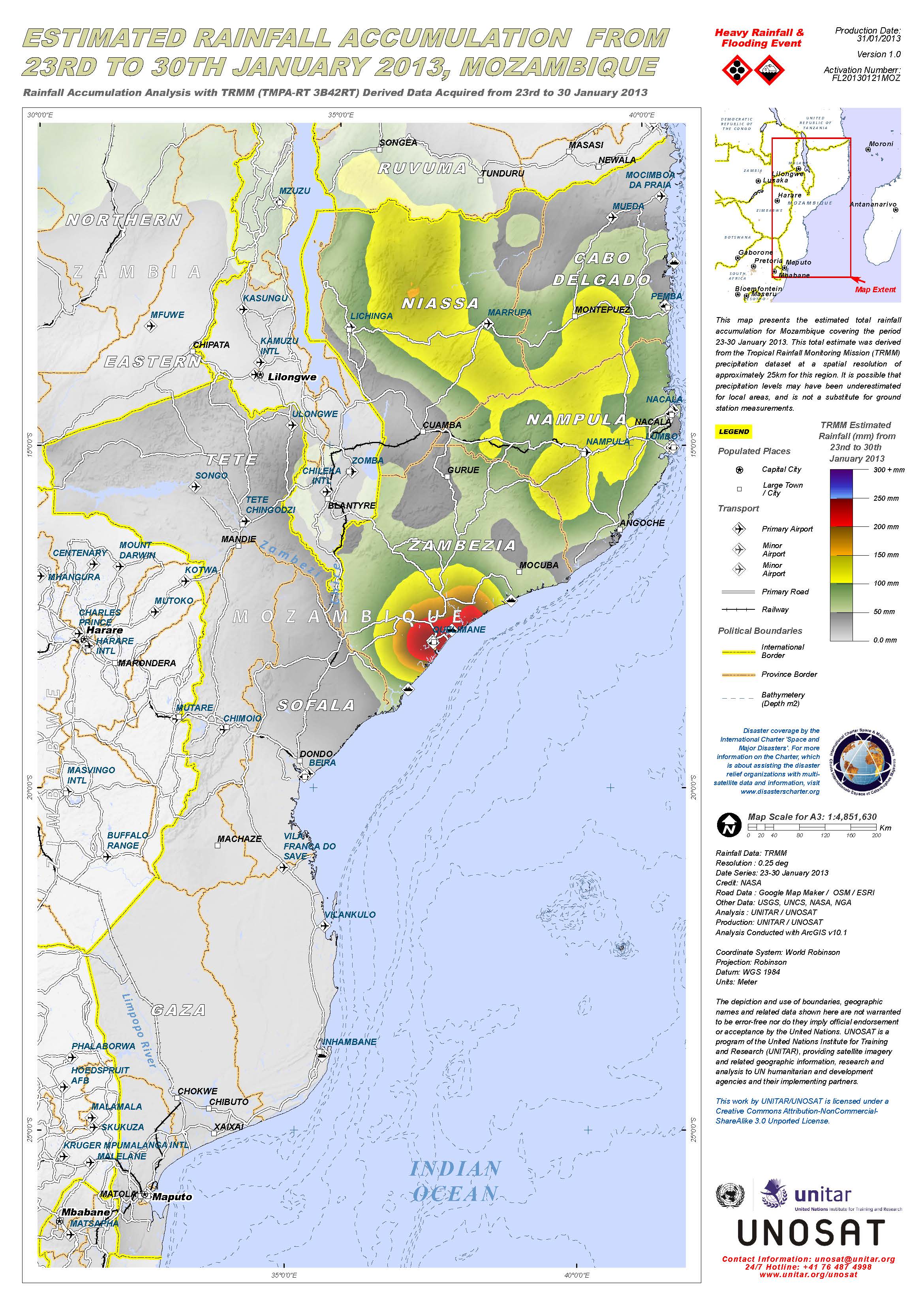
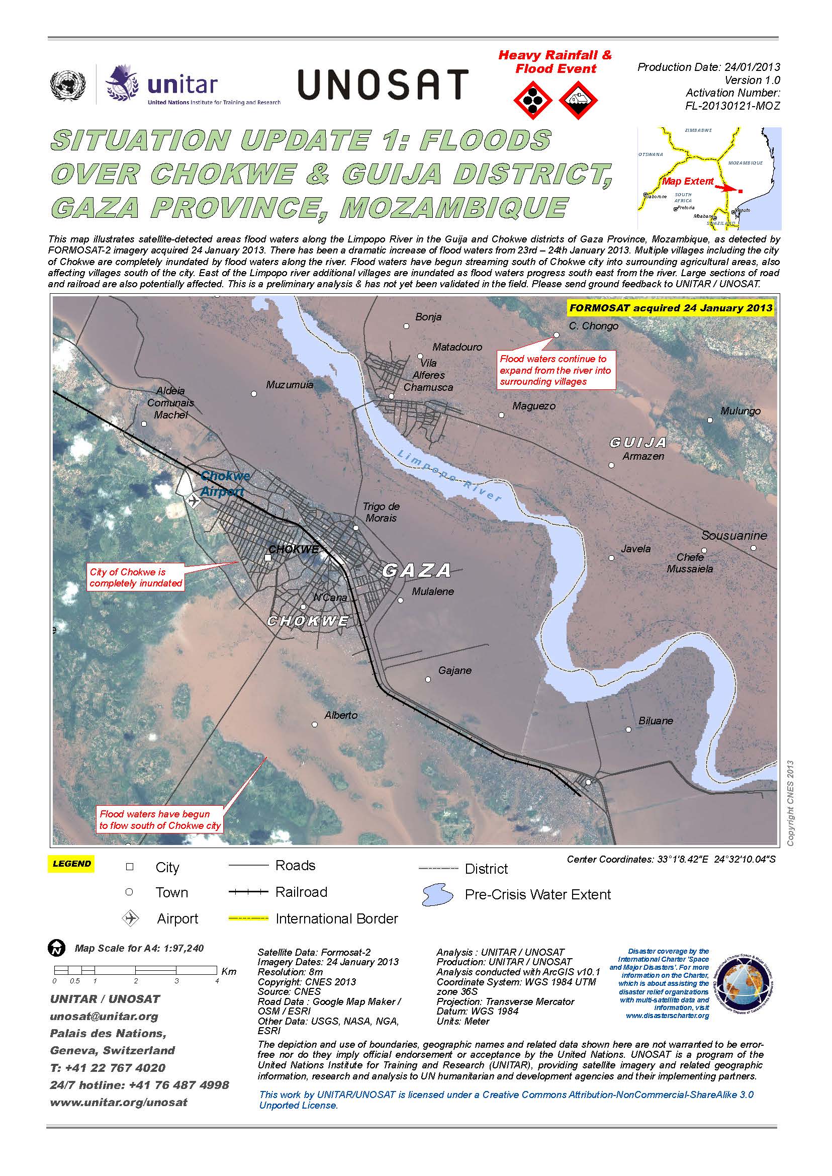
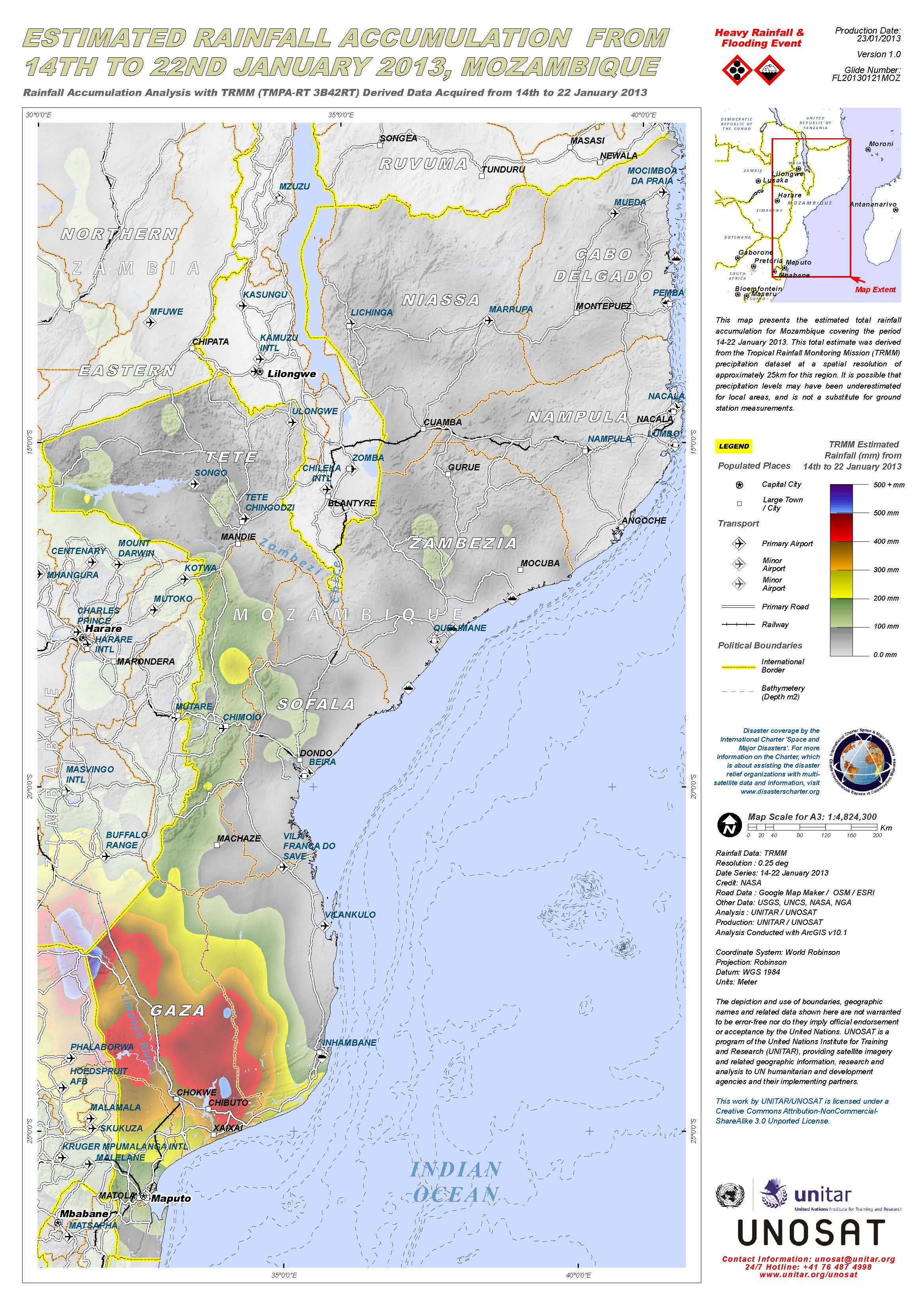
Floods in Mozambique
On Tuesday, torrential rains and high winds hit Mozambique. Continuous storms have destroyed 6,000 cashew trees, power supplies, farm animals and crops. 4,000 people have lost their homes and four others have died.
The southern provinces; Gaza and Maputo are the worst affected areas. The storms also reached as far as Kruger National Park, South Africa, where tourists had to be evacuated.
Severe flooding has also destroyed 160 classrooms, 600 hectares of farm land and the main crops of Mozambique; the cashew nut.
Meteorologists warn of an intense Category 2 storm heading towards Mozambique with stronger winds and heavier downpours.
In 2000, Mozambique experienced the worst flooding of its lifetime, where half a million people were left homeless and 700 people were killed.
| Type of Event: | Floods / Ocean Storm |
| Location of Event: | Mozambique - Gaza / Maputo provinces |
| Date of Charter Activation: | 21 January 2013 |
| Charter Requestor: | UNITAR/UNOSAT on behalf of UNICEF |
| Project Management: | UNITAR |
Products

Situation update 1: Floods over Xai Xai City, Gaza Province, Mozambique
Download the full report (PDF)
Copyright: CNES 2013
Map produced by UNITAR/UNOSAT
Information about the Product
Acquired: 29/01/2013
Source: SPOT-5


 Back to the full activation archive

