 English
 Spanish
 French
 Chinese
 Russian
 Portuguese
 Latest Activation
Charter activations
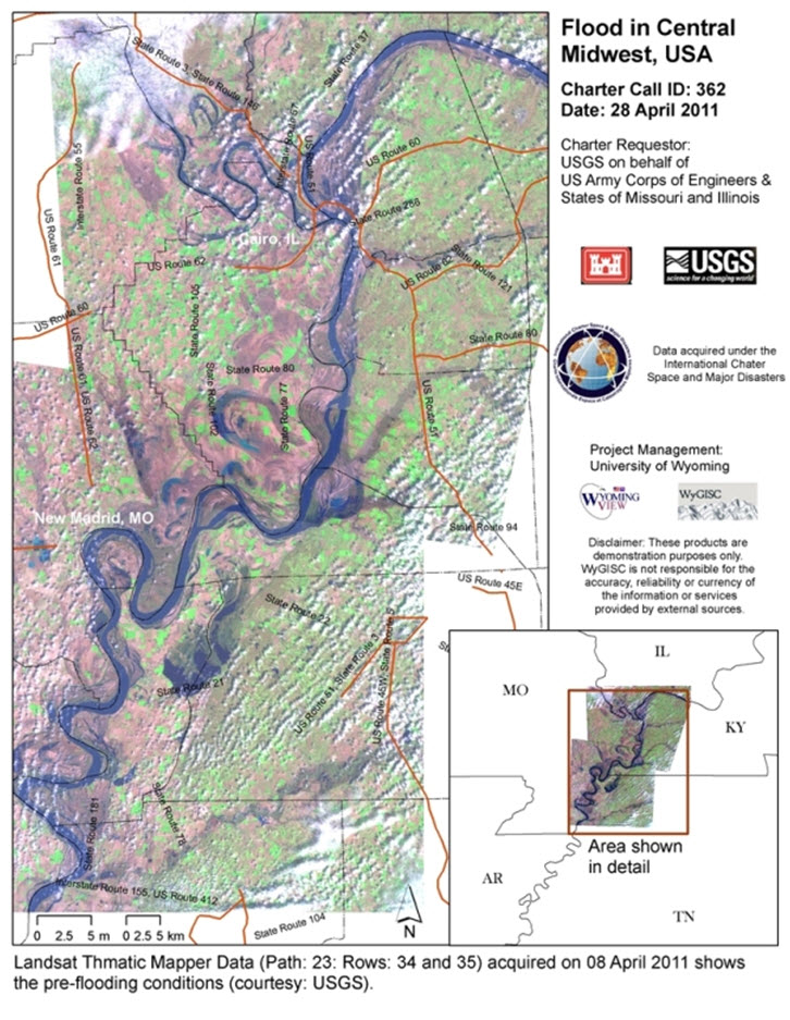
Flood in Central Midwest, USA
Flood stage in Cairo is at 40 feet, and the river is expected to crest soon at 60.5. Additional heavy rains of 2+ inches overnight in southern Illinois caused many smaller streams to again rise to flood levels. This is in addition to already high levels on larger streams in southern IL. Water levels exceed NWS Flood Stage at 40 USGS streamgages in IL.
Moderate to major flooding is occurring on the Kaskaskia, Big Muddy, Illinois, Little Wabash Rivers as well as border rivers (Wabash, Mississippi and Ohio Rivers).
| Type of Event: | Flood |
| Location of Event: | Central Midwest, USA |
| Date of Charter Activation: | 28/04/2011 |
| Charter Requestor: | USGS on behalf of US Corps of Engineers, States of Missouri and Illinois |
| Project Management: | University of Wyoming |
Products

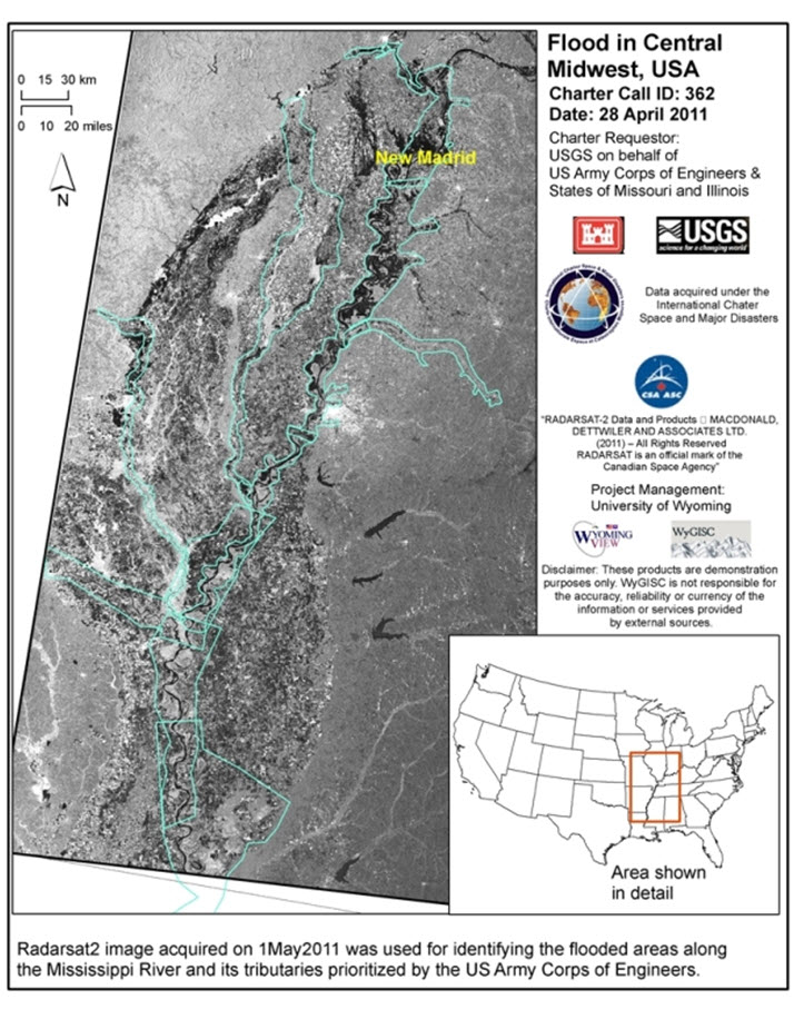
Flood in Central Midwest, USA
Copyright: RADARSAT-2 Data and Products © MacDonald, Dettwiler and Associates Ltd. (2011) - All Rights Reserved. RADARSAT is an official trademark of the Canadian Space Agency
Map produced by University of Wyoming
Information about the Product
Acquired: 01/05/2011
Source: RADARSAT-2

 Back to the full activation archive

