 English
 Spanish
 French
 Chinese
 Russian
 Portuguese
 Latest Activation
Charter activations
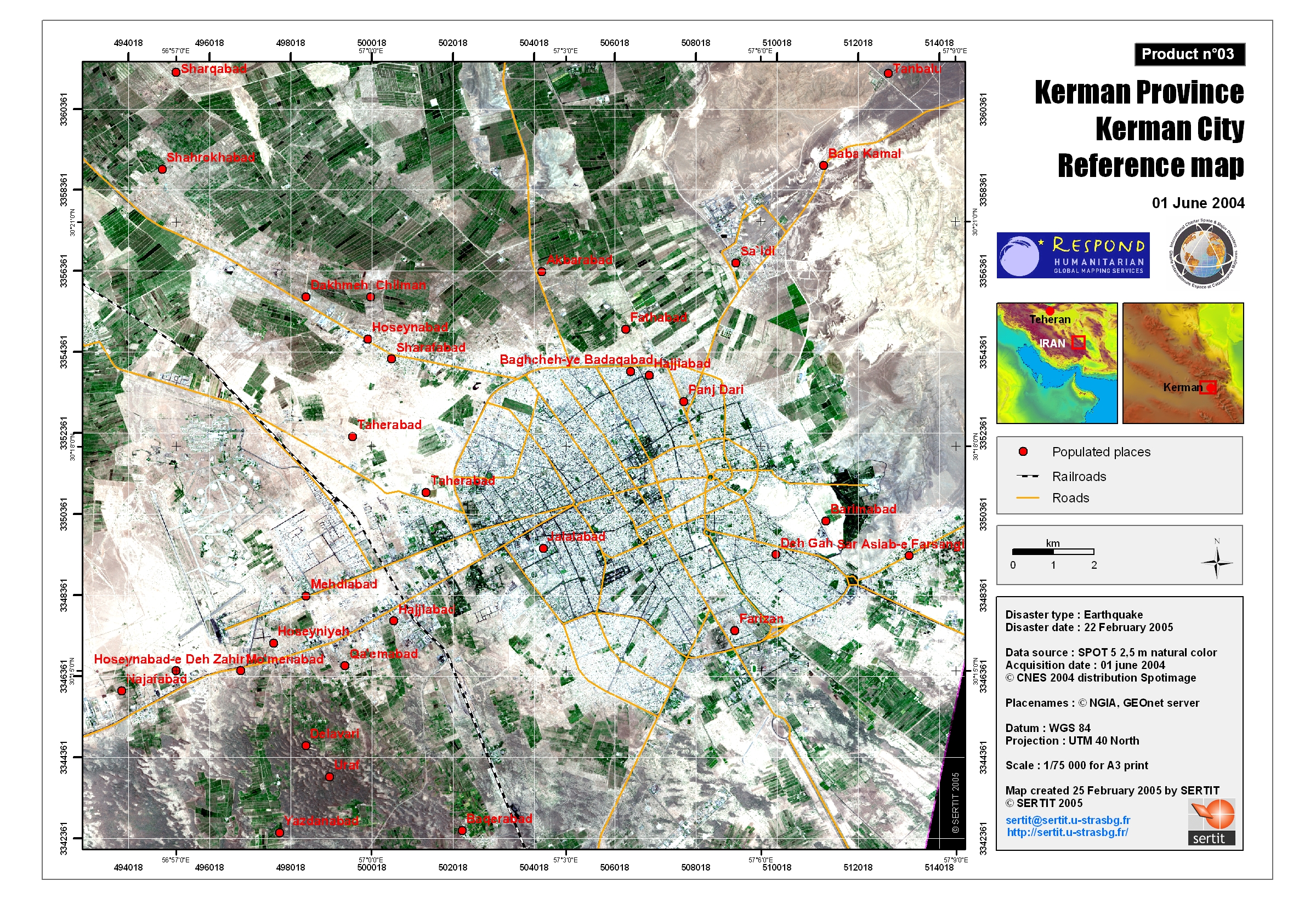
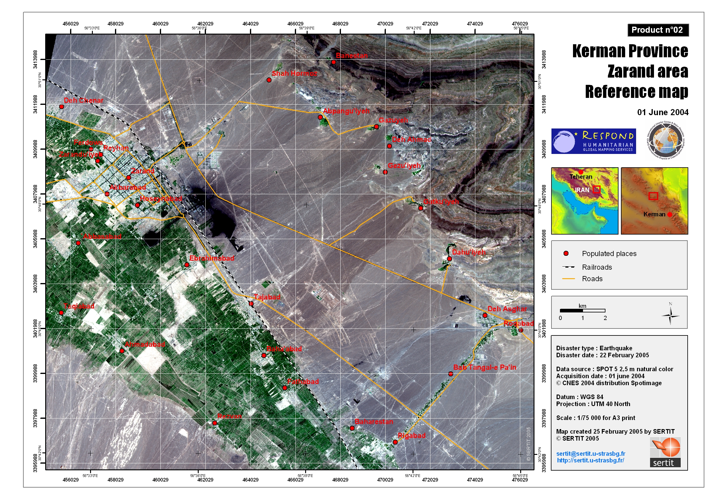
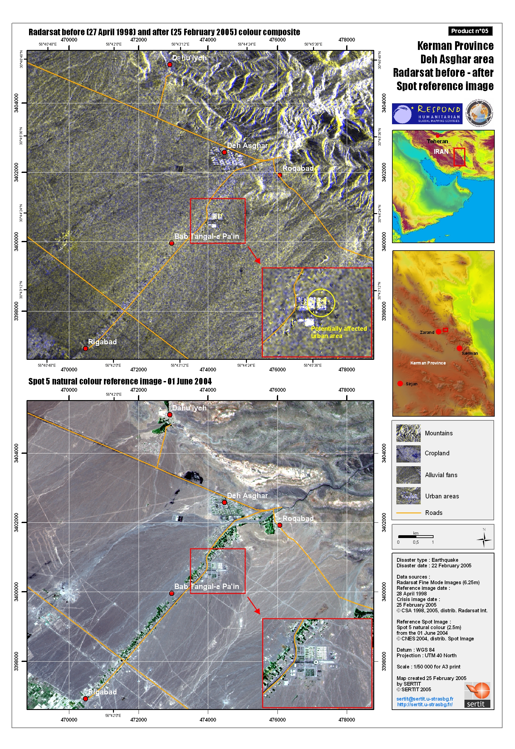
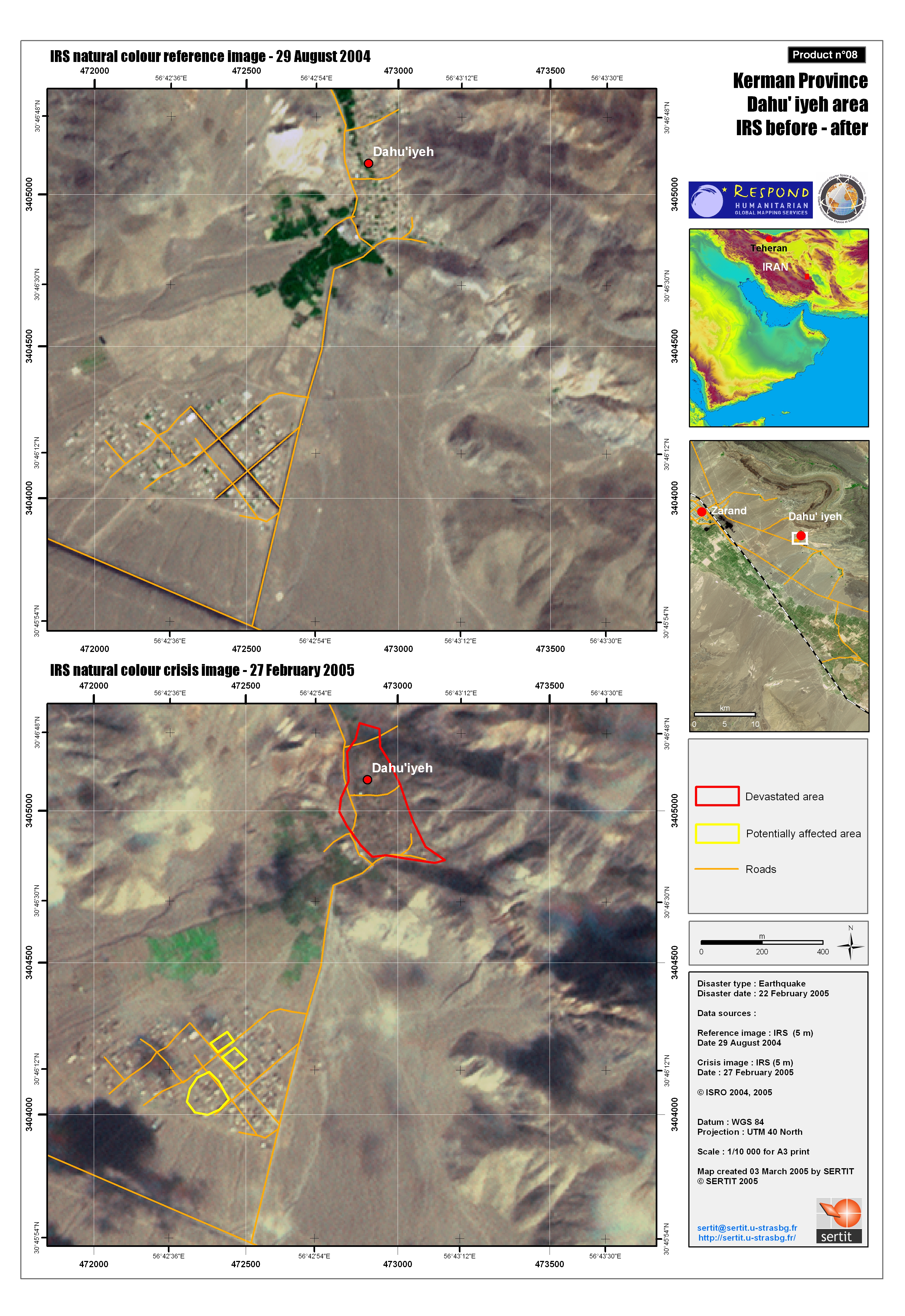
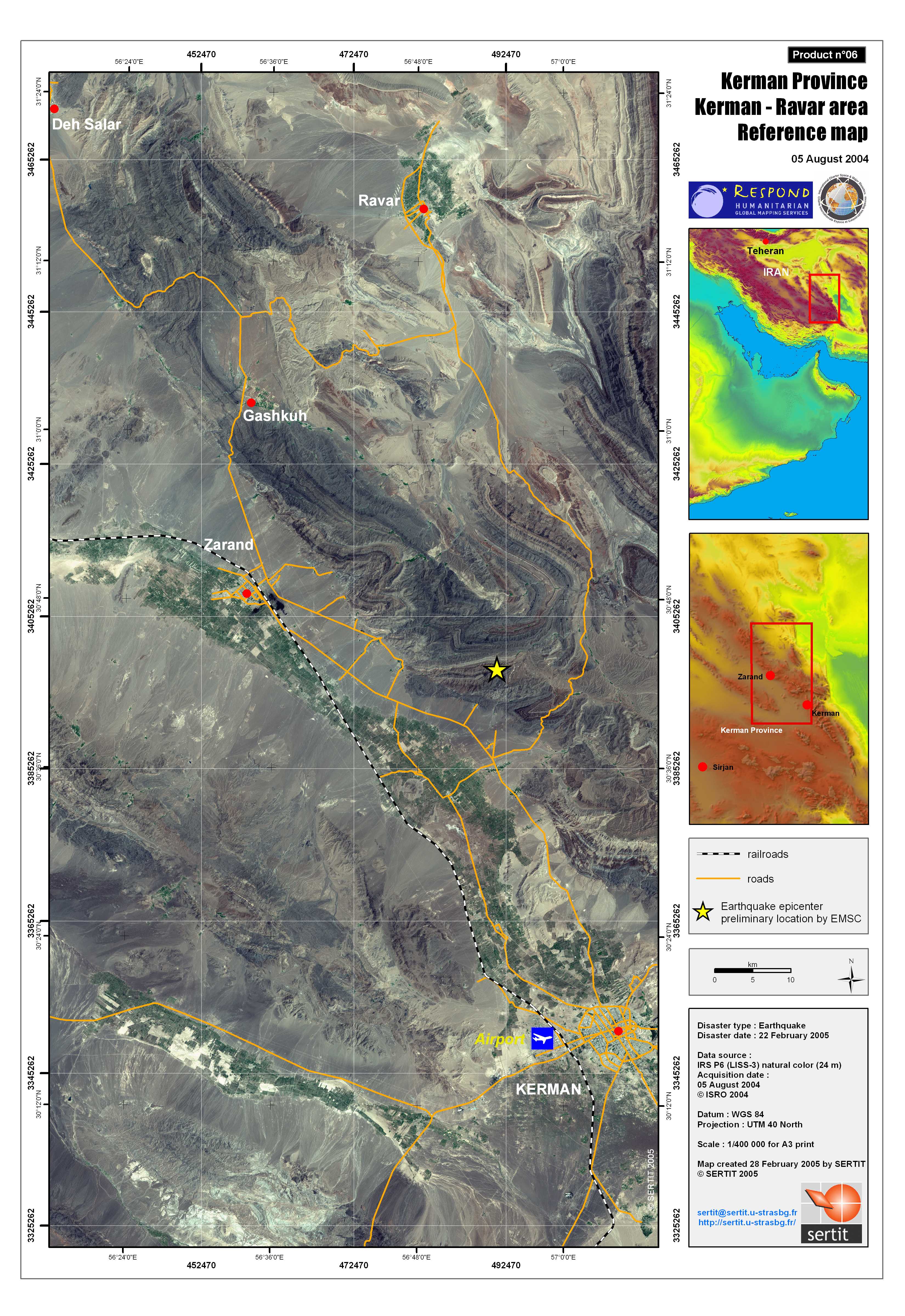
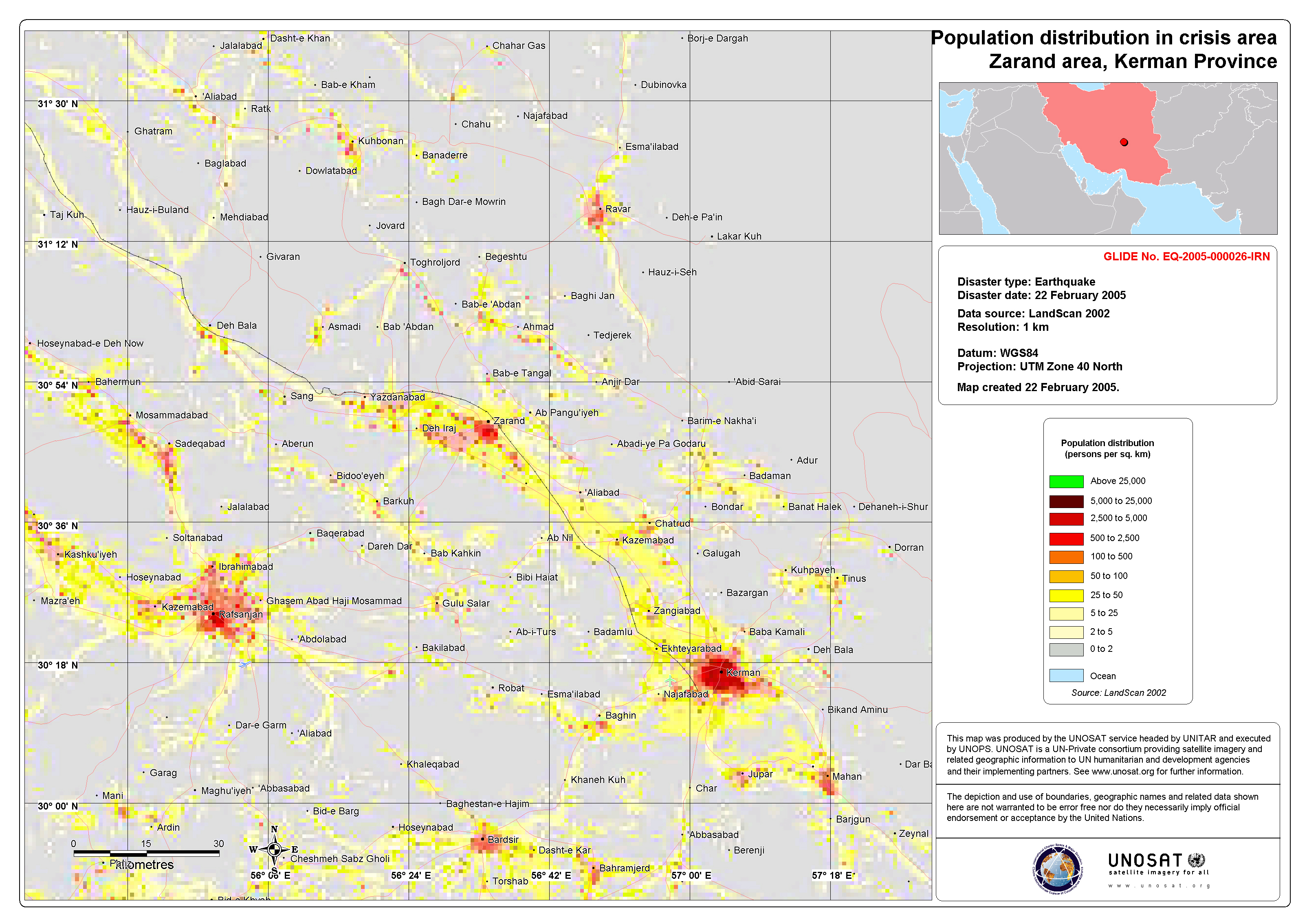
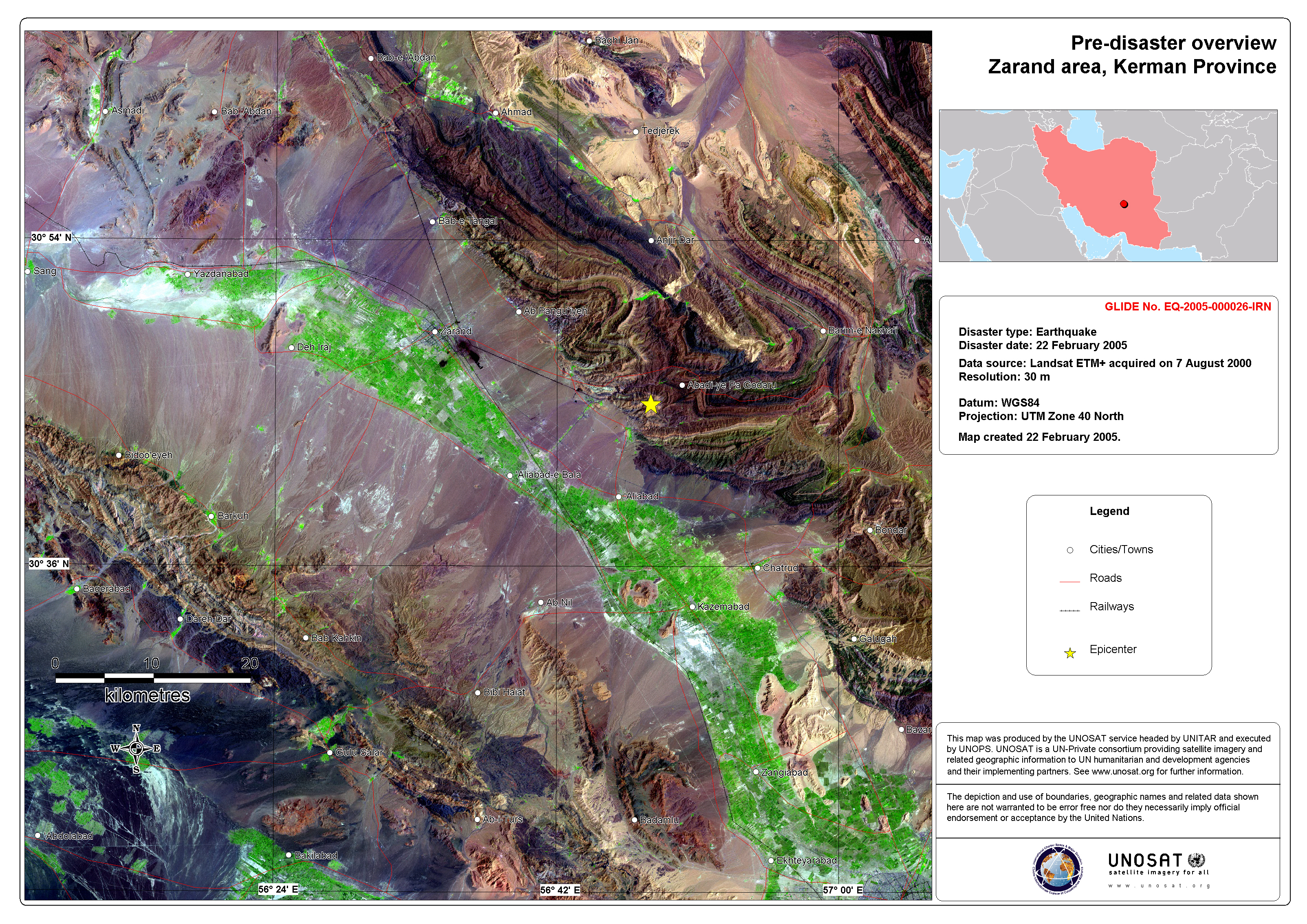
Earthquake in Iran
An earthquake of a 6.4 magnitude on the Richter scale hit the southwest of Iran on Tuesday, 22 February. According to initial reports, the powerful earthquake has left at least 170 people dead and 5,000 injured in the province of Kerman. Nine villages in the region have been affected. At the end of May 2004, an earthquake hit the the north of Iran and Tehran causing the deaths of 35 people and leaving 220 injured.
| Type of Event: | Earthquake |
| Location of Event: | Iran |
| Date of Charter Activation: | 22/02/2005 |
| Charter Requestor: | European Monitoring and Information Centre, French Civil Protection Agency, United Nations Office for Outer Space Affairs (UNOOSA) |
| Project Management: | ESA |
Products


 Back to the full activation archive

