 English
 Spanish
 French
 Chinese
 Russian
 Portuguese
 Latest Activation
Charter activations
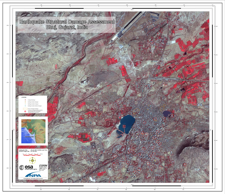
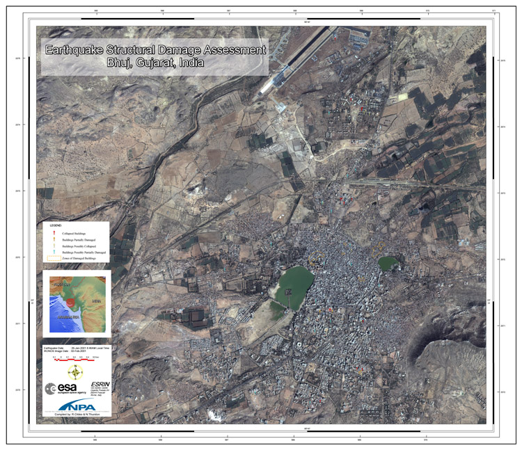
Earthquake in India
At 03:16 UTC on January 26, 2001, an Earthquake with a magnitude of 7.7 occurred in Gujarat, India, the epicenter of which lay near the city of Bhuj. On January 29, 2001, the DDSC, France's Civil Protection Agency, requested Charter images to be used in the assessment of damages to the area.
| Type of Event: | Earthquake |
| Location of Event: | Bhuj, Gujarat, India |
| Date of Charter Activation: | 29/01/2001 |
| Charter Requestor: | French Civil Protection Agency |
| Project Management: | ESA |
Products


 Back to the full activation archive

