English
 Spanish
 French
 Chinese
 Russian
 Portuguese
Partners of the Charter
News
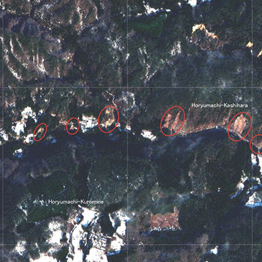
29 September 2021
Partners of the Charter
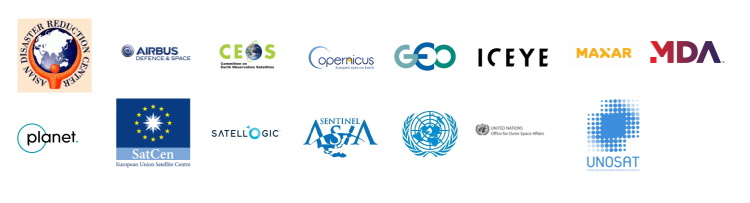
The International Charter "Space and Major Disasters" consists of 17 members, from space agencies and space system operators around the world, who provide their satellite data free of cost to support disaster response worldwide. In addition to those members, 20 organizations collaborate with or support the Charter in disaster monitoring activities.
These partners share the same goals of the Charter, and work with the Charter in different ways:
- Data contributors: Providing imagery from their satellites, free of cost
- Collaborative Partners: Collaborating to extend the reach of the Charter to regions of the world
- Co-operating Bodies: Co-operating with the Charter on similar disaster response activities
The following partners currently work with the Charter:
Data contributors
- Airbus Defence and Space
- ICEYE
- Maxar Technologies
- MDA
- Planet
- Satellogic
Collaborative partners
- Committee on Earth Observation Satellites (CEOS)
- Group on Earth Observations (GEO)
- United Nations Institute for Training and Research (UNITAR) and United Nations Satellite Centre (UNOSAT)
Co-operating Bodies
- Sentinel Asia and Asian Disaster Reduction Centre (ADRC)
- United Nations Office for Outer Space Affairs (UNOOSA)
- Copernicus EMS
This article highlights a few of the partners as examples, and the role they play.
UNOOSA and UNITAR
The United Nations Office for Outer Space Affairs (UNOOSA) and the United Nations Institute for Training and Research (UNITAR) signed agreements with the Charter in 2008 and 2009, respectively.
UNOOSA shares the Charter's goal of international cooperation, with a focus on promoting the peaceful use and exploration of space, and utilising space technology to support sustainable economic and social development. The Office supports UN member states in using this technology, and integrating it into their national programmes. The Charter is mainly promoted through UNOOSA's programme UN-SPIDER (United Nations Platform for Space-based Information for Disaster Management and Emergency Response). UN-SPIDER encourages national Disaster Management Agencies to benefit from the Charter's Universal Access policy and has hosted Project Manager training sessions for the Charter on several occasions.
The goal of UNITAR is to train individuals, institutions, and organizations to overcome global challenges. The Institute offers a broad range of training and supports research activities. As part of UNITAR's activities, the United Nations Satellite Centre (UNOSAT) analyzes satellite imagery for disasters and conflicts. UNOSAT supports the Charter as a Project Manager as well as value-adding provider, taking imagery acquired through the Charter and performing rapid mapping to assess the impact of disasters.
Sentinel Asia
Sentinel Asia is a voluntary international initiative that aims to respond to disasters in the Asia-Pacific region, an area of the world that frequently suffers from disasters such as floods, storms, earthquakes and volcanoes. Sentinel Asia aims to demonstrate the benefits of Earth observation technology for preparing for and responding to disasters, to help mitigate their destructive impact and support response and recovery efforts.
As part of its goal to share disaster related information, Sentinel Asia signed a cooperation agreement with the Charter in 2010. Through this agreement, Sentinel Asia members may submit requests to the Charter for satellite data to be used in disaster response activities.
The Asian Disaster Reduction Center (ADRC) is a Co-operating Body of the Charter and can activate the Charter upon request from the Sentinel Asia members.
Copernicus EMS
The Charter signed a cooperation agreement with the European Union's Copernicus Emergency Management Service (EMS) on April 20, 2018. Copernicus EMS is an on-demand service that provides mapping based on satellite data for selected disasters. Primarily covering disasters in Europe, it also responds to disasters around the world.
As part of the cooperation agreement, when the Charter and Copernicus EMS are both activated for the same disaster, the two organisations share maps they produce.
Planet
The United States Earth imaging company Planet signed an agreement with the Charter to serve as a data contributor in May 2018. Planet operates over 100 minisatellites, providing daily coverage of the Earth's surface. Planet provides data from its PlanetScope constellation to the Charter.

ICEYE
One of the most recent partners to support the Charter, the Finnish company ICEYE serves as a data contributor. ICEYE has provided data from its commercial Synthetic Aperture Radar (SAR) satellite constellation to the Charter through an agreement with the European Space Agency since 2019.
These partners are just a small number of the organizations that have played a role in supporting over 20 years of operations for the Charter. The Charter members look forward to continued collaboration with all of these partners in the future.

Related News