 English
 Spanish
 French
 Chinese
 Russian
 Portuguese
 Latest Activation
Charter activations
Flood in Bolivia
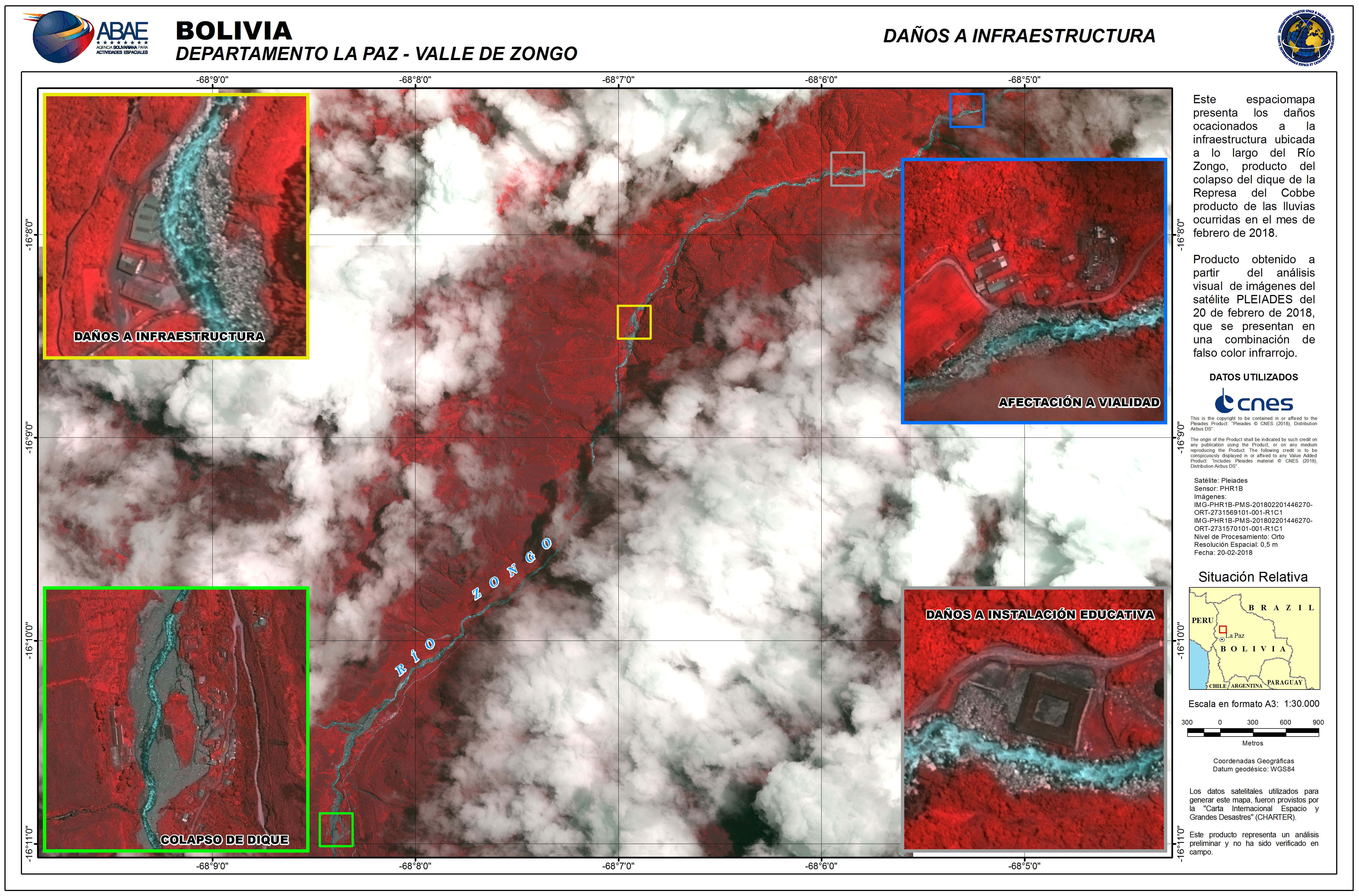
Record rainfall in southern Bolivia has caused severe flooding with local authorities declaring a state of emergency.
Seven of the nine departments in the country have been affected, and authorities have reported that 50,000 people have been forced from their homes.
The floods follow days of heavy rain and particularly affect the southern part of the nation along the border with Paraguay and Argentina; which is also experiencing floods.
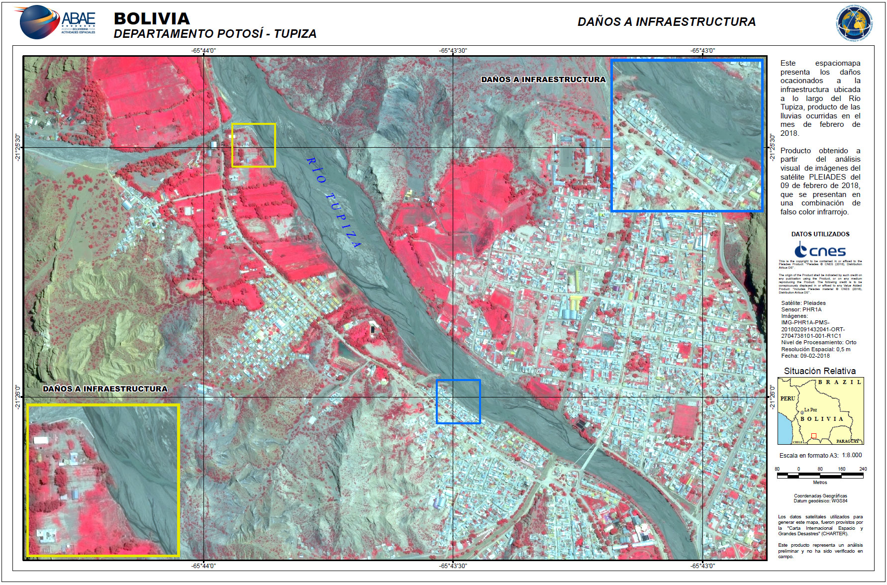
The rain caused the Tupiza River to overflow, flooding the city which shares the same name and affecting an estimated 1000 people. Reports indicate flood waters reached as high as 7 metres in some places.
Due to the flood conditions, some roads in the affected regions have been inundated, making them impassable for relief efforts.
| Type of Event: | Flood |
| Location of Event: | Bolivia |
| Date of Charter Activation: | 2018-02-08 |
| Time of Charter Activation: | 22:12 |
| Time zone of Charter Activation: | UTC+01:00 |
| Charter Requestor: | UOB/SINAGER/VIDECI |
| Activation ID: | 565 |
| Project Management: | ABAE |
Products

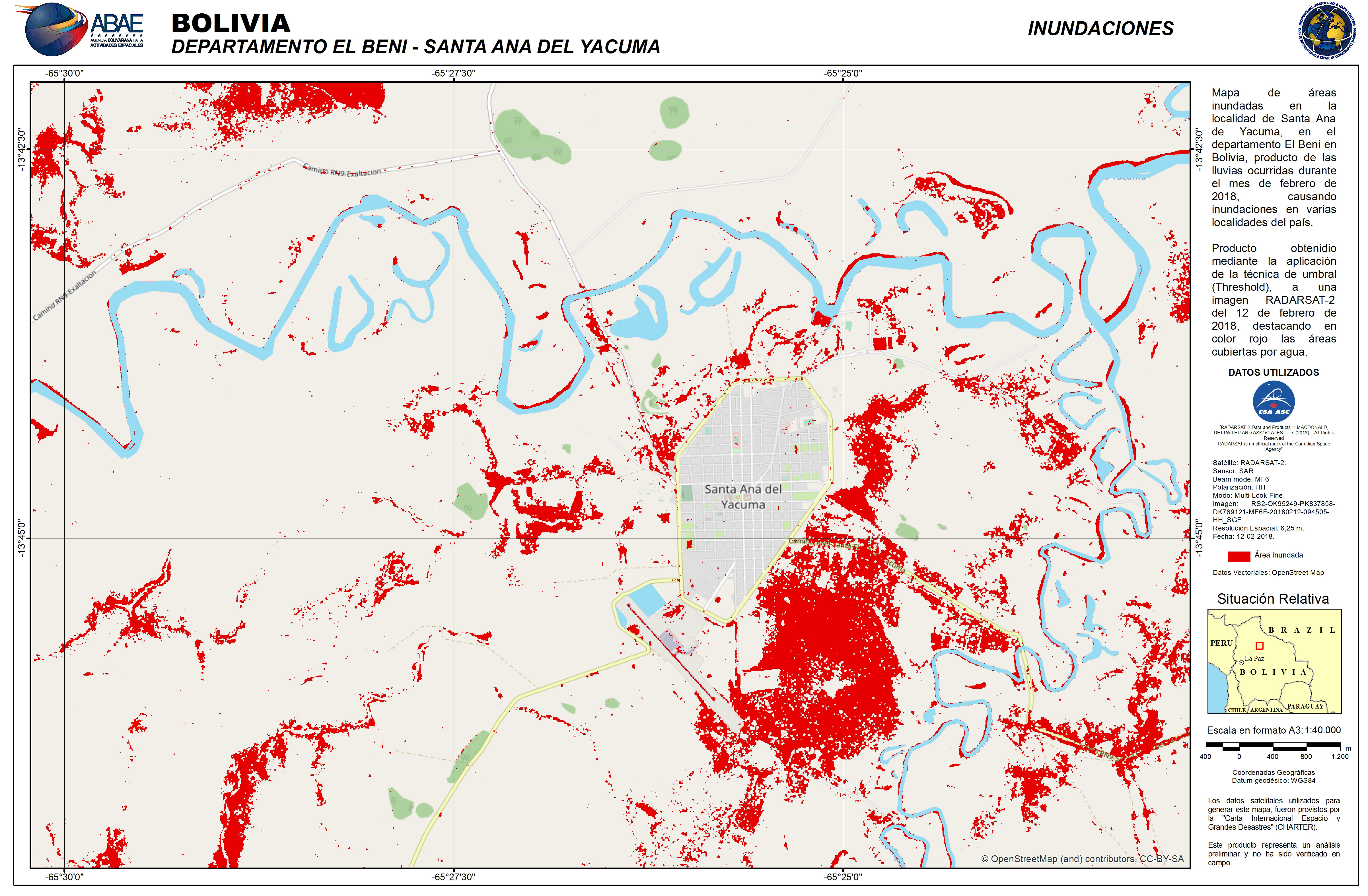
Satellite detected waters at Santa Ana Del Yacuma
Copyright: RADARSAT-2 Data and Products © Maxar Technologies Ltd. (2018) - All Rights Reserved. RADARSAT is an official trademark of the Canadian Space Agency.
Map produced by ABAE
Information about the Product
Acquired: 12/02/2018
Source: RADARSAT-2
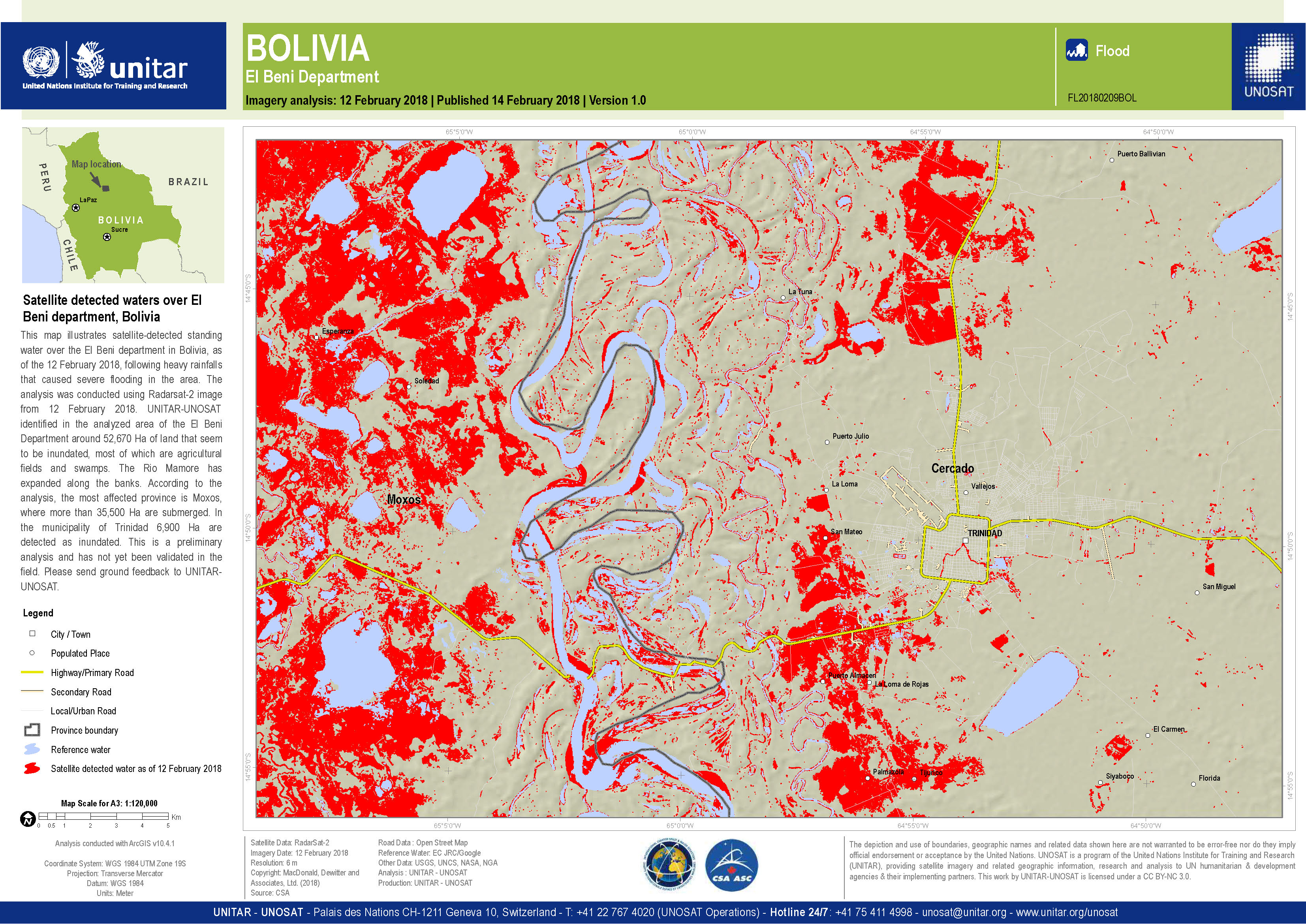
Satellite detected waters over El Beni department
Copyright: RADARSAT-2 Data and Products © Maxar Technologies Ltd. (2018) - All Rights Reserved. RADARSAT is an official trademark of the Canadian Space Agency.
Map produced by UNITAR/UNOSAT
Information about the Product
Acquired: 12/02/2018
Source: RADARSAT-2
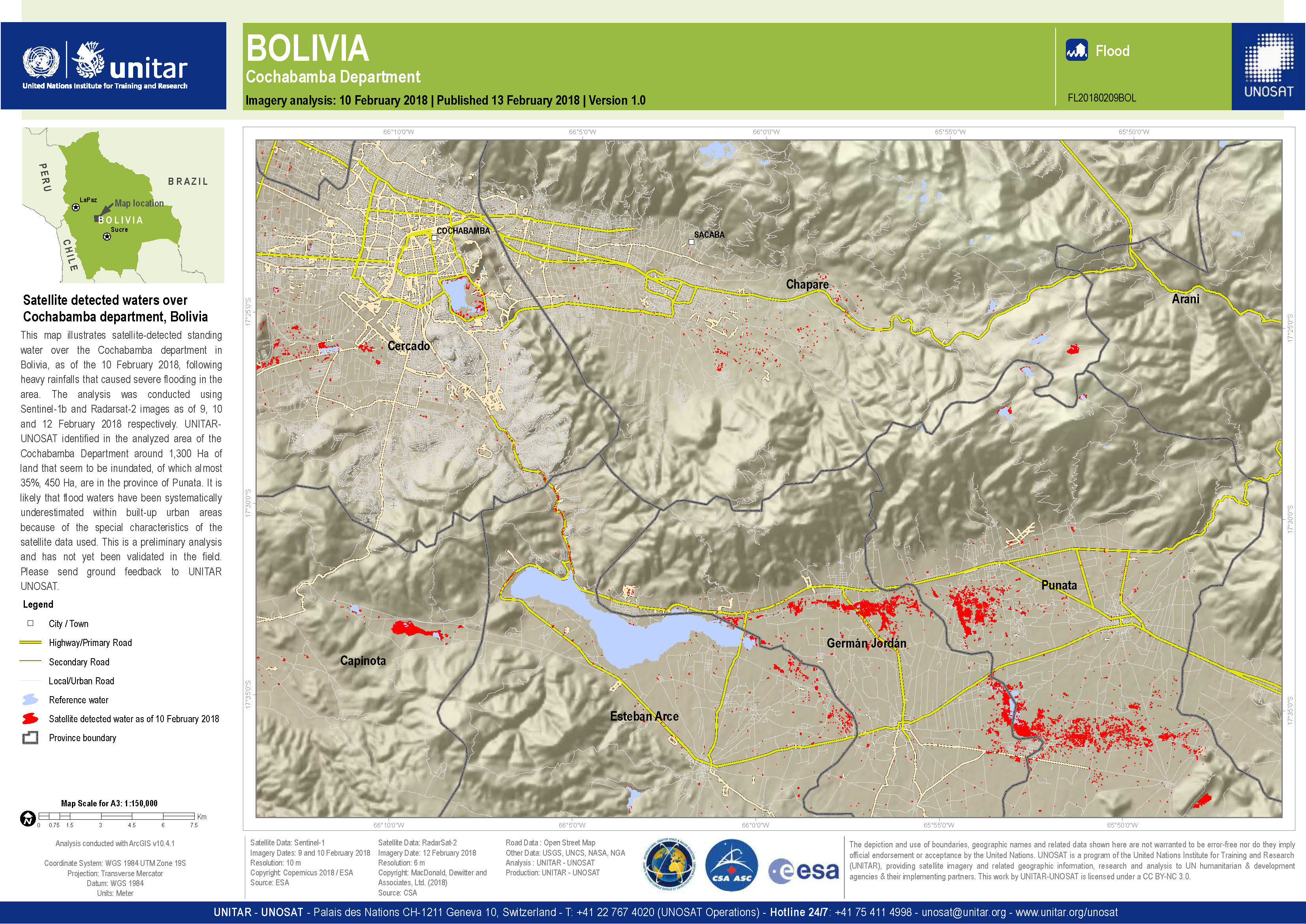
Satellite detected waters over Cochabamba department
Copyright: Sentinel-1 © Copernicus Sentinel data (2018)
RADARSAT-2 Data and Products © Maxar Technologies Ltd. (2018) - All Rights Reserved. RADARSAT is an official trademark of the Canadian Space Agency.
Map produced by UNITAR/UNOSAT
Information about the Product
Acquired: Sentinel-1: 09/02/2018 and 10/02/2018
RADARSAT-2: 12/02/2018
Source: Sentinel-1 / RADARSAT-2
 Back to the full activation archive

