 English
 Spanish
 French
 Chinese
 Russian
 Portuguese
 Latest Activation
Charter activations
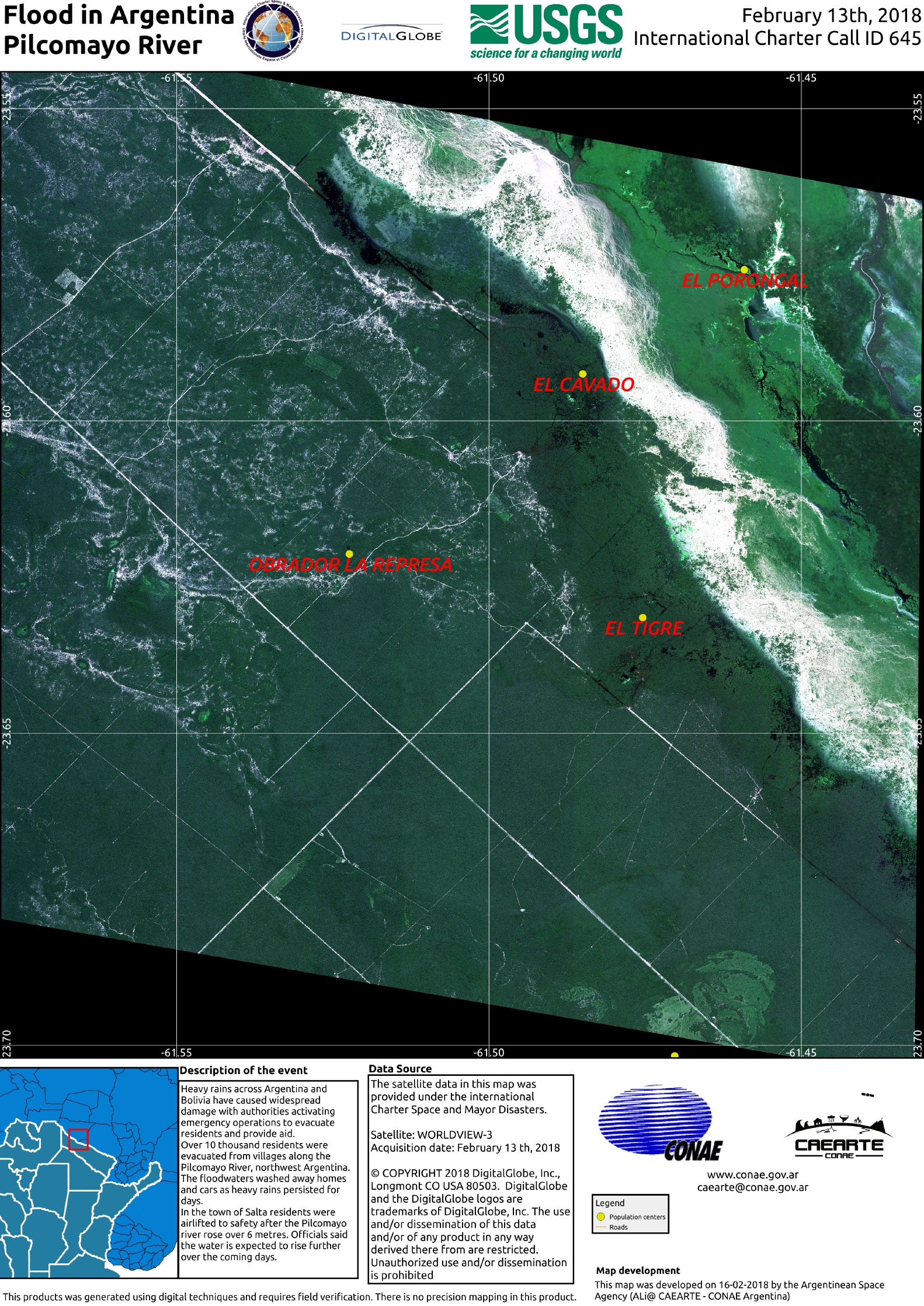
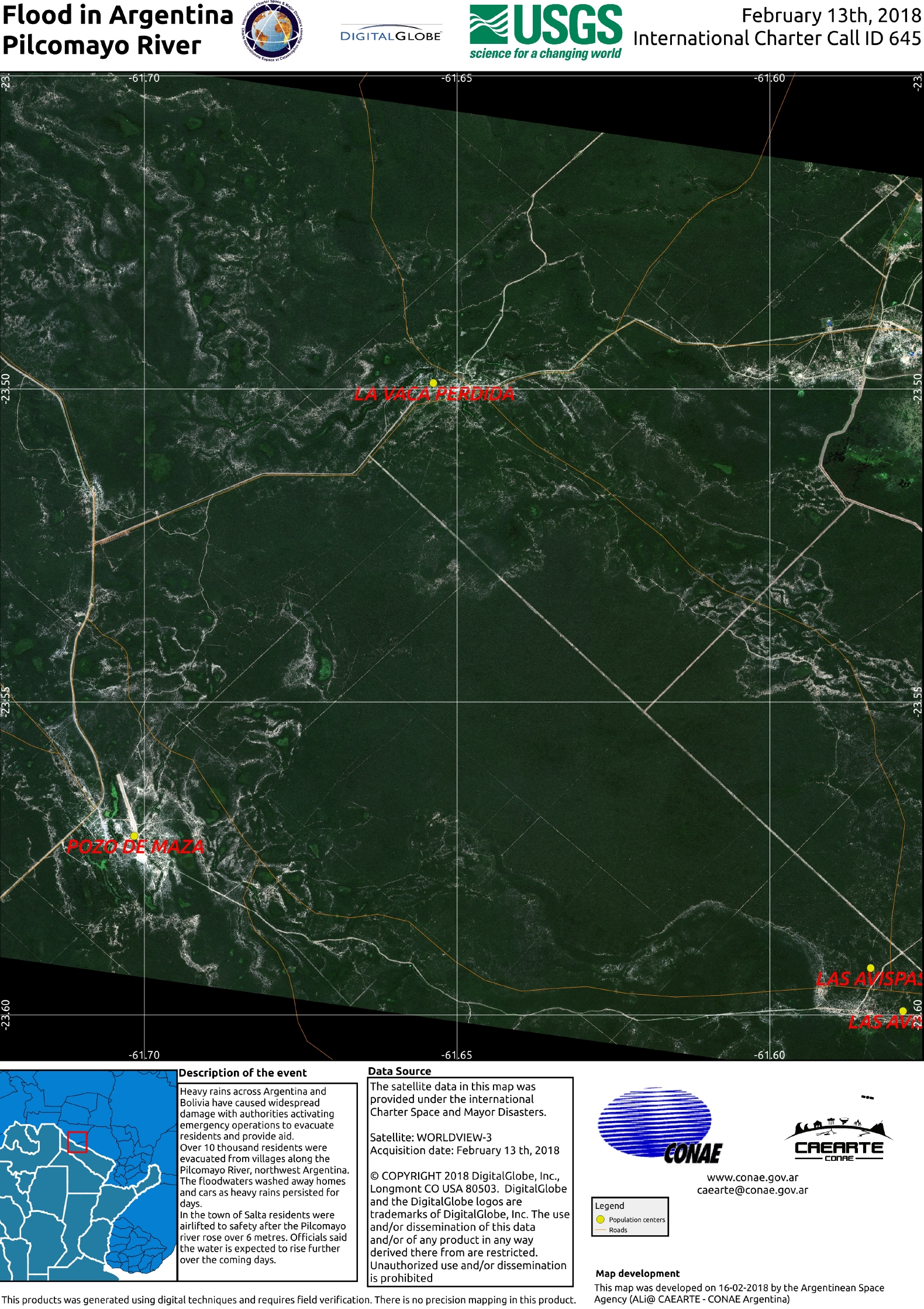
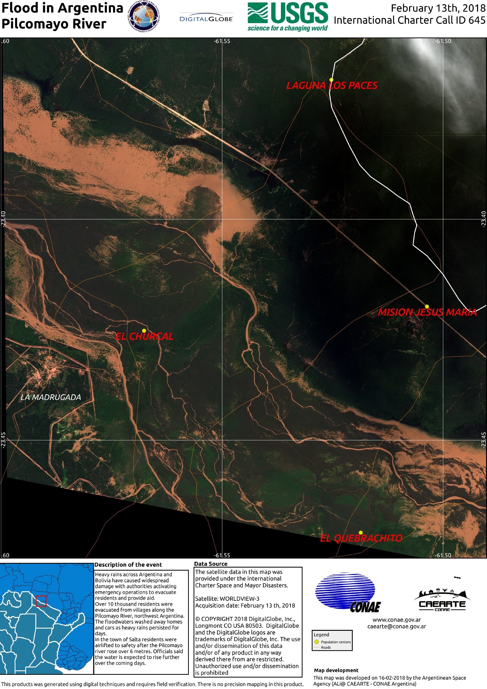
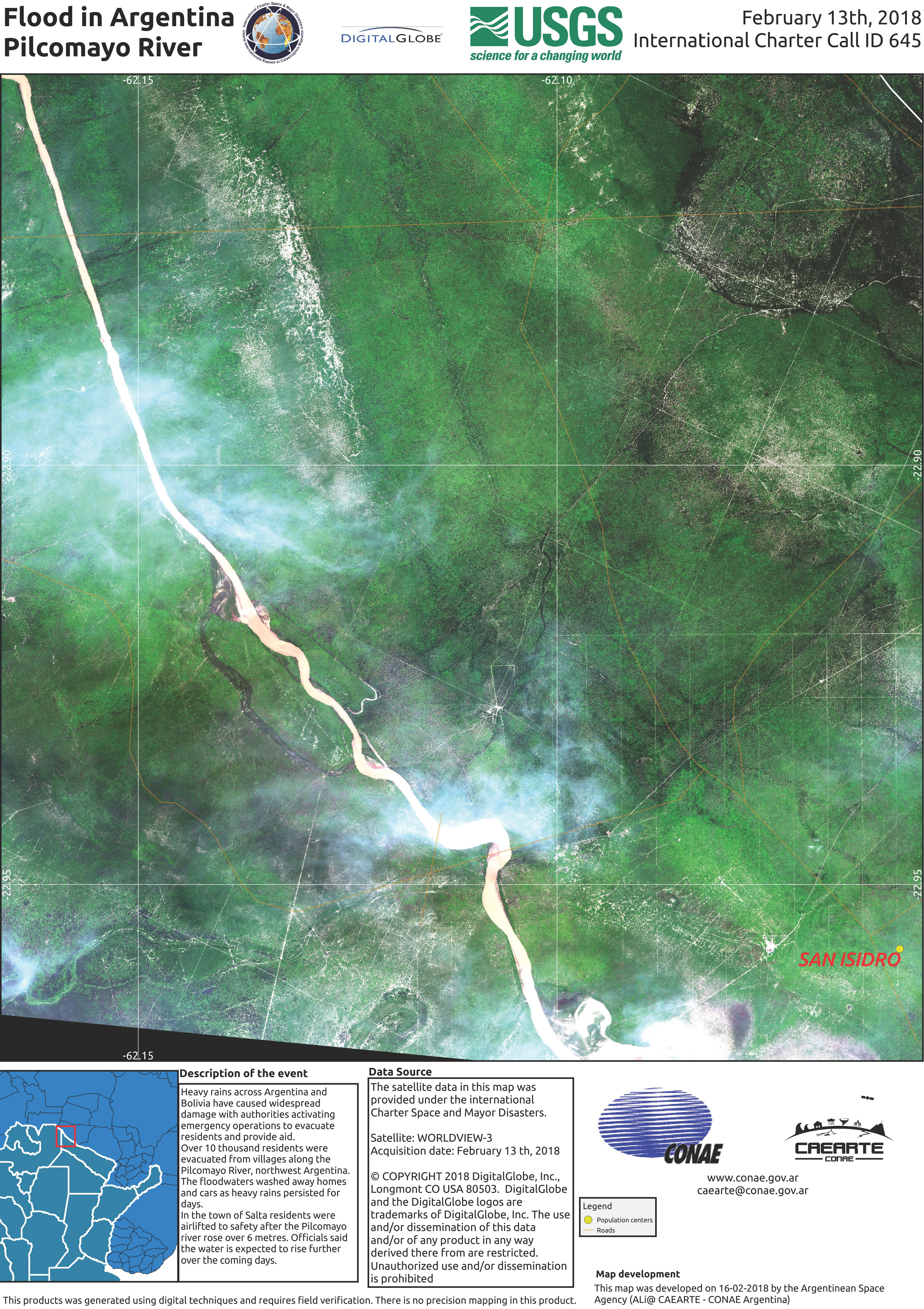
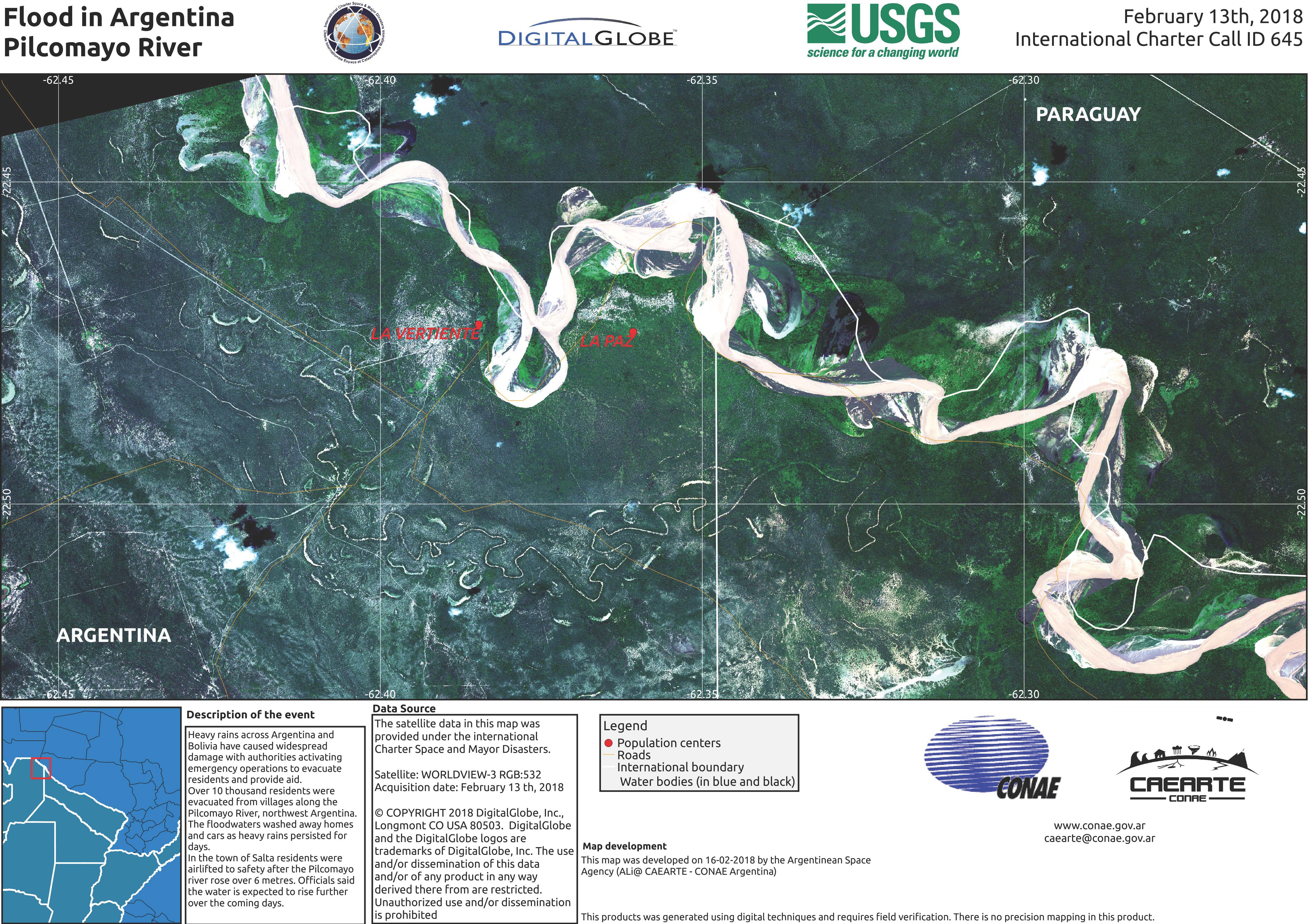
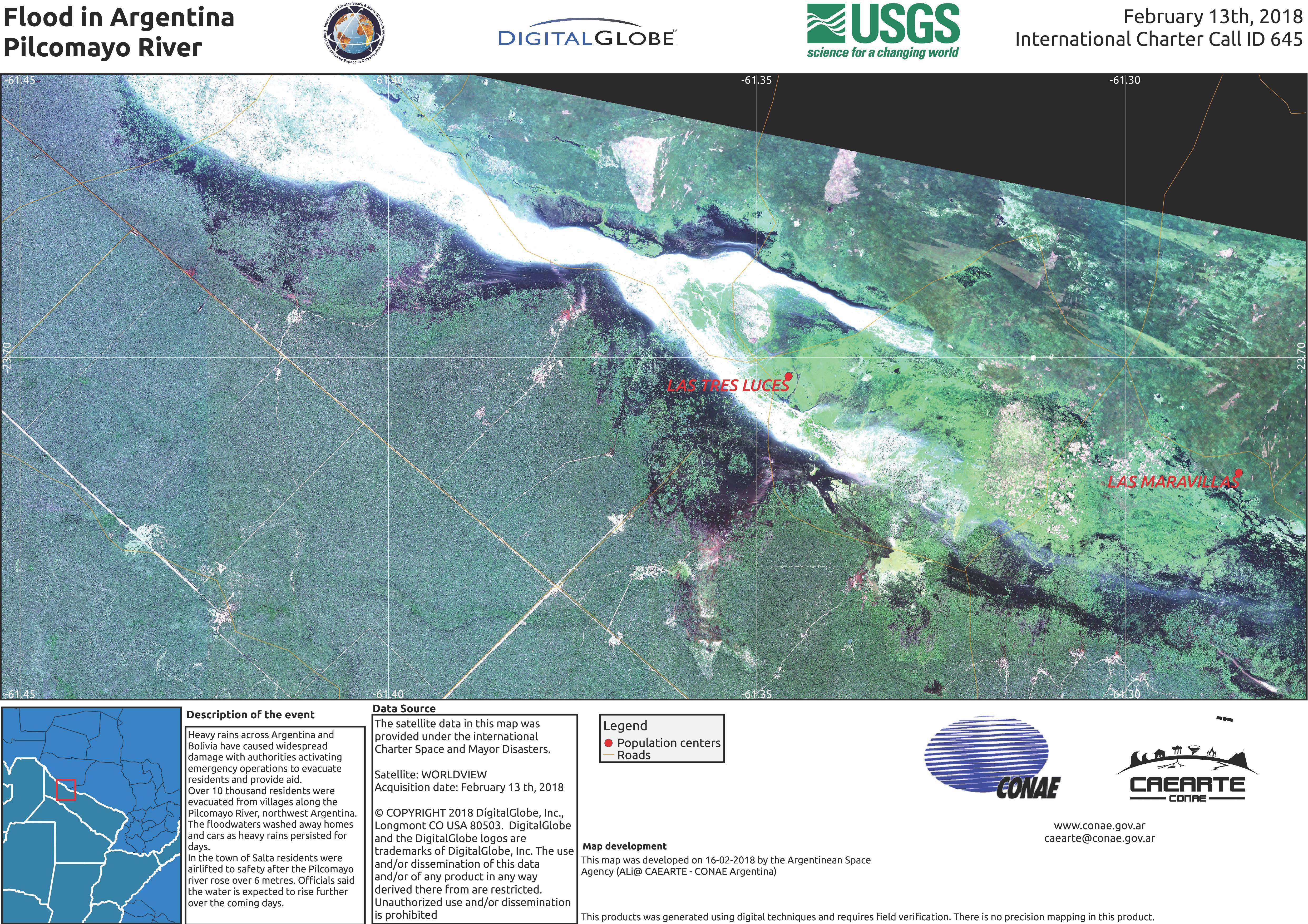
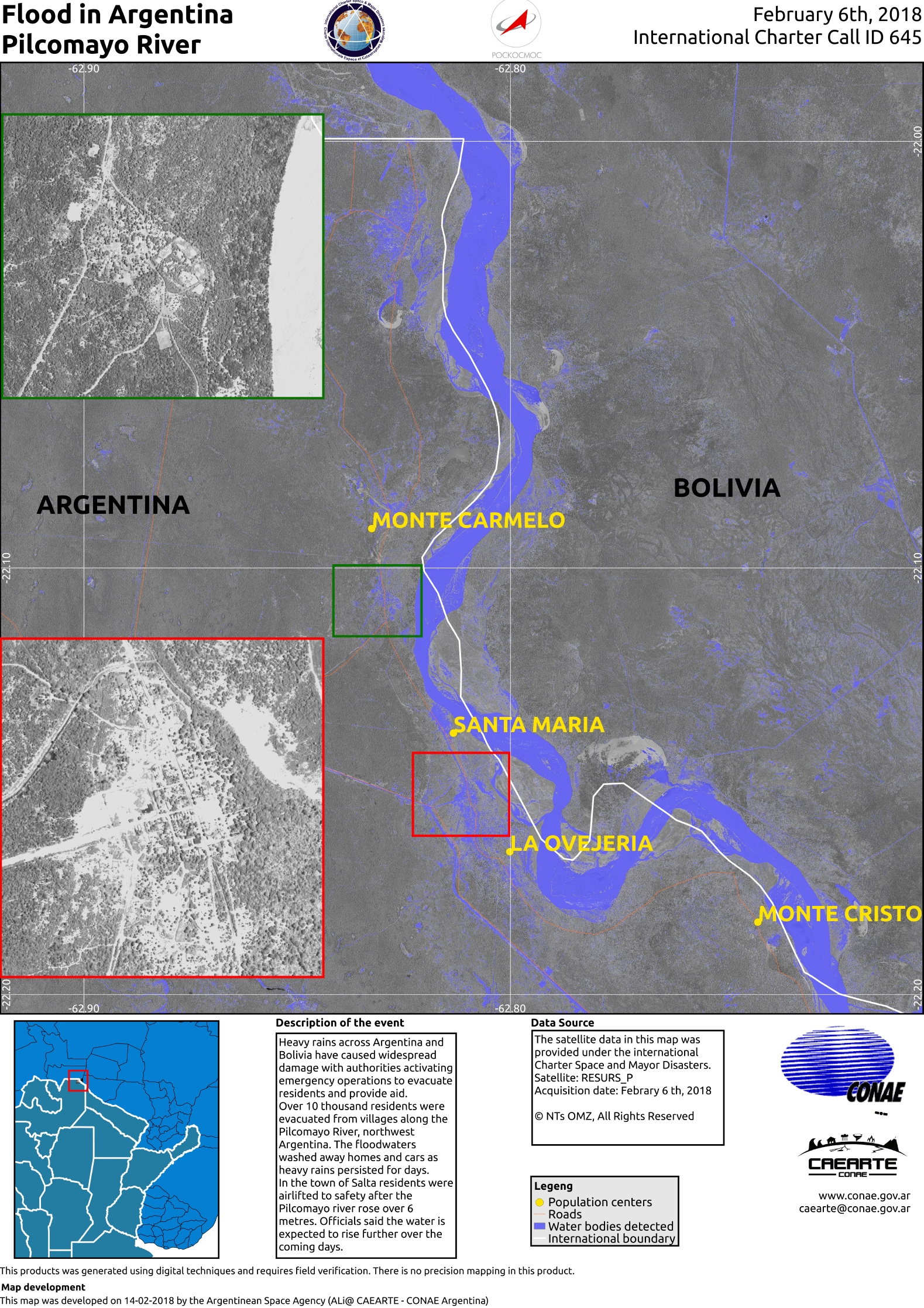
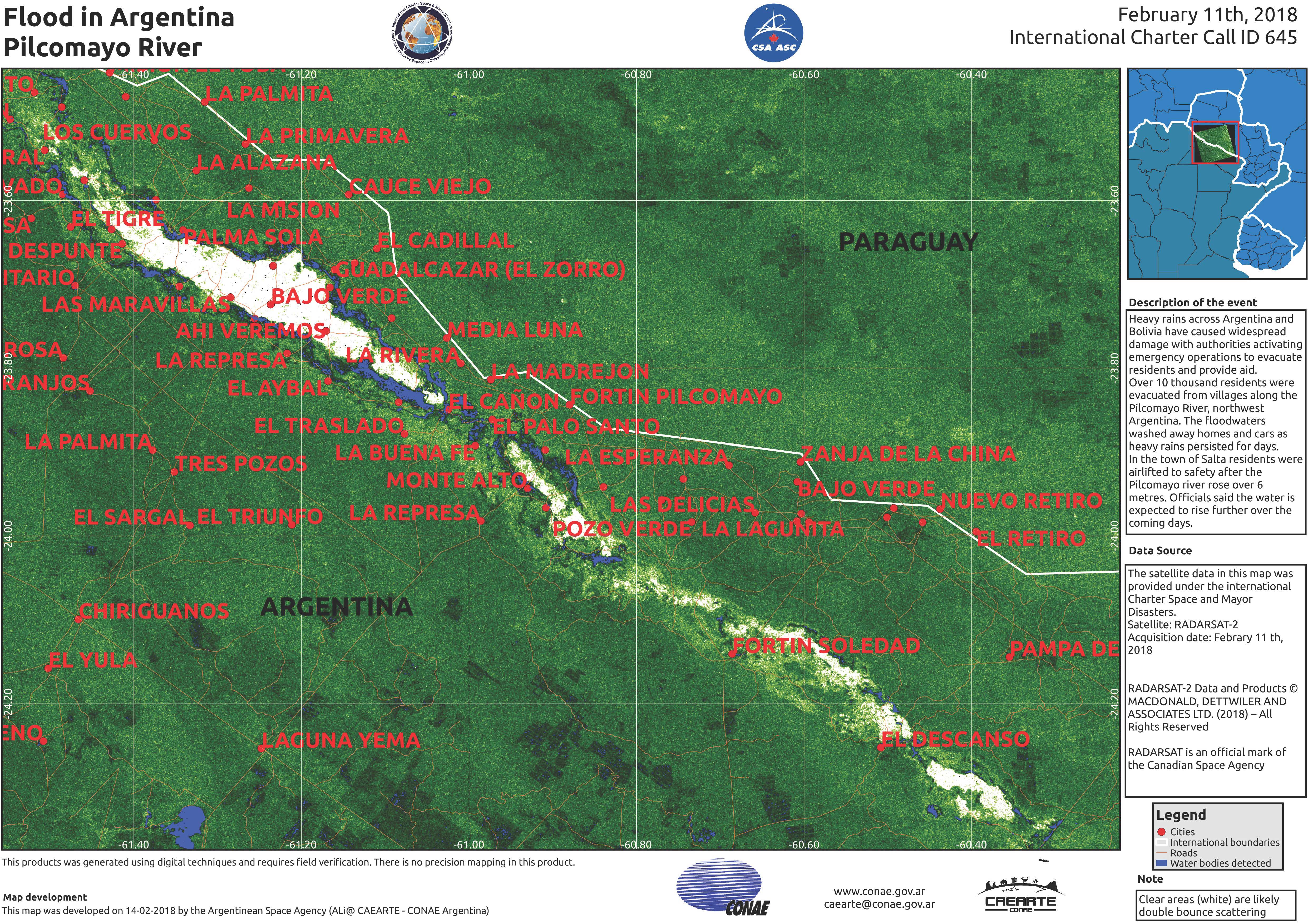
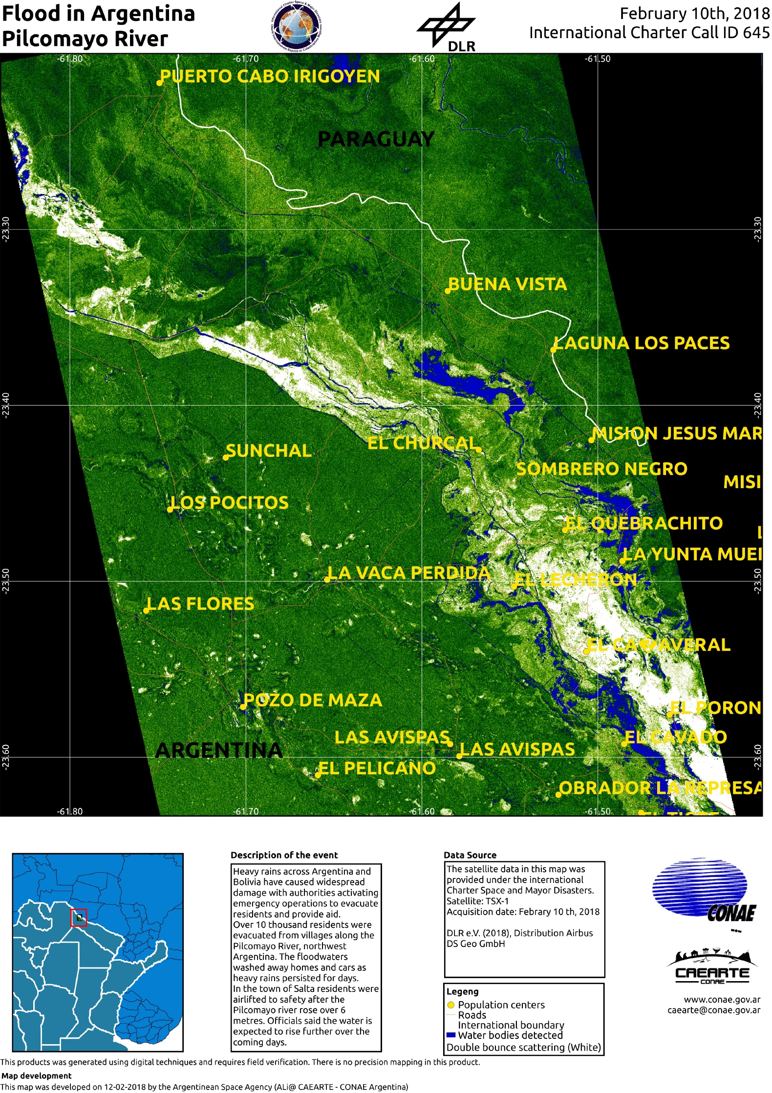
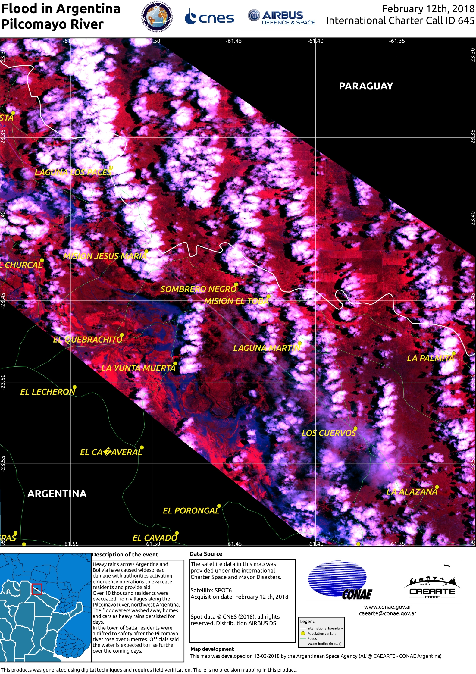
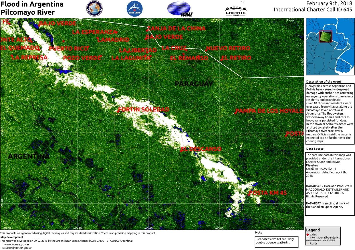
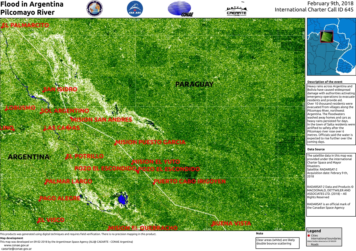
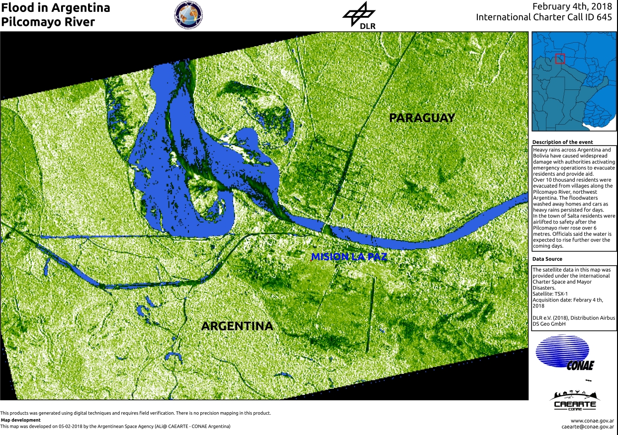
Flood in Argentina
Heavy rains across Argentina and Bolivia have caused widespread damage with authorities activating emergency operations to evacuate residents and provide aid.
Over 10 thousand residents were evacuated from villages along the Pilcomayo River, northwest Argentina. The floodwaters washed away homes and cars as heavy rains persisted for days.
In the town of Salta residents were airlifted to safety after the Pilcomayo river rose over 6 metres. Officials said the water is expected to rise further over the coming days.| Type of Event: | Floods |
| Location of Event: | Argentina |
| Date of Charter Activation: | 2018-02-03 |
| Time of Charter Activation: | 04:51 |
| Time zone of Charter Activation: | UTC+01:00 |
| Charter Requestor: | Sec. Nacional de Protección Civil Argentina – Ministerio de Seguridad – SIFEM - ARGENTINA |
| Activation ID: | 564 |
| Project Management: | CONAE |
Products


Flooding on the Pilcomayo River
Copyright: RADARSAT-2 Data and Products © Maxar Technologies Ltd. (2018) - All Rights Reserved. RADARSAT is an official trademark of the Canadian Space Agency.
Map produced by CONAE
Information about the Product
Acquired: Pre-disaster: 02/05/2016
Post-disaster: 06/02/2018
Source: RADARSAT-2


 Back to the full activation archive

