English
 Spanish
 French
 Chinese
 Russian
 Portuguese
20 years on and progressing further
News
20 October 2020
20 years on and progressing further
The International Charter Space and Major Disasters, hereafter referred to as the Charter, was proposed by the European Space Agency (ESA) and the French Space Agency (CNES) in 1999. They were soon joined by the Canadian Space Agency (CSA), and on October 20, 2000, the three agencies formally signed the Charter.
Today marks the 20th anniversary of the Charter. Since the Charter entered operations on November 1, 2000, the Charter has been activated 680 times (as of October 19, 2020) to support disasters in 126 countries, including the earthquake and tsunami in the Indian Ocean in 2004, the earthquake in Haiti in 2010, Typhoon Haiyan in the South East Asia in 2013, the explosion in Lebanon in 2020. Membership in the Charter has grown from the founding 3 space agencies to now 17 space agencies and space system operators and their 61 satellites provide observation data to disaster management authorities around the world.
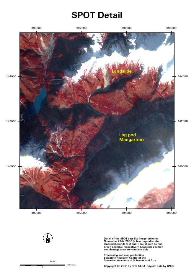
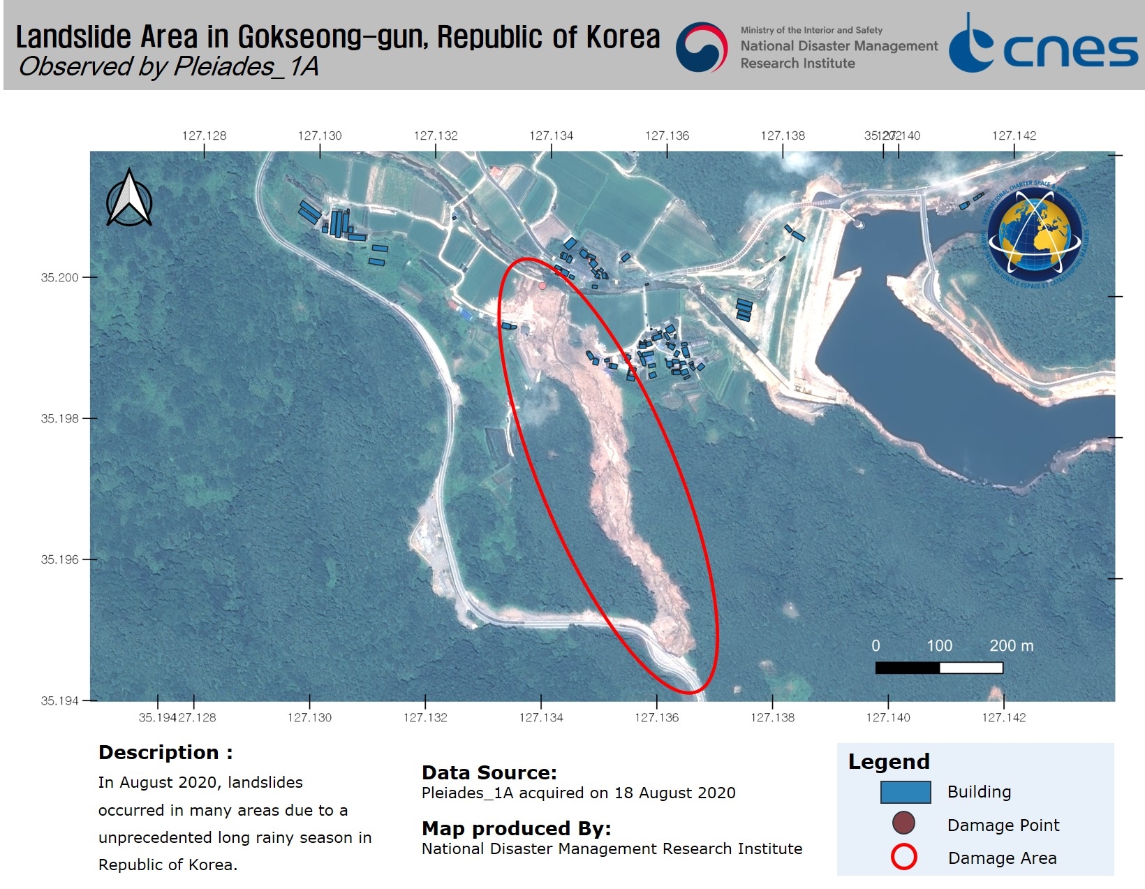
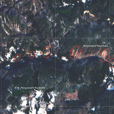
Capability of satellites has been much improved during the past 20 years. For comparison, SPOT imagery in 2000 and Pleiades imagery in 2020.
First image: Copyright Centre national d'études spatiales 2001
Second image: Map by SRC SASA and Includes Pleiades material © CNES (2020), Distribution Airbus DS. Map produced by National Disaster Management Research Institute of Korea
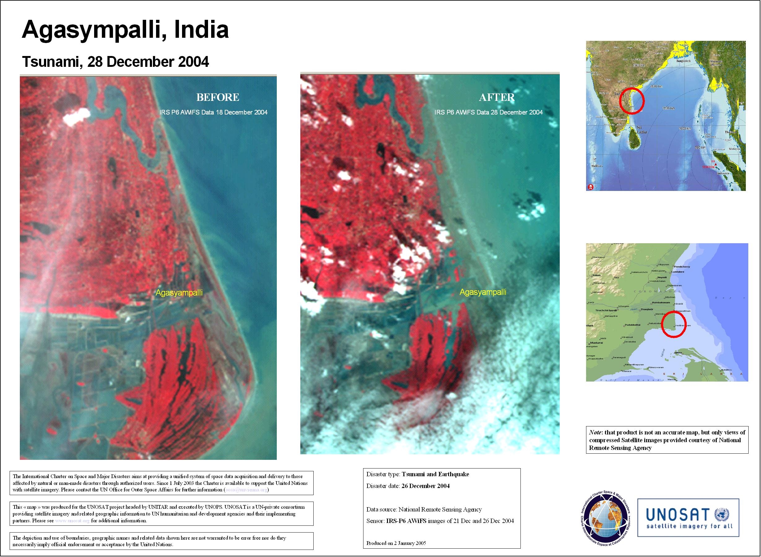

First image: In December, 2004, an earthquake occurred near Indonesia and caused one of the greatest tsunamis in the Indian Ocean, which took more than 200,000 lives. The Charter provided satellite observation data, such as the above support disaster monitoring. Map produced by UNITAR/UNOSAT.
Second image: The great Typhoon Haiyan hit the Asian region including the Philippines and Vietnam in 2013. CNES 2013 - Distribution: Astrium Services/Spot Image S.A., all rights reserved Map produced by UNITAR/UNOSAT.
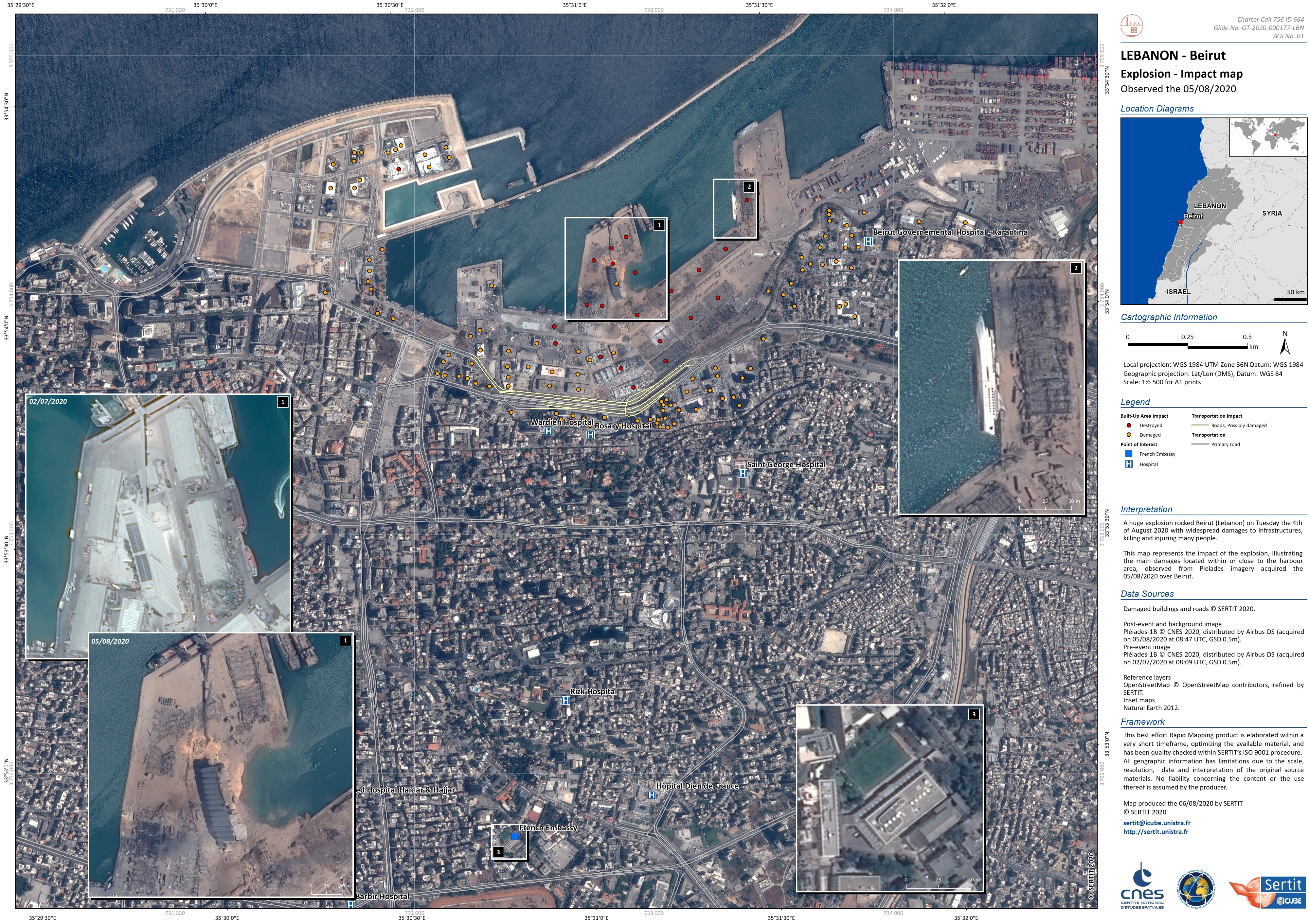
A warehouse in the port of Beirut, Lebanon exploded in August 2020. Map produced by SERTIT.
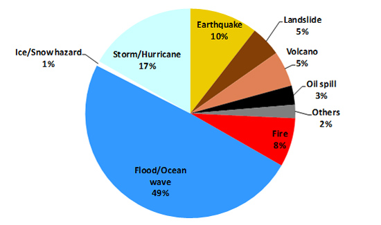

First image: Charter Activations by disaster type: Water related hazards such as floods and storms are the most common disasters.
Second image: Charter Activations by geographical distribution. The Charter responds to emergency calls from all over the world.
The Charter continues to improve the manner in which it serves people. In addition to the 17 Charter members, the Charter extends its cooperation to disaster management entities throughout the world. These organizations in Charter member countries are classified as "Authorized Users" and can request the Charter to acquire emergency satellite observations for disasters occurring in their countries.
To extend the framework for serving humanity, the Charter collaborates with external organizations. The Charter concluded agreements with the United Nations Office for Outer Space Affairs (UNOOSA) and the United Nations Institute for Training and Research (UNITAR) in 2008 and 2009, respectively, under which UNOOSA and UNITAR/UNOSAT can request emergency observations on behalf of United Nations users. In 2010, the Charter and Sentinel Asia, a regional framework for the use of satellite data for disaster management in the Asia-Pacific area, drafted an interface control document for cooperation. In 2018, a cooperation agreement was signed between the Charter and the European Union's Copernicus Emergency Management Service (Copernicus EMS). The Charter also maintains cooperation with the Group on Earth Observations (GEO).
In 2012, the Charter adopted the principle of Universal Access, which enables any national disaster management authority to apply for registration as an Authorized User. As of September 2020, 73 national users from 67 countries are recognized as authorized users under the universal access provision.
Map showing countries (in dark blue) with direct access to the Charter as of September 2020
Today Charter members dedicate their efforts to realizing the ideal of the Charter, which is to provide satellite data to support disaster response worldwide. It is unfortunate that the Charter members could not come together to celebrate the 20th anniversary due to the corona virus pandemic, but the Charter will continue to expand and strengthen its support to humanity through the use of space technologies.

Related News