 English
 Spanish
 French
 Chinese
 Russian
 Portuguese
 Последняя Активация
Charter activations
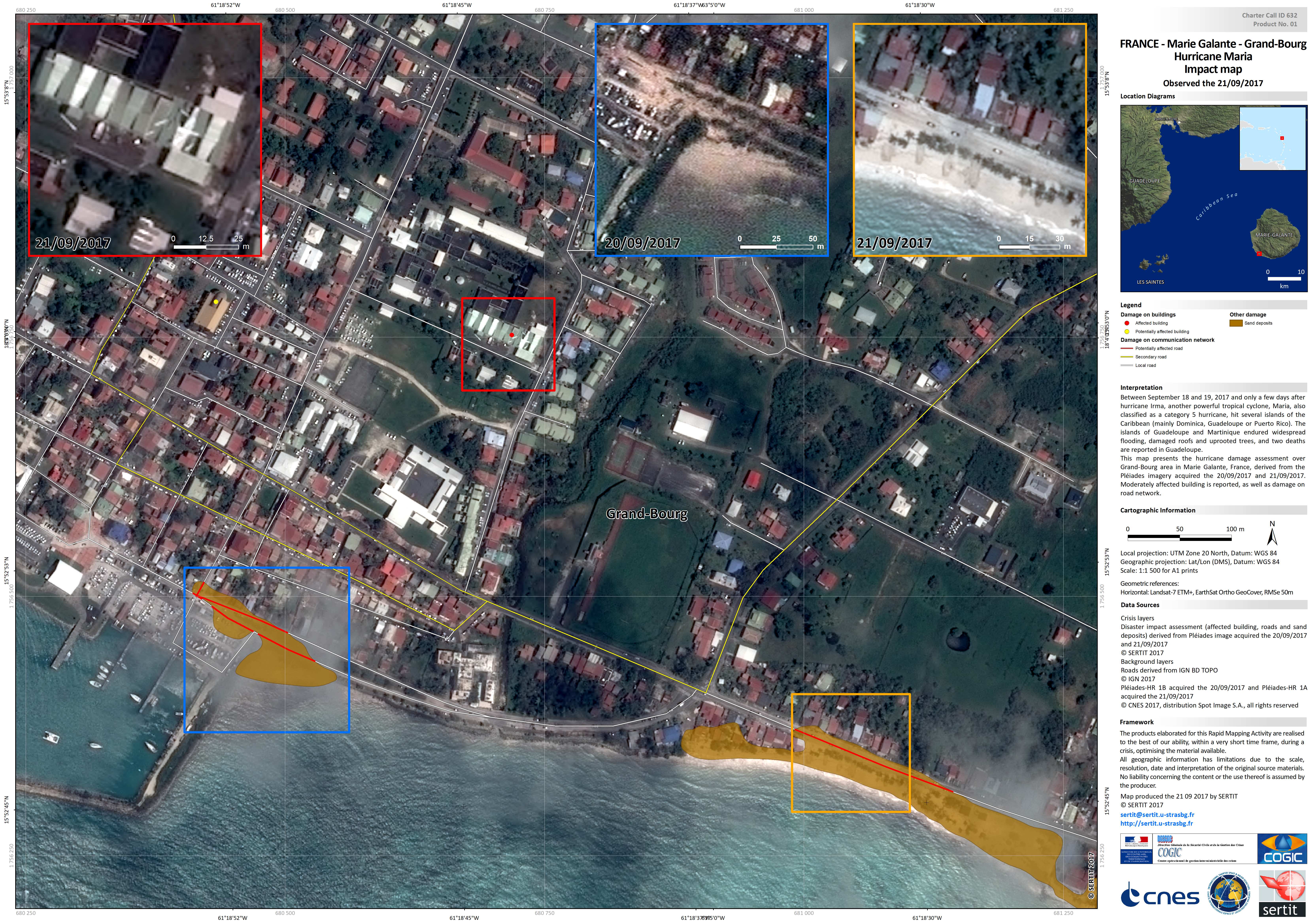
Hurricane Maria in the Antilles Islands
Hurricane Maria, a Category Five storm, passed through the Antilles Islands on 19 September.
Category 5 is the highest grade on the Saffir-Simpson Hurricane Scale, and indicates a storm that could cause catastrophic damage. A state of emergency was declared in the islands as the storm approached, with residents urged to evacuate and seek shelter.
Two people were killed in Guadeloupe and the island suffered widespread damage and the island of Marie-Galante close to the south also suffered damage. Some parts of Pointe-à-Pitre in Guadeloupe were left under a metre of flood water.
Initial assessments indicate limited damage to Martinique, but the island received torrential rain as Maria passed close to the north of the island.
Maria continued on course for Puerto Rico in a north-west direction, following a similar path to Hurricane Irma.
Thousands of emergency response workers and the military were placed on standby in advance of the storm and moved in to assist in the aftermath.
| Тип события: | Ocean Storm - Hurricane |
| Место события: | Antilles Islands |
| Date of Charter Activation: | 2017-09-18 |
| Время активации Хартии: | 16:31 |
| TЧасовой пояс в районе активации Хартии: | UTC+02:00 |
| Запрос на активацию поступил от: | COGIC |
| Номер активации: | 553 |
| Менеждер проекта от: | SERTIT |
 Вернуться к полному архиву активаций

