 English
 Spanish
 French
 Chinese
 Russian
 Portuguese
 Последняя Активация
Charter activations
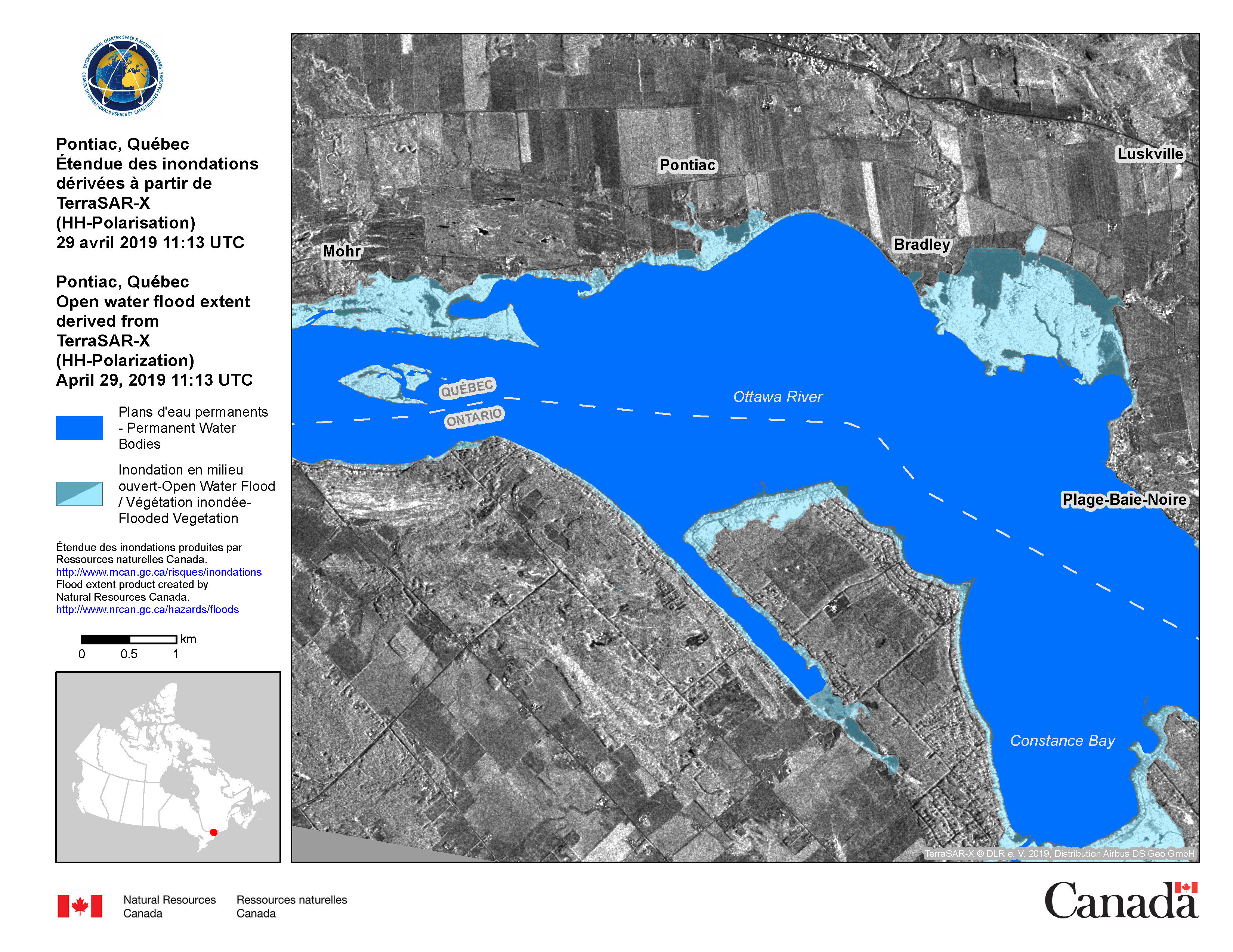
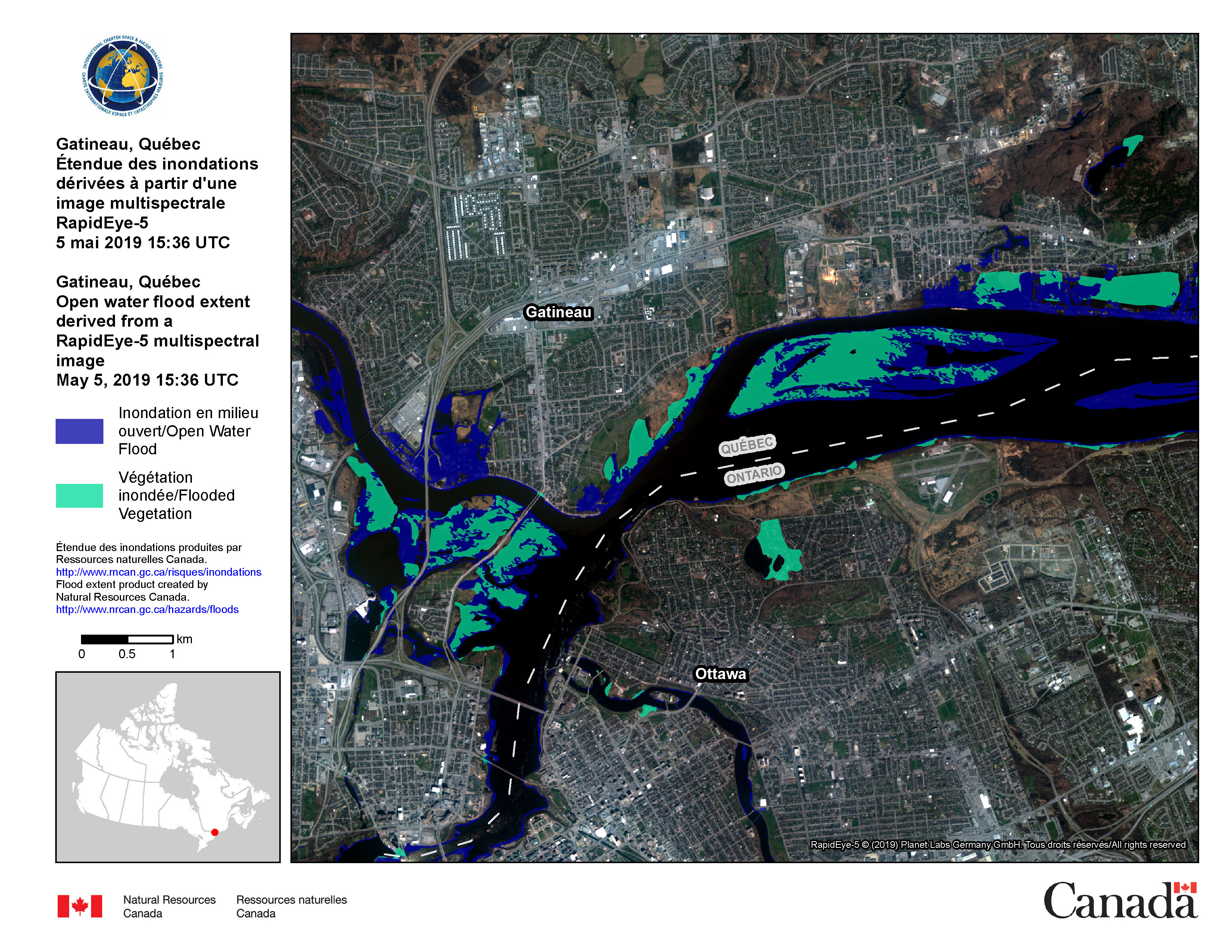
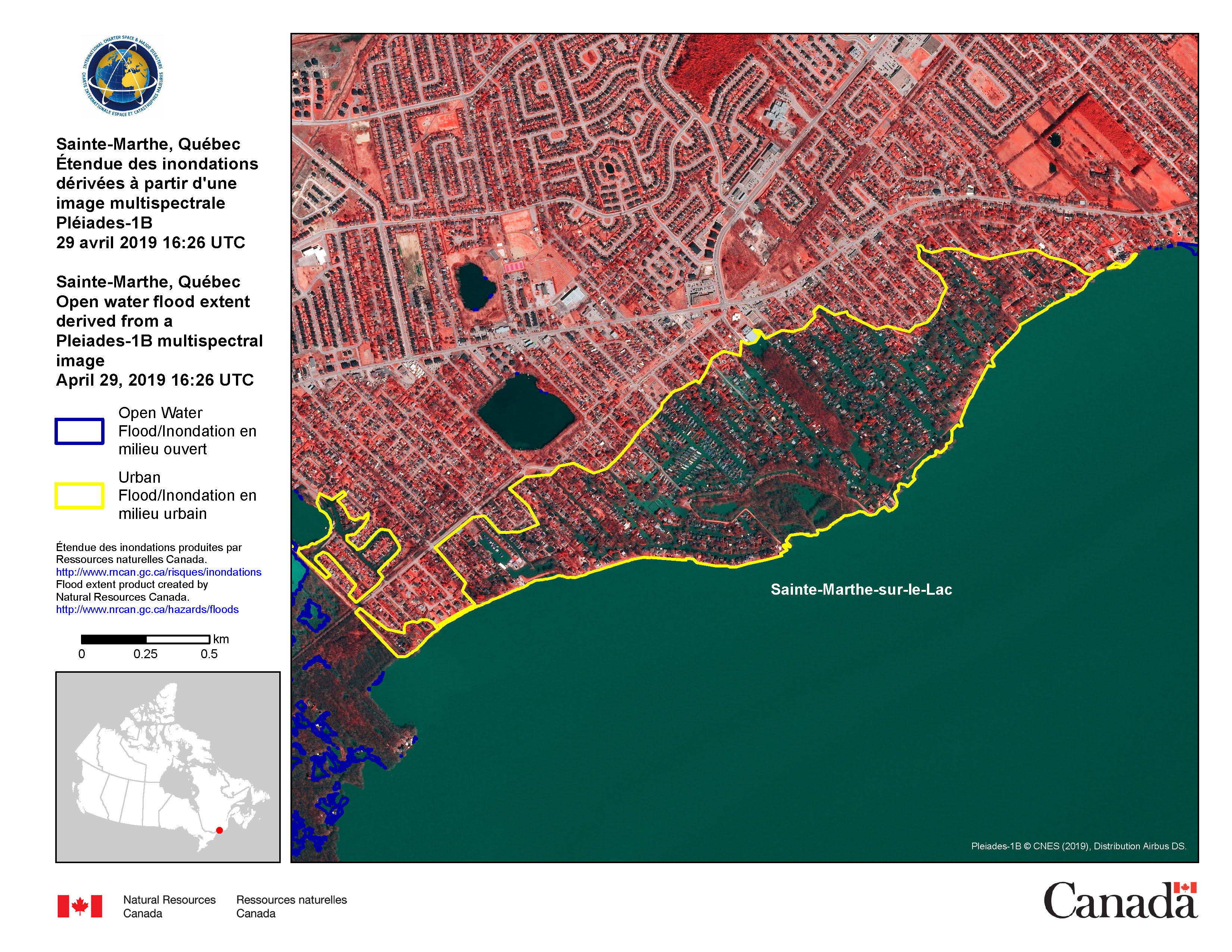
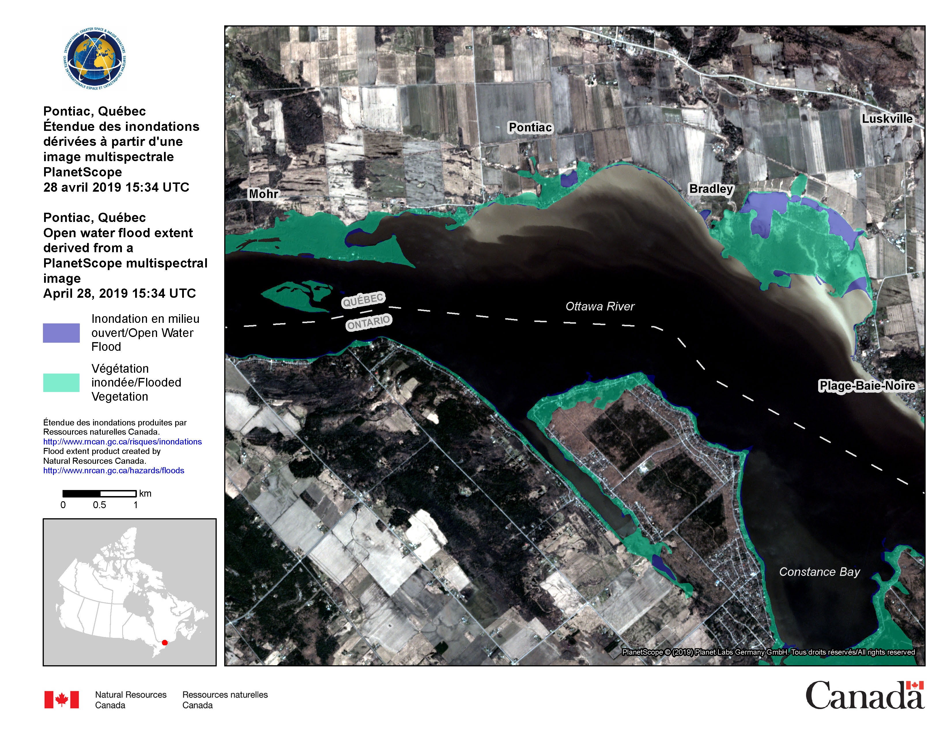
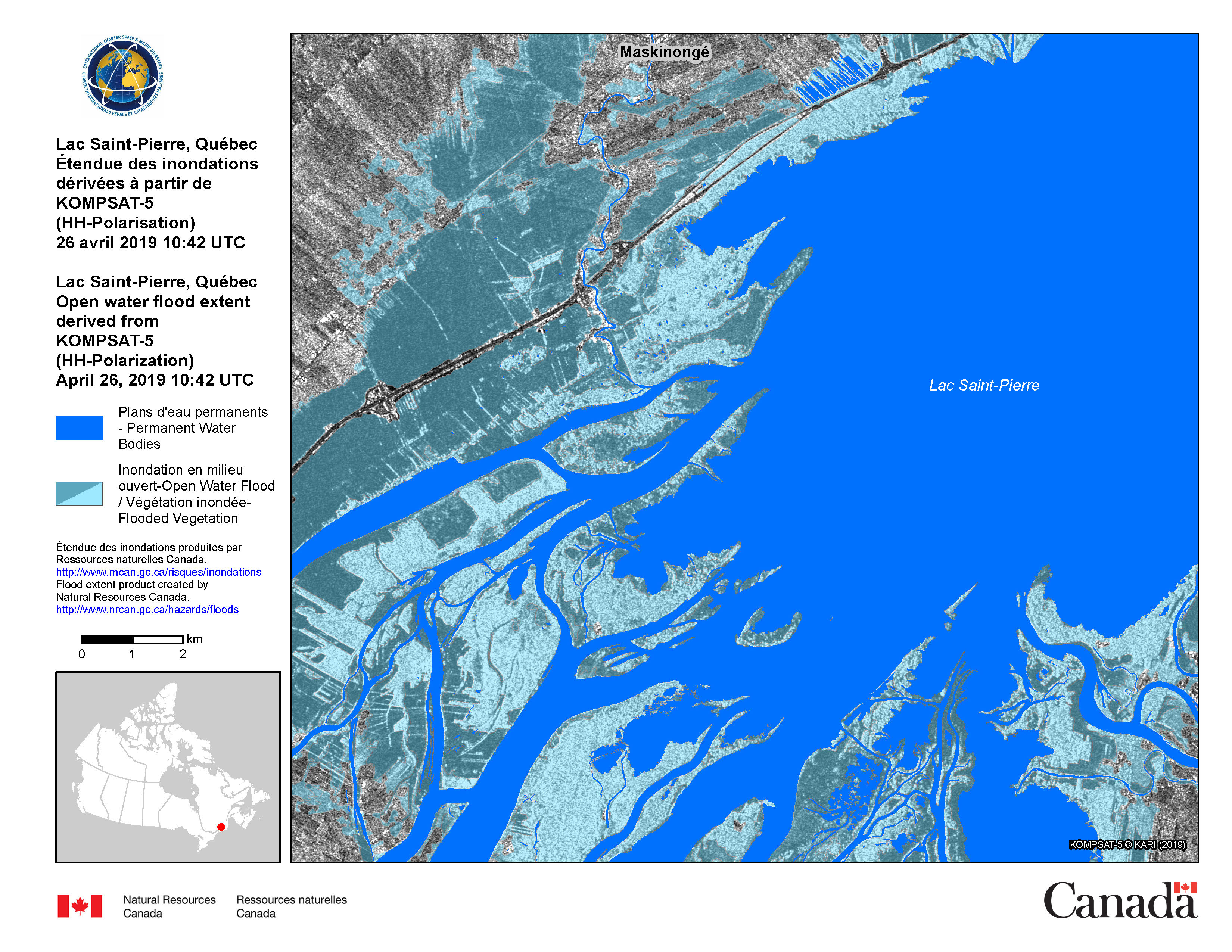
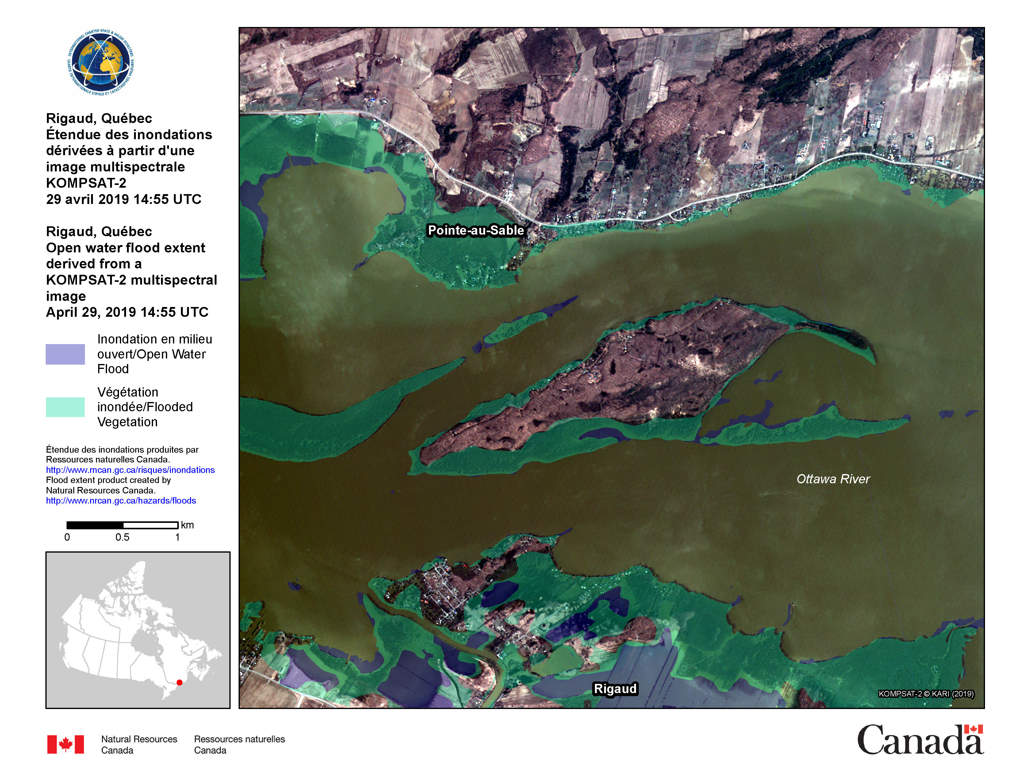
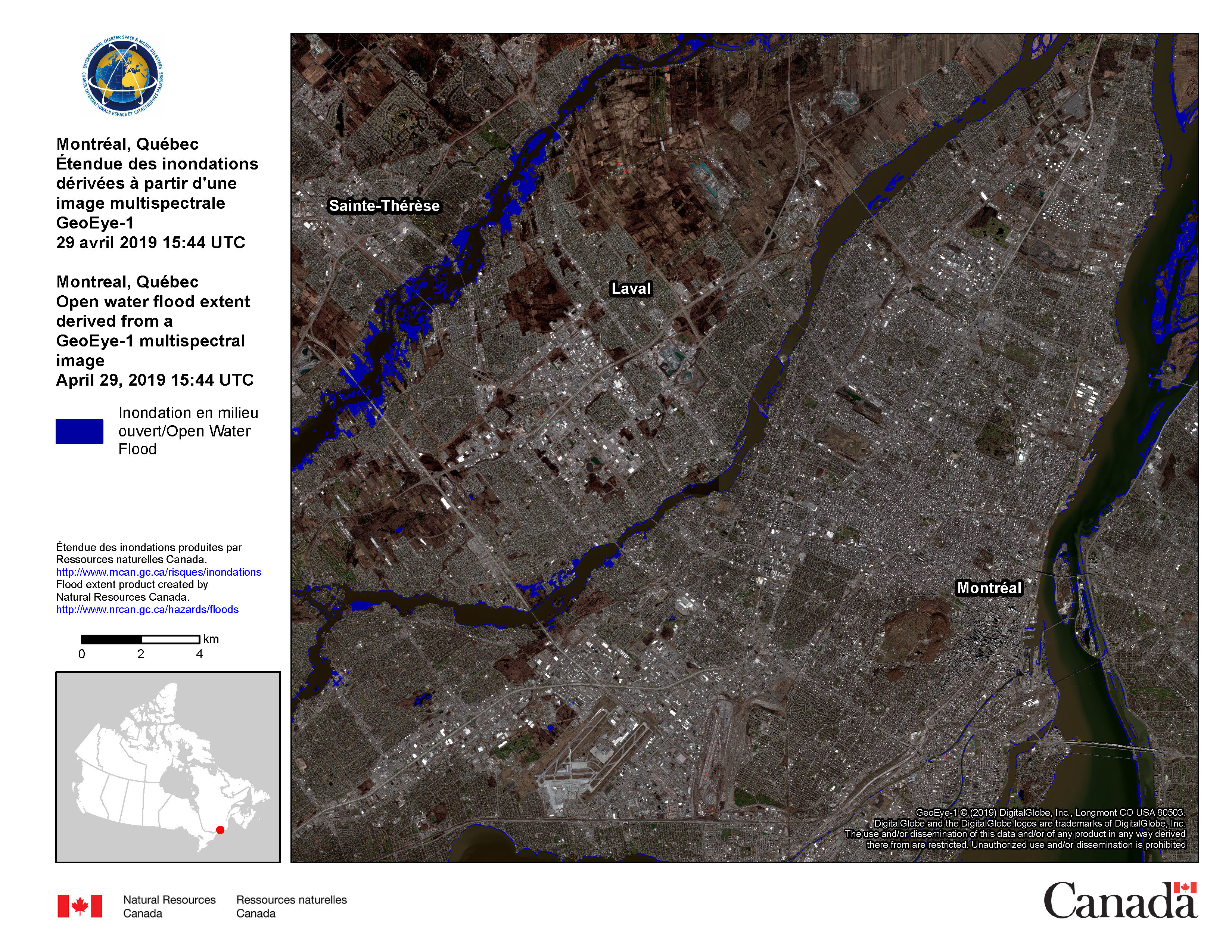
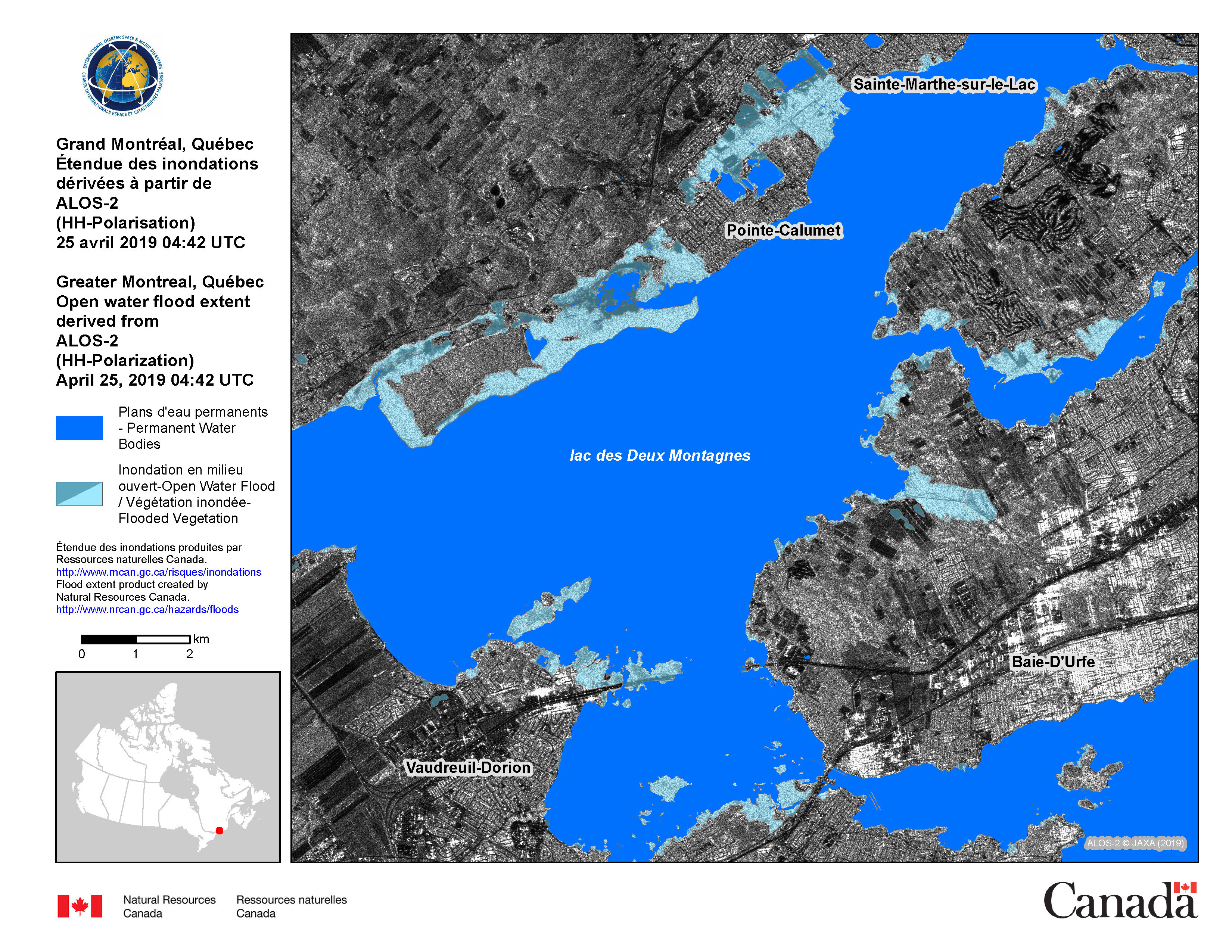
Flood in Canada
Spring flooding has damaged over 2500 homes and displaced over 1500 as rivers and lakes overflowed in the regions of Quebec and Montreal. The worst affected areas are the city of Sainte-Marie and Chaudière-Appalaches Region. One fatality was reported as a road was washed away causing a road accident.
The floods started by snowmelt and rain, caused the Chaudière, Ottawa and St Lawrence rivers to burst their banks bringing flooding to 18 locations. In worst affected areas up to 700 homes have been left isolated.
Many roads are closed and 100 people have been evacuated from Saint-André-Avellin and another 100 from Quebec's Beauce region.
600 Canadian soldiers have been deployed to affected areas to help shore up flood defences. Hundreds of volunteers and municipal workers are also working to protect properties.
Related News and Resources
| Место события: | Canada |
| Date of Charter Activation: | 2019-04-19 |
| Время активации Хартии: | 12:42 |
| TЧасовой пояс в районе активации Хартии: | UTC-04:00 |
| Запрос на активацию поступил от: | Government Operations Centre |
| Номер активации: | 604 |
| Менеждер проекта от: | Canadian Space Agency (CSA) |
Products
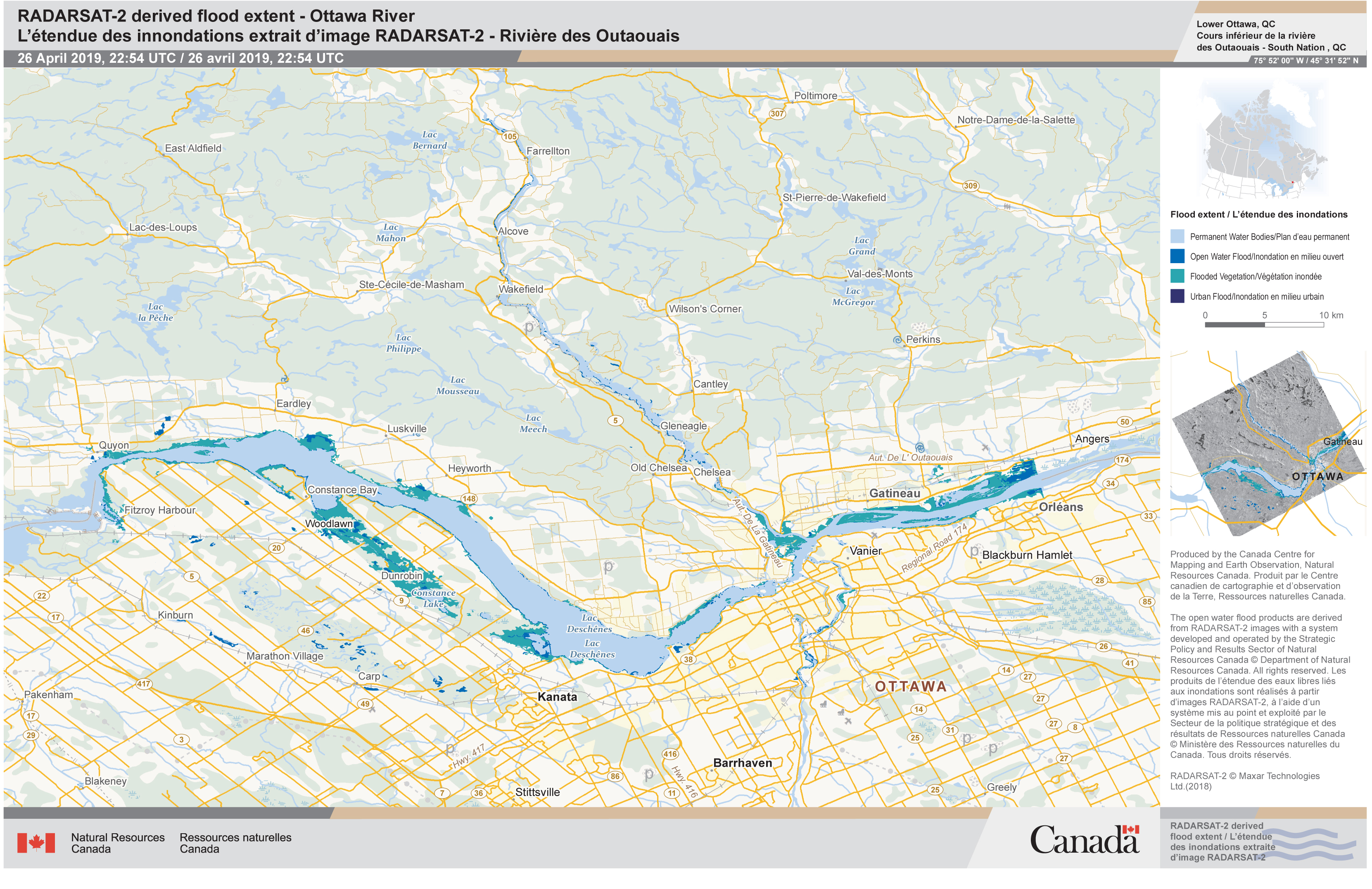
Flooding extent, Ottawa River, Ottawa, Canada
Авторские права: RADARSAT-2 Data and Products © Maxar Technologies Ltd. (2019) - All Rights Reserved. RADARSAT is an official trademark of the Canadian Space Agency.
Map produced by Canada Centre for Mapping and Earth Observation
Information about the Product
Получено: 26/04/2019
Источник: RADARSAT-2
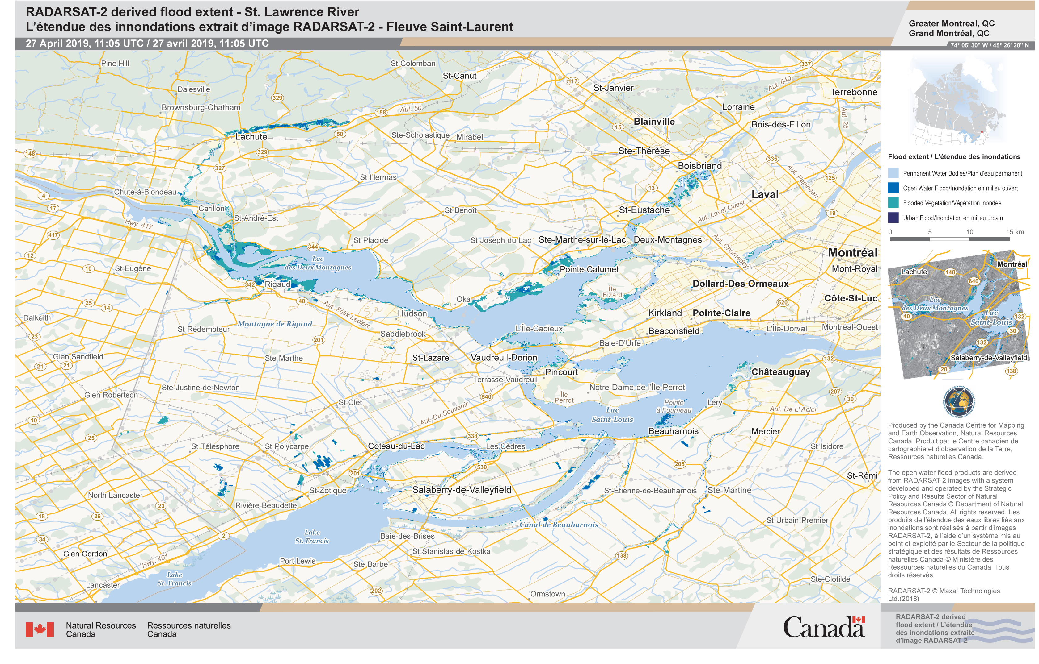
Flooding extent, St. Lawrence River, Montreal, Canada
Авторские права: RADARSAT-2 Data and Products © Maxar Technologies Ltd. (2019) - All Rights Reserved. RADARSAT is an official trademark of the Canadian Space Agency.
Map produced by Canada Centre for Mapping and Earth Observation
Information about the Product
Получено: 27/04/2019
Источник: RADARSAT-2

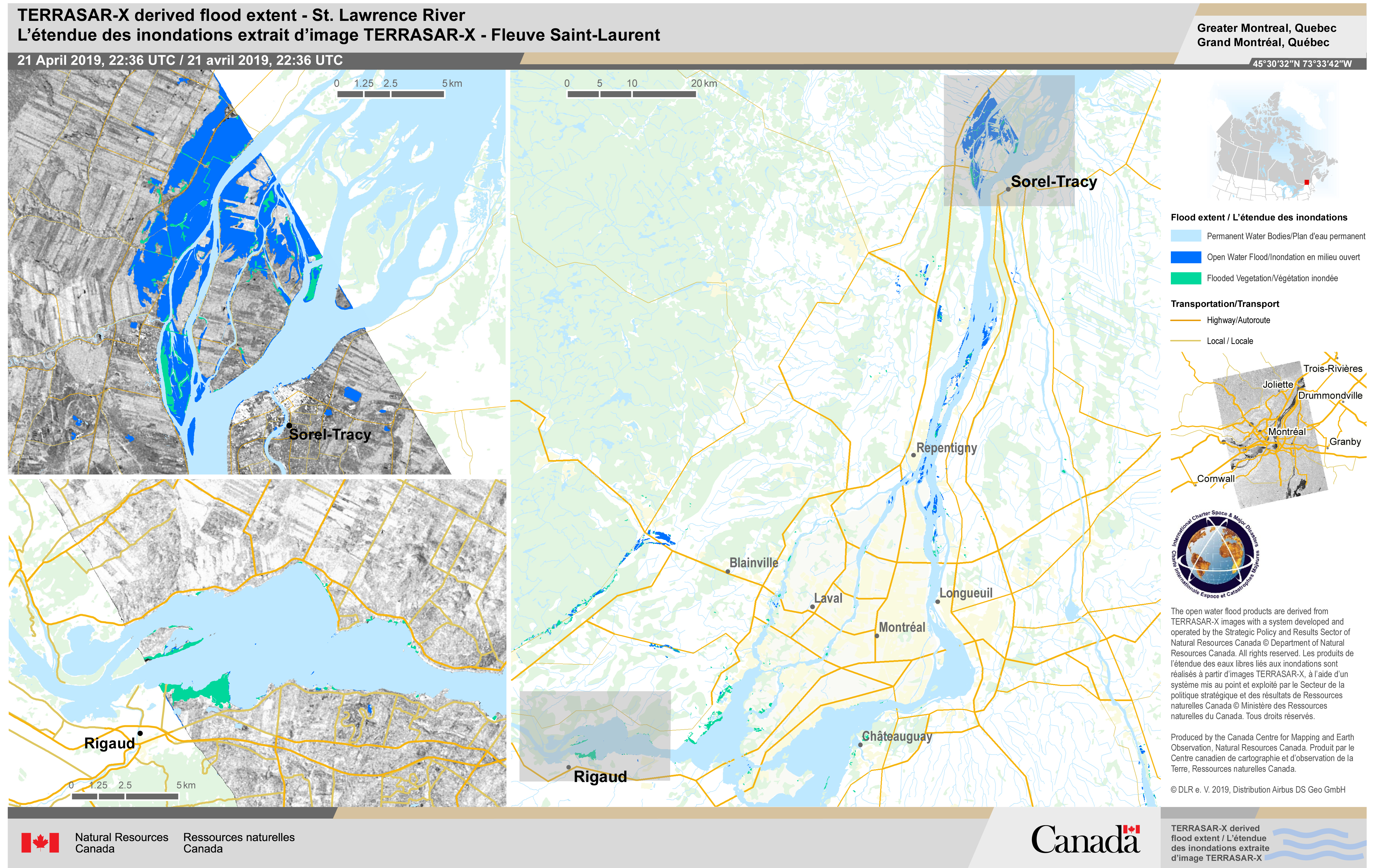
Flooding extent, St. Lawrence River, Canada
Авторские права: RADARSAT-2 Data and Products © Maxar Technologies Ltd. (2019) - All Rights Reserved. RADARSAT is an official trademark of the Canadian Space Agency.
Map produced by Canada Centre for Mapping and Earth Observation
Information about the Product
Получено: 27/04/2019
Источник: RADARSAT-2
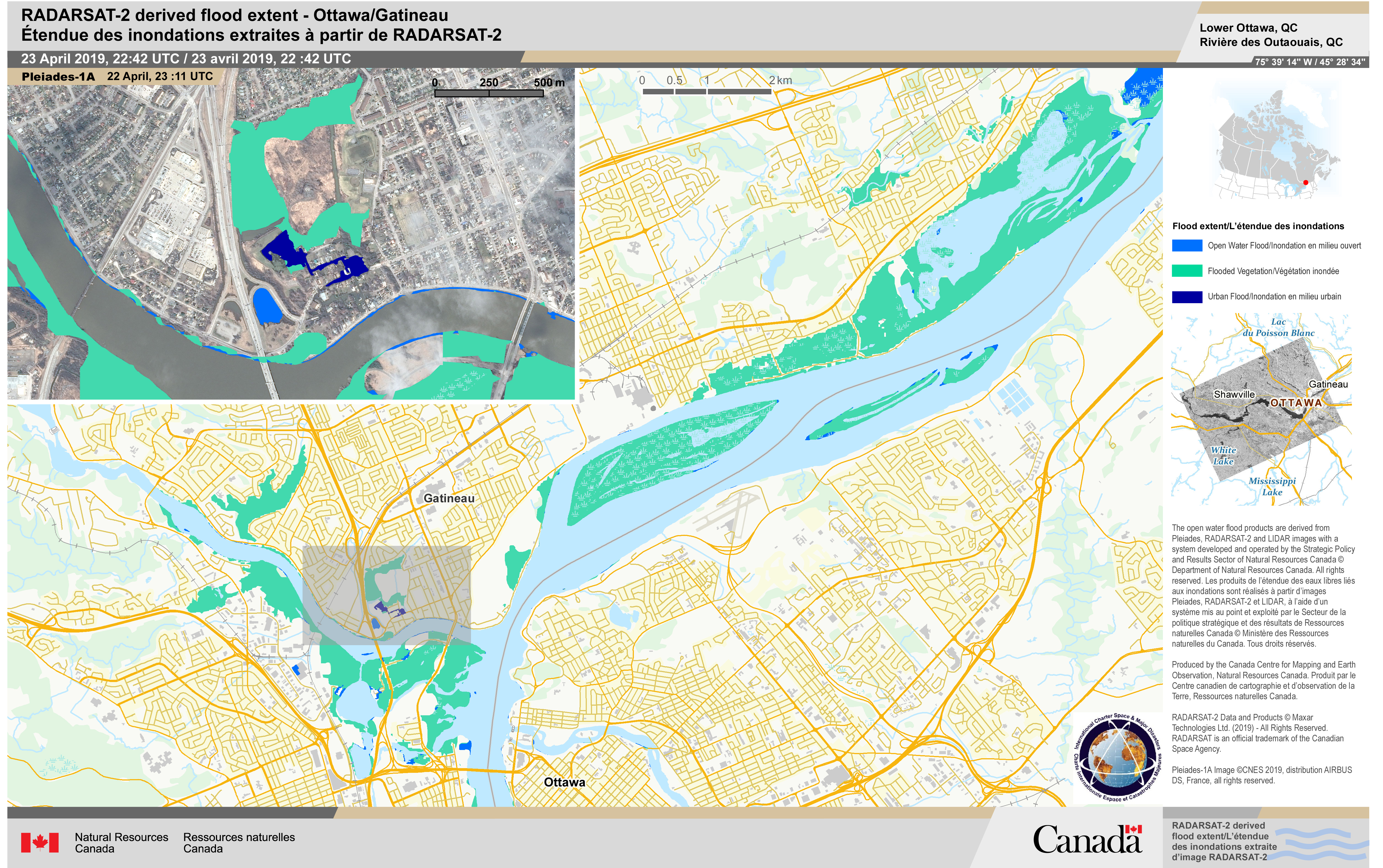
Flooding extent, Gatineau, Ottawa, Canada
Авторские права: RADARSAT-2 Data and Products © Maxar Technologies Ltd. (2019) - All Rights Reserved. RADARSAT is an official trademark of the Canadian Space Agency.
Pleiades ©CNES 2019,distribution AIRBUS DS, France, all rights reserved.
Map produced by Canada Centre for Mapping and Earth Observation
Information about the Product
Получено: RADARSAT-2: 23/04/2019
Pleiades: 22/04/2019
Источник: RADARSAT-2 / Pleiades
 Вернуться к полному архиву активаций

