 English
 Spanish
 French
 Chinese
 Russian
 Portuguese
 Последняя Активация
Charter activations
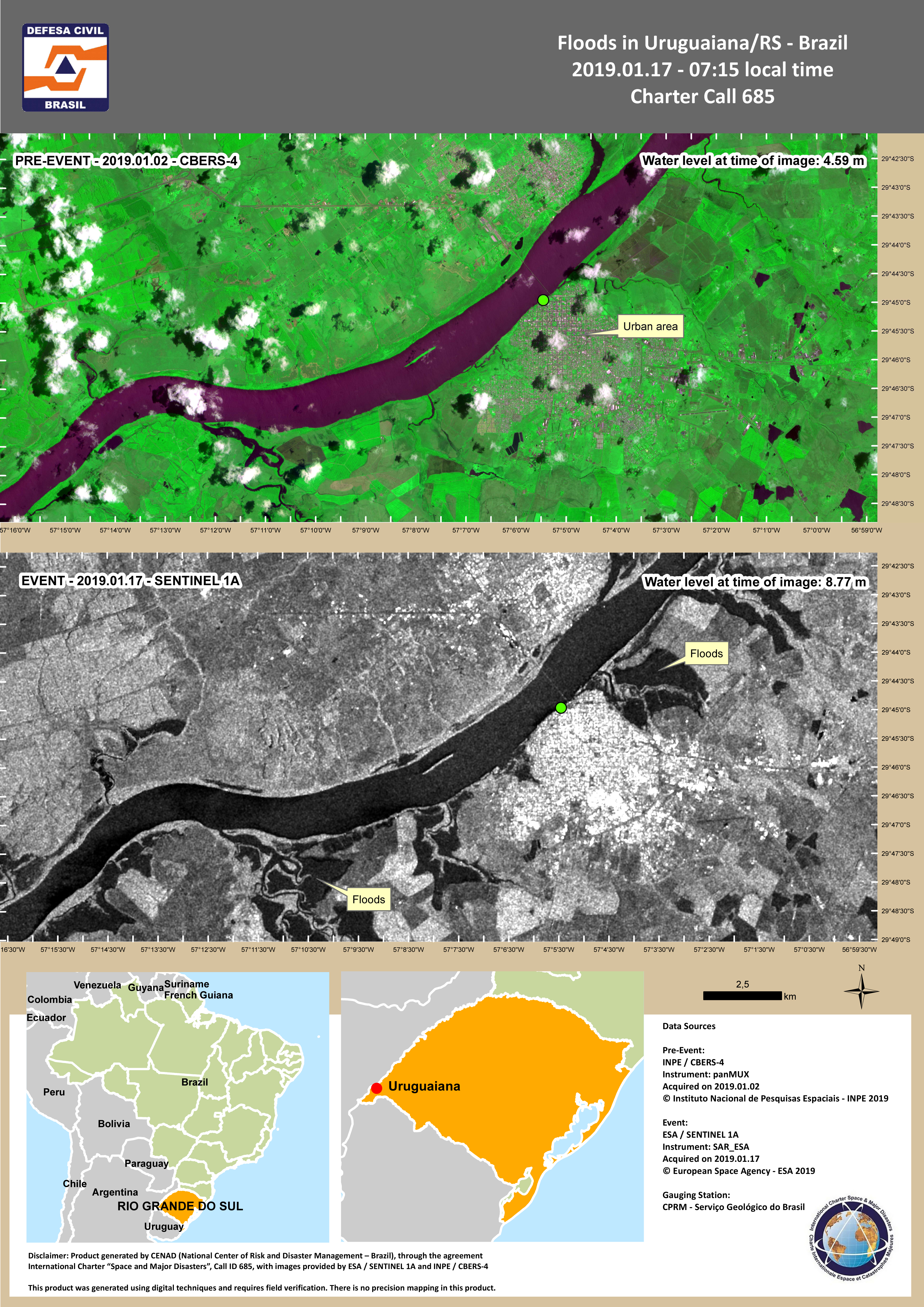
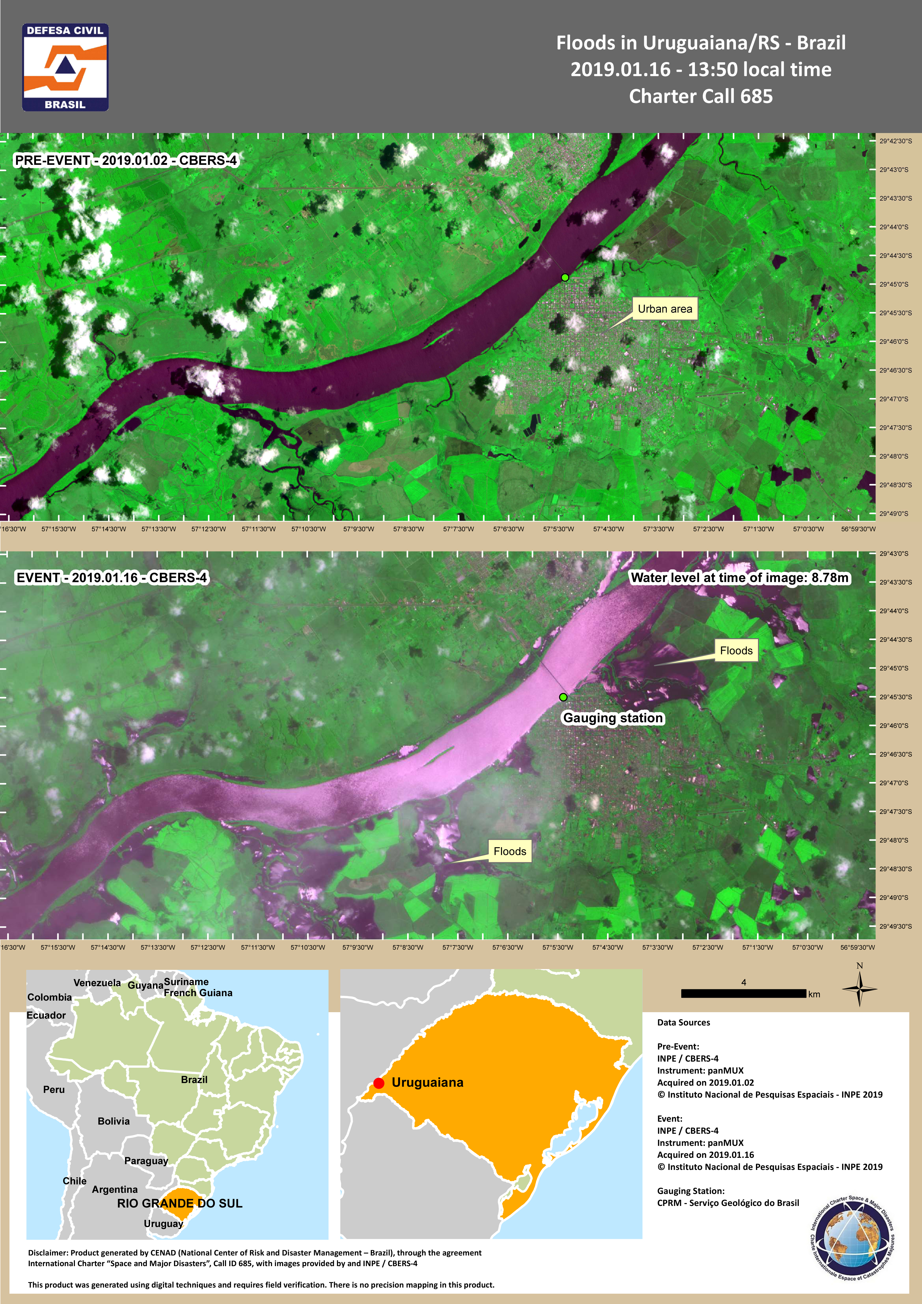
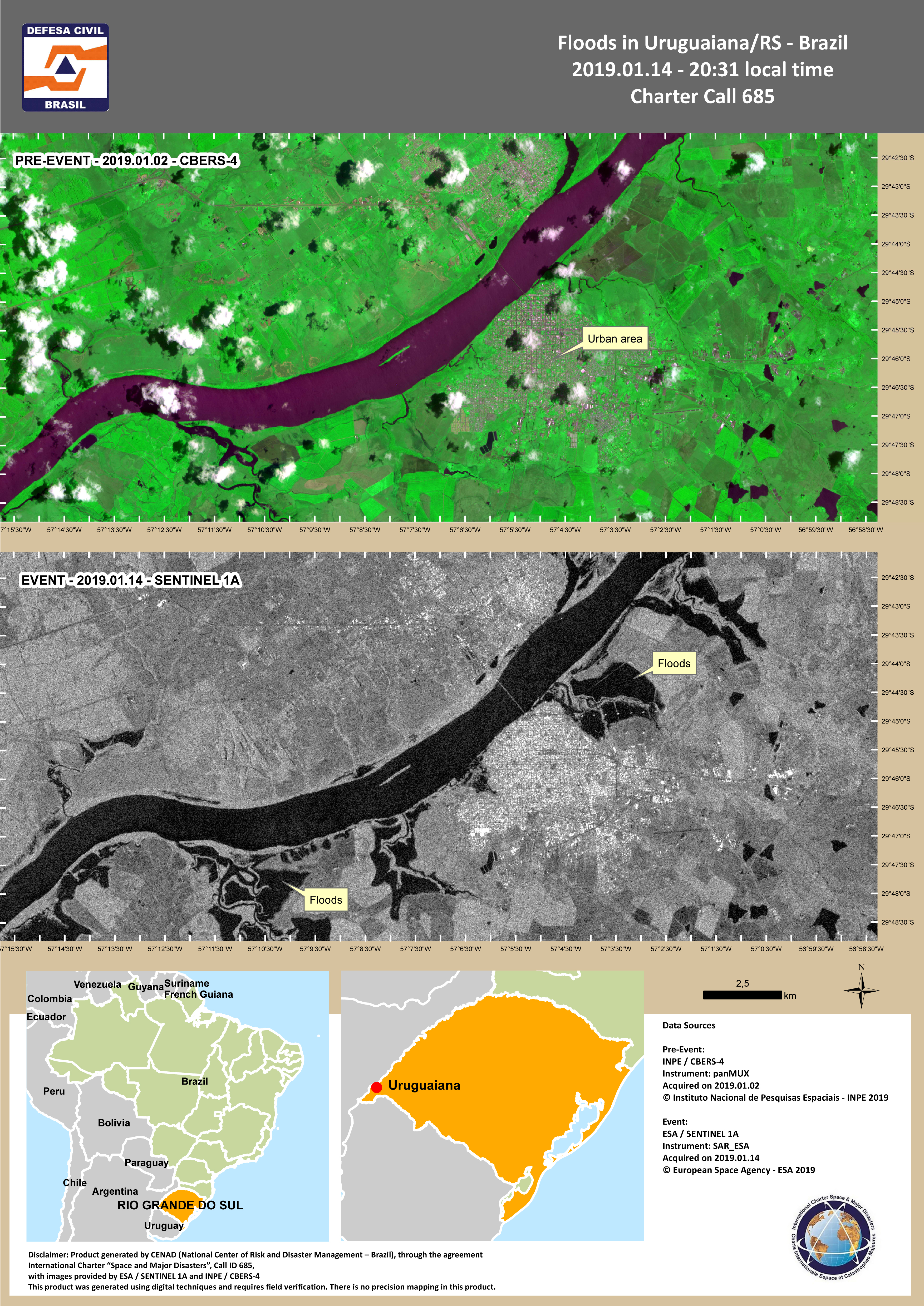
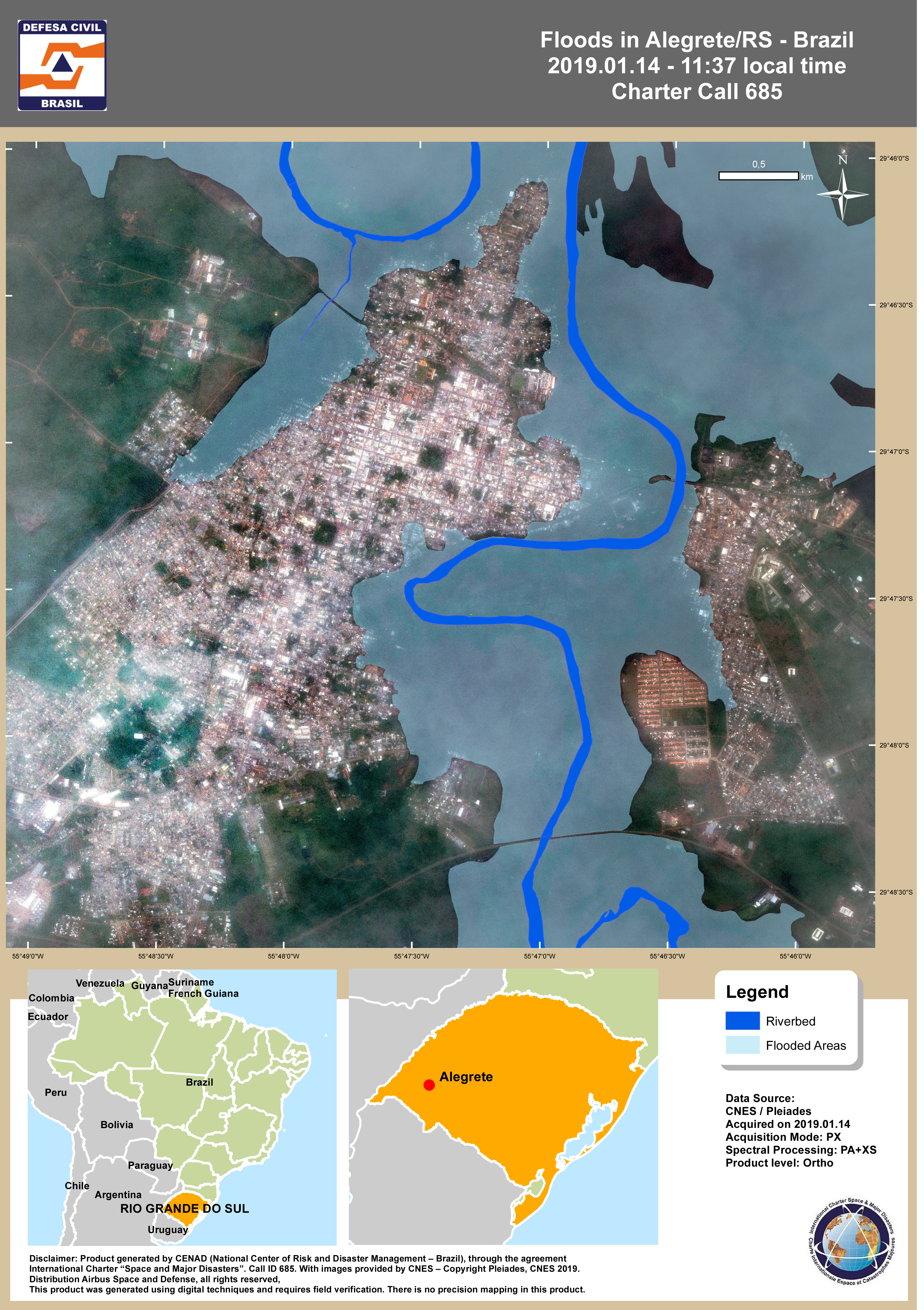
Flood in Brazil
Heavy rainfall over the western area of Rio Grande do Sul State have caused the Ibirapuita, Ibicui and Uruguai rivers to break their banks and cause widespread flooding.
MetSul Meteorologia reported 497mm of rainfall in 72 hours in the state of Uruguaiana. Strong winds have also affected the state. Local media reported one death after a tree uprooted.
Over 2000 people have been displaced and moved to temporary accomodation as the floods damaged houses, blocked roads and water supplies were disrupted.
Local reports say the flooding peak in the city of Algrete was reached on 13 January, while the areas of Manoel Viana and Uruguaiana are set to peak on 14 January.
| Тип события: | Flood |
| Место события: | Brazil |
| Date of Charter Activation: | 2019-01-13 |
| Время активации Хартии: | 19:11 |
| TЧасовой пояс в районе активации Хартии: | UTC+01:00 |
| Запрос на активацию поступил от: | National Center of Risk and Disaster Management – Brazil (CENAD) |
| Номер активации: | 595 |
| Менеждер проекта от: | Ministério da Integração Nacional |
Products
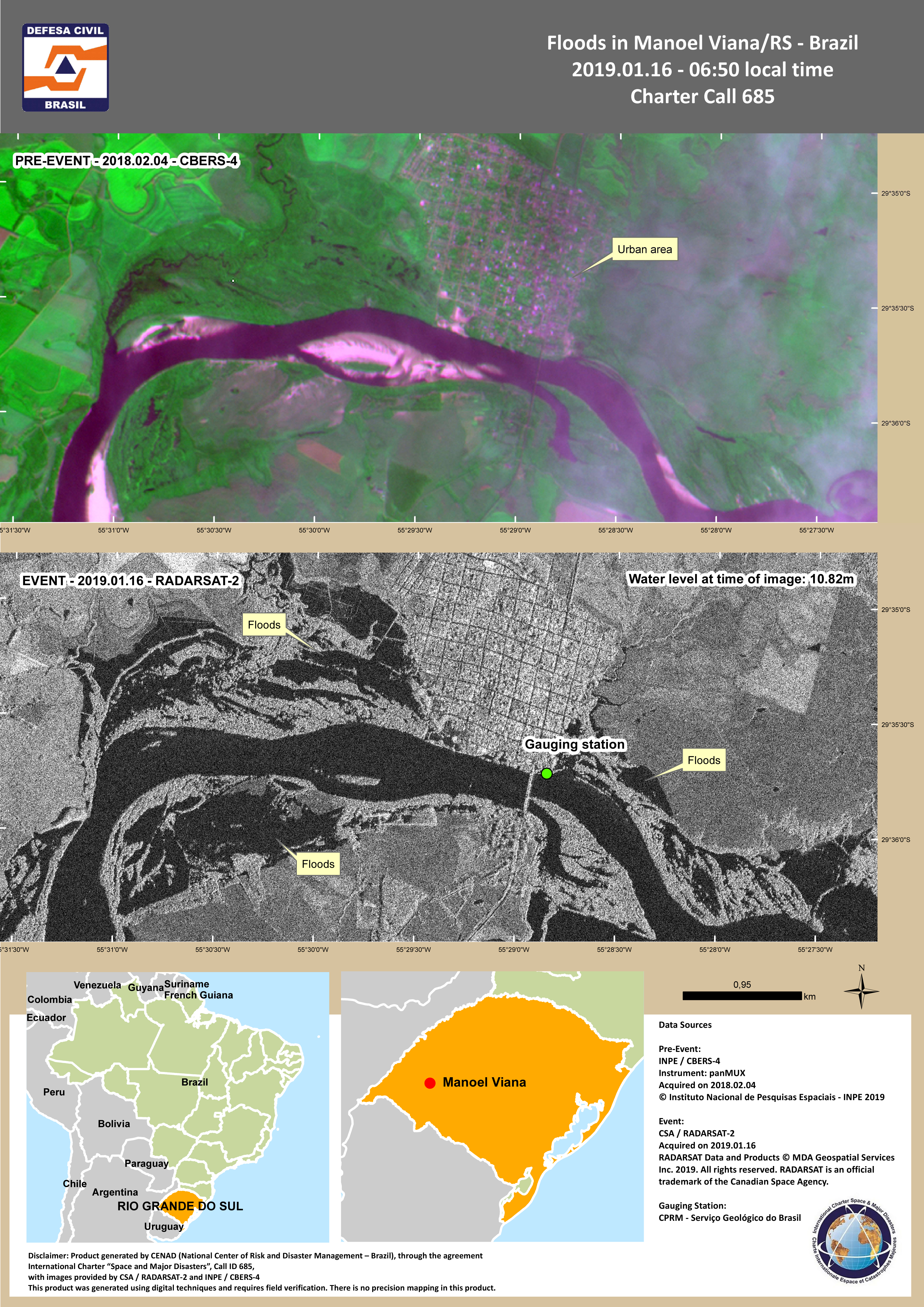
Floods in Manoel Viana, Rio Grande do Sul, Brazil
Авторские права: CBERS-4 © INPE 2019
RADARSAT-2 Data and Products © Maxar Technologies Ltd. (2019) - All Rights Reserved. RADARSAT is an official trademark of the Canadian Space Agency.
Map produced by CENAD
Information about the Product
Получено: CBERS-4: 04/02/2018
RADARSAT-2: 16/01/2019
Источник: CBERS-4 / RADARSAT-2
 Вернуться к полному архиву активаций

