 English
 Spanish
 French
 Chinese
 Russian
 Portuguese
 最新のチャータ発動
Charter activations
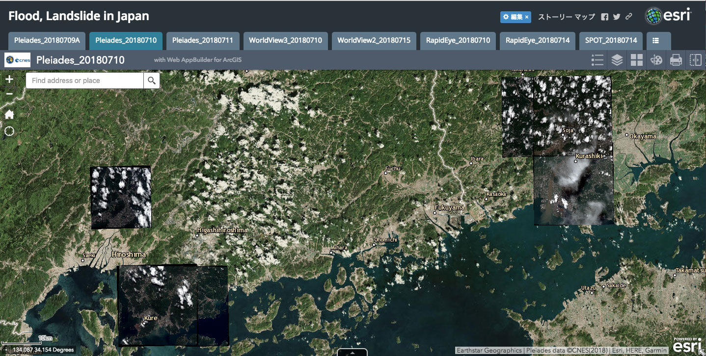
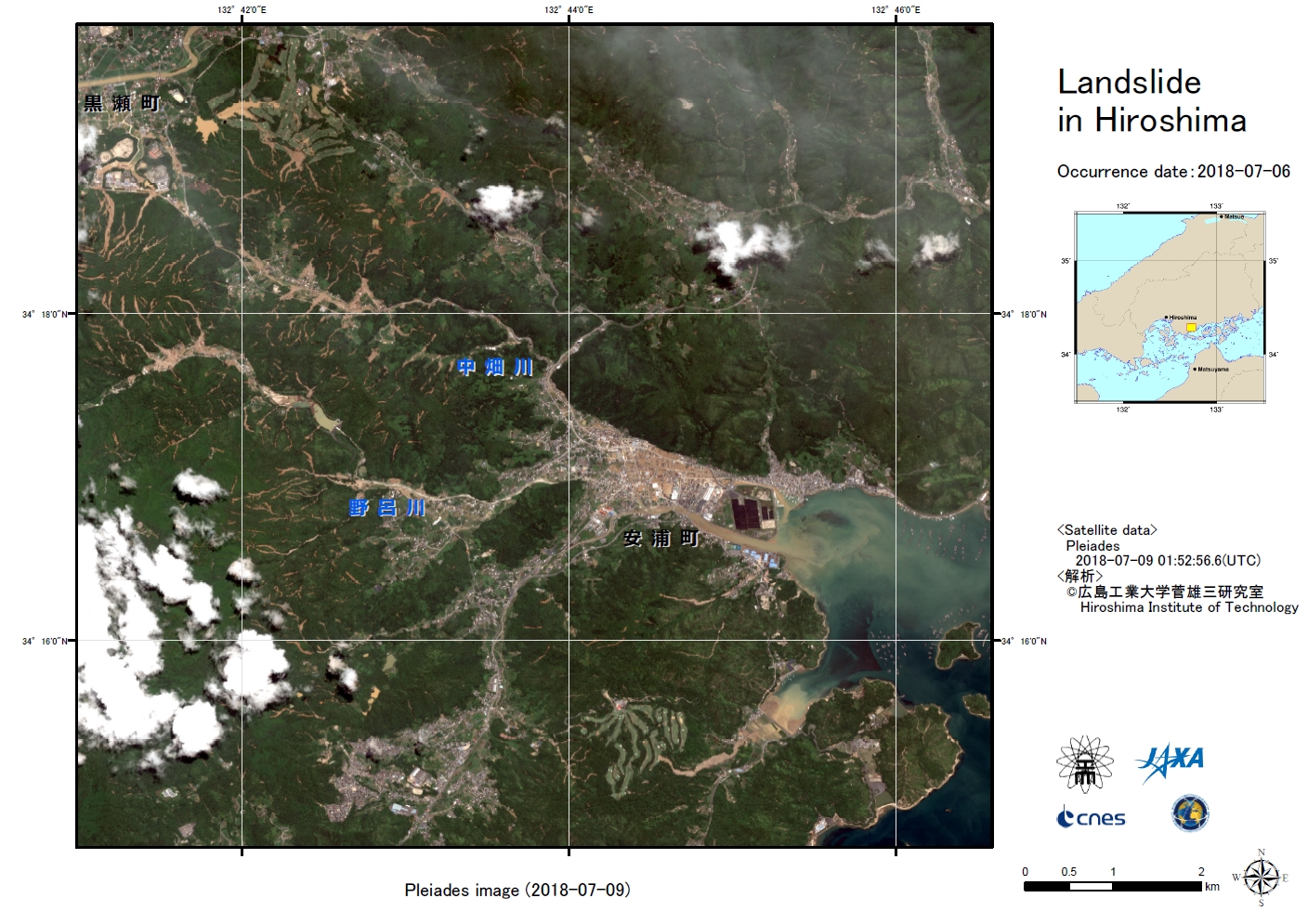
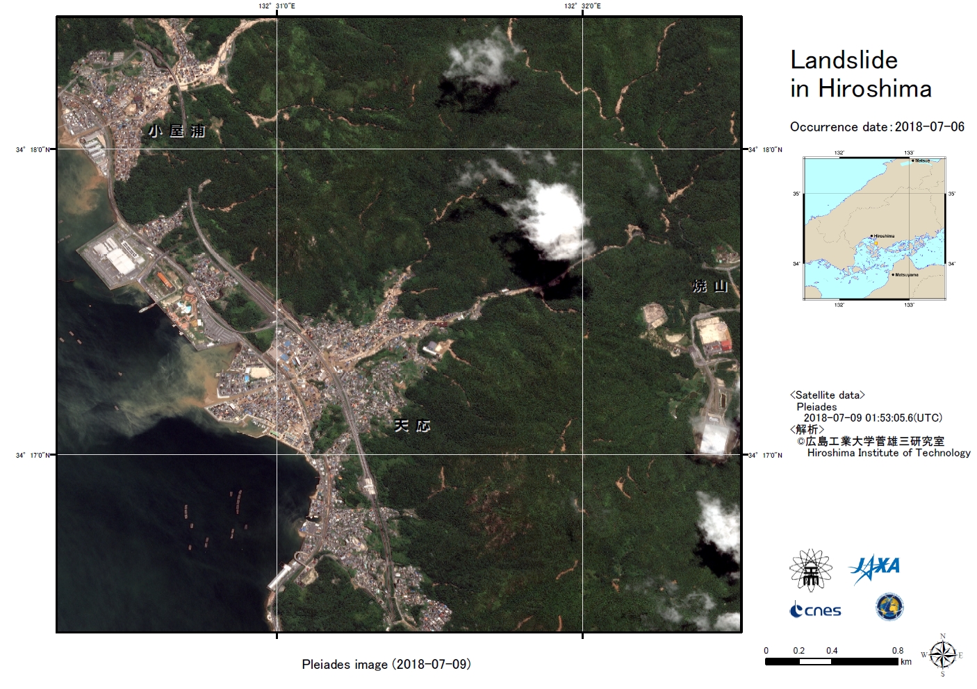
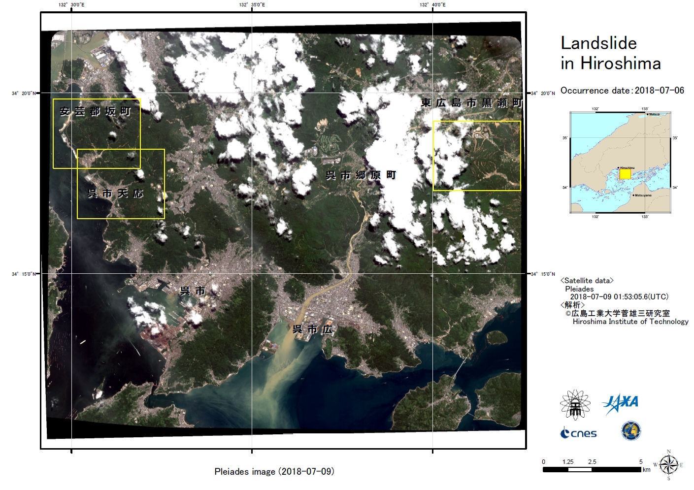
Flood in Japan
Record-breaking torrential rainfall struck the western and central parts on Japan on Thursday, 05 July 2018. The rainfall continued for several days and caused floods and landslides.
More than 100 people have died and 50 remain missing. Two million people were ordered to evacuate the area, across 23 prefectures. Thousands of houses have been damaged and the floods and landslides have left many roads flooded, restricting access to some affected areas. Due to the swiftly rising flood waters, some residents were left stranded in their homes and awaiting rescue.
Search and rescue operations began on 09 July.
Related News and Resources
This video shows the weather which brought torrential rainfall to western parts of Japan on 05 July 2018. The animation is created with images taken every 10 minutes from 01 to 08 of July by Himawari-8.
| Type of Event: | Flood |
| Location of Event: | Japan |
| Date of Charter Activation: | 2018-07-07 |
| Time of Charter Activation: | 07:06 |
| Time zone of Charter Activation: | UTC+03:00 |
| Charter Requestor: | Cabinet office Goverment of Japan on behalf of Cabinet office Goverment of Japan |
| Activation ID: | 577 |
| Project Management: | JAXA |
Products


Flood detection in Mabi, Kurashiki, Japan
Copyright: ALOS-2: © JAXA (2018)
Pleiades: Pleiades © CNES (2018) - Distribution: Airbus Defence and Space, all rights reserved
Map produced by Yamaguchi University
Information about the Product
Acquired: ALOS-2: 14/04/2018 & 07/07/2018
Pleiades: 09/07/2018
Source: ALOS-2 / Pleiades


 Back to the full activation archive

