Charter activations
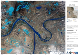
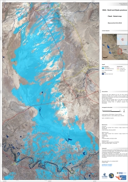
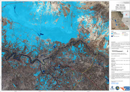
Flood in Iraq
Torrential rains have affected Iraq over two days causing widespread flooding that has killed at least 21 people and displaced tens of thousands, with Nineveh and Salahaddin being the most affected regions.
Iraq's health ministry reported the 21 deaths were caused by flooding, car accidents and collapsing buildings, a further 180 people have also been injured. The UN also reported that 15,000 people in Nineveh were in desperate need of aid and were living in temporary camps.
In Mosul the storms caused the rivers to submerge floating bridges along the Tigris river, and in Baghdad whole houses were submerged in flash flooding.
Damage assessments are ongoing with relief workers, security forces and local authorities coordinating relief responses.
| Type of Event: | Flood |
| Location of Event: | Iraq |
| Date of Charter Activation: | 2018-11-25 |
| Time of Charter Activation: | 20:05 |
| Time zone of Charter Activation: | UTC+03:00 |
| Charter Requestor: | Disaster Information Management Centre / Ministry of Science and Technology |
| Activation ID: | 592 |
| Project Management: | ZKI / DLR |
Products
 Back to the full activation archive

 English
 Spanish
 French
 Chinese
 Russian
 Portuguese


