 English
 Spanish
 French
 Chinese
 Russian
 Portuguese
 最新のチャータ発動
Charter activations
Fire in Greece
Wildfires which have been spread by strong winds have struck the Attica region in Greece. The fires have killed at least 80 people and dozens more are missing.
Fifteen fires began on 23 July, in what has been described as the worst fire disaster in Greek record. 1500 homes have been damaged or destroyed.
The worst affected area is nearby Athens, where the villages of Mati, Kokkino Limanaki and Neos Voutzas have reportedly been badly damaged as the fires - spread by winds reaching 120 kilometres per hour - swept the flames through the region, leaving people with little time to escape.
Firefighters working with the armed forces are working to render aid to affected residents and contain the remaining active fires.
Related News and Resources
- Products published by Copernicus EMS (Copernicus)
- Forest Fires Situation Update: Daily Map of 26 July (ERCC)
- Athens, Greece Surrounded by Two Huge, Deadly Wildfires (NASA)
- Greece Wildfires: Satellite images show extent of the damage (EuroNews)
- Devastating wildfires near Athens (EUMETSAT)
- Deadly Wildfires in Greece (NOAA)
- Devastation in Mati captured by Pléiades (Airbus DS)
| Type of Event: | Fires |
| Location of Event: | Greece |
| Date of Charter Activation: | 2018-07-24 |
| Time of Charter Activation: | 16:33 |
| Time zone of Charter Activation: | UTC+02:00 |
| Charter Requestor: | General Secretariat for Civil Protection on behalf of Hellenic Space Agency |
| Activation ID: | 579 |
| Project Management: | ESA |
Products
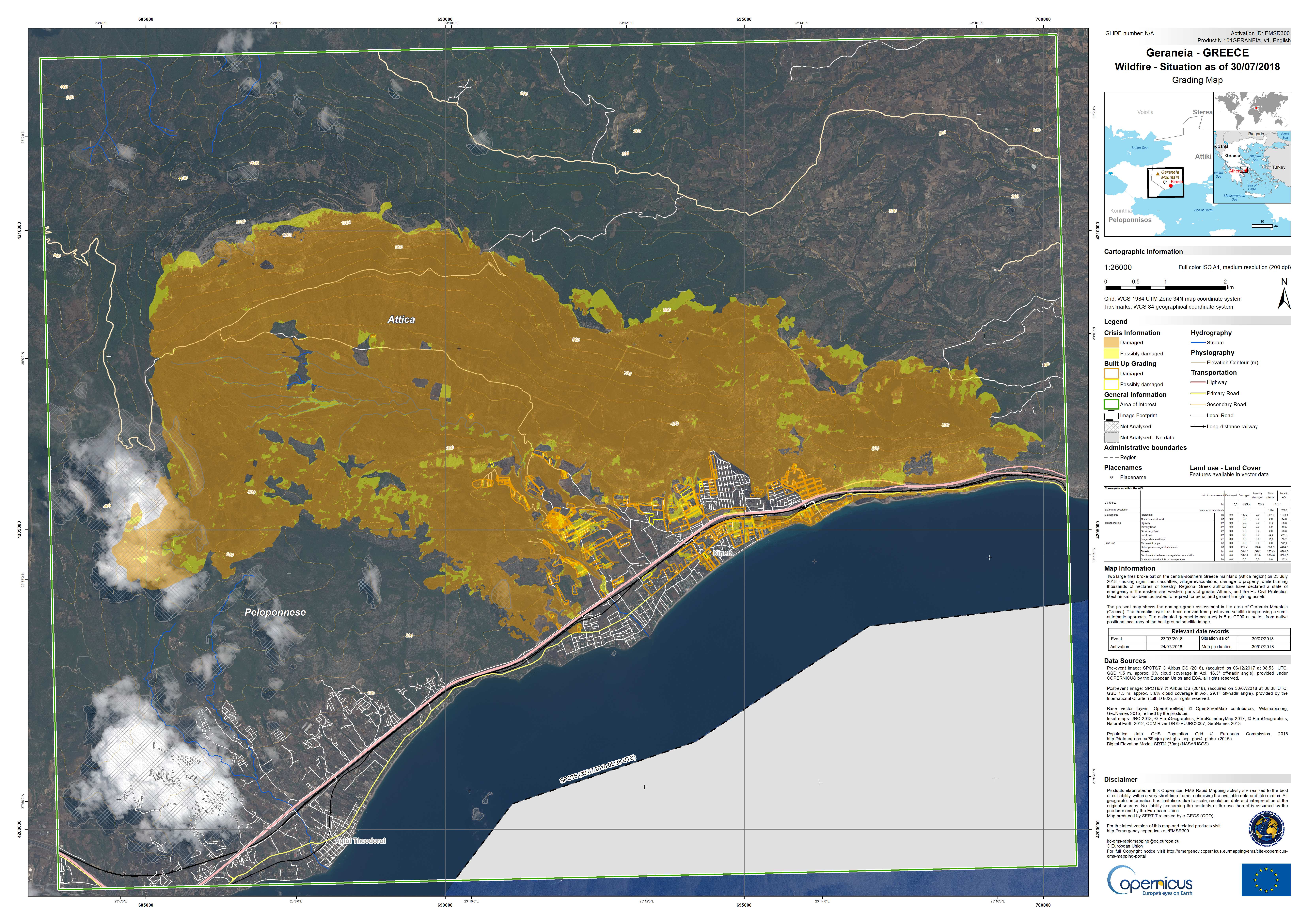
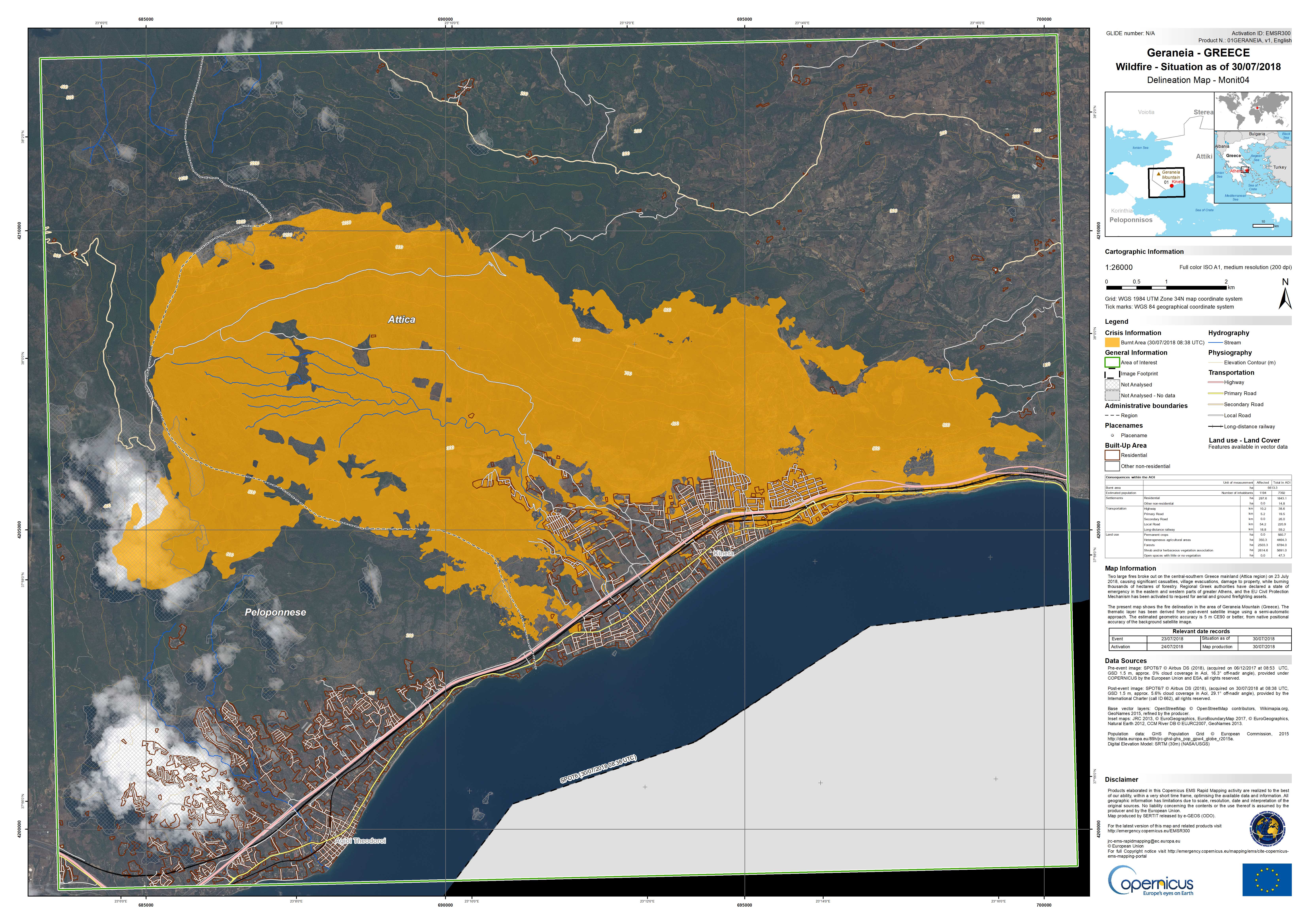
Wildfire delineation map of Geraneia, Greece
Copyright: SPOT-6 and 7 © Airbus DS (2018)
Pleiades © CNES (2018), Distribution: Airbus DS
Copernicus Contributing Mission data.
Map produced by the Copernicus Emergency Management Service
Information about the Product
Acquired: SPOT-6/7: 06/12/2017
Pleiades: 29/07/2018
Source: SPOT-6 and -7 / Pleiades
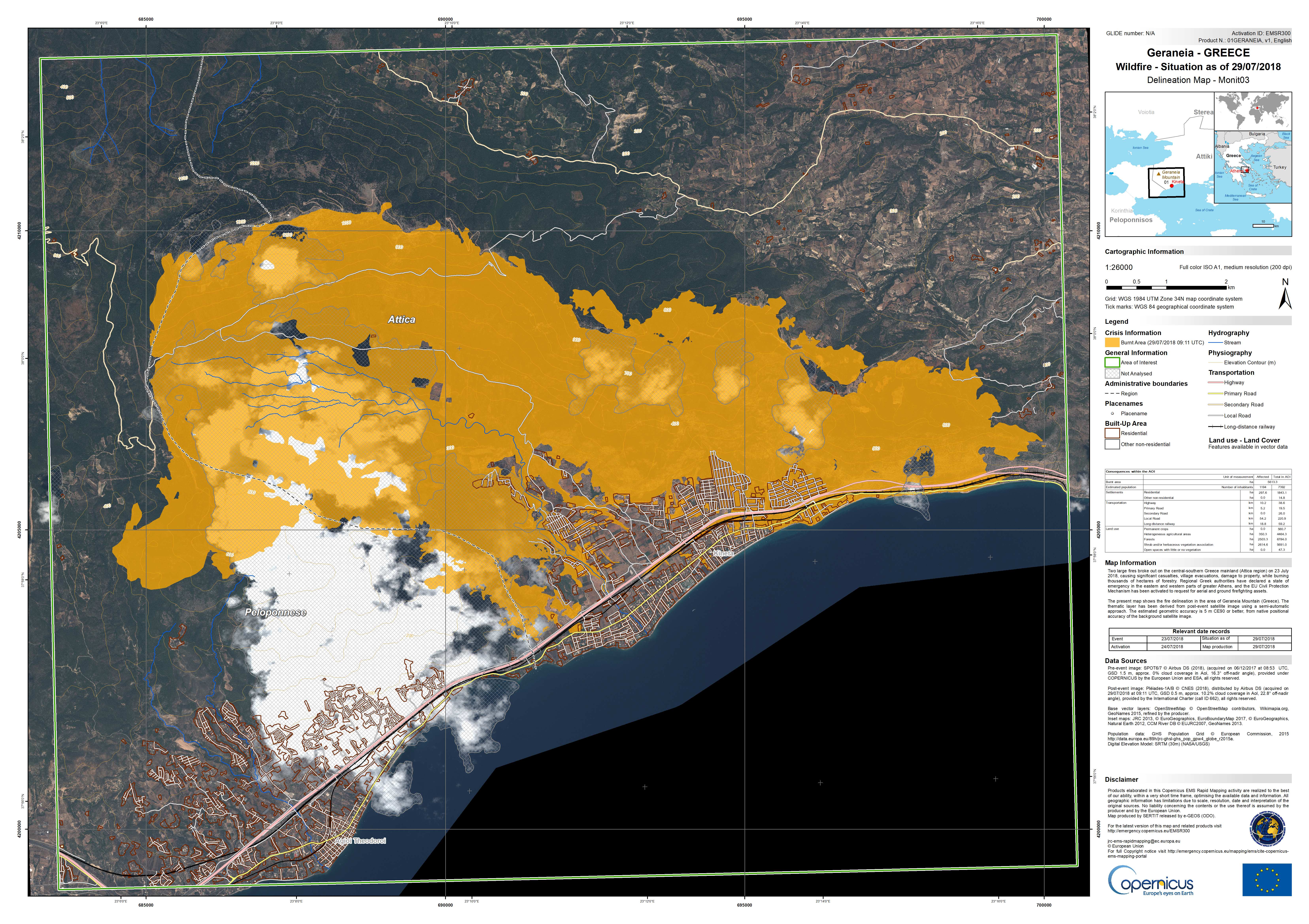
Wildfire delineation map of Geraneia, Greece
Copyright: SPOT-6 and 7 © Airbus DS (2018)
Pleiades © CNES (2018), Distribution: Airbus DS
Copernicus Contributing Mission data.
Map produced by the Copernicus Emergency Management Service
Information about the Product
Acquired: SPOT-6/7: 06/12/2017
Pleiades: 27/07/2018
Source: SPOT-6 and -7 / Pleiades
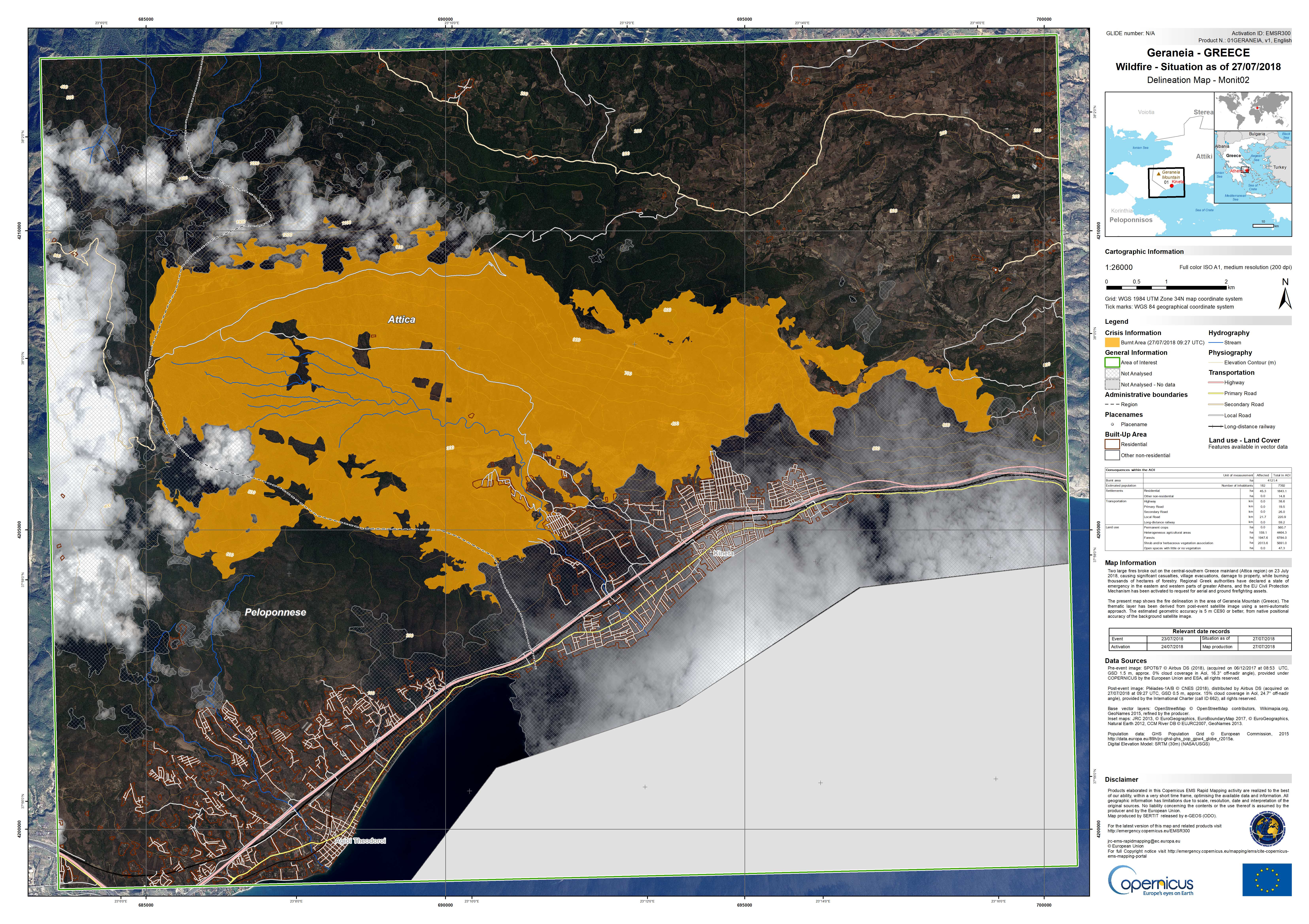
Wildfire delineation map of Geraneia, Greece
Copyright: SPOT-6 and 7 © Airbus DS (2018)
UK-DMC2 © DMCii 2018, distribution DMCii, all rights reserved
Copernicus Contributing Mission data. Map produced by the Copernicus Emergency Management Service.
Information about the Product
Acquired: SPOT-6 and -7: 06/12/2017 and 25/07/2018
UK-DMC2: 25/07/2018
Source: SPOT-6 and -7 / UK-DMC2

 Back to the full activation archive

