 English
 Spanish
 French
 Chinese
 Russian
 Portuguese
 最新のチャータ発動
Charter activations
イラクの地震
11月12日の18:18にマグニチュード7.3の地震がイラク北部国境付近を襲いました。
震源地はイランに隣接するケルマンシャー州でしたが、国境に限りなく近い、イラクのクルディスタン地域に衝撃を与えました。
クルディスタンで9名が死亡したと見積もられており、ダーバンディカーン市が特に影響を受けました。
数百人以上の人々が怪我をしたと報告されました。
大部分が山岳地域であるため、地すべりにより救援活動は崩壊しております。
リチャードスケールにおいてマグニチュード7.3は最上位であり、比べることが出来ない程の被害をもたらした地震が分類されております。アメリカ地質調査所によれば、地震は25kmと浅い箇所で発生しました。
| Type of Event: | 地震 |
| Location of Event: | イラク |
| Date of Charter Activation: | 2017年11月12日 |
| Time of Charter Activation: | 23:41 |
| Time zone of Charter Activation: | UTC+05:30 |
| Charter Requestor: | UNOCHAに代わってUNITAR/UNOSAT |
| Activation ID: | 558 |
| Project Management: | UNITAR/UNOSAT |
Products

Damage assessment in Darbandikhan city and dam, Sulaymaniyah province
Copyright: Pleiades © CNES (2017) - Distribution: Airbus Defence and Space, all rights reserved
Map produced by UNITAR / UNOSAT
Information about the Product
Acquired: 15/11/2017
Source: Plediades
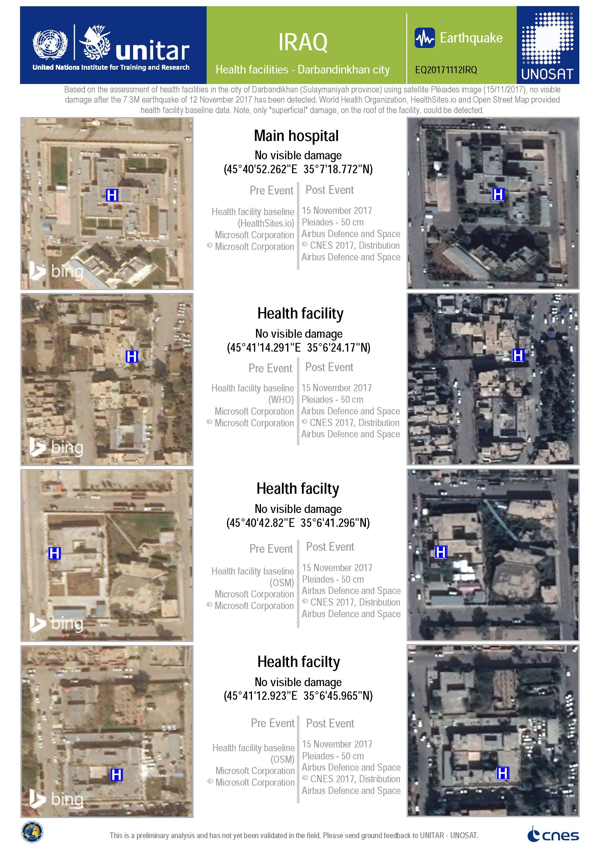
Damage assessment of health facilities in Darbandikhan city
Copyright: Pleiades © CNES (2017) - Distribution: Airbus Defence and Space, all rights reserved
Map produced by UNITAR / UNOSAT
Information about the Product
Acquired: 15/11/2017
Source: Pleiades
 Back to the full activation archive

