Charter activations
Typhoon Mangkhut in Philippines
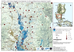
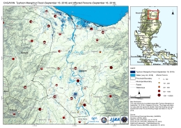
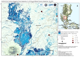
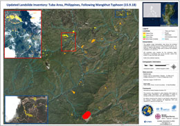
Typhoon Mangkhut hit the northern coast of Luzon in the Philippines on 15 September, bringing winds of up to 180mph making it one of the strongest storms in decades. The rainfall also triggered a number of landslides across the region, in particular the mining town of Itogon.
At least 60 people have been killed across Luzon, mostly by landslides, with the majority of the deaths occurring in the Benguet province. A group of goldminers in the village of Ucab sheltered in a building that was crushed by landslides with 29 people still missing.
The storm has also damaged forests, taken out electricity supplies and caused widespread damage to farmland in Cagayan. The high winds also churned rough seas as it moved across Luzon, producing 30 foot high waves.
Mass evacuations, restricted travel and school closures have helped to manage the situation across the Philippines with the army on standby to assist relief efforts.
Mangkhut moved across the Phillippines and on 16 September was making its way to southeastern China.
Related News and Resources
| Type of Event: | Ocean Storm, Typhoon and Landslide |
| Location of Event: | Philippines |
| Date of Charter Activation: | 2018-09-18 |
| Time of Charter Activation: | 21:26 |
| Time zone of Charter Activation: | UTC+02:00 |
| Charter Requestor: | ADRC/Sentinel Asia on behalf of Manila observatory / UNITAR - UNOSAT on behalf of UNOCHA ROAP |
| Activation ID: | 586 |
| Project Management: | Philippine Institute of Volcanology and Seismology (PHIVOLCS) - DOST |
Products
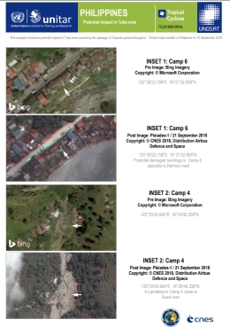
Potential impact in Tuba area, Philippines
View the full report
Copyright: Pleiades © CNES (2018), Distribution: Airbus DS Map produced by UNITAR/UNOSAT
Information about the Product
Acquired: 21/09/2018
Source: Pleiades

Potentially affected settlements in the Tuba area of the Philippines, following Typhoon Mangkhut
Copyright: Pleiades © CNES (2018), Distribution: Airbus DS
Map produced by UNITAR/UNOSAT
Information about the Product
Acquired: 21/09/2018
Source: Pleiades
 Back to the full activation archive

 English
 Spanish
 French
 Chinese
 Russian
 Portuguese

