 English
 Spanish
 French
 Chinese
 Russian
 Portuguese
 Latest Activation
Charter activations
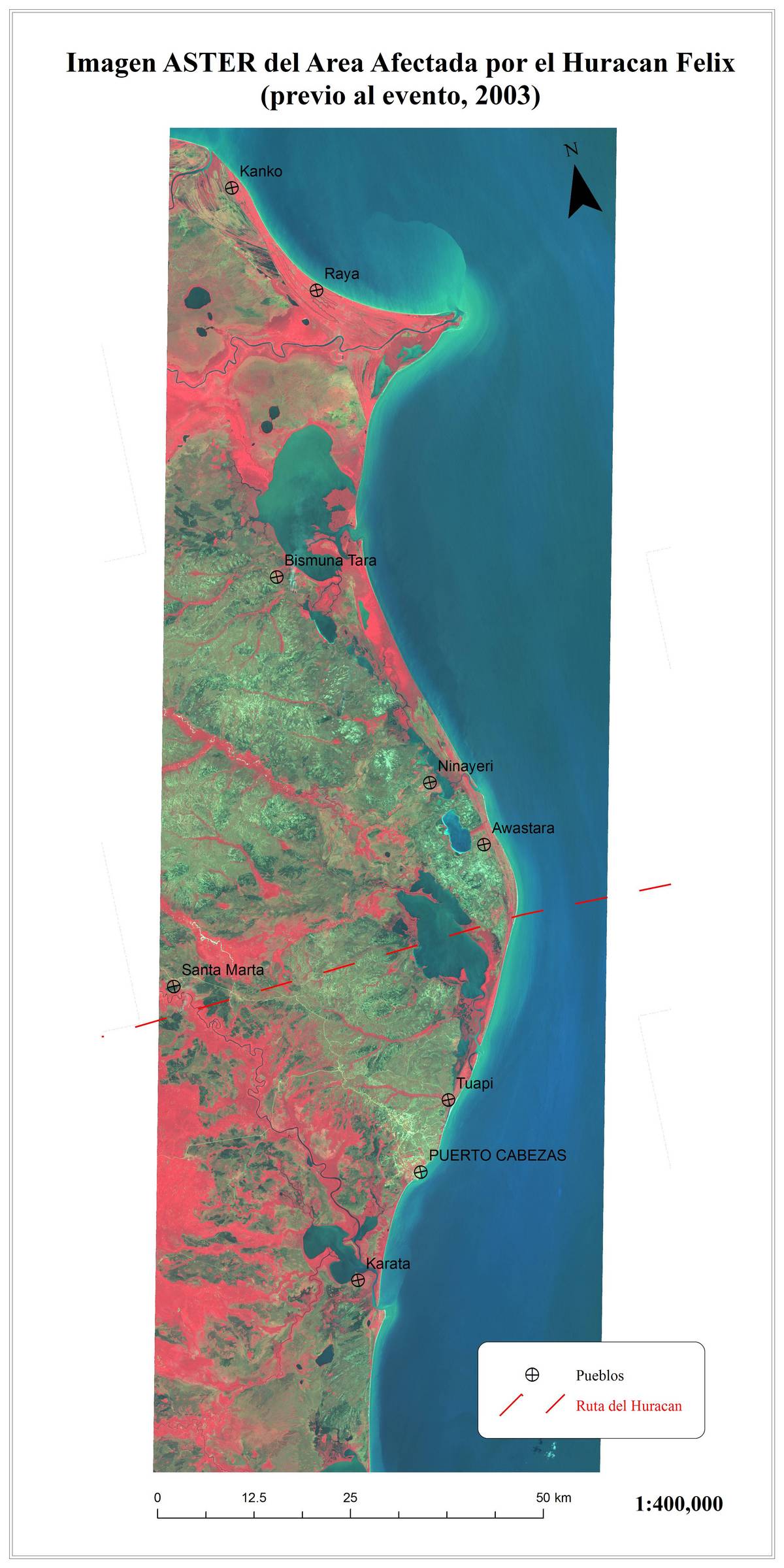
Flooding in Mexico
Since 28 October, the state of Tabasco and its capital, Villahermosa, were completely flooded due to several days of unusally heavy rainfall. The rains caused the overflow of seven rivers, affecting 17 municipalities.
By the 2nd November, media reported dozens of deaths and 1 million persons affected.
| Tipo de evento: | Flooding |
| Local do evento: | Mexico |
| Data da Ativação da Carta: | 02/11/2007 |
| Requisitante da Carta: | SIFEM for the National Center for Disaster Prevention of Mexico |
| Gerenciamento de projeto: | CATHALAC |
Products
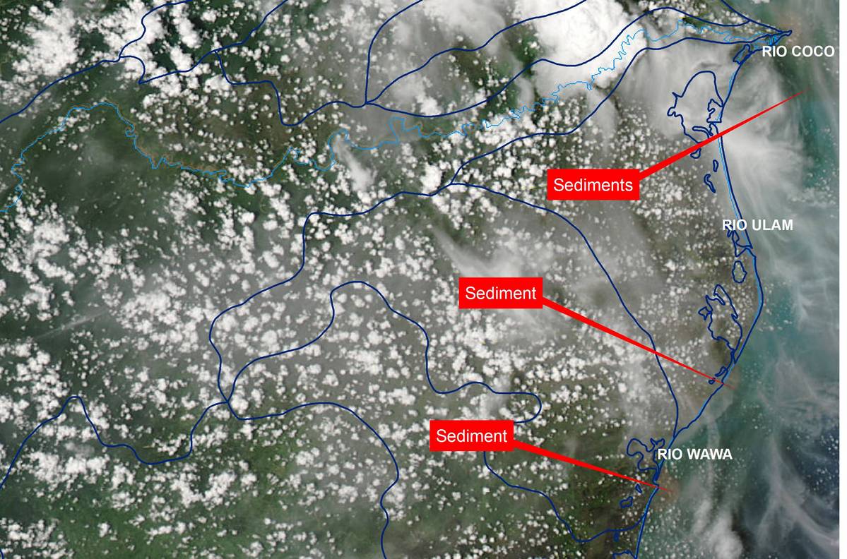
MODIS-postevent
Direitos autorais: Credit NASA 2007 Image processing, map created 10/09/2007 by CATHALAC-SERVIR.
Information about the Product
Adquirida: 09/2007 Annotated MODIS post-event image, showing large amounts of sediment left in suspension by the hurricane.
Fonte: MODIS on Terra, 250m/pixel resolution.
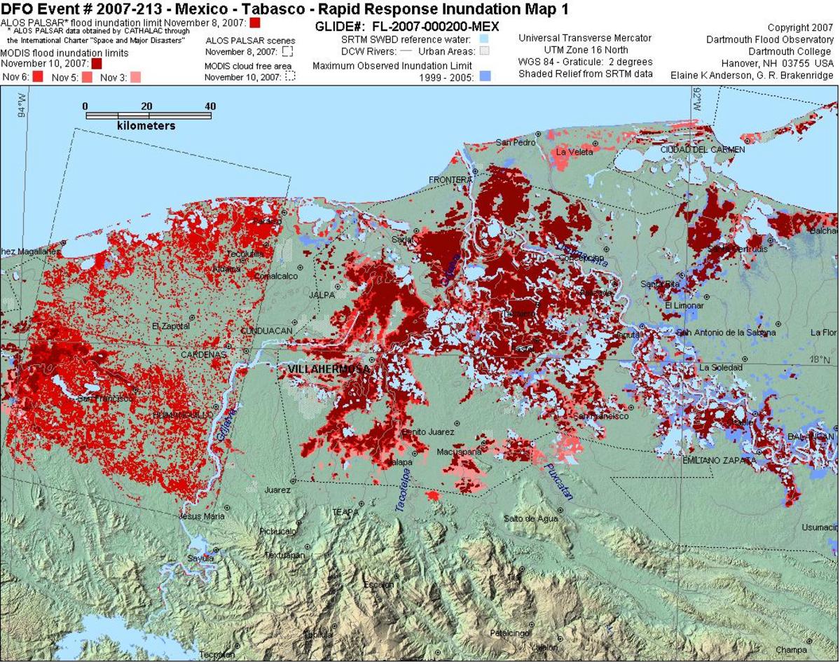
ALOS-PALSAR/MODIS, Flooded Areas, 08/11/2007-10/11/2007
Direitos autorais: Copyright JAXA 2007 Image processing, map created 11/11/2007 by CATHALAC-SERVIR
Information about the Product
Adquirida: 08/11/2007 (ALOS-PALSAR) and 08-10/11/2007 (MODIS) Flood detection using ALOS Palsar radar scenes and MODIS optical scenes, 08/11/2007 and 08-10/11/2007, over the Tabasco province of Mexico.
Fonte: ALOS Palsar; MODIS , ~20m/pixel resolution.
 Voltar ao arquivo completo da Ativação

