 English
 Spanish
 French
 Chinese
 Russian
 Portuguese
 Dernière activation
Charter activations
Cyclone Tauktae in India
India's western state of Gujarat is braced for cyclone Tauktae, reported to be the strongest storm to hit the region since 1998. it is expected to make landfall on Monday night 17/05/2021 with wind speeds of up to 160km/h (99mph).
At least six were killed and thousands evacuated in the last two days amid heavy rains accompanying the storm. The meteorological department said the storm has now intensified into an "extremely severe cyclonic storm
Officials have advised people to stay indoors - they anticipate flooded roads, damaged power lines and uprooted trees because of heavy rains and heavy winds.
Teams from the National Disaster Response Force (NDRF) have been deployed in both Gujarat and its neighbouring state Maharashtra.
| Type of Event: | Flood |
| Location of Event: | India |
| Date of Charter Activation: | 2021-05-16 |
| Time of Charter Activation: | 14:54 |
| Time zone of Charter Activation: | UTC+05:30 |
| Charter Requestor: | ISRO |
| Activation ID: | 709 |
| Project Management: | NRSC |
Products
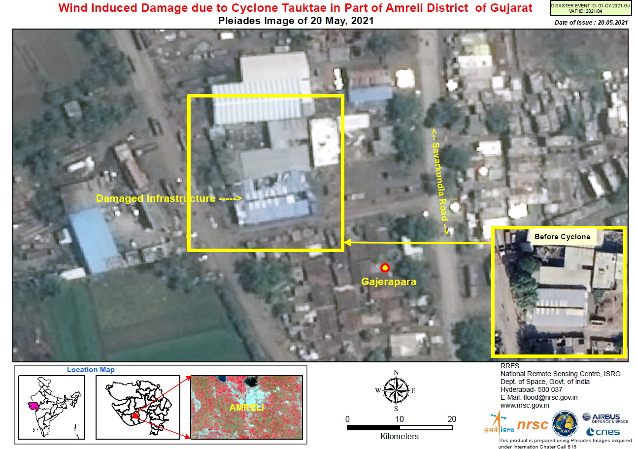
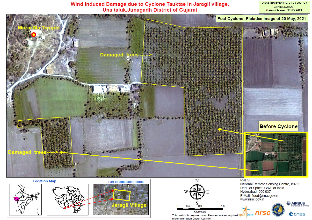
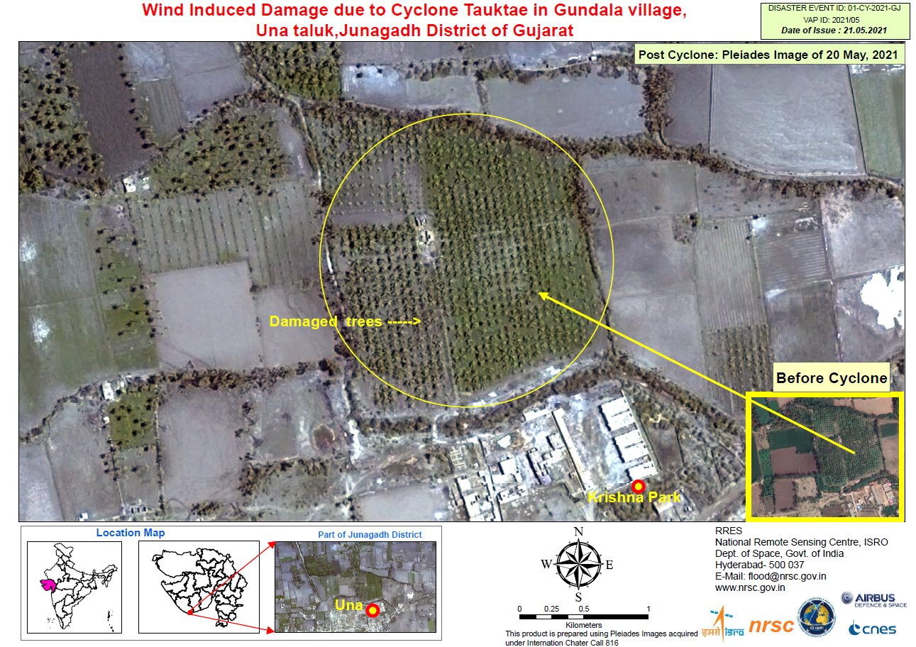

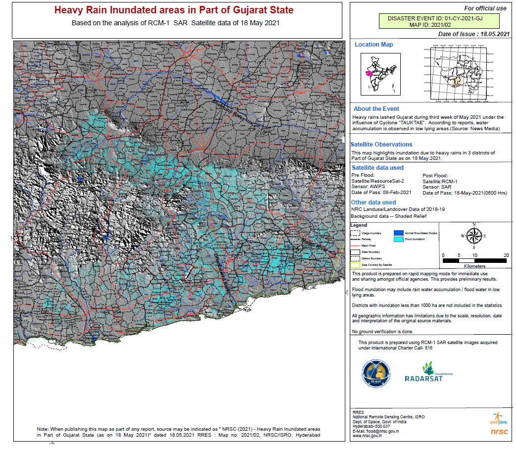
Heavy Rain Inundated Areas in Part of Junagadh District of Gujarat State
Copyright: RADARSAT Constellation Mission Imagery © Government of Canada (2021) - RADARSAT is an official mark of the Canadian Space Agency
Map produced by NRSC / ISRO
Information about the Product
Acquired: RCM-1: 18/05/2021
Source: RCM-1

 Back to the full activation archive

