Minimiser Dernière activation

Charter activations

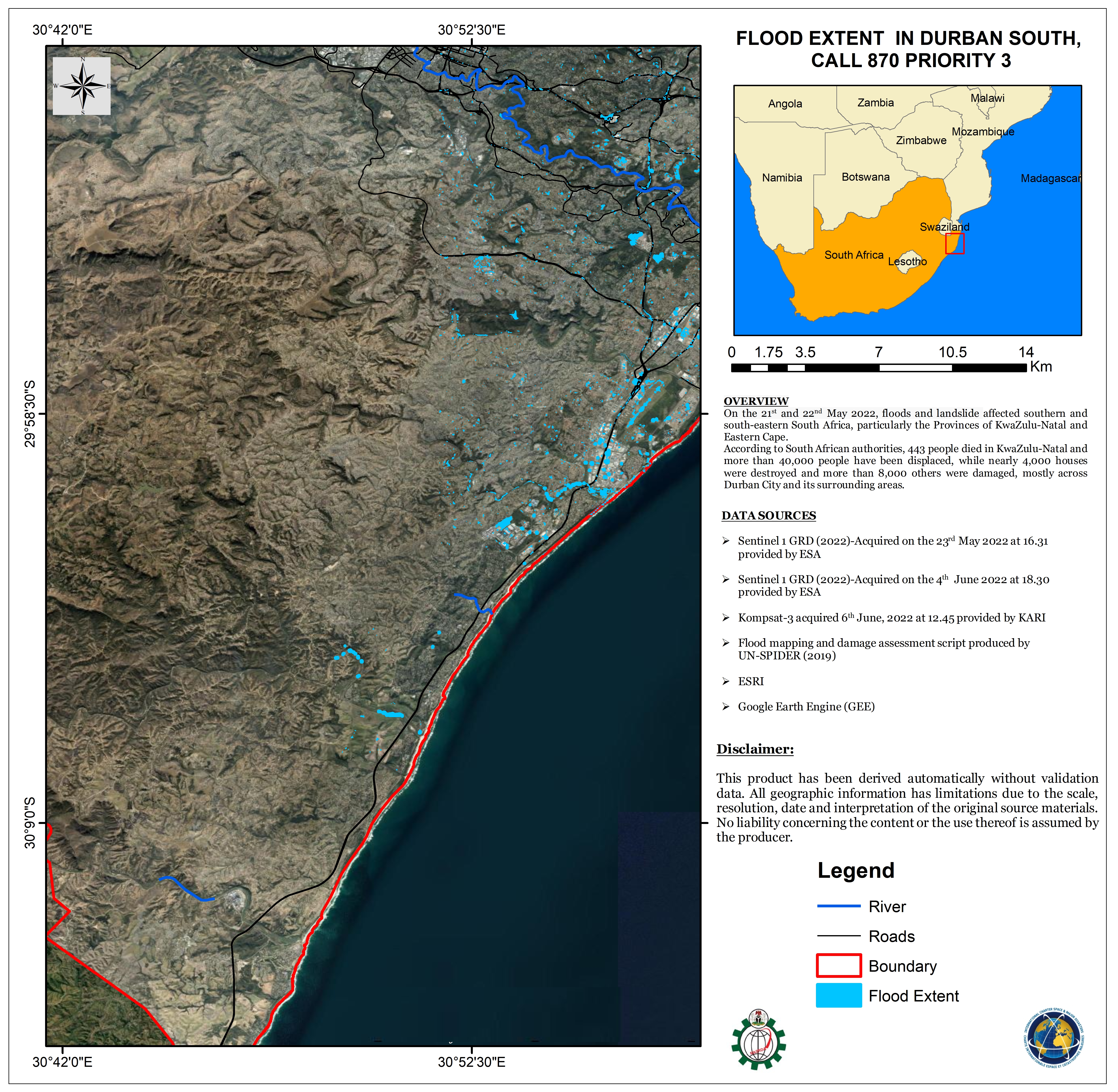
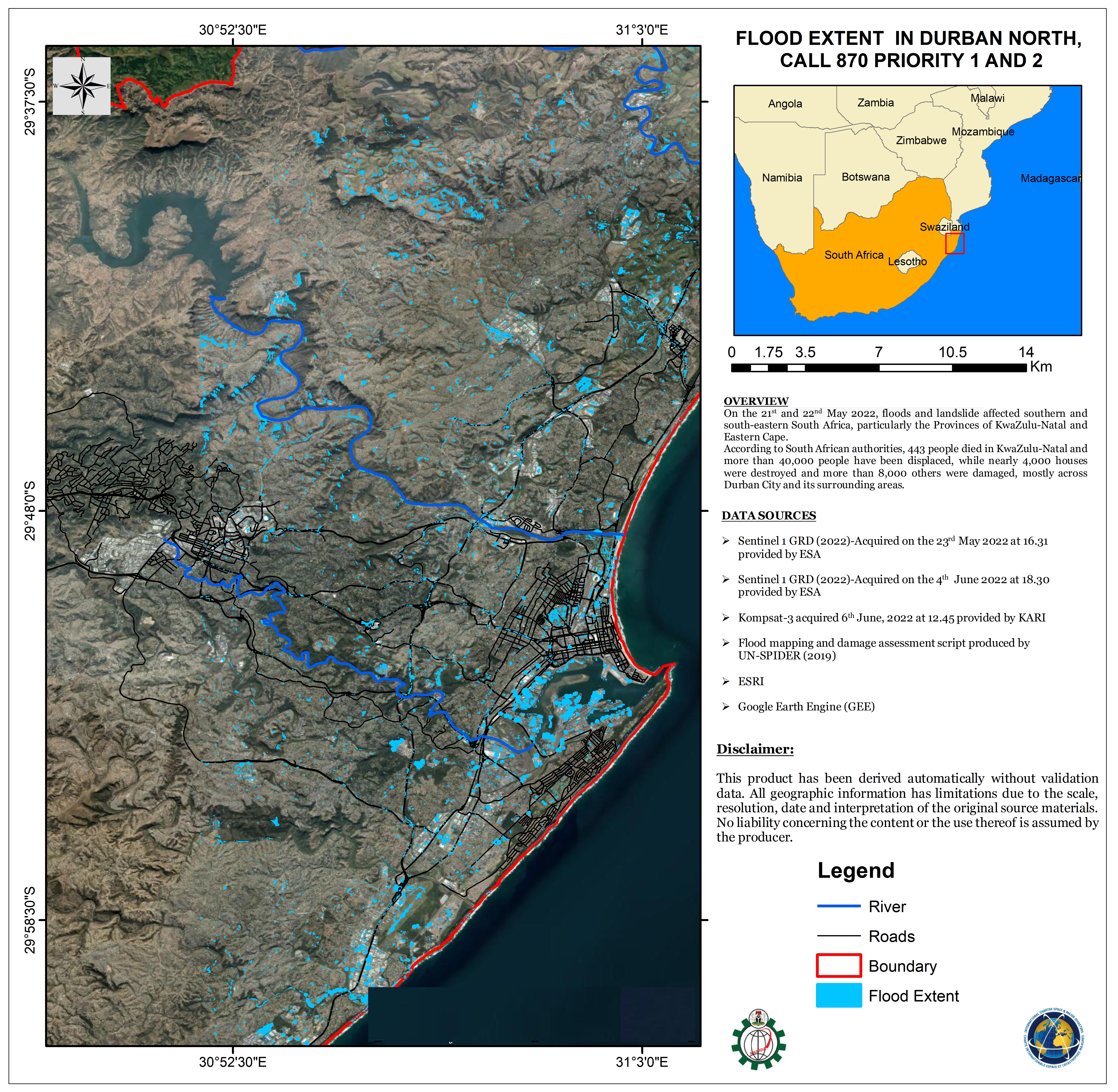
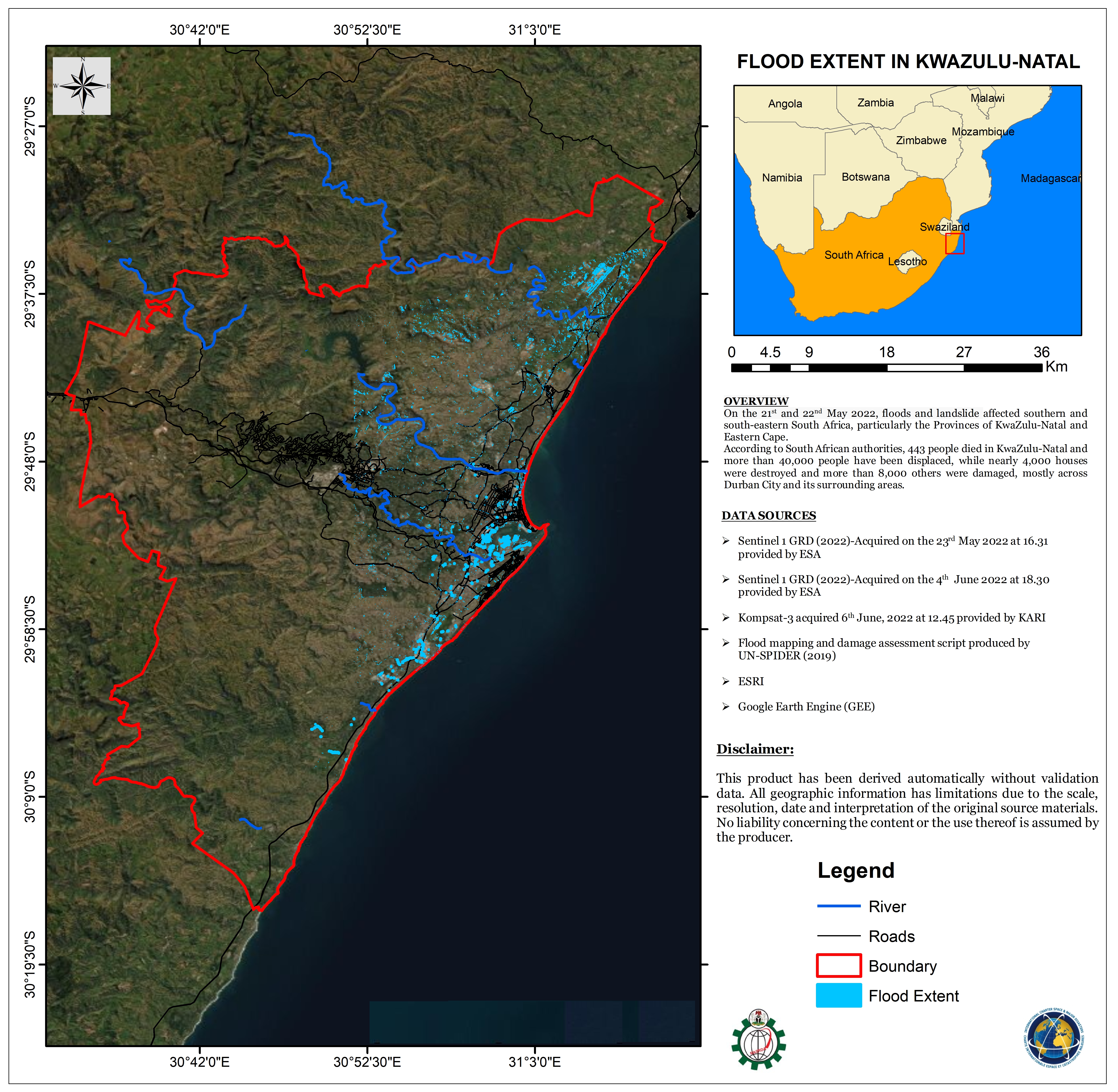
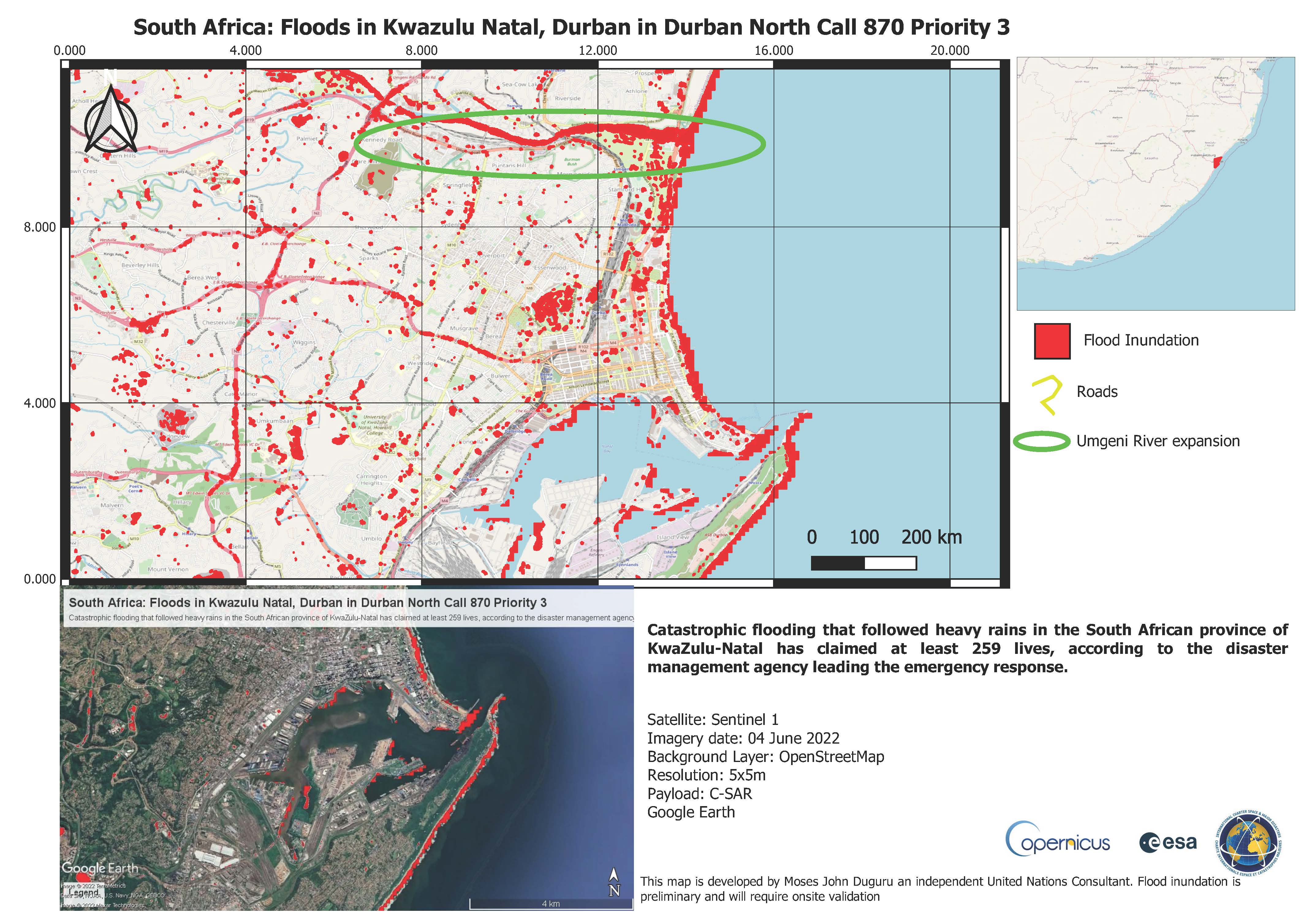
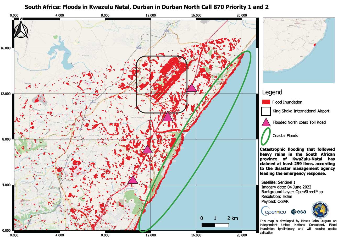
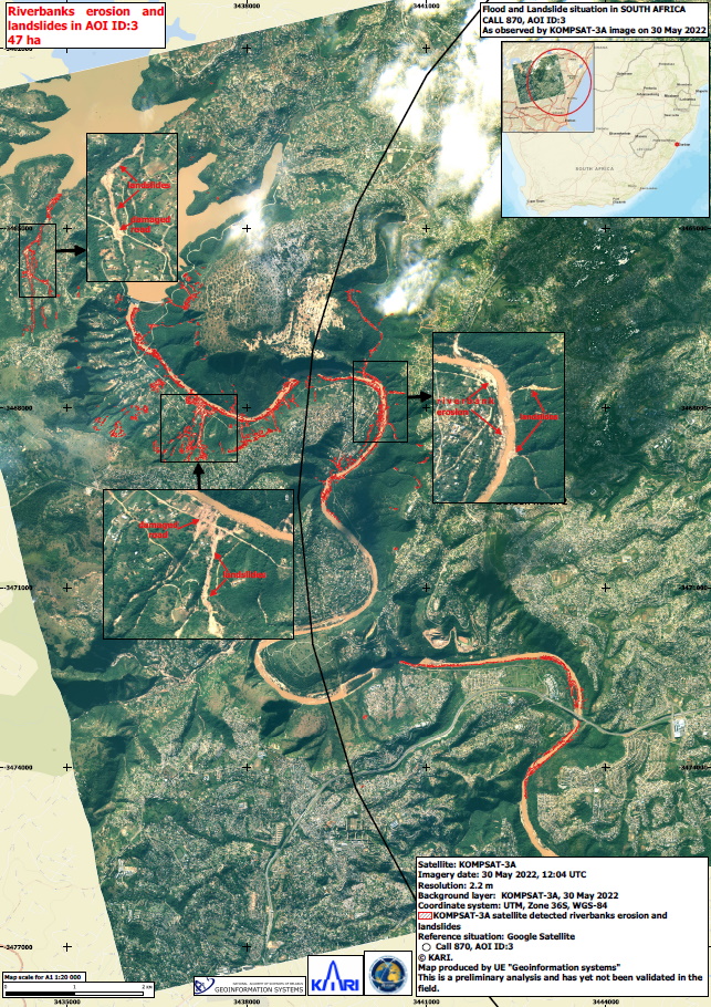
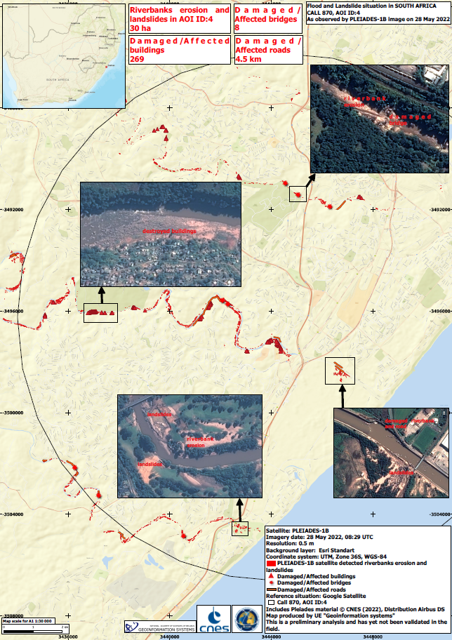
Flooding in South Africa

Torrential downpours caused large scale flooding in South Africa. Hundreds of people were forced to flee their homes on the east coast, according to officials, only a month after the worst floods in living memory killed more than 400. Infrastructure, roads, bridges and buildings were damaged. Authorities opened reception centres while police, firefighters and rescue workers remained on high alert ready to respond rapidly to emergencies.

Related News and Resources

Type of Event:Floods
Location of Event:South Africa
Date of Charter Activation:2022-05-24
Time of Charter Activation:13:43
Time zone of Charter Activation:UTC+02:00
Charter Requestor:National Disaster Management Centre
Activation ID:757
Project Management:SANSA

Products

Flood extent in South Durban

Copyright: Contains modified Copernicus Sentinel data (2022)
Map produced by NASRDA

Information about the Product

Acquired: 23/05/2022, 04/06/2022

Source: Sentinel-1

Category: Delineation Map

Flood extent in Durban North

Copyright: Contains modified Copernicus Sentinel data (2022)
Map produced by NASRDA

Information about the Product

Acquired: 23/05/2022, 04/06/2022

Source: Sentinel-1

Category: Delineation Map

Flood extent in Durban North

Copyright: Contains modified Copernicus Sentinel data (2022)
Map produced by NASRDA

Information about the Product

Acquired: 04/06/2022, 23/05/2022

Source: Sentinel-1

Category: Delineation Map

Flood extent in Kwazulu-Natal

Copyright: Contains modified Copernicus Sentinel data (2022)
Map produced by NASRDA

Information about the Product

Acquired: 04/06/2022, 23/05/2022

Source: Sentinel-1

Category: Delineation Map

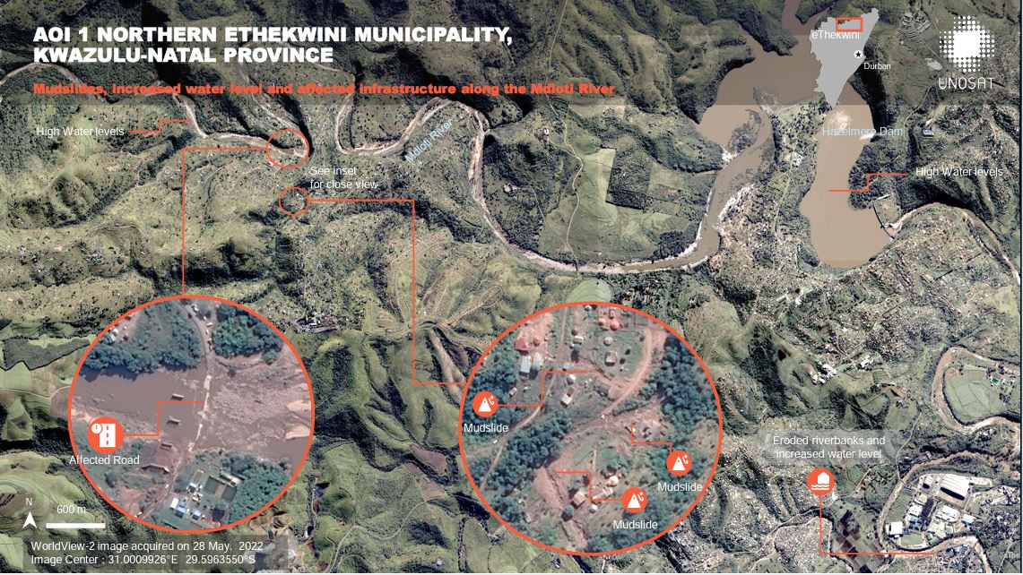
Preliminary satellite-derived flood and landslides assessment

Download the full report

Copyright: © (2022) DigitalGlobe, Inc., Longmont CO USA 80503. DigitalGlobe and the DigitalGlobe logos are trademarks of DigitalGlobe, Inc. The use and/or dissemination of this data and/or of any product in any way derived there from are restricted. Unauthorized use and/or dissemination is prohibited
Includes Pleiades material © CNES (2022), Distribution Airbus DS.
Map produced by UNITAR / UNOSAT

Information about the Product

Acquired: WorldView-2: 28/05/2022
Pleiades:25/05/2022

Source: WorldView-2 / Pleiades

Category: Reference Map

Durban Central Kwazulu Natal, South Africa

Copyright: Contains modified Copernicus Sentinel data (2022)
Map produced by Moses John Duguru and independent UN consultant

Information about the Product

Acquired: 04/06/2022

Source: Sentinel-1

Category: Reference Map

South Africa: Floods in Kwazulu Natal, Durban in Durban North

Copyright: Contains modified Copernicus Sentinel data (2022)

Information about the Product

Acquired: 04/06/2022

Source: Sentinel-1

Category: Delineation Map

Flood and Landslide situation in South Africa

Copyright: © KARI (2022). Map produced by Geoinformation systems

Information about the Product

Acquired: 30/05/2022

Source: KOMPSAT-3

Category: Reference Map

Flood and Landslide situation in South Africa

Copyright: Includes Pleiades material © CNES (2022), Distribution Airbus DS.
Map produced by GeoInformation Systems

Information about the Product

Acquired: 28/05/2022

Source: Pleiades

Category: Reference Map

Back to the full activation archive