 English
 Spanish
 French
 Chinese
 Russian
 Portuguese
 Dernière activation
Charter activations
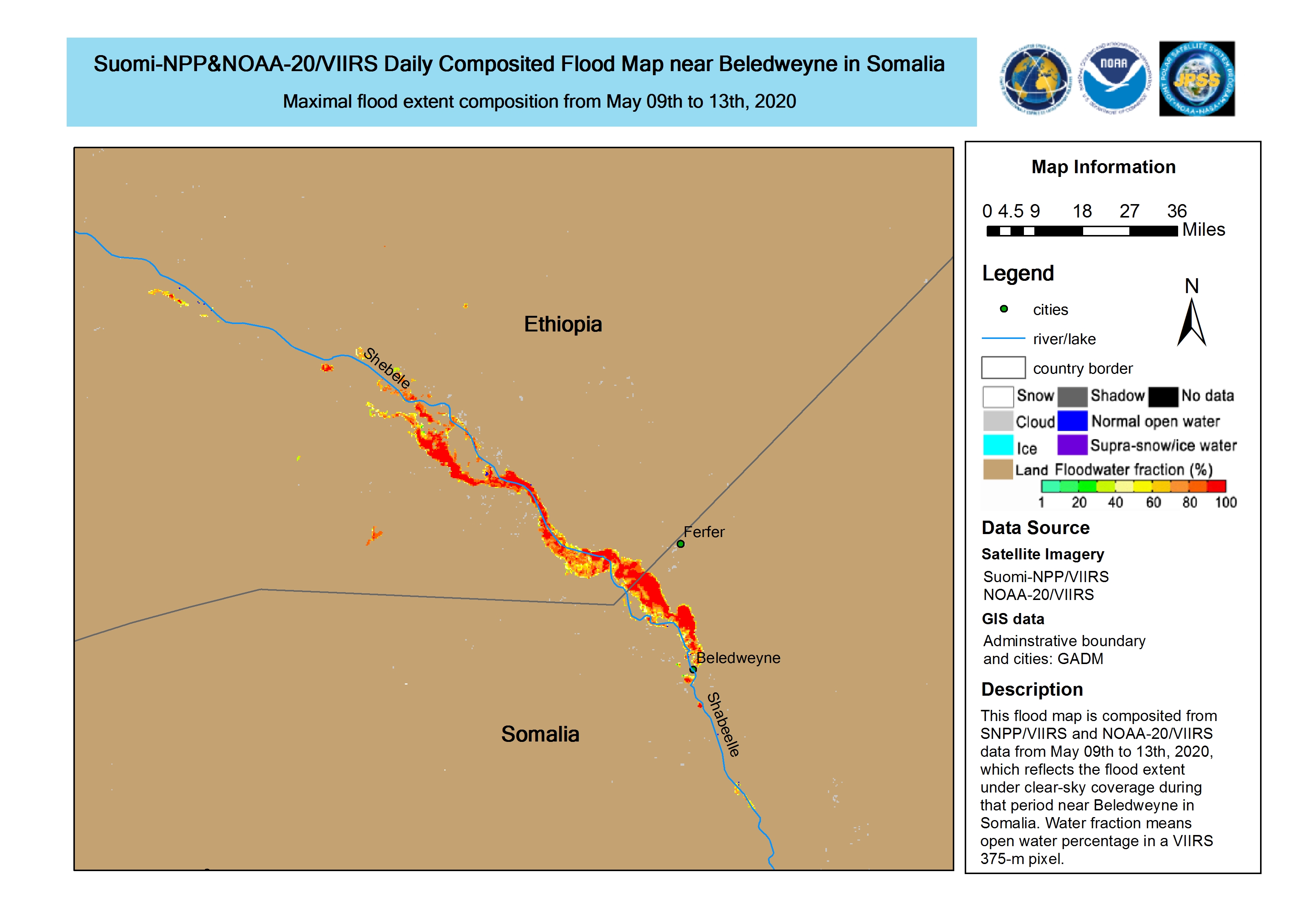
Flood in Somalia
Heavy rain in Somalia has caused flash floods in the Hiran and Gedo regions.
The Shabelle and Juda rivers are at high risk of flooding, as the rainfall has increased their water level to as much as 6 m in some areas.
Rain is expected to continue for several more days, raising the risk of further flooding.
| Type of Event: | Floods |
| Location of Event: | Somalia |
| Date of Charter Activation: | 2020-04-28 |
| Time of Charter Activation: | 11:54 |
| Time zone of Charter Activation: | UTC+02:00 |
| Charter Requestor: | UNITAR on behalf of Food and Agriculture Organization of the United Nations, FAO - Somalia |
| Activation ID: | 650 |
| Project Management: | UNITAR/UNOSAT |
Products
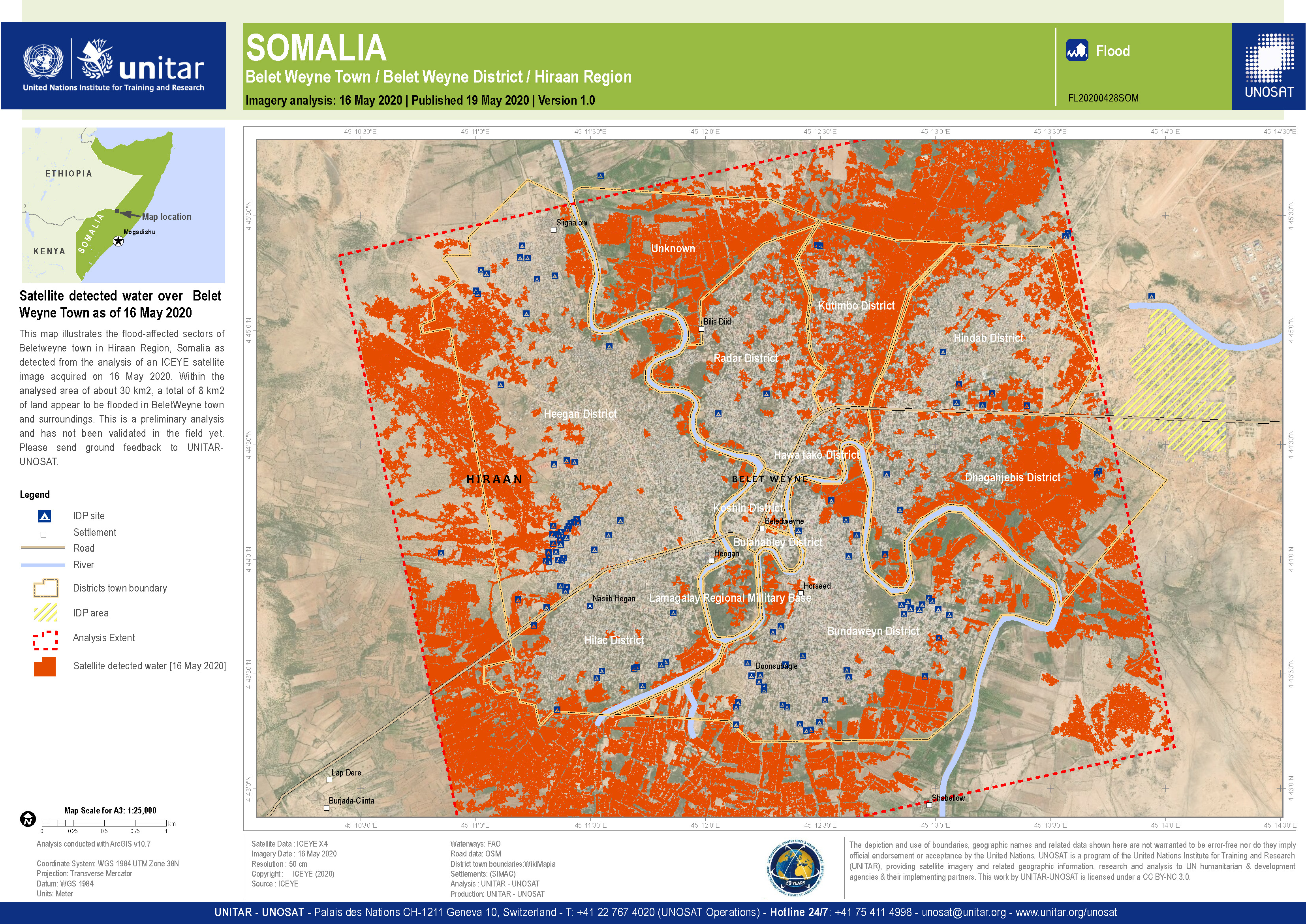
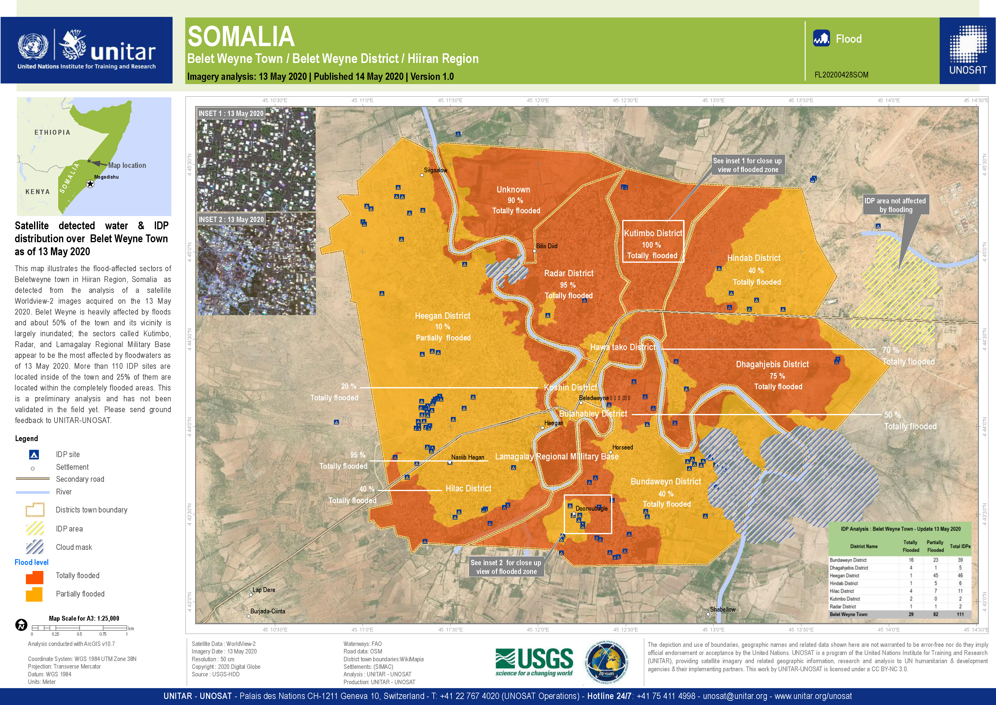
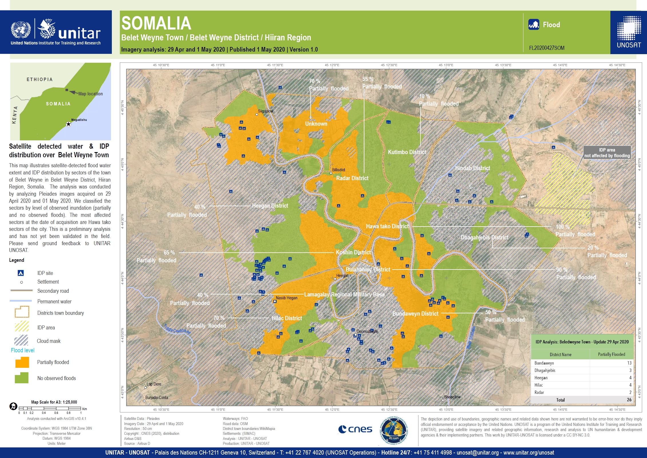
Satellite detected water and IDP distribution over Belet Weyne Town, Somalia
Copyright: Worldview-2 © (2020) DigitalGlobe, Inc., Longmont CO USA 80503. DigitalGlobe and the DigitalGlobe logos are trademarks of DigitalGlobe, Inc. The use and/or dissemination of this data and/or of any product in any way derived there from are restricted. Unauthorized use and/or dissemination is prohibited
Map produced by UNITAR/UNOSAT
Information about the Product
Acquired: 13/05/2020
Source: WorldView-2

Preliminary satellite-derived damage assessment, Beletweyne District, Hiraan Region, Somalia
Download the full report
Copyright: Report produced by UNITAR/UNOSAT
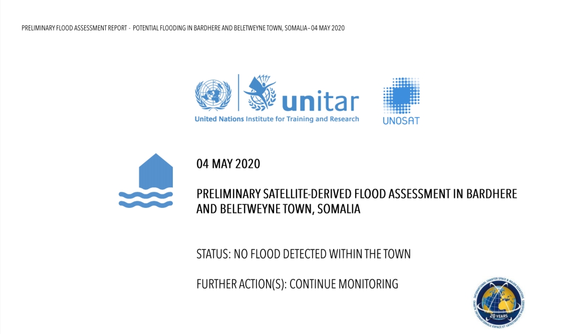
Preliminary satellite-derived flood assessment in Bardhere and Beletweyne Town, Somalia
Download the full report
Copyright: Report produced by UNITAR/UNOSAT
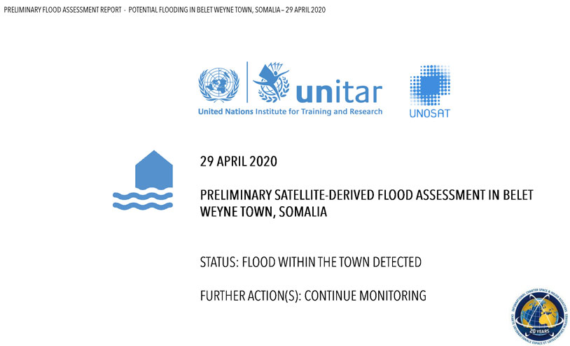
Preliminary satellite-derived flood assessment in Belet Weyne town, Somalia
Download the full report
Copyright: Report produced by UNITAR/UNOSAT
 Back to the full activation archive

