 English
 Spanish
 French
 Chinese
 Russian
 Portuguese
 Dernière activation
Charter activations
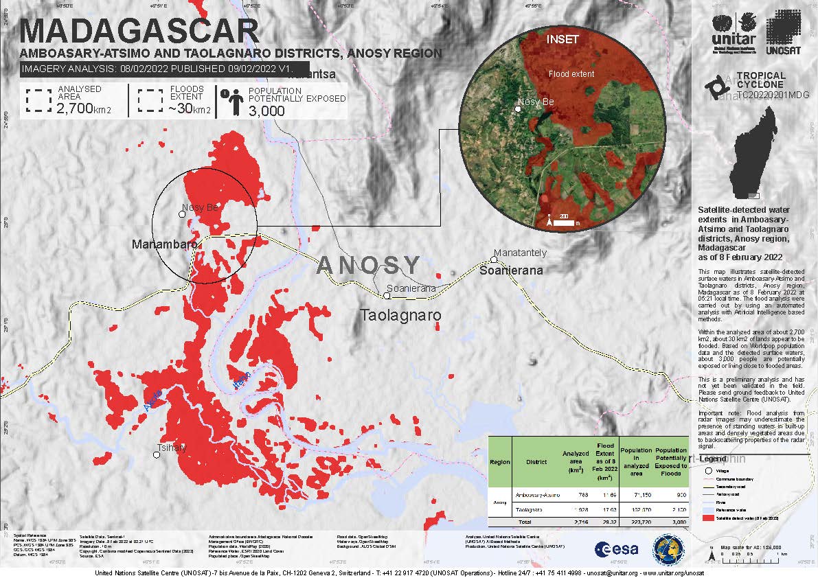
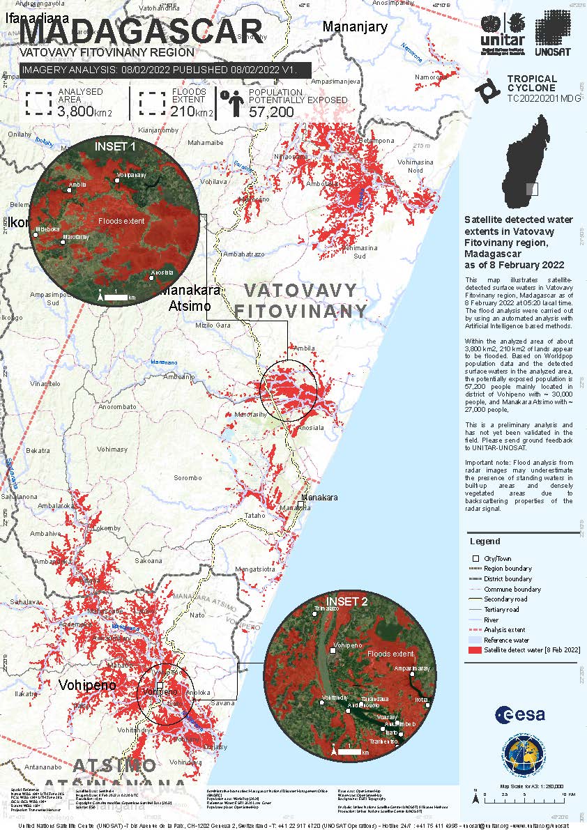
Tropical Cyclone Batsirai in Madagascar
Tropical Cyclone Batsirai killed at least 10 people in southeastern Madagascar, after making landfall on 5 February, bringing heavy rains and strong winds.
This is the second storm to hit the Indian Ocean island in just two weeks.
One of the worst-hit towns was Nosy Varika on the east coast, where almost 95% of buildings were destroyed and access to it was cut off by severe flooding.
Related News and Resources
| Type of Event: | Ocean Storm - Cyclone |
| Location of Event: | Madagascar |
| Date of Charter Activation: | 2022-02-04 |
| Time of Charter Activation: | 19:52 |
| Time zone of Charter Activation: | UTC+01:00 |
| Charter Requestor: | UNITAR on behalf of United Nations Office for the Coordination of Humanitarian Affairs ¦ Regional Office for Southern & Eastern Africa BUREAU NATIONAL DE GESTION DES RISQUES ET DES CATASTROPHES (BNGRC) |
| Activation ID: | 750 |
| Project Management: | UNITAR |
Products
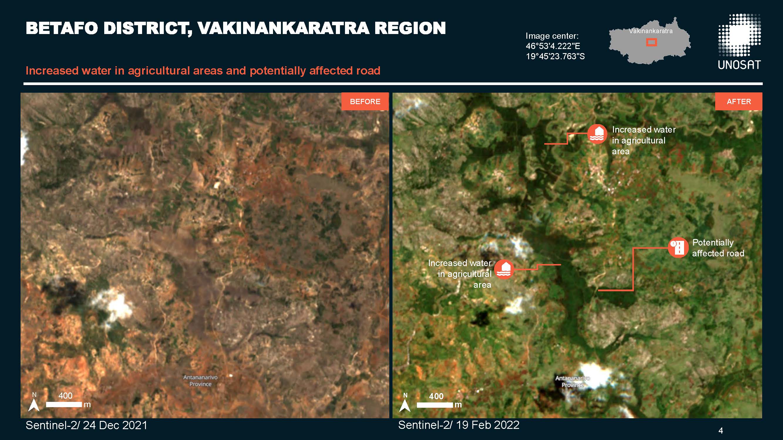
Preliminary satellite-derived flood assessment in Amoron'I Mania and Vakinankaratra regions of Madagascar
Download full report
Copyright: Contains modified Copernicus Sentinel data (2022)
Report produced by UNOSAT / UNITAR
Information about the Product
Acquired: 17/02/2022, 19/02/2022
Source: Sentinel-2
Category: Dossier
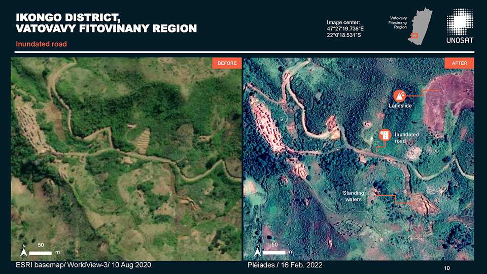
Preliminary satellite-derived road damage assessment in Vatovavy Fitovinany Region of Madagascar
Download the full report
Copyright: Includes Pleiades material © CNES (2022), Distribution Airbus DS.
Report produced by UNITAR/UNOSAT
Information about the Product
Acquired: 16/02/2022
Source: Pleiades
Category: Dossier
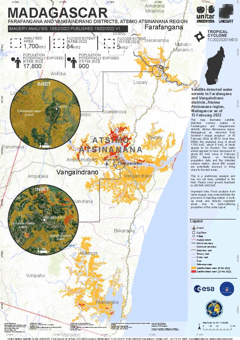
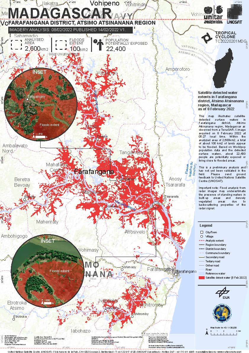
Satellite detected water extents in Farafangana and Vangaindrano District, Atsimo Atsinanana Region, Madagascar
Copyright: Contains modified Copernicus Sentinel data (2022)
Map produced by UNITAR/UNOSAT
Information about the Product
Acquired: 15/02/2022
Source: Sentinel-1
Category: Delineation Monitoring Maps
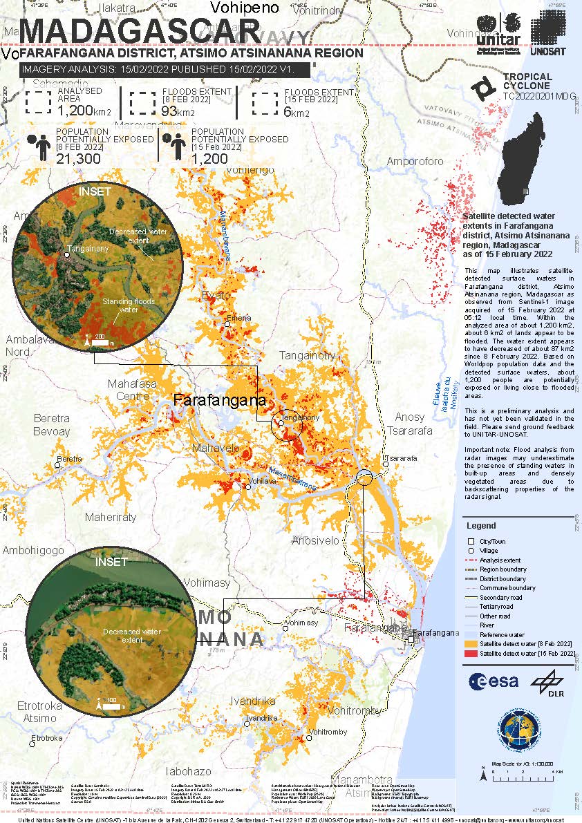
Preliminary Satellite-Derived Road Damage Assessment in Atsimo Atsinanana Province of Madagascar
Download the full report
Copyright: Includes Pleiades material © CNES (2022), Distribution Airbus DS.
Report produced by UNITAR/UNOSAT
Information about the Product
Acquired: 15/02/2022
Source: Pleiades
Category: Dossier
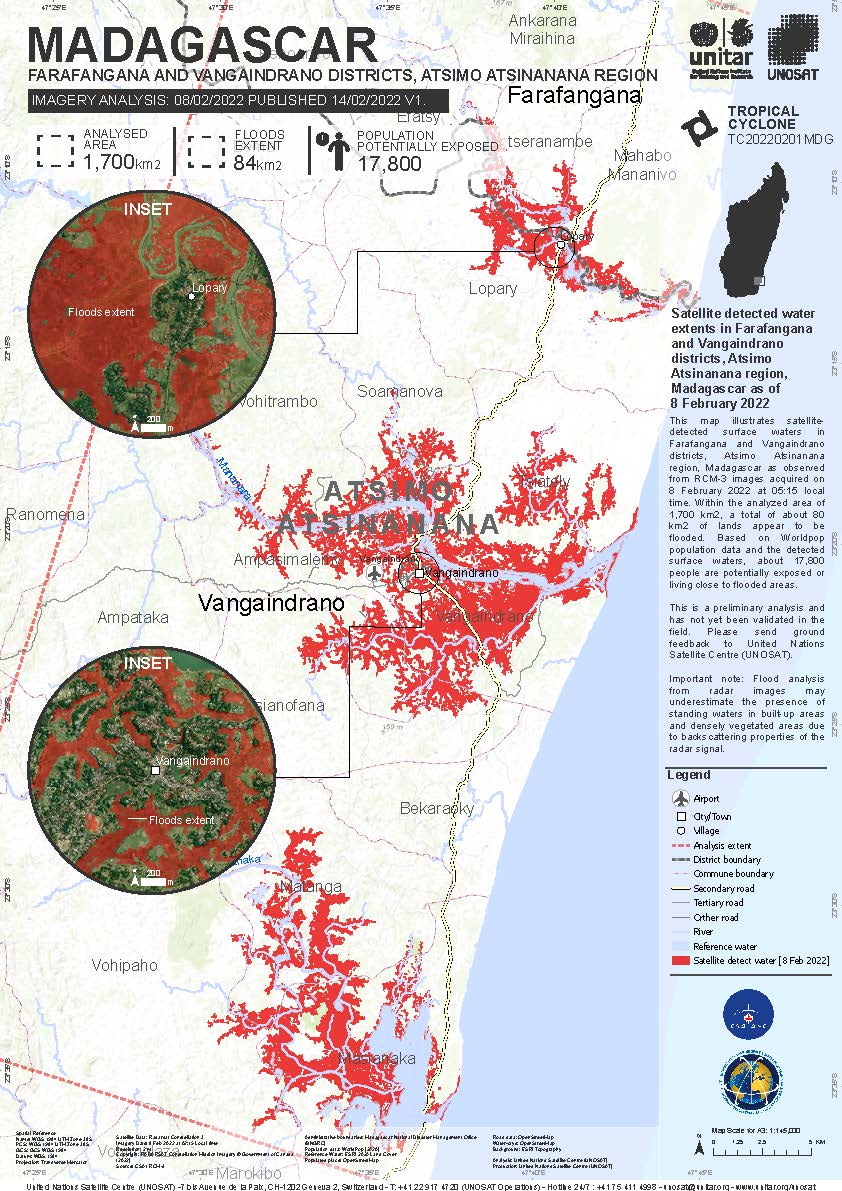
Satellite detected water extents in Farafangana and Vangaindrano Districts, Atsimo Atsinanana Region, Madagascar
Copyright: RADARSAT Constellation Mission Imagery © Government of Canada (2022) - RADARSAT is an official mark of the Canadian Space Agency
Map produced by UNITAR/UNOSAT
Information about the Product
Acquired: 08/02/2022
Source: RCM
Category: Reference Map

Satellite detected water extents in Betroka District, Anosy Region, Madagascar
Copyright: Contains modified Copernicus Sentinel data (2022)
Map produced by UNITAR / UNOSAT
Information about the Product
Acquired: Sentinel-1: 08/02/2022
Sentinel-2 09/02/2022
Source: Sentinel-1, Sentinel-2
Category: Delineation Map

 Back to the full activation archive

