 English
 Spanish
 French
 Chinese
 Russian
 Portuguese
 Dernière activation
Charter activations
Cyclone Fani in India
Cyclone Fani made landfall in eastern India with wind speeds of 120mph killing at least three people and forcing a million others to evacuate during the last 24 hours.
Fani spent days building in the Bay of Bengal, and then struck the coastline of Odisha State creating storm surges and flooding. As the storm moved inland it uprooted trees and electricity poles. Authorities ordered schools and airports in the area to close.
Relief teams have deployed to assist in evactuations and sheltering displaced persons, while naval warships and helicopters are placed on standby. The country's National Disaster Response Force (NDRF) has also deployed several relief teams with medical aid and other materials.
Cyclone Fani is expected to hit 15 districts in Odisha, before weakening and moving towards Chittagong in Bangladesh over the next days.
News and resources:
| Location of Event: | India |
| Date of Charter Activation: | 2019-05-03 |
| Time of Charter Activation: | 00:41 |
| Time zone of Charter Activation: | UTC-04:00 |
| Charter Requestor: | ISRO |
| Activation ID: | 608 |
| Project Management: | NRSC |
Products

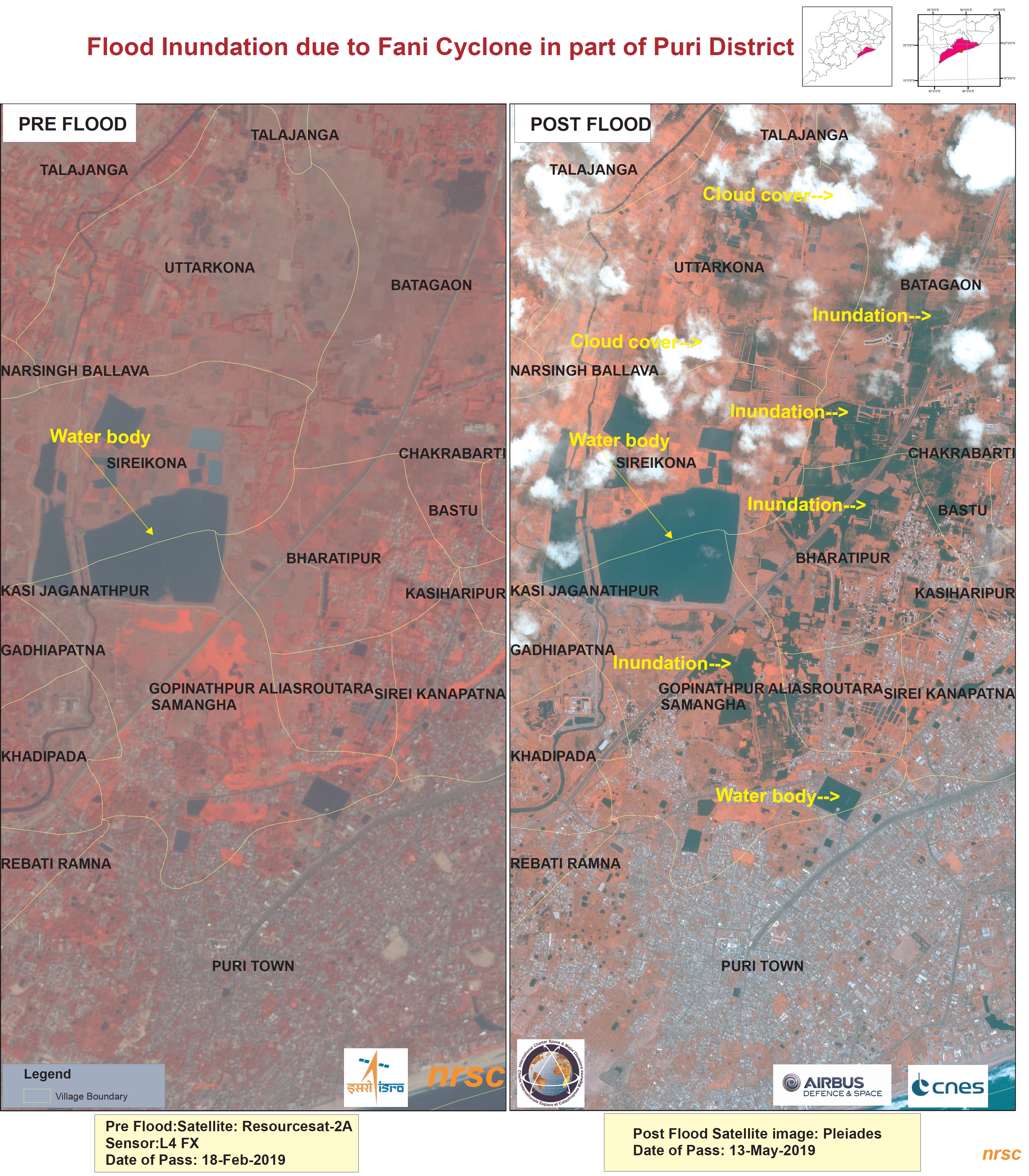
Cyclone Fani, flood affected areas, Puri District, India
Copyright: ResourceSat-2: data and products © ISRO (2019) - All rights reserved
Pleiades © CNES (2019) - Distribution: Airbus Defence and Space, all rights reserved
Map produced by NRSC
Information about the Product
Acquired: ResourceSat-2: 18/02/2019
Pleiades: 13/05/2019
Source: ResourceSat-2 / Pleiades
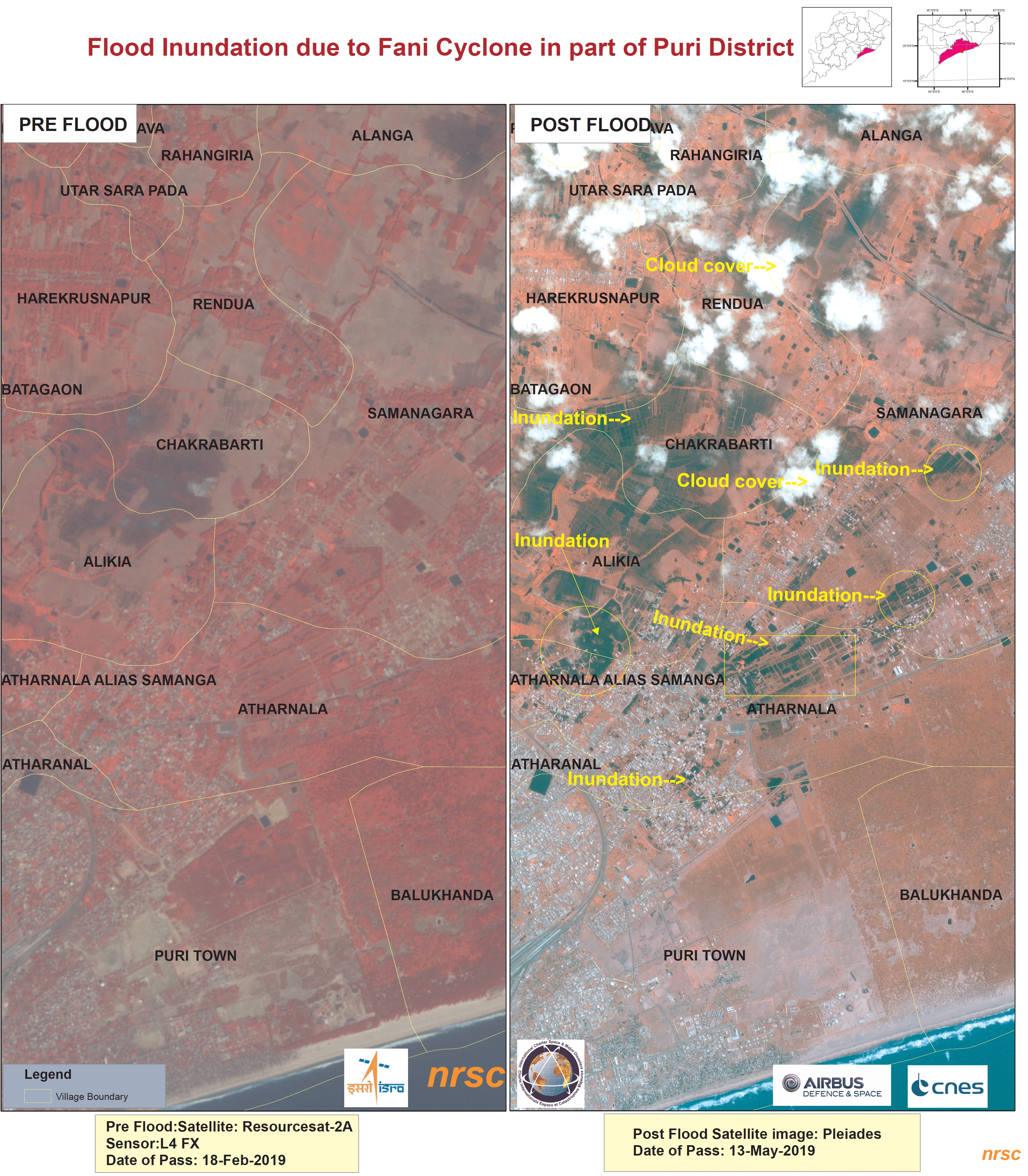
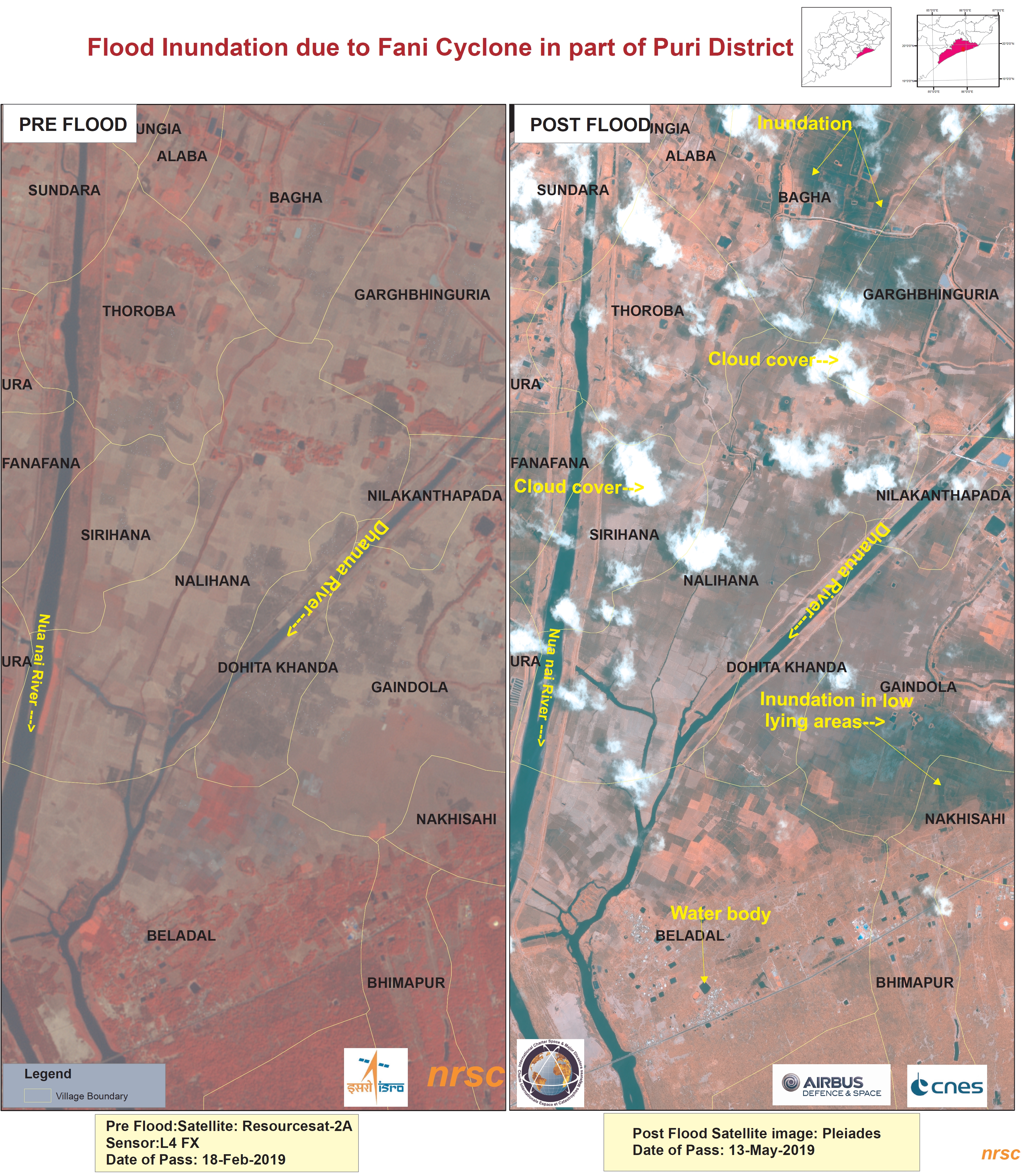

Cyclone Fani, flood affected areas, Odisha District, India
Copyright: ResourceSat-2: data and products © ISRO (2019) - All rights reserved
Kanopus-V © All rights reserved ROSCOSMOS 2019
Map produced by NRSC
Information about the Product
Acquired: ResourceSat-2: 20/02/2019
Kanopus-V: 09/05/2019
Source: ResourceSat-2 / Kanopus-V
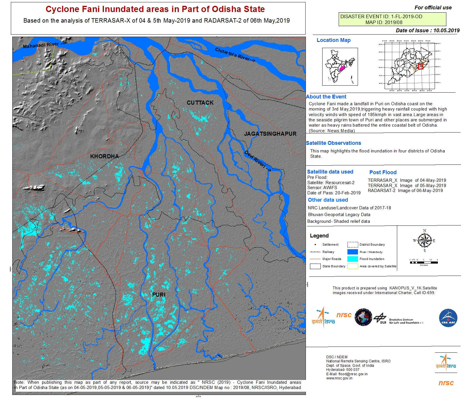
Cyclone Fani, flood affected areas, Odisha District, India
Copyright: TerraSAR-X © DLR e. V. 2019, Distribution: Airbus DS Geo GmbH
RADARSAT-2 Data and Products © Maxar Technologies Ltd. (2019) - All Rights Reserved. RADARSAT is an official trademark of the Canadian Space Agency.
Map produced by NRSC
Information about the Product
Acquired: RADARSAT-2: 20/02/2019
TerraSAR-X: 04/05/2019, 05/05/2019 and 06/05/2019
Source: TerraSAR-X / RADARSAT-2
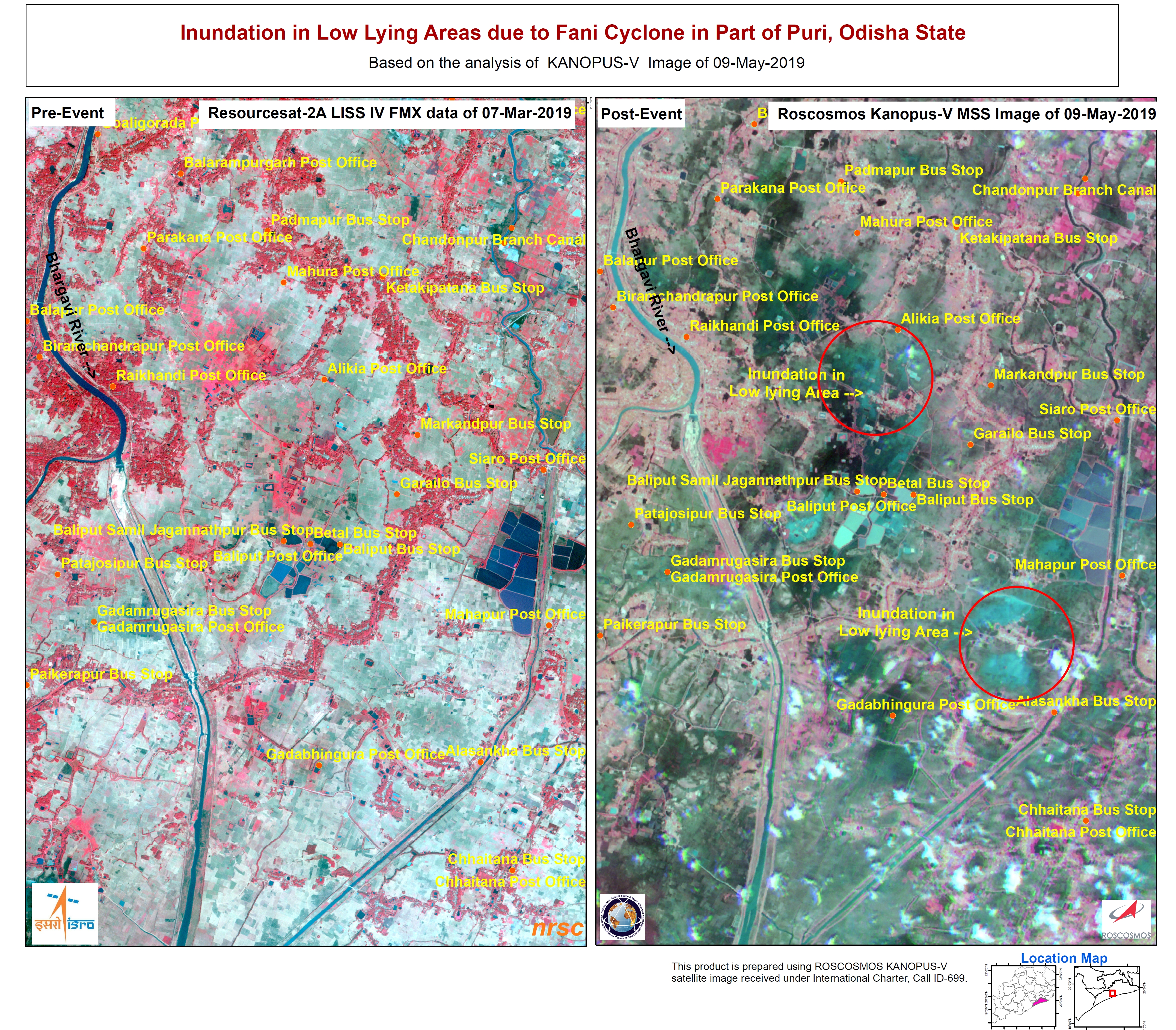
Cyclone Fani, flood affected areas, Odisha District, India
Copyright: ResourceSat-2: data and products © ISRO (2019) - All rights reserved
Kanopus-V © All rights reserved ROSCOSMOS 2019
Map produced by NRSC
Information about the Product
Acquired: ResourceSat-2: 07/03/2019
Kanopus-V: 09/05/2019
Source: ResourceSat-2 / Kanopus-V
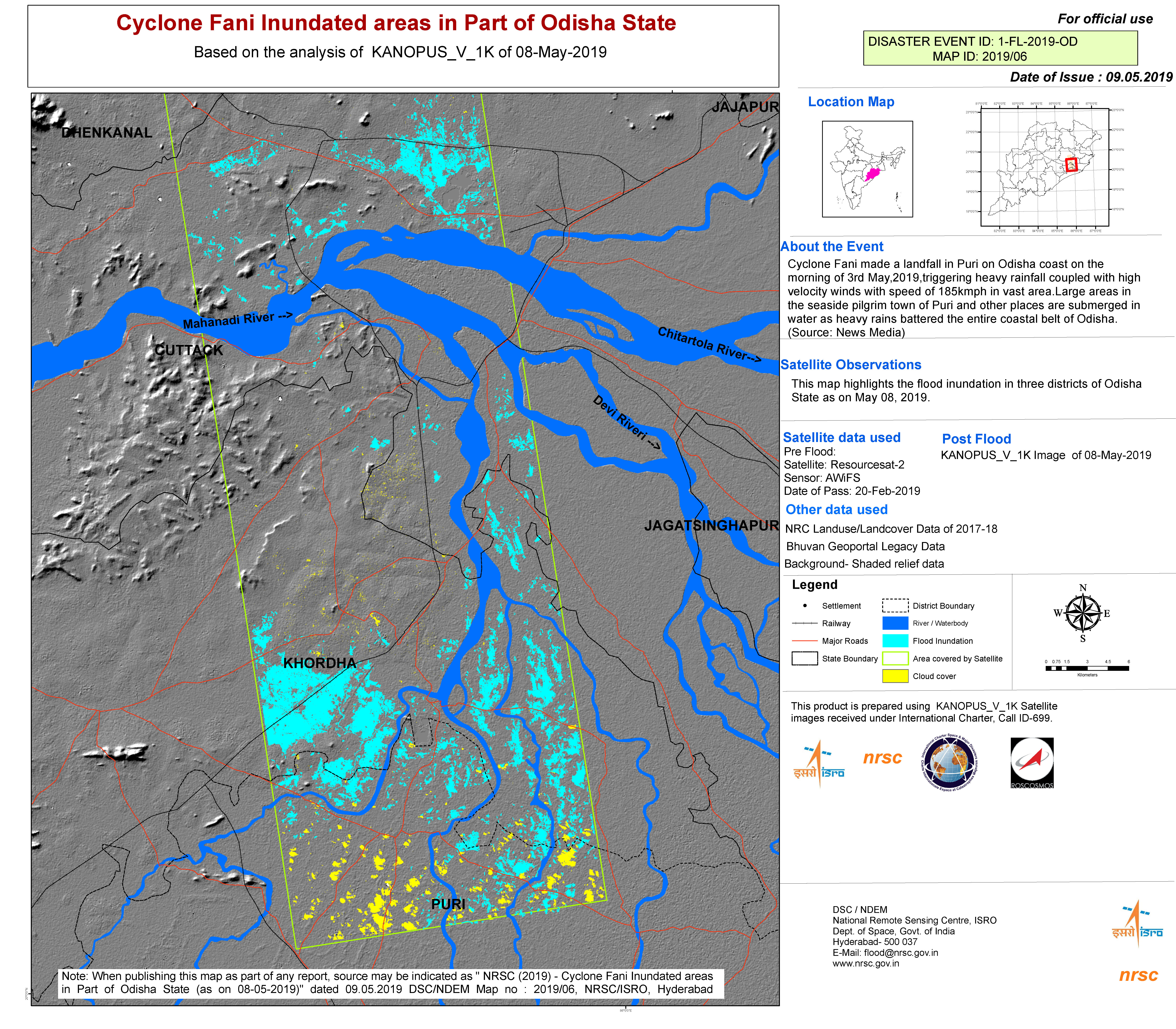
Cyclone Fani, flood affected areas, Odisha State, India
Copyright: ResourceSat-2: data and products © ISRO (2019) - All rights reserved
Kanopus-V © All rights reserved ROSCOSMOS 2019
Map produced by NRSC
Information about the Product
Acquired: ResourceSat-2: 20/02/2019
Kanopus-V: 08/05/2019
Source: ResourceSat-2 / Kanopus-V

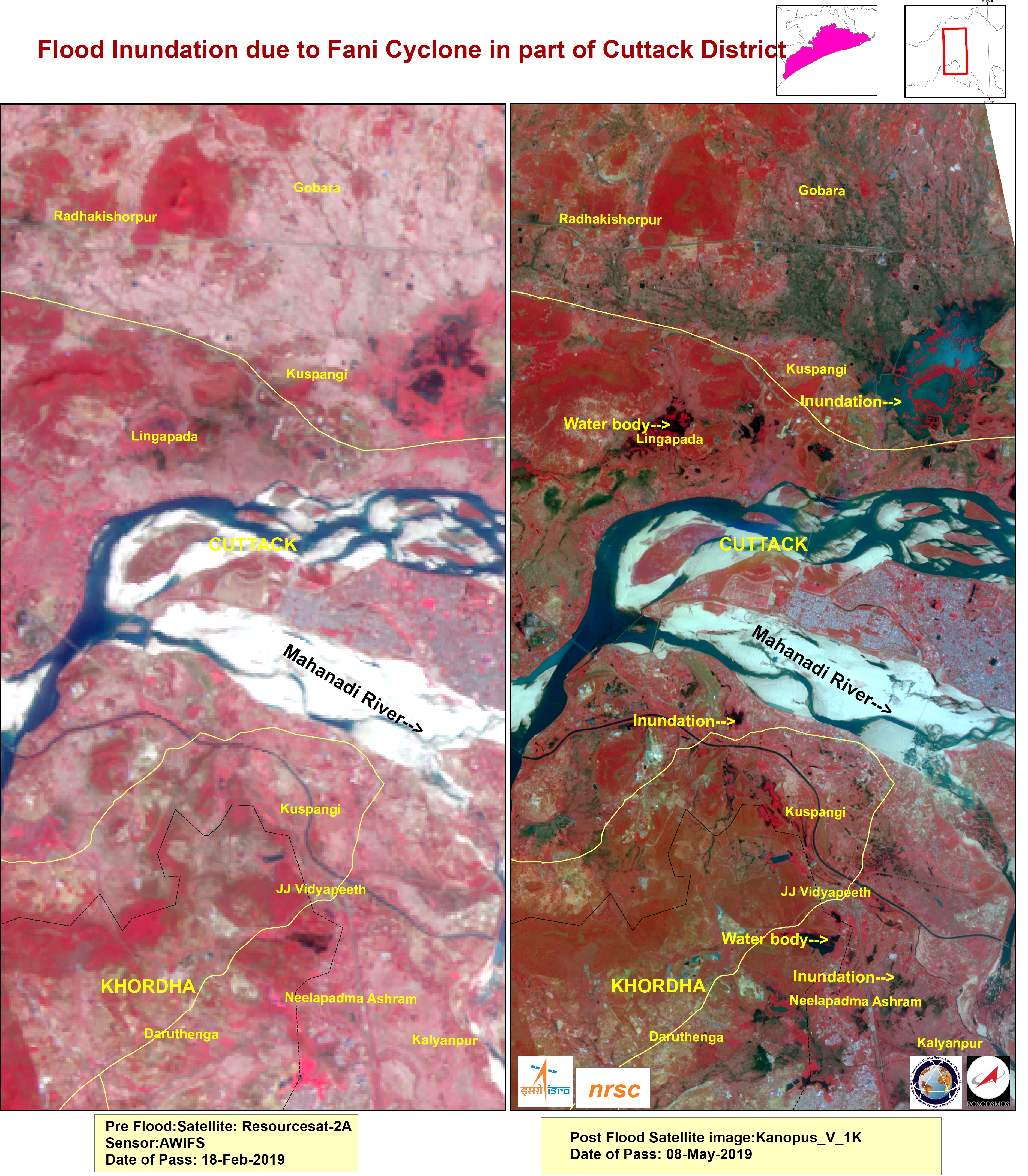
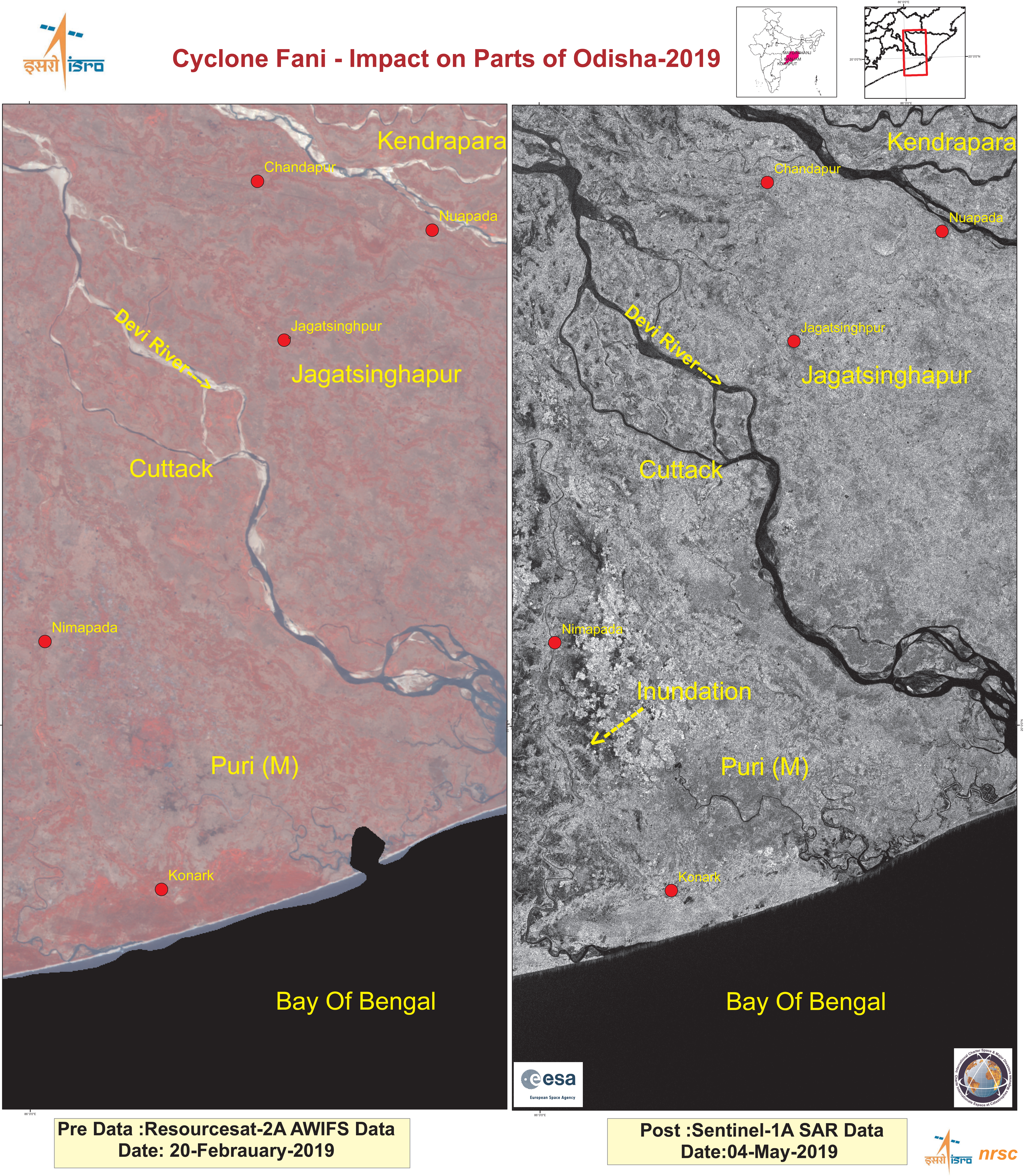
Cyclone Fani, flood affected areas, Cuttack District, India
Copyright: ResourceSat-2: data and products © ISRO (2019) - All rights reserved
Kanopus-V © All rights reserved ROSCOSMOS 2019
Map produced by NRSC
Information about the Product
Acquired: ResourceSat-2: 18/02/2019
Kanopus-V: 08/05/2019
Source: ResourceSat-2 / Kanopus-V
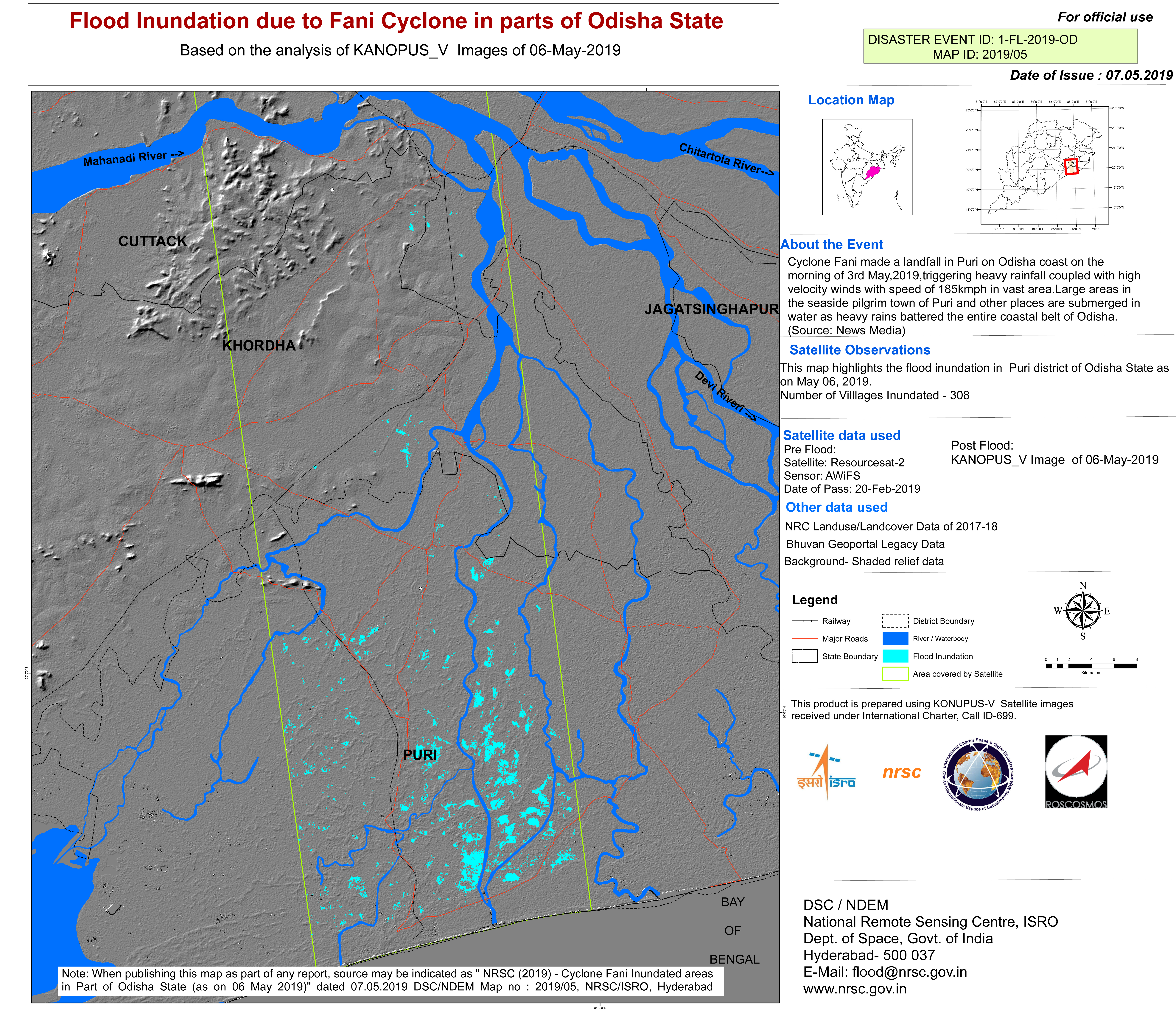
Cyclone Fani, flood affected areas, Odisha State, India
Copyright: ResourceSat-2: data and products © ISRO (2019) - All rights reserved
Kanopus-V © All rights reserved ROSCOSMOS 2019
Map produced by NRSC
Information about the Product
Acquired: ResourceSat-2: 20/02/2019
Kanopus-V: 06/05/2019
Source: ResourceSat-2 / Kanopus-V


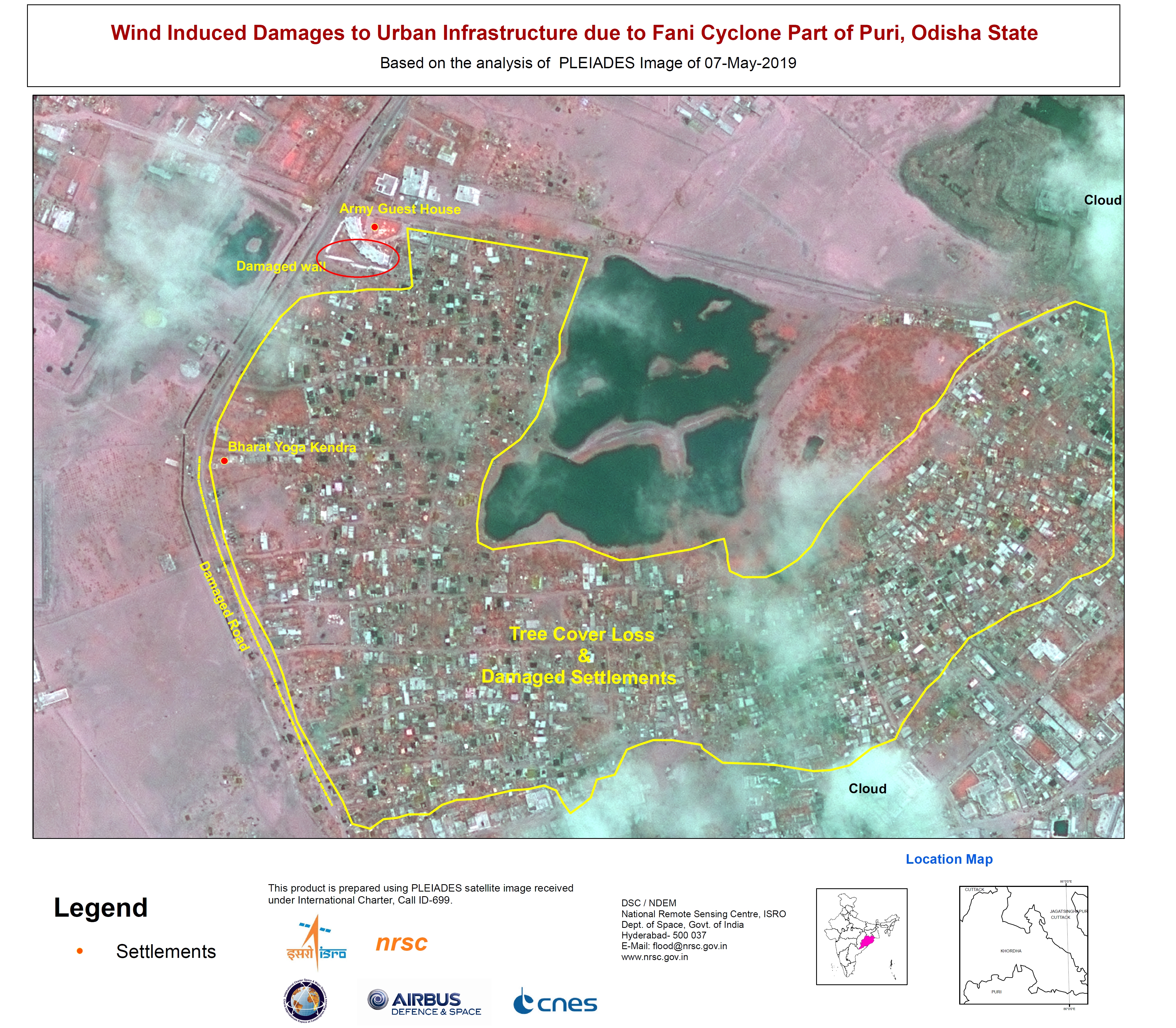
Cyclone Fani, flood affected areas, Khorda District, India
Copyright: ResourceSat-2: data and products © ISRO (2019) - All rights reserved
Pleiades © CNES (2019) - Distribution: Airbus Defence and Space, all rights reserved
Map produced by NRSC
Information about the Product
Acquired: ResourceSat-2: 07/03/2019
Pleiades: 06/05/2019
Source: ResourceSat-2 / Pleiades


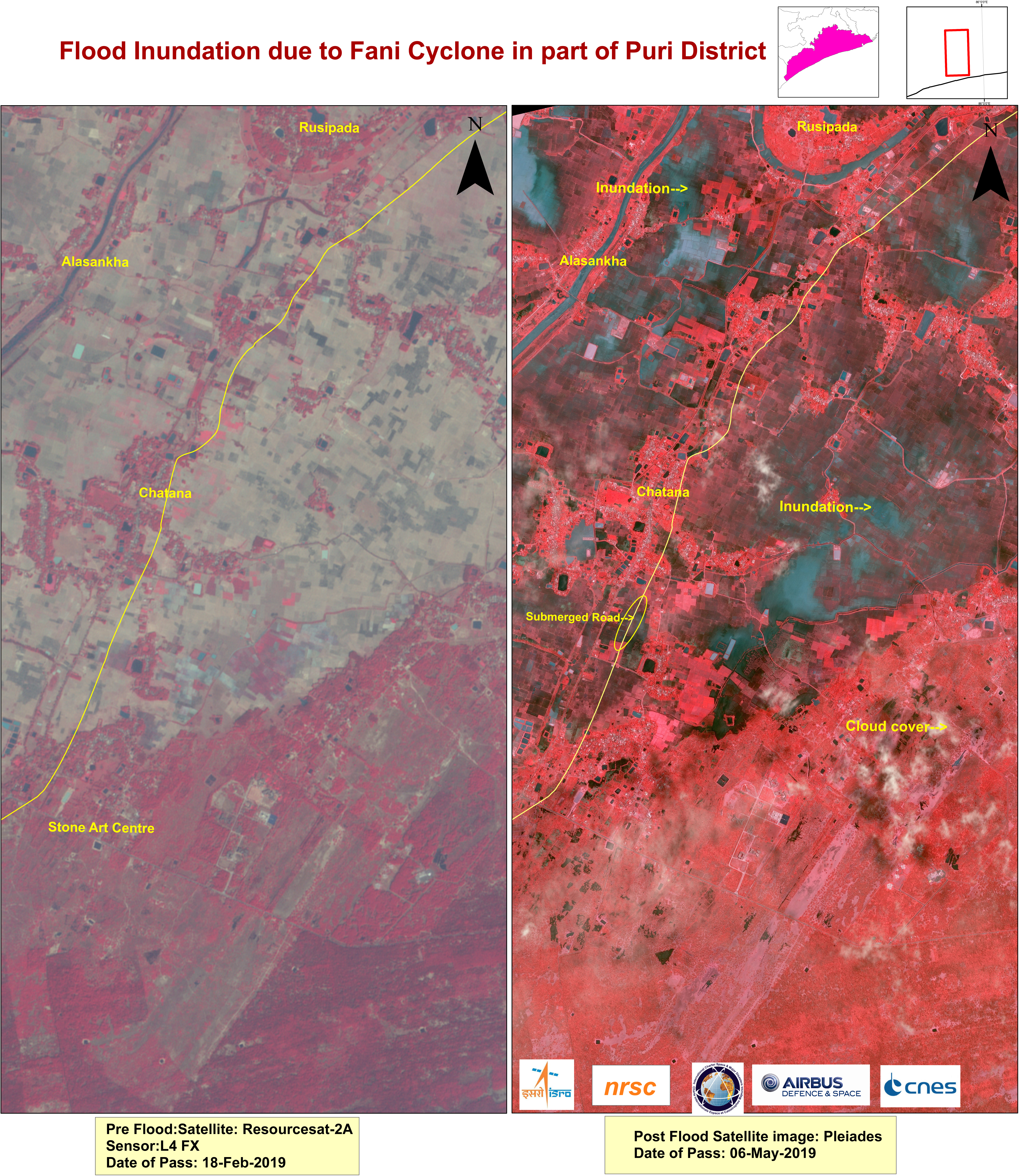
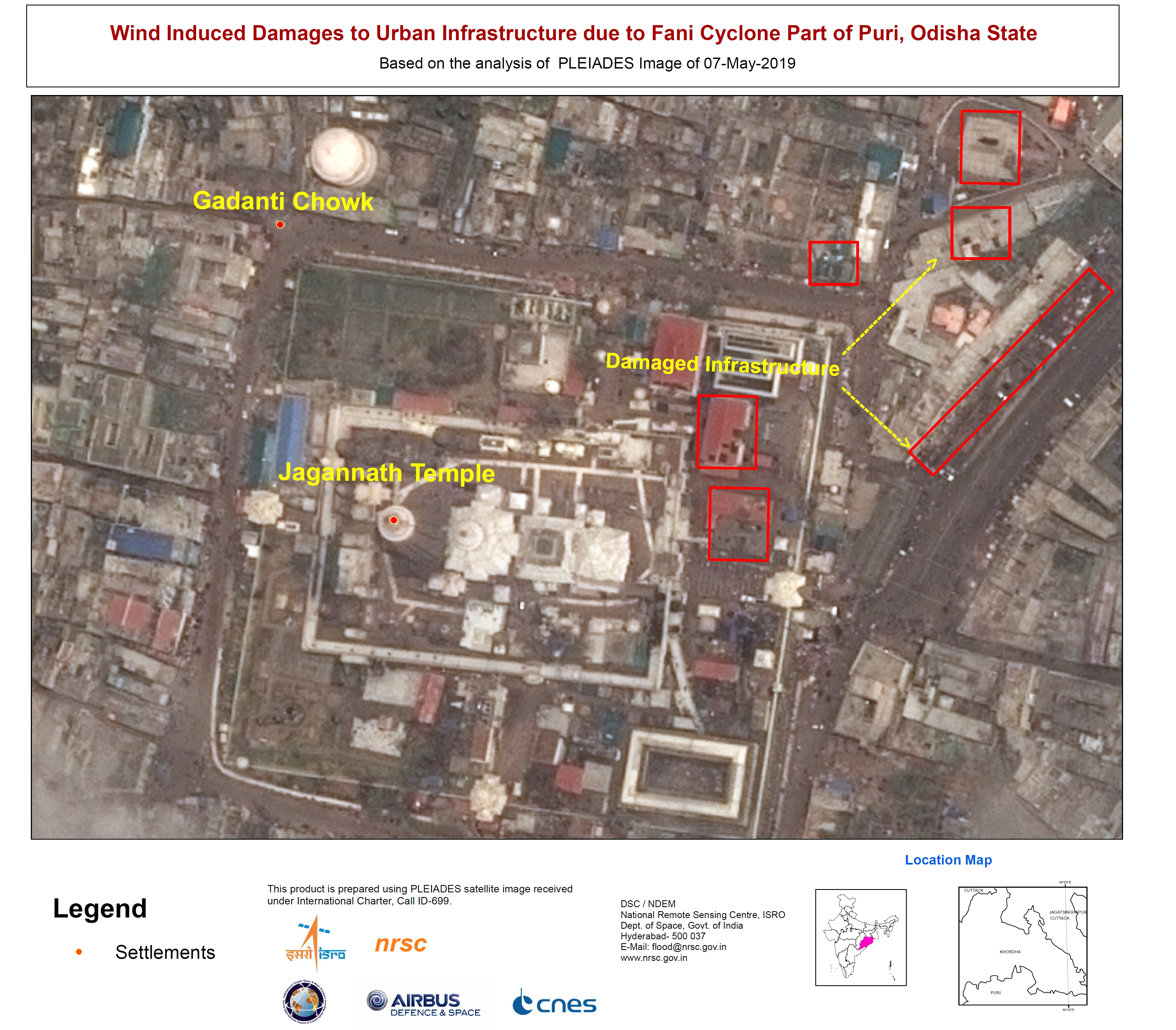
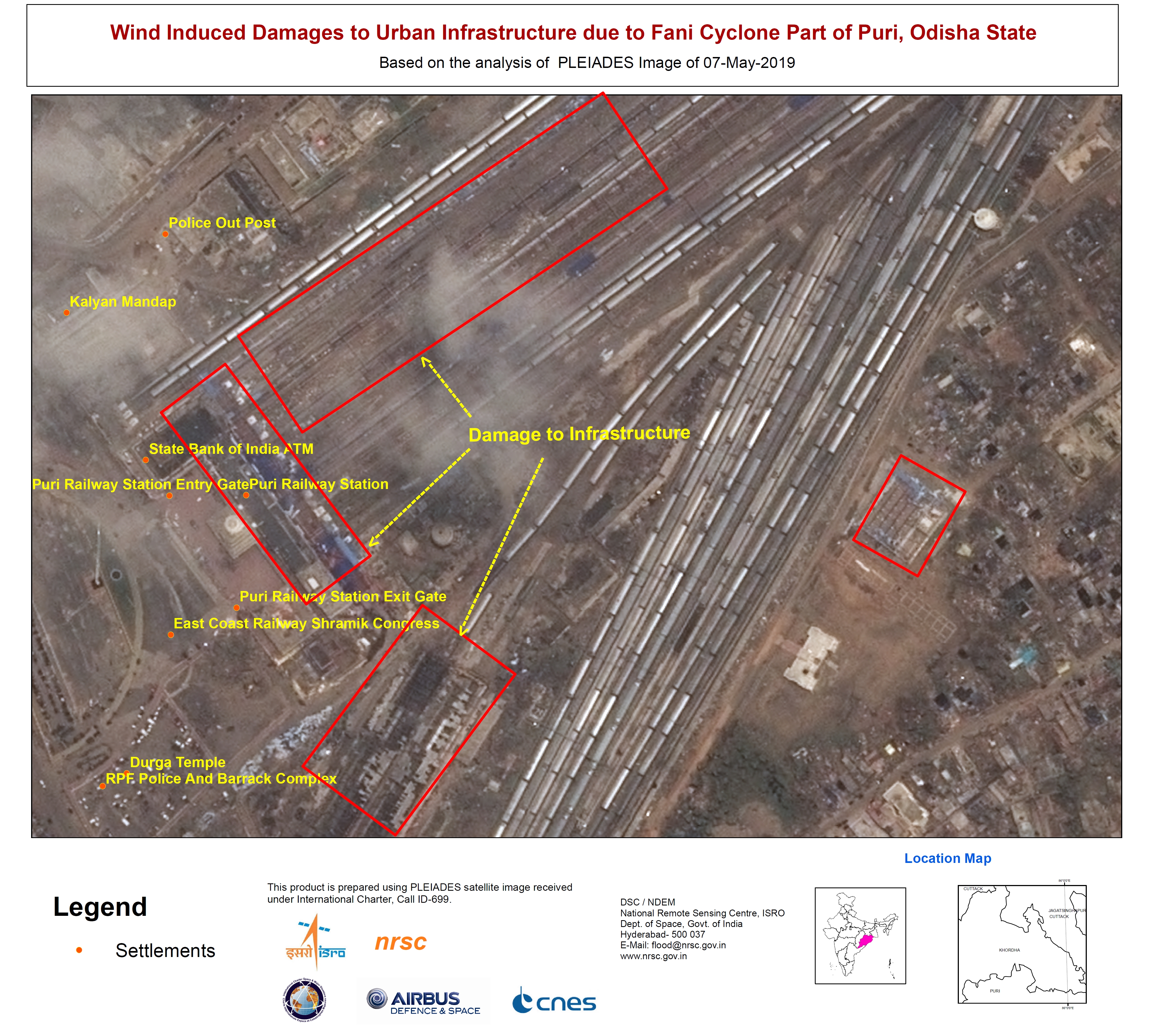
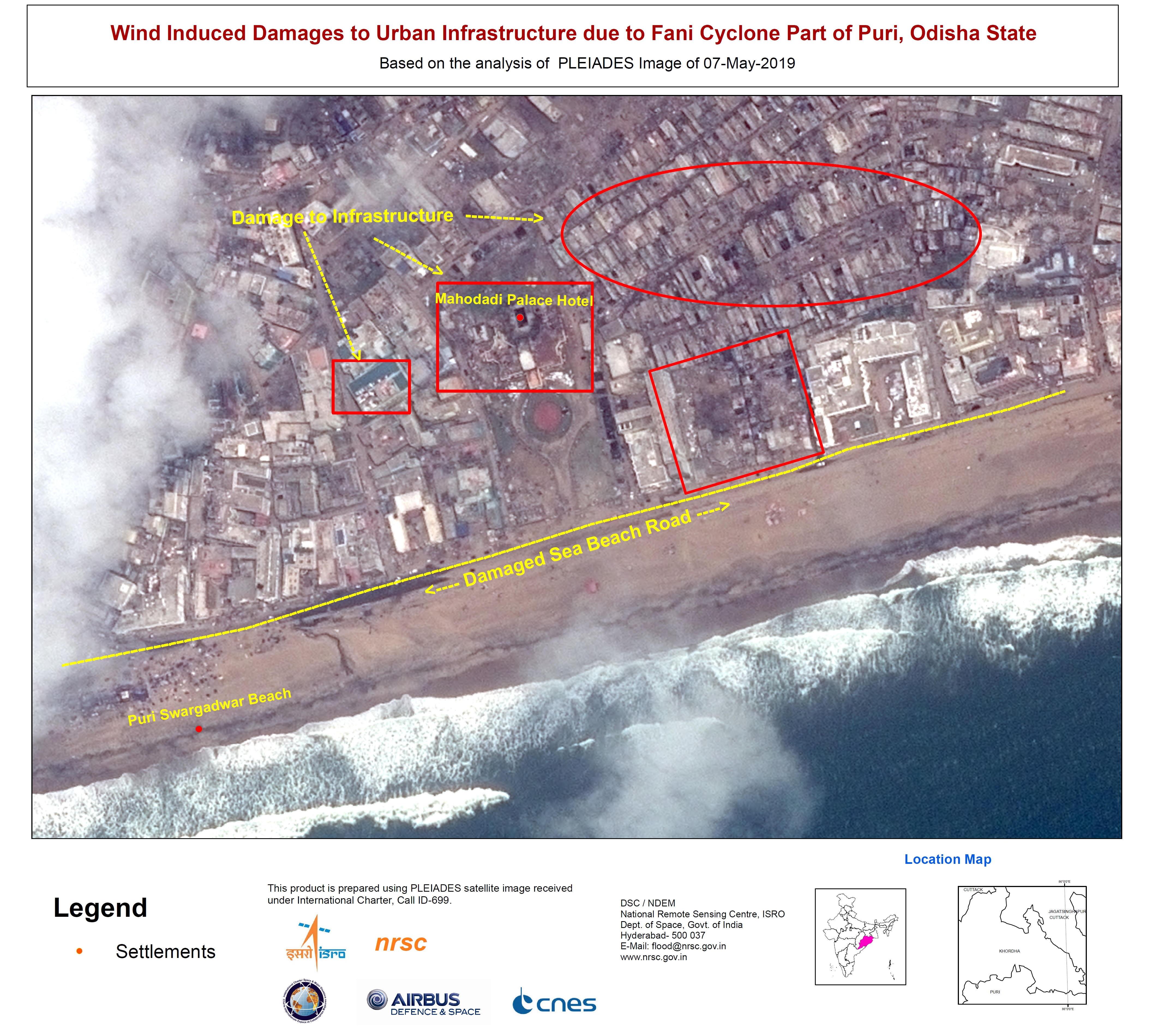
Cyclone Fani, flood affected areas, Puri District, India
Copyright: ResourceSat-2: data and products © ISRO (2019) - All rights reserved
Pleiades © CNES (2019) - Distribution: Airbus Defence and Space, all rights reserved
Map produced by NRSC
Information about the Product
Acquired: ResourceSat-2: 18/02/2019
Pleiades: 06/05/2019
Source: ResourceSat-2 / Pleiades

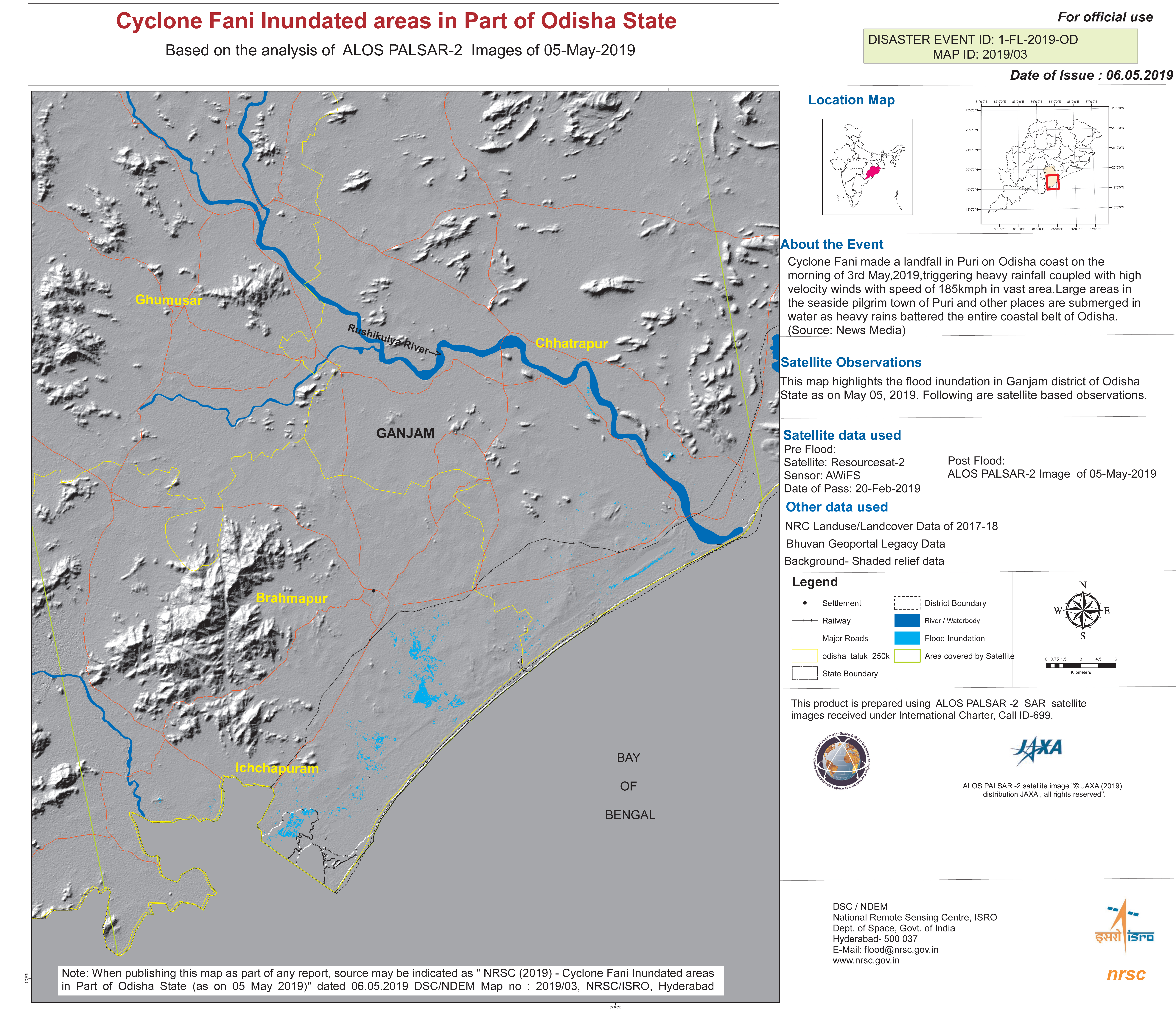
Cyclone Fani, flood affected areas, Odisha, India
Copyright: ResourceSat-2: data and products © ISRO (2019) - All rights reserved
ALOS © JAXA (2019) All rights reserved
Map produced by NRSC
Information about the Product
Acquired: ResourceSat-2: 20/02/2019
ALOS: 05/05/2019
Source: ResourceSat-2 / ALOS-2
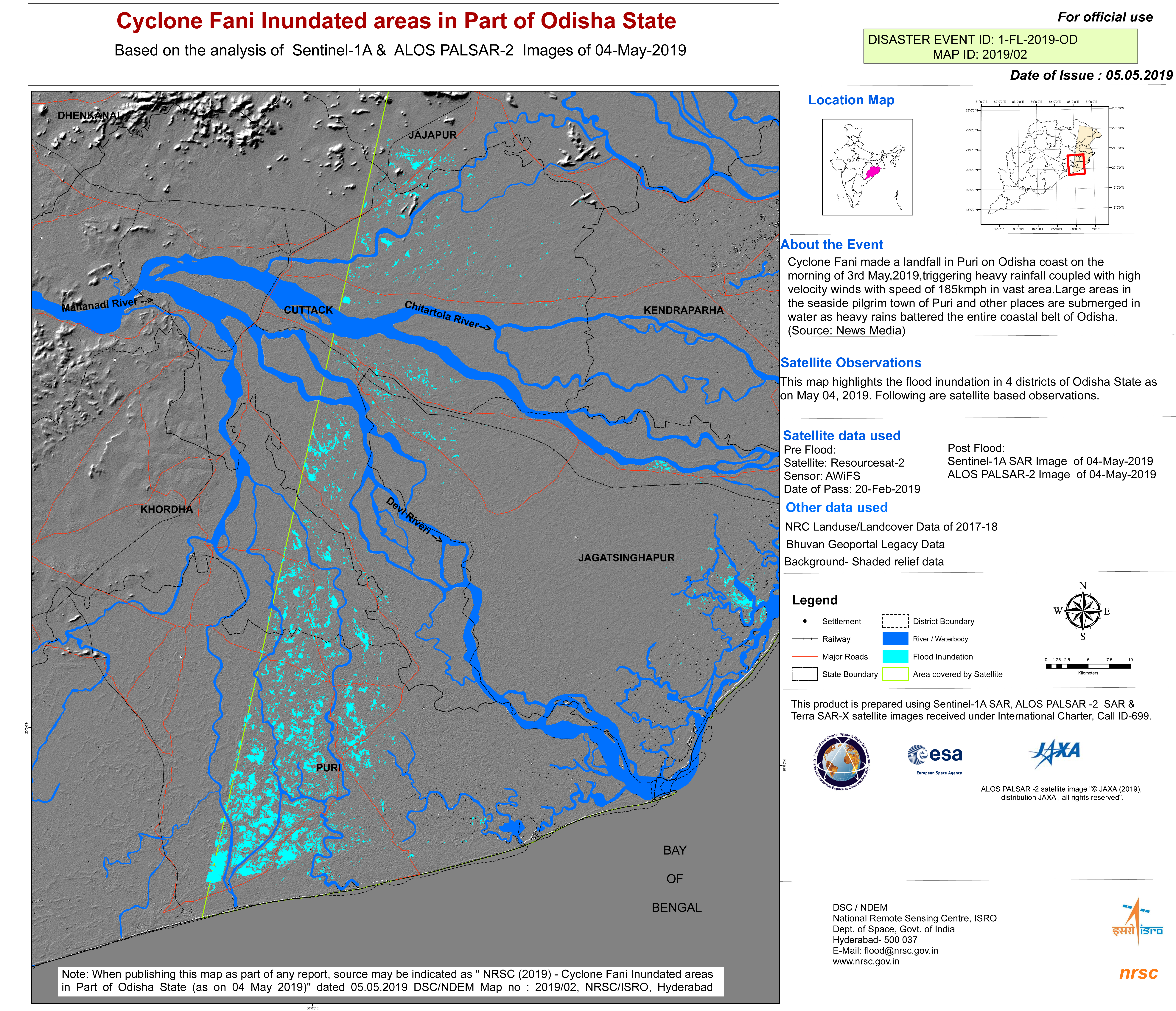
Cyclone Fani impact map, Odisha, India
Copyright: ResourceSat-2: data and products © ISRO (2019) - All rights reserved
Sentinel-1: © Contains modified Copernicus Sentinel data (2019)
Map produced by NRSC
Information about the Product
Acquired: Resourcesat-2: 20/02/2019
Sentinel-1: 04/05/2019
Source: Resourcesat-2 / Sentinel-1
 Back to the full activation archive

